For historical information only, do not use for navigation or aviation purposes!
| Coordinates | N504236 E0070921 ca. (WGS84) Google Maps |
| Elevation | 155 ft |
| Federal state | Nordrhein-Westfalen (North Rhine-Westphalia) |
| Location indicator | EDOJ |
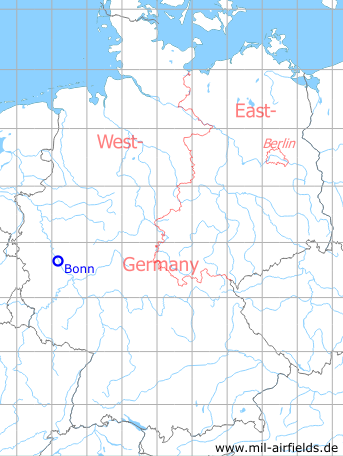
Germany during the Cold War Map
The history of the Cold War airfields: Bonn
General
In Bonn Bad Godesberg was a small US Army landing ground and helipad for the US Embassy. A use is documented for the 1960s and 1970s. It is unclear exactly when the site was closed; it was probably out of operation as early as the 1980s. Today, there are no remains of the simple airfield.
Location of airfield
The grass runway ran parallel to today's Von-Sandt-Ufer. It began near the south-eastern tip of today's Auensee and ended near the old waterworks.
During the Cold War
Use
Landing ground and later helipad of the US Army for the US embassy.
In the 1960s
Runways
- 13/31: 400 m Grass
Airspace and procedures
Instructions from 1963:
For helicopter: Approach and departure direction at pilot's discretion. Traffic pattern away from the housing area. The airfield is unattended. Prior Permission Only (PPO) via US Embassy Mehlem telephone 3337 or 3367.
For aircraft: Traffic pattern over the river away from the housing area. Closed to U-8 aircraft. Strip rough. VIP traffic only. Prior Permission Only (PPO) from USAREUR liaison officer telephone Mehlem 3337 or 3367 or from Aviation Officer telephone Mehlem 3746.
Today
Use
Closed. The site has been completely dismantled.
Overview
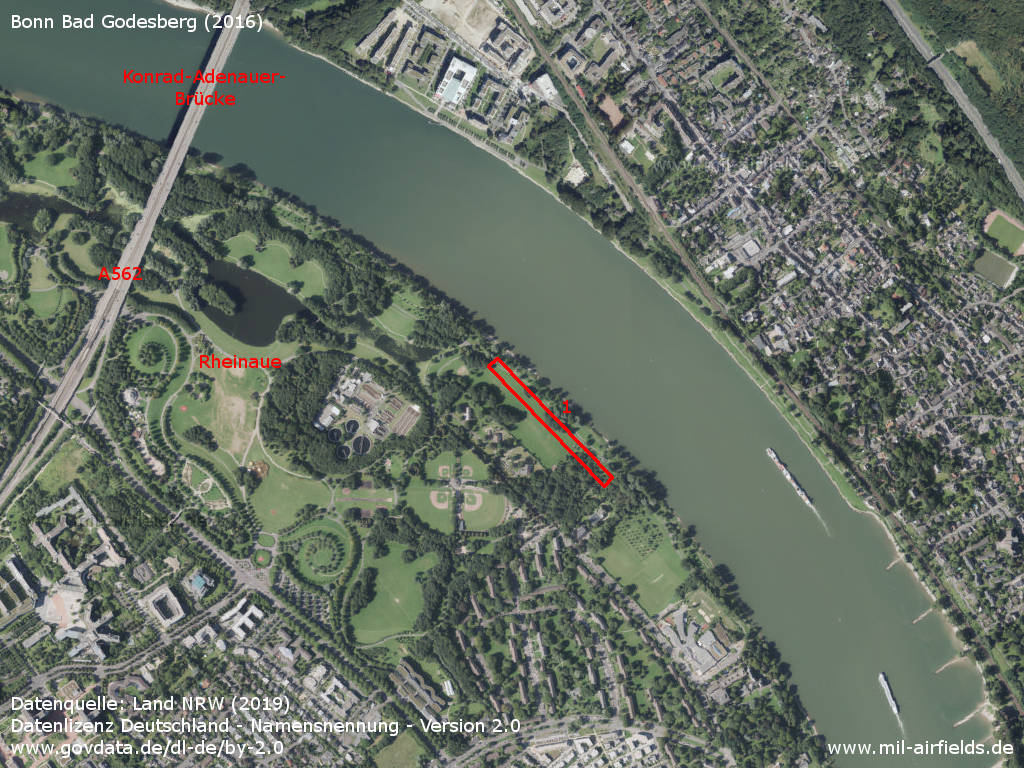
Aerial image (2016) - 1: Location of former runway, today completely dismantled.
Source: Datenquelle: Land NRW (2019) Datenlizenz Deutschland - Namensnennung - Version 2.0 www.govdata.de/dl-de/by-2.0)
Sources
- https://www.geoportal.nrw/ - Geoportal NRW
Airfields in the vicinity
Categories
Military Airfields GermanyMilitary Airfields in former West GermanyUS Army Airfields and Heliports in GermanyRecommended
Image credits are shown on the respective target page, click on the preview to open it.
 Follow mil-airfields on Facebook