For historical information only, do not use for navigation or aviation purposes!
| Coordinates | N493639 E0071112 (WGS84) Google Maps |
| Elevation | 1087 ft |
| Federal state | Rheinland-Pfalz (Rhineland-Palatinate) |
| Location indicator | EDIJ (-1995), EDRH (1995-) |

Germany during the Cold War Map
The history of the Cold War airfields: Hoppstädten-Weiersbach
During the Cold War
Use
US Army airfield.
Situation
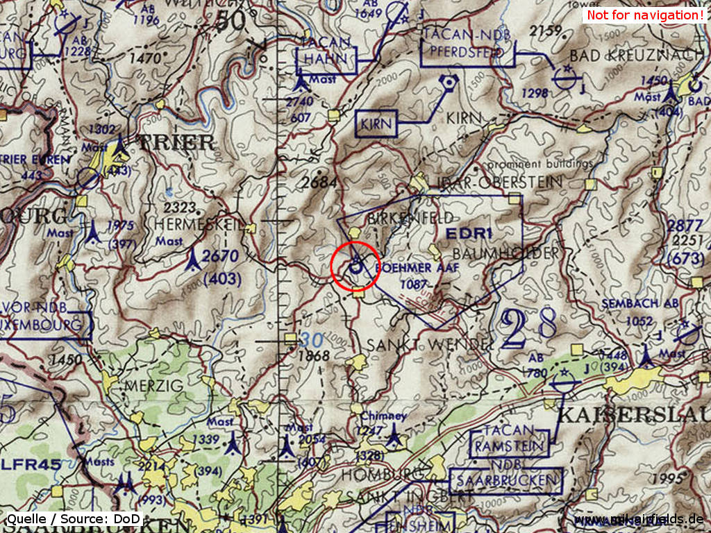
Boehmer Army Airfield on a map of the US Department of Defense from 1972
Source: ONC E-2 (1972), Perry-Castañeda Library Map Collection, University of Texas at Austin
Runways
Data for the year 1990:
- 06/24: 671 m x 21 m Asphalt
Today
Situation
General aviation.
Overview
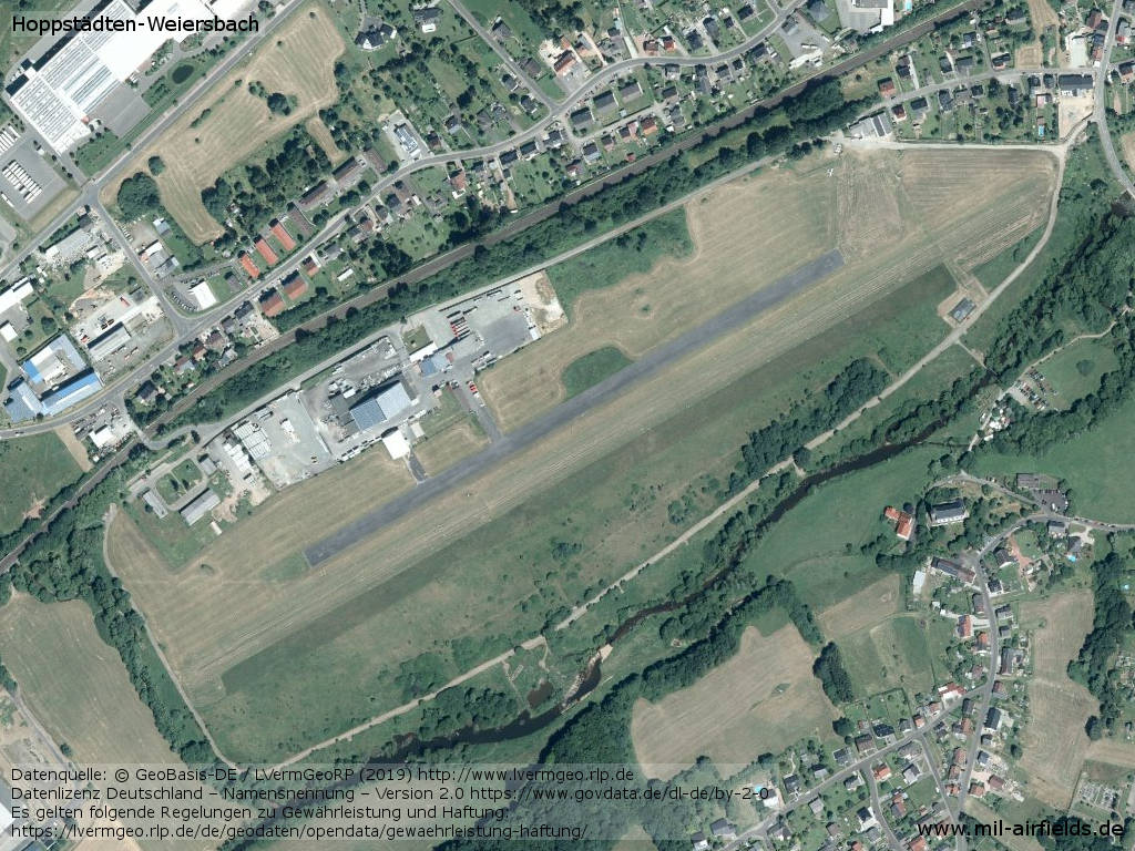
Source: © GeoBasis-DE / LVermGeoRP (2019), http://www.lvermgeo.rlp.de, Datenlizenz Deutschland – Namensnennung – Version 2.0 https://www.govdata.de/dl-de/by-2-0.
Sources
- http://www.lvermgeo.rlp.de - Geoportal Rheinland-Pfalz
Links
- https://www.fsvhowei.de/ - Flugsportverein Hoppstädten-Weiersbach e.V.
Airfields in the vicinity
- 062°/10km Baumholder: Army Airfield AAF (Army Airfield AAF)
- 153°/29km Miesau: West AHP
- 132°/34km Landstuhl: US Army Heliport AHP (Landstuhl Army Heliport AHP)
- 123°/36km Ramstein: Air Base (Landstuhl Air Base, Landstuhl-Ramstein)
- 008°/38km Hahn: Air Base (Hahn Air Base)
Categories
Military Airfields GermanyMilitary Airfields in former West GermanyUS Army Airfields and Heliports in GermanyRecommended
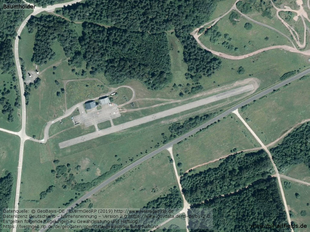
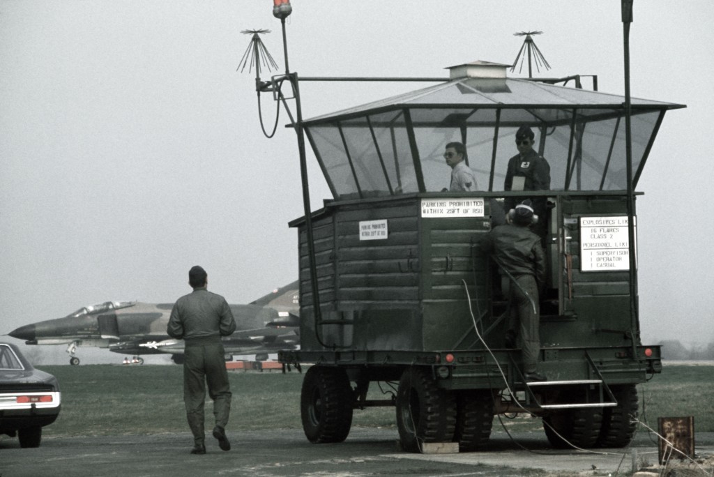
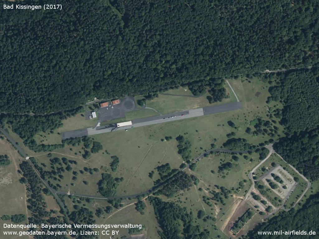
Image credits are shown on the respective target page, click on the preview to open it.
 Follow mil-airfields on Facebook