For historical information only, do not use for navigation or aviation purposes!
| Coordinates | N480756 E0114159 (WGS84) Google Maps |
| Federal state | Bayern (Bavaria) |
| Location indicator | DDMU (195x), EDDM |
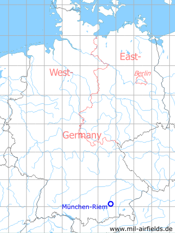
Germany during the Cold War Map
The history of the Cold War airfields: Munich Riem Airport
General
Riem was opened in 1939 as a new airport for Munich. During World War II, the airfield was used by the Luftwaffe. From 1945 onwards the field served the US forces for a few years and then became the international airport for Munich. In 1992 it was replaced by the newly built Munich Airport at Erdinger Moos and closed. The former airport site was redeveloped into the Messestadt Riem ("Trade fair city of Riem"), where the Munich Trade Fair is located.
During World War II
Situation
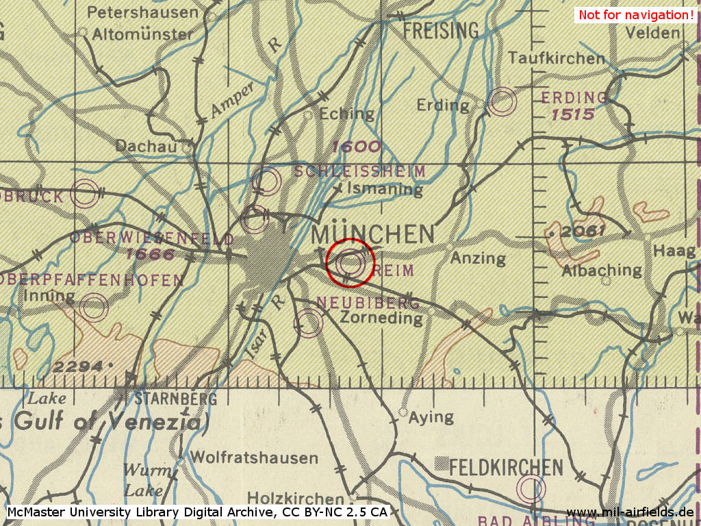
Munich Riem airfield in World War II on a US map from 1944. Here it was wrongly named "Reim" - (McMaster University Library Digital Archive, License: Creative Commons Attribution-NonCommercial 2.5 CC BY-NC 2.5 CA /MULDA/)
During the Cold War
In the 1940s
Overview
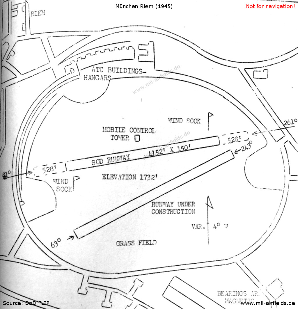
Munich Riem on 21 July 1945
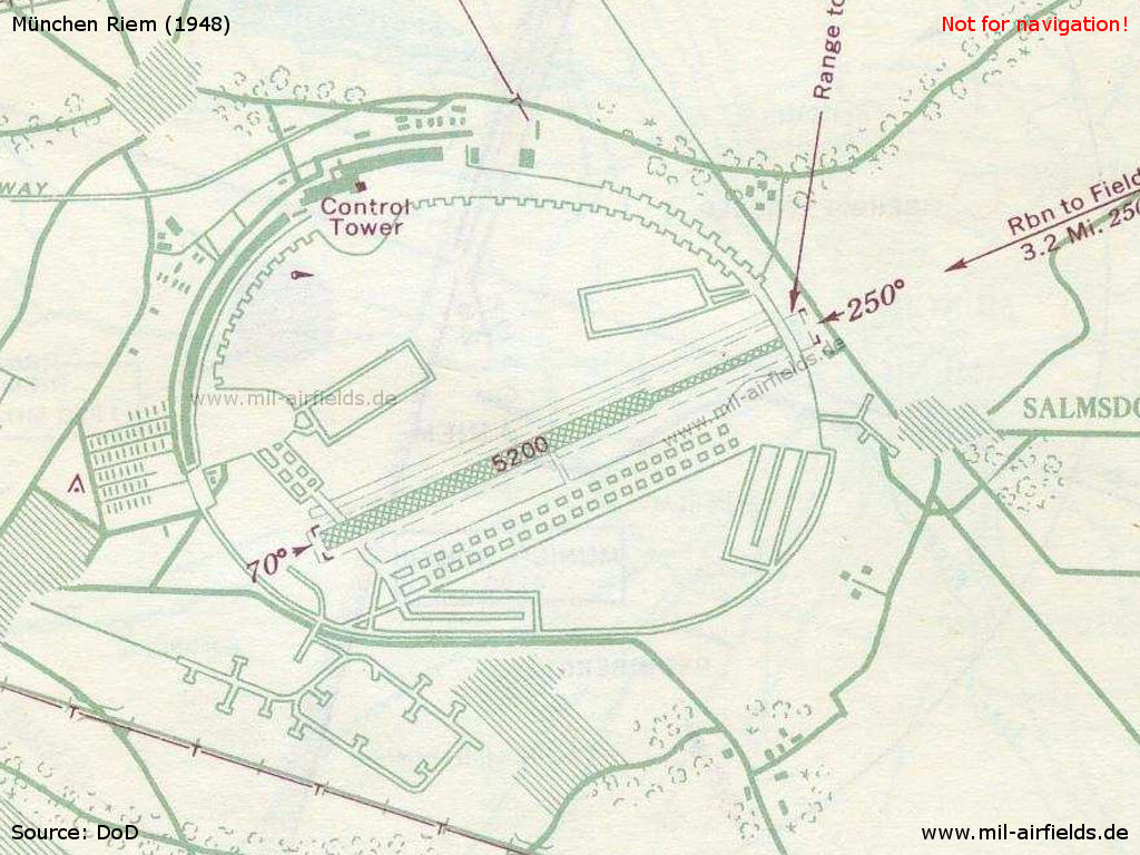
Munich Riem airfield in 1948
In the 1950s
Situation
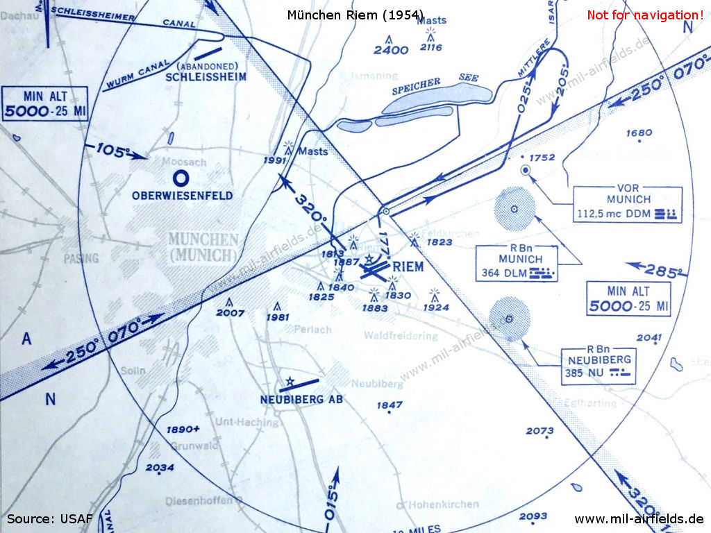
Airspace in the Munich area in 1954
Overview
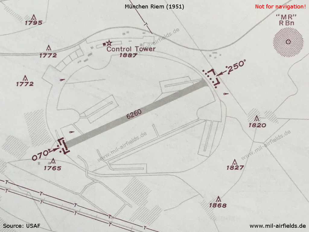
Munich Riem Airport in 1951 - The length of the runway is 1908 m (6260 ft). The "MR" radio beacon just northeast of the runway is removed shortly afterwards.Riem is now operated as a civil airport. However, air traffic control is still performed by the Airways and Air Communications Service (AACS) of the US forces..
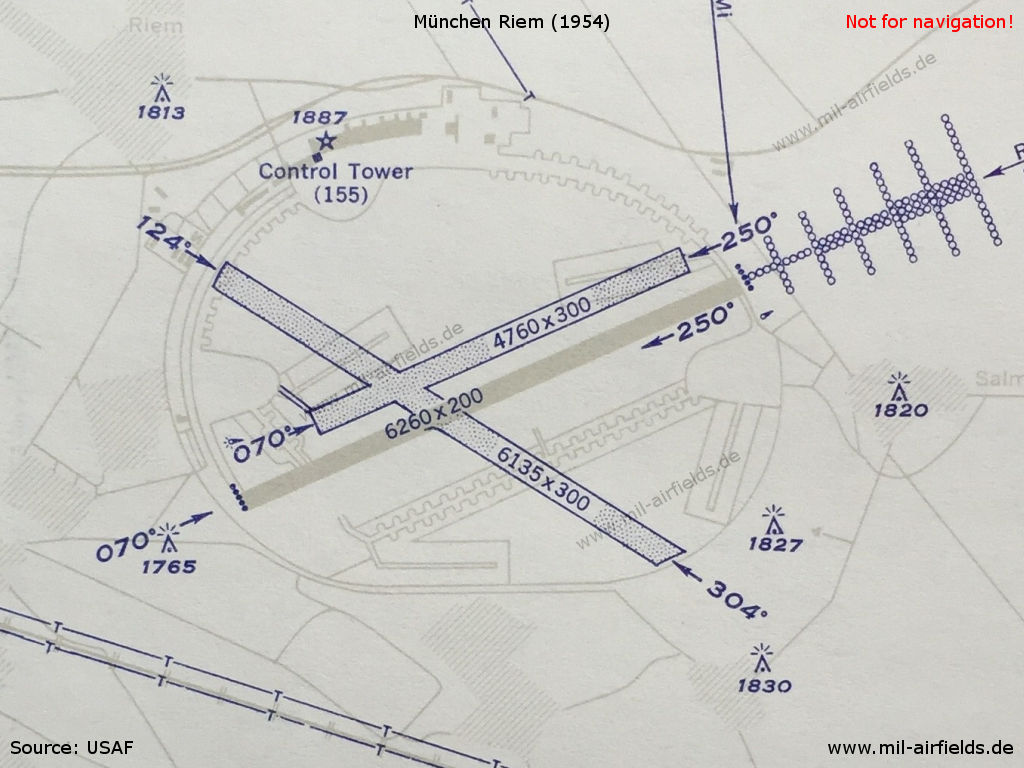
Munich Riem Airport in 1954 - In the meantime, two grass runways and an approach lighting system in the east have been added
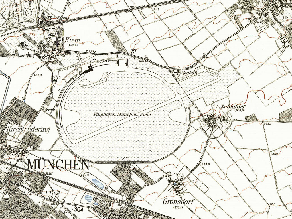
München Riem on a topographic map from 1959 - Places in the vicinity: Gronsdorf, Kirchtrudering, Salmdorf, Straßtrudering
Source: Bayerische Vermessungsverwaltung, Lizenz CC BY-ND 3.0
Images
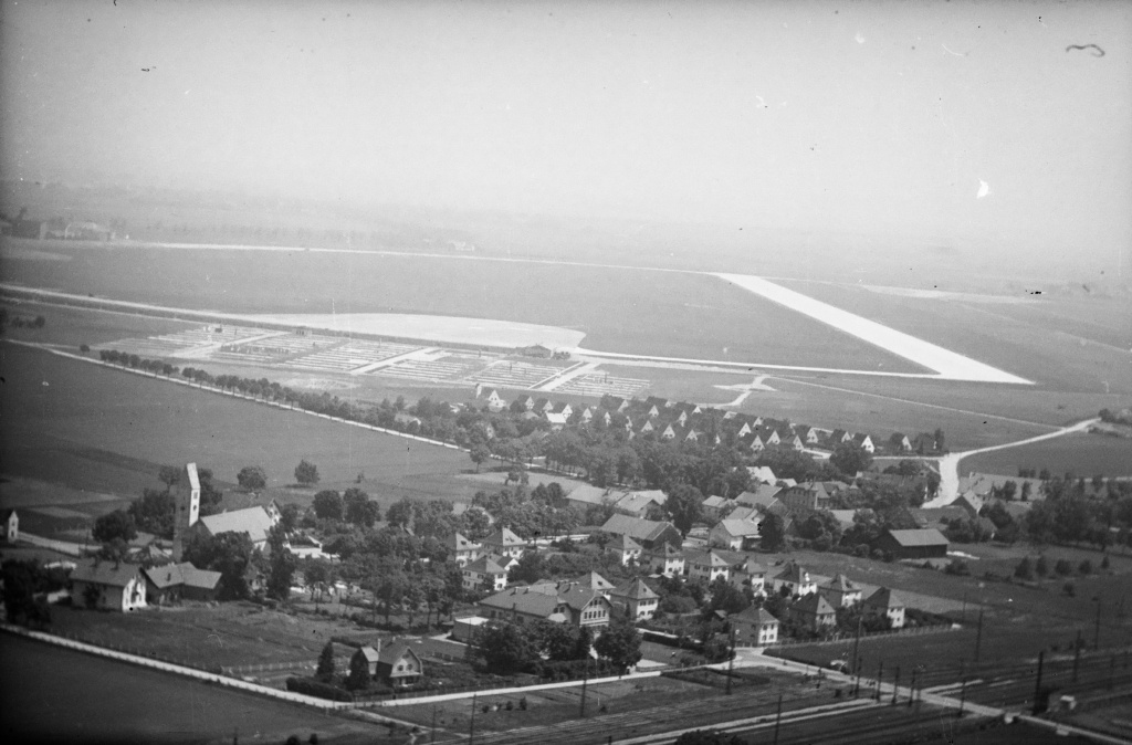
Aerial picture of Munich Riem airport in 1950 - (ETH-Bibliothek Zürich, Bildarchiv/Stiftung Luftbild Schweiz / Fotograf: Gardi, René / LBS_SR12-51-0775 / CC BY-SA 4.0)
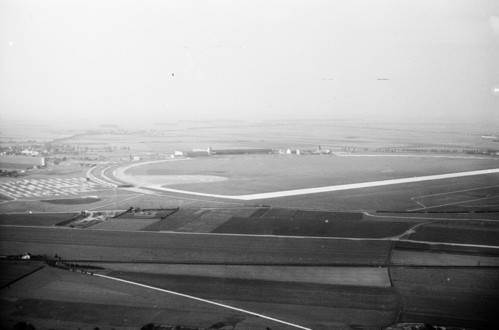
Aerial picture of Munich Riem airport in 1950 - (ETH-Bibliothek Zürich, Bildarchiv/Stiftung Luftbild Schweiz / Fotograf: Gardi, René / LBS_SR12-51-0729 / CC BY-SA 4.0)
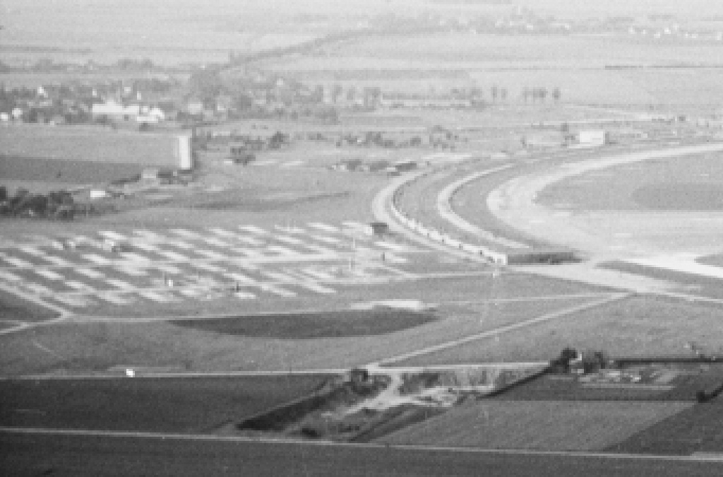
Enlargement: Parking pads at the western side
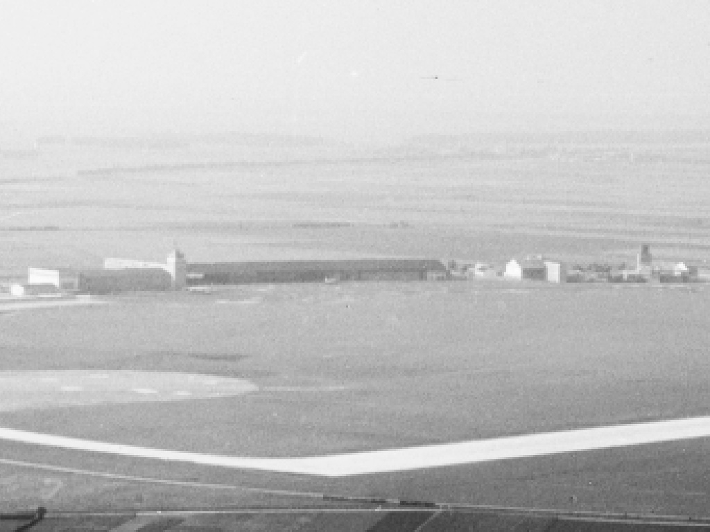
Enlargement: Airport buildings
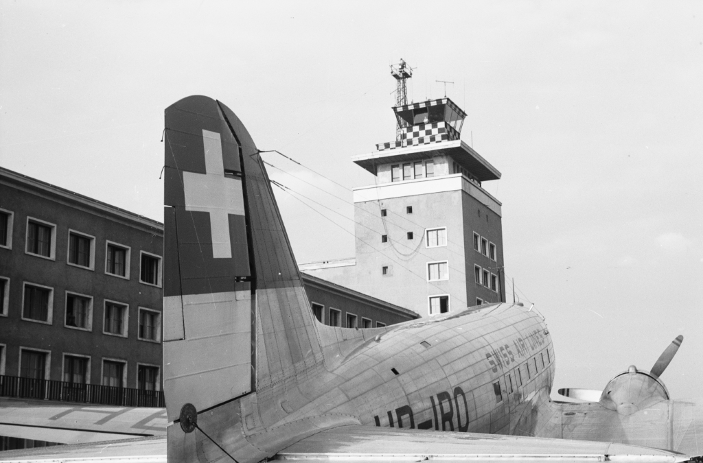
Swissair DC-3 and control tower in 1950 - (ETH-Bibliothek Zürich, Bildarchiv/Stiftung Luftbild Schweiz / Fotograf: Gardi, René / LBS_SR12-51-0730 / CC BY-SA 4.0)
In the 1960s
Situation
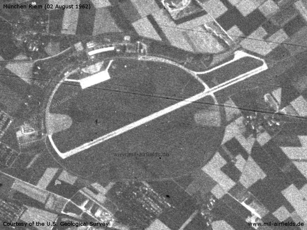
Munich Riem Airport on a US satellite image from 02 August 1962
Source: U.S. Geological Survey
In the 1970s
Overview
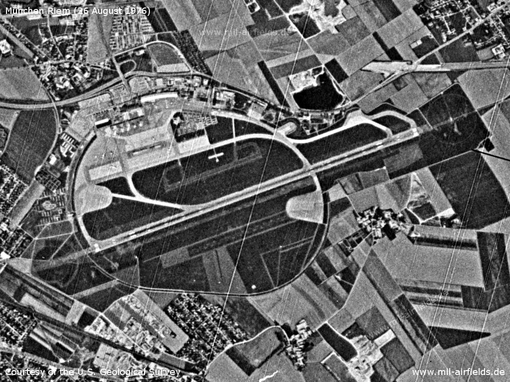
Munich Riem Airport on a US satellite image from 26 August 1976
Source: U.S. Geological Survey
In the 1980s and early 1990s
Situation
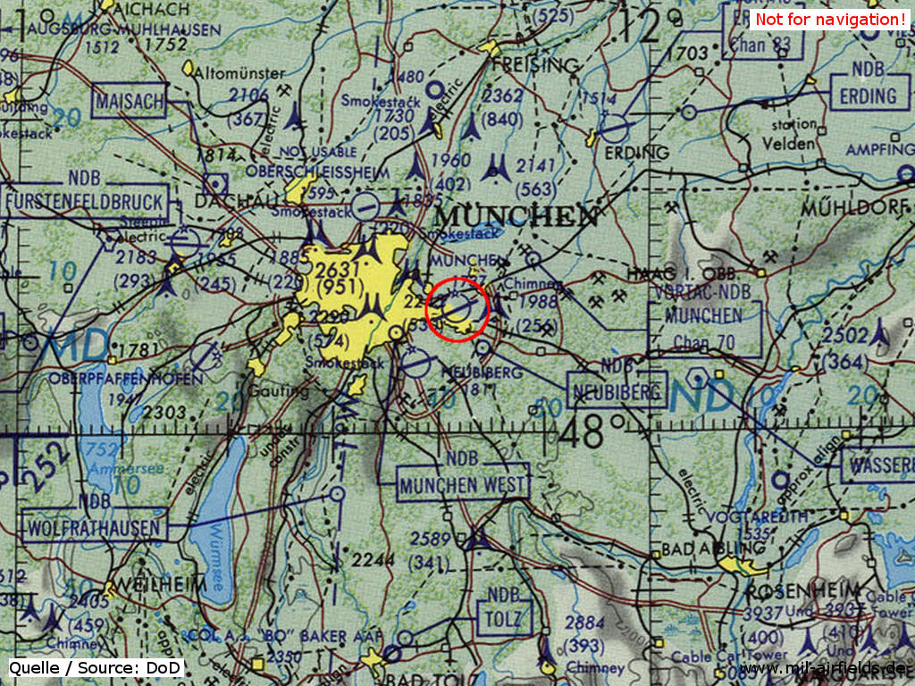
Riem Airport on a map of the US Department of Defense from 1981 - (ONC F-2 (1981), Perry-Castañeda Library Map Collection, University of Texas at Austin /PCL MC/)
The move
In May 1992, the entire airport operations moved from Munich Riem to the new airport in Erdinger Moos. This marked the end of Riem's aviation history.
Today
Use
The airport is closed since 1992. The Messestadt Riem (trade fair center) is located on the area today. It is served by the U2 subway line with Messestadt West and Messestadt Ost stations. Some facilities of the old airport are still preserved and some of them are listed. These include the Wappenhalle (Coat of Arms Hall) and the tower.
Former Munich Riem airport
Tower, Wappenhalle, Kopfbau and the New Munich Trade Fair Centre
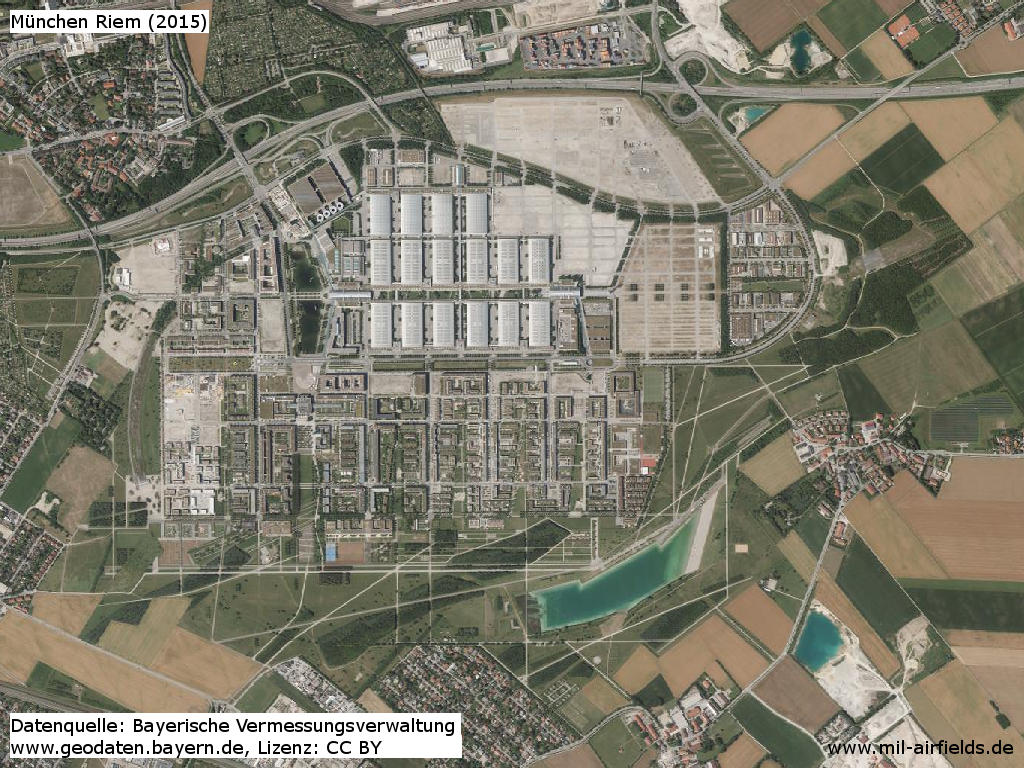
Orthophoto 2015
Source: Bayerische Vermessungsverwaltung, License CC-By
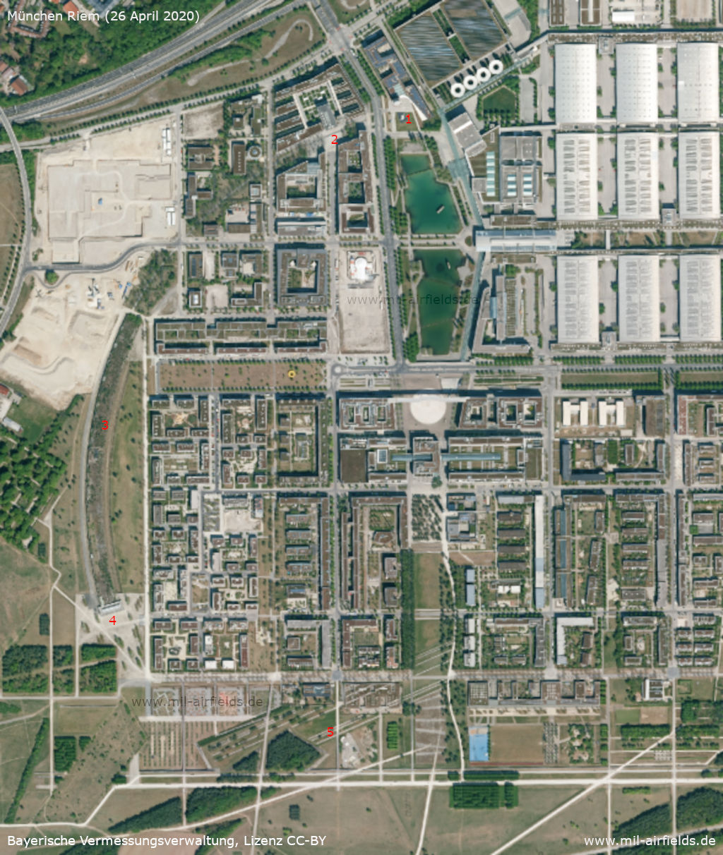
Western part in 2020 - In the west, some structures are still preserved: 1: Former control tower, 2: Wappenhalle (former terminal building), 3: Spectator grandstand, 4: Box office spectator grandstand, 5: Alignments of the former runway
Source: Bayerische Vermessungsverwaltung, License CC-By
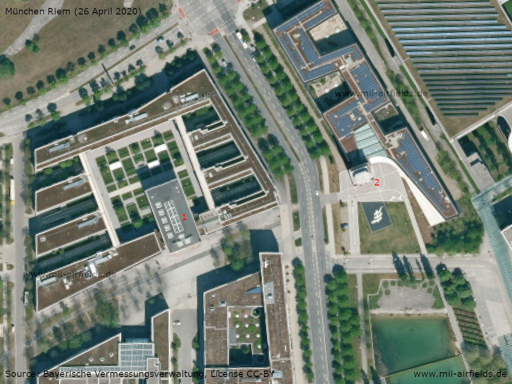
Wappenhalle (1) and control tower (2)
Source: Bayerische Vermessungsverwaltung, License CC-By
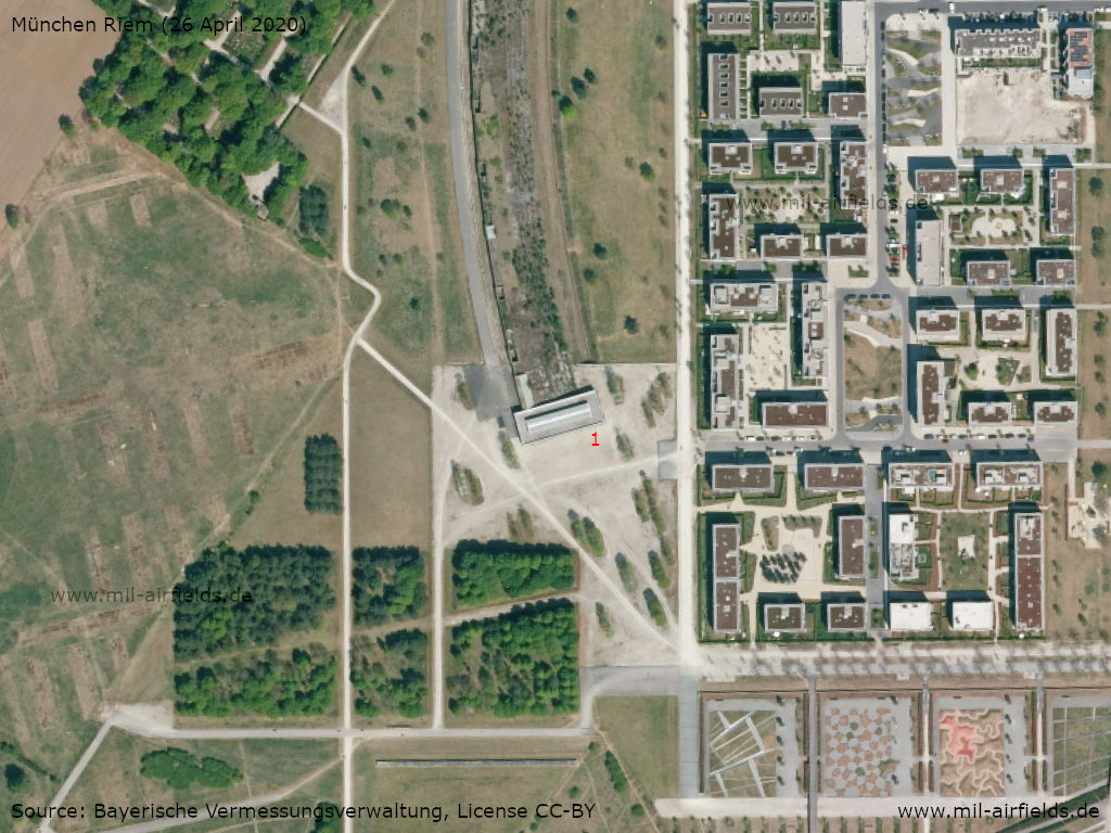
Kopfbau: Former ticket office of the grandstand (1) - During the Bundesgartenschau 2005 (Federal Horticultural Show 2005) called "Buga Lounge"
Source: Bayerische Vermessungsverwaltung, License CC-By
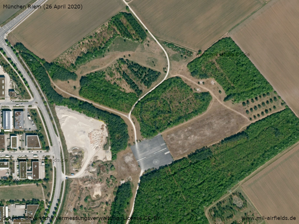
A preserved section of the runway in the eastern part of the site - Here, furthermore, paths of the former taxiways are recognizable.
Source: Bayerische Vermessungsverwaltung, License CC-By
Links
- https://flughafen-muenchen-riem.de/ - Online-Archiv des alten Flughafen München-Riem
Sources
- http://ba.e-pics.ethz.ch/ - ETH Bibliothek
- http://geoportal.bayern.de/ - Geoportal Bayern
- https://www.usgs.gov/ - USGS U.S. Geological Survey
Airfields in the vicinity
Recommended
Image credits are shown on the respective target page, click on the preview to open it.
 Follow mil-airfields on Facebook