For historical information only, do not use for navigation or aviation purposes!
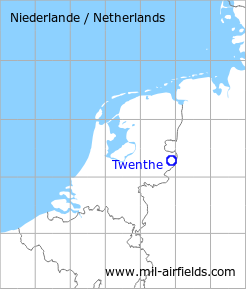
| Coordinates | N521633 E0065321 (WGS84) Google Maps |
| Elevation | 114 ft |
| Location indicator | EHTW |
The history of the Cold War airfields: Twenthe
Use
Royal Netherlands Air Force (Koninklijke Luchtmacht, KLu) base
During World War II
Situation
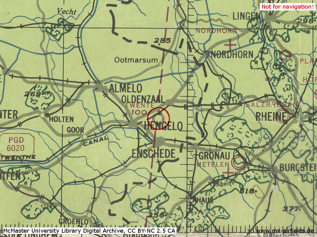
Twenthe Air Base in World War II on a US map from 1943
Source: McMaster University Library Digital Archive, License: Creative Commons Attribution-NonCommercial 2.5 CC BY-NC 2.5 CA
During the Cold War
In the 1950s
Situation
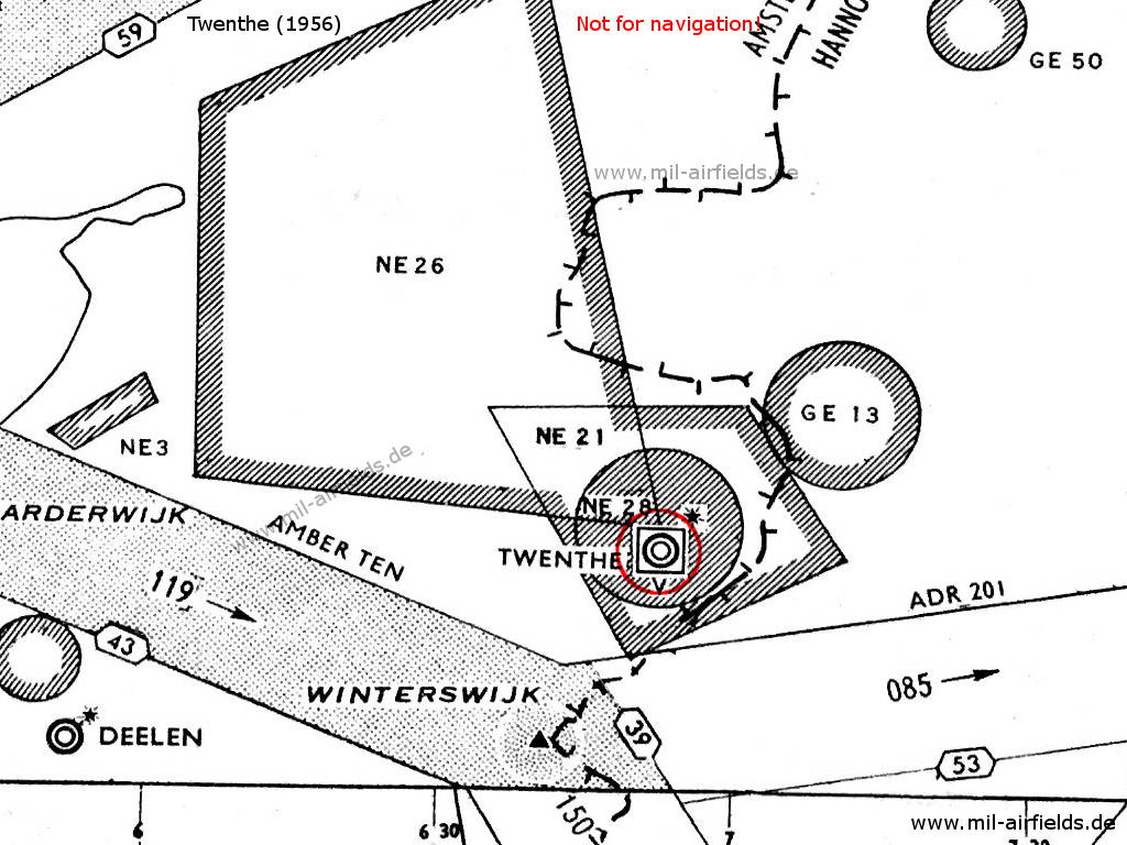
Twenthe airfield and surrounding airways and restricted areas on a map 1956
Lights
Red identification beacon with ident "TW"
Radio communication
- Homer 117.9
- Tower 117.9, 118.1, 121.5, 116.1, 119.7
During the 1960s
Runways
- 06/24: 2440 m x 50 m
- 12/30: 1553 m x 23 m
Lights
Identification beacon with ident TW at the northern side of the field,
Approach lights for runway 24
Approach lights for runway 24
Radio beacons
- NDB: 336 "TWN", at field, at the eastern side, near the control tower
Radio communication
- Twenthe Approach Control 117.9
- Twenthe Tower 136.35, 117.9, 357.1, 257.8
During the 1970s
Situation
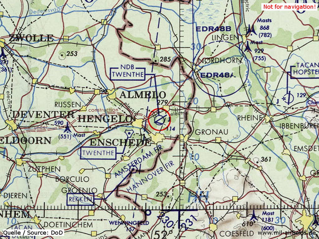
Twenthe Air Base on a map of the US Department of Defense from 1972
Source: ONC E-2 (1972), Perry-Castañeda Library Map Collection, University of Texas at Austin
Radio beacons
- TACAN: CH 44 "TWN", at field
Radio communication
- Twenthe Approach 122.1, 268.3, 362.3
- Twenthe GCA 123.3, 254.6
- Twenthe Tower 122.1, 257.8, 297.4
During the 1980s and early 1990s
Runways
- 06/24: 2406 m x 50 m Asphalt
- 11/29: 1646 m x 25 m Asphalt
Radio beacons
- NDB: 335.5 "TWN"
- TACAN: CH 44 "TWN", at field
Radar
ASR, PAR
Radio communication
- Approach 122.1, 268.3, 362.3
- GCA 123.3, 122.1, 122.45, 254.6, 281.5, 344.0, 385.4
- Tower 122.1, 119.7, 297.4, 257.8
- Ground 250.7
Telephone
(053) 350705
Today
Use
Closed.
Airfields in the vicinity
- 087°/34km Rheine-Bentlage: Airfield
- 081°/45km Hopsten: Air Base (Rheine)
 Follow mil-airfields on Facebook