For historical information only, do not use for navigation or aviation purposes!
| Coordinates | N520738 E0051633 (WGS84) Google Maps |
| Elevation | 66 ft |
| Region | Utrecht |
| Location indicator | EHSB |
The history of the Cold War airfields: Soesterberg
During World War II
Situation
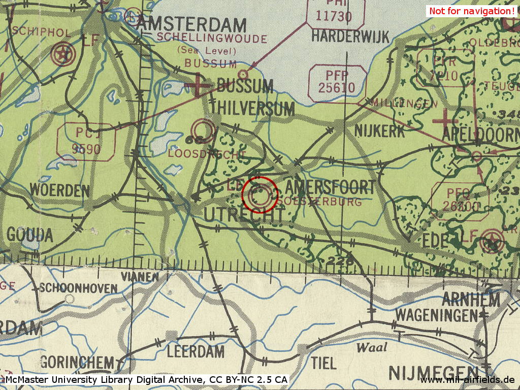
Soesterberg Air Base in World War II on a US map from 1943
Source: McMaster University Library Digital Archive, License: Creative Commons Attribution-NonCommercial 2.5 CC BY-NC 2.5 CA
During the Cold War
Use
Royal Netherlands Air Force (Koninklijke Luchtmacht, KLu) base. Also used by the US Air Force (USAF).
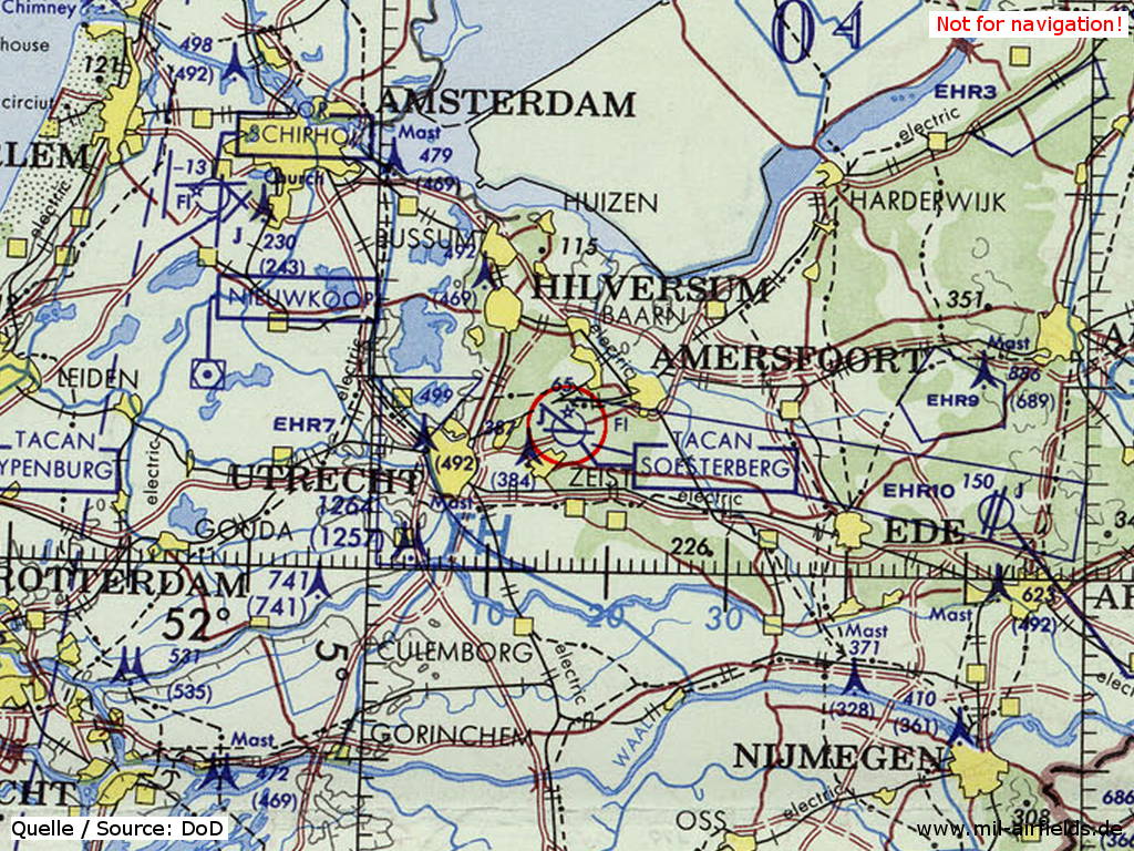
In the 1950s
Situation
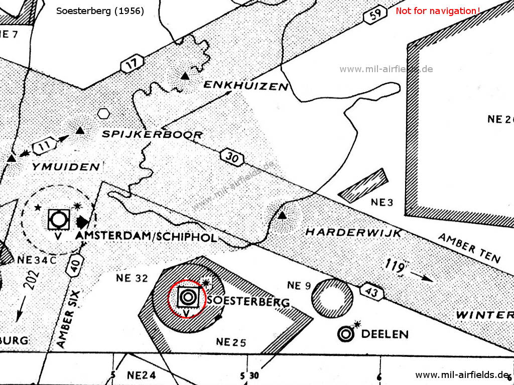
Soesterberg airfield and surrounding airways and restricted areas on a map 1956
Lights
Red identification beacon with ident "SB"
Radio beacons
- NDB: 339.0 "PES", 056°/1.3 NM to field
Radar
GCA
Radio communication
- Homer 117.9, 305.4, 362.3
- Approach 117.9, 305.4, 362.3
- Tower 117.9, 118.1, 121.5, 257.8
In the 1960s
Overview
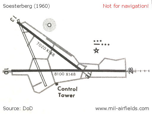
Runways and taxiways on a map from 1960
Source: DoD
In the 1970s
Situation
Soesterberg Air Base (Camp New Amsterdam) on a map of the US Department of Defense from 1972
Source: ONC E-2 (1972), Perry-Castañeda Library Map Collection, University of Texas at Austin
Overview
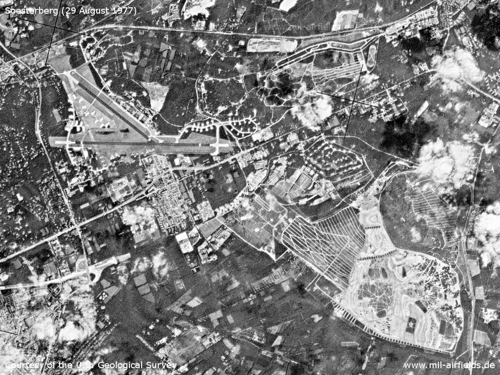
Soesterberg with air base, barracks and training grounds on a US satellite image from 29 August 1977
Source: U.S. Geological Survey
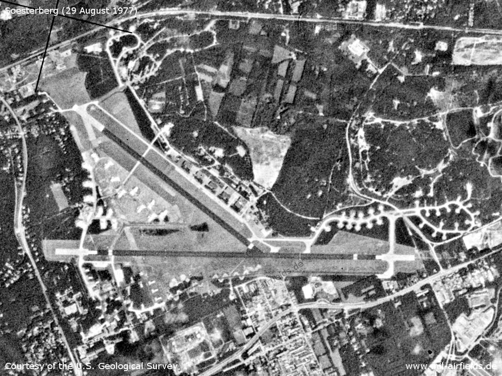
Airfield
Source: U.S. Geological Survey
In the 1980s and early 1990s
Runways
Data for the year 1990:
- 13/31: 2094 m x 50 m Asphalt
- 09/27: 2132 m x 45 m Asphalt
Radio beacons
Data for the year 1990:
- TACAN: CH105 "SSB"
Images
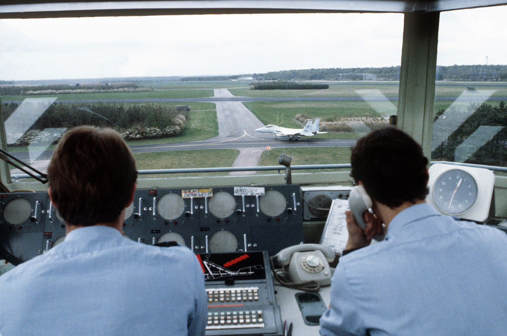
Royal Netherlands Air Force air traffic controllers man the control tower. The viewing direction is north-northwest. - On the left handwritten sign, "BRANDWEER" is written, on the right "BIRDS ...". In the middle below you can see a scheme of the runways and taxiways of Soesterberg (white lines, red arrows, black background). In the background is an F-15 Eagle aircraft from the 32nd Tactical Fighter Squadron US Air Force, stationed here.
Source: US DoD, Scene Camera Operator: TSGT John L. Marine (1980)
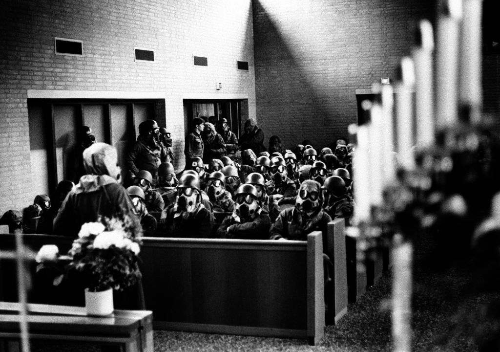
Members of the 32nd Tactical Fighter Squadron use the base chapel for shelter during a simulated air and gas attack.
Source: US DoD, Scene Camera Operator: MAJ Steven Kleid (1980)
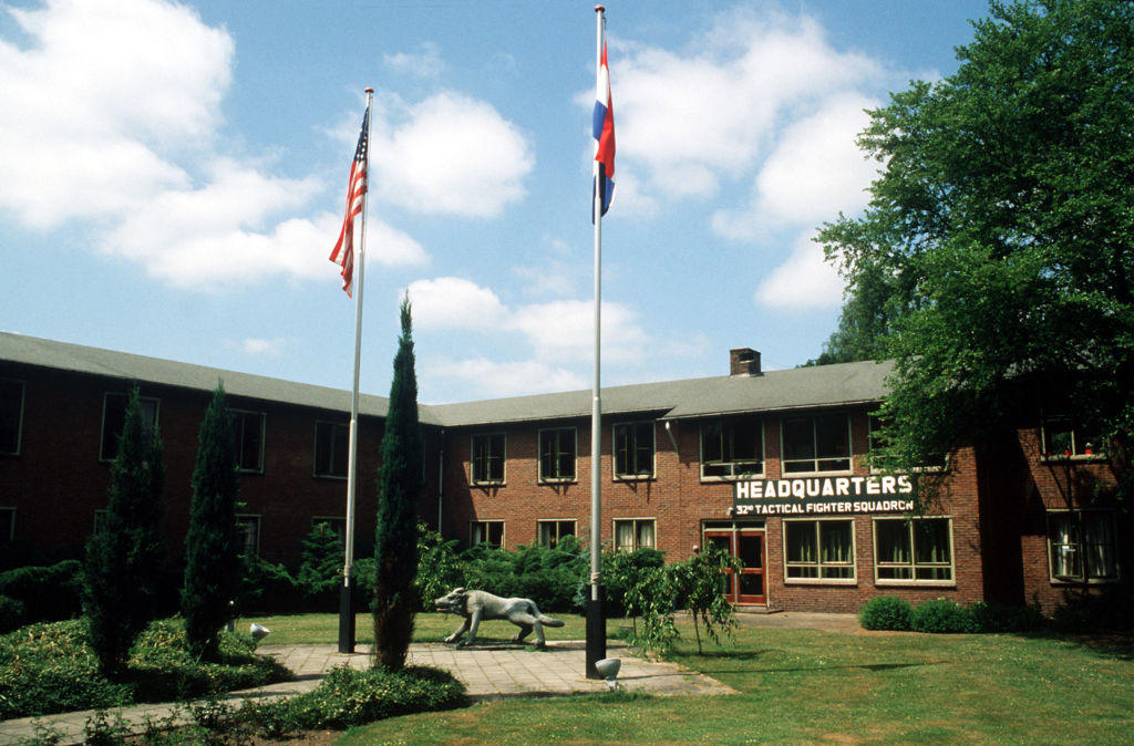
Headquarters of the 32nd Tactical Fighter Squadron
Source: US DoD (1982)
Today
Use
Closed.
Links
- https://www.vliegbasis-soesterberg.nl/index-engels... - Soesterberg Airbase 1910 - 2009
- https://www.nmm.nl/ - Nationaal Militair Museum - Military museum at the former air base.
Airfields in the vicinity
Categories
Air Bases NetherlandsRecommended
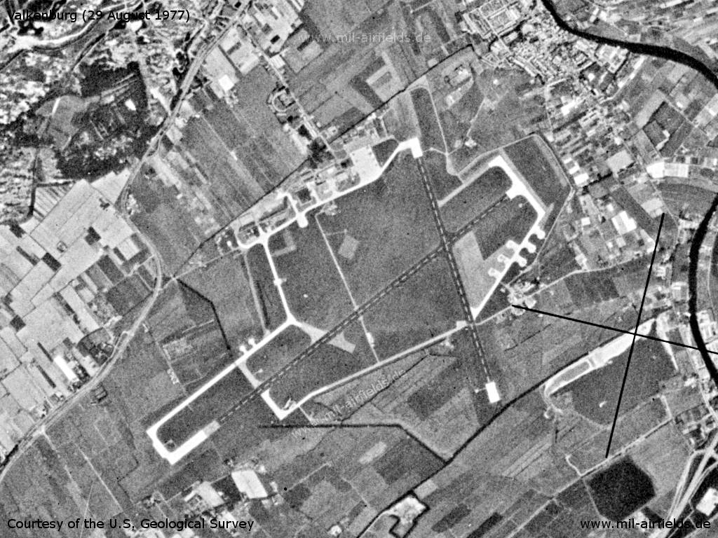
Image credits are shown on the respective target page, click on the preview to open it.
 Follow mil-airfields on Facebook