For historical information only, do not use for navigation or aviation purposes!
| Coordinates | N531331 E0054510 (WGS84) Google Maps |
| Elevation | 4 ft |
| Location indicator | EHLW |
The history of the Cold War airfields: Leeuwarden
During World War II
Situation
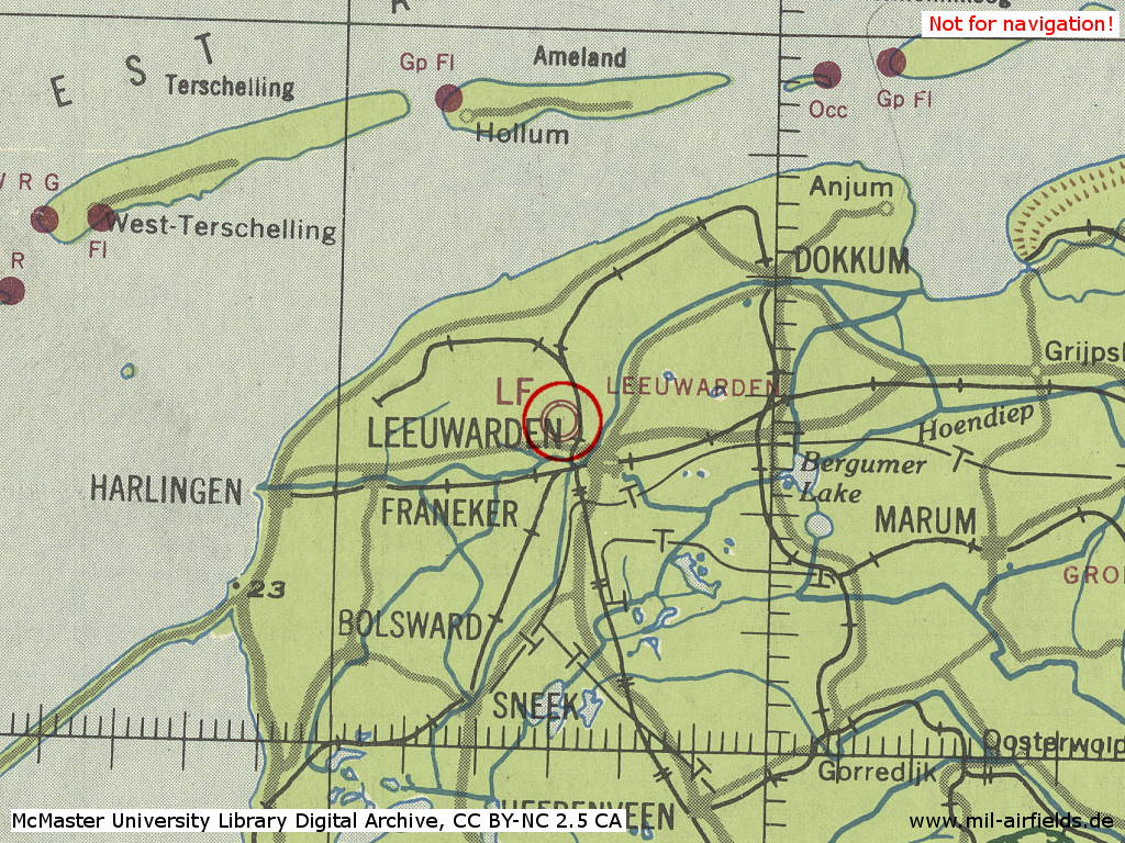
Leeuwarden Air Base in World War II on a US map from 1943
Source: McMaster University Library Digital Archive, License: Creative Commons Attribution-NonCommercial 2.5 CC BY-NC 2.5 CA
During the Cold War
Use
Royal Netherlands Air Force (Koninklijke Luchtmacht, KLu) base
In the 1950s
Situation
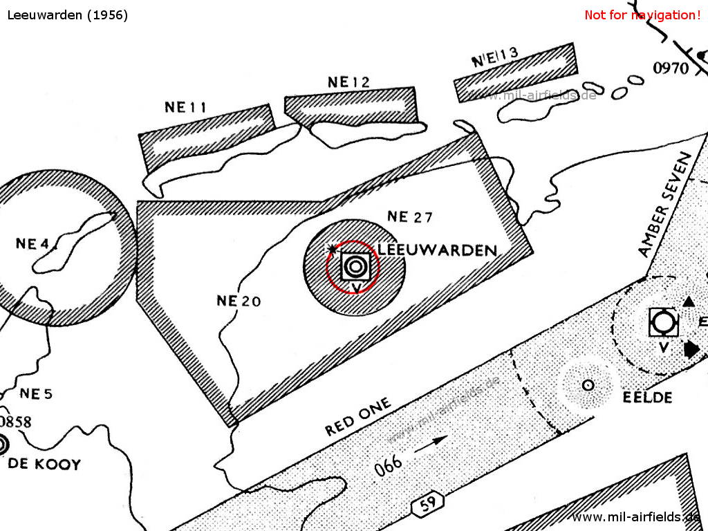
Leeuwarden airfield and surrounding airways and restricted areas on a map 1956
Lights
Red identification beacon with ident "LO"
Radar
GCA
Radio communication
- Homer 117.9
- Tower 117.9, 257.8, 119.7, 118.1, 121.5
In the 1970s
Situation
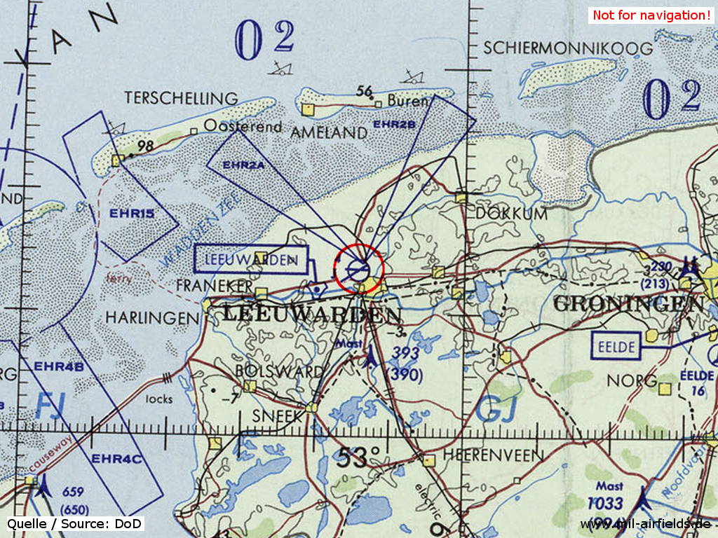
Leeuwarden Air Base on a map of the US Department of Defense from 1972
Source: ONC E-2 (1972), Perry-Castañeda Library Map Collection, University of Texas at Austin
In the 1980s and early 1990s
Runways
Data for the year 1990:
- 09/27: 1994 m x 48 m Asphalt
- 06/24: 2382 m x 48 m Asphalt
Radio beacons
Data for the year 1990:
- TACAN: CH94 "LWD", at field
Sources
- https://legacy.lib.utexas.edu/maps/ - Perry-Castañeda Library Map Collection
- https://digitalarchive.mcmaster.ca/ - McMaster University Library Digital Archive
 Follow mil-airfields on Facebook