Nur zur geschichtlichen Information, nicht zur Navigation oder zum Fliegen verwenden!
| Koordinaten | N520236 E0042225 (WGS84) Google Maps |
| HNN | -6 ft |
| Region | Zuid-Holland |
| Location indicator | EHYB |
Die Geschichte der Flugplätze im Kalten Krieg: Ypenburg
Nutzung
Flugplatz der niederländischen Luftstreitkräfte (Koninklijke Luchtmacht, KLu).
Im Zweiten Weltkrieg
Situation
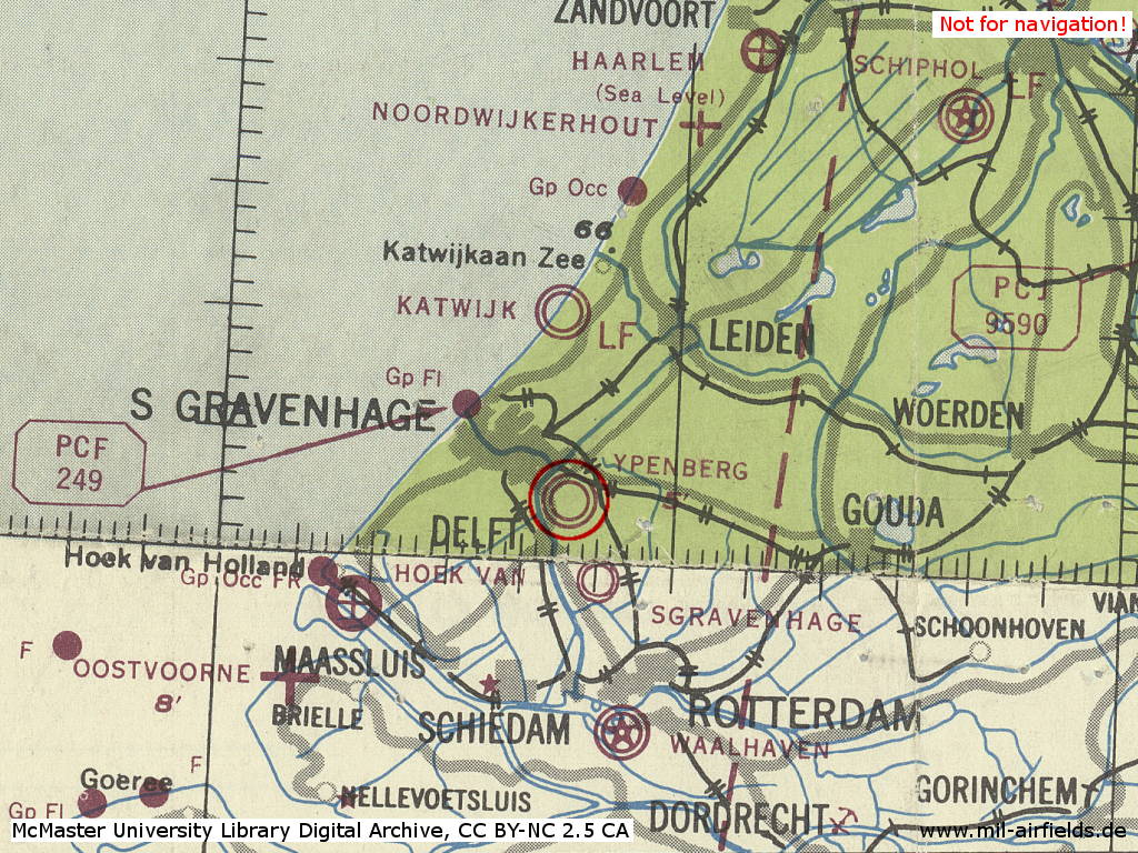
Der Flugplatz Ypenburg im Zweiten Weltkrieg auf einer US-Karte aus dem Jahr 1943
Quelle: McMaster University Library Digital Archive, Lizenz: Creative Commons Attribution-NonCommercial 2.5 CC BY-NC 2.5 CA
1950er Jahre
Situation
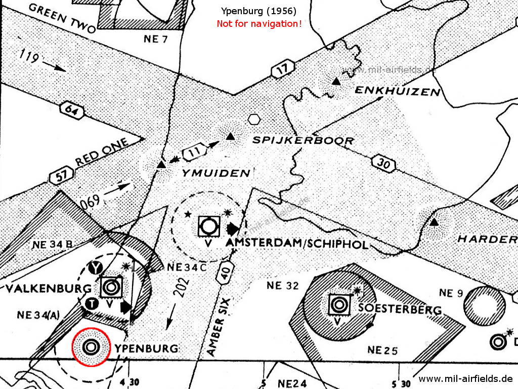
Ypenburg mit umliegenden Luftstraßen und Sperrgebieten 1956
Funkfeuer
- NDB: 376 "PEY"
Flugfunk
- Tower 117.9, 257.8, 111.42, 121.5, 262.9, 100.26
1960er Jahre
Übersicht
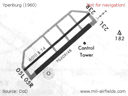
Start- und Landebahnen sowie Rollwege 1960
Quelle: DoD
Start- und Landebahnen
- 05L/23R: 2441 m x 23 m
- 05R/23L: 2140 m x 45 m
Befeuerung
Leuchtfeuer mit der Kennung YB auf der Nordwestseite des Platzes,
Anflugbefeuerung Landebahn 23L
Anflugbefeuerung Landebahn 23L
Funkfeuer
- NDB: 376 "YBR", am Platz, in der Südwestecke
Radar
ASR, PAR
Flugfunk
- Ypenburg Approach Control 362.3, 136.35, 117.9
- Ypenburg Tower 357.1, 257.8, 117.9
1970er Jahre
Situation
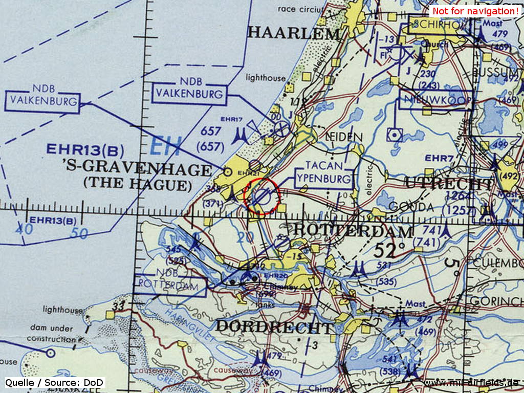
Der Flugplatz Ypenburg auf einer Karte des US-Verteidigungsministeriums aus dem Jahr 1972
Quelle: ONC E-2 (1972), Perry-Castañeda Library Map Collection, University of Texas at Austin
Übersicht
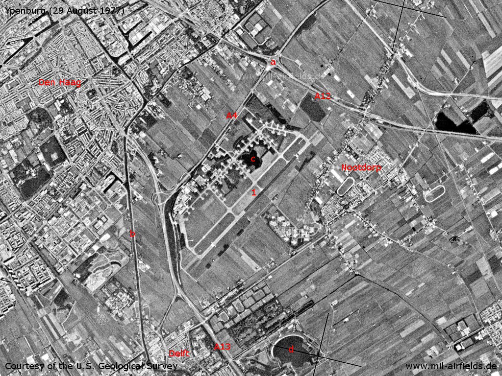
Ypenburg und Umgebung auf einem US-Satellitenbild vom 29.08.1977 - 1: Flugplatz. Autobahnen A4, A12 und A13. a: Knooppunt Prins Clausplein; b: Kanal Delftsche Vliet; c: See Bosplas (auf dem Flugplatz-Gelände); d: See Grote Plas. Orte: Delft, Den Haag, Nootdorp.
Quelle: U.S. Geological Survey
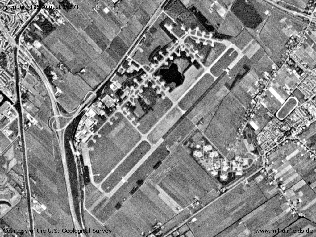
Flugplatz Ypenburg
1980er Jahre
Start- und Landebahnen
- 05L/23R: 2442 m Beton
- 05R/23L: 2442 m Beton
Funkfeuer
- TACAN: CH 49 "YBR", am Platz
Flugfunk
- Approach 122.1, 341.8, 362.3
- GCA 123.3, 226.7, 260.1, 122.1, 280.4, 344.0, 385.4
- Tower 122.1, 257.8, 337.3
Telefon
(070) 469335
Frühe 1990er Jahre
Start- und Landebahnen
Die vormals zwei parallelen Start- und Landebahnen wurden auf eine reduziert.
- 05/23: 2440 m Asphalt/Beton
Funkfeuer
- TACAN: CH 49 "YBR", am Platz
Flugfunk
- Rotterdam Approach 127.025, 230.5, 362.3, 119.7
- Final 399.35, 385.4, 257.5, 123.3, 122.1
- Tower 122.1, 308.55, 257.8
Telefon
(015) 146441
Luftraum und Verfahren
Der Flugplatz darf nur noch nach besonderer Absprache mit dem Verteidigungsministerium in Den Haag und nur in Ausnahmefällen genutzt werden.
Heute
Nutzung
Geschlossen. Auf dem Gelände wurde ein Wohngebiet und ein Industriegelände errichtet. In der Nordwestecke ist der ehemalige Kontrollturm erhalten geblieben.
Links
- http://home.deds.nl/%7Evliegveldypenburg/index.htm - Vliegveld Ypenburg - Van sportvliegveld tot vliegbasis Der ehemaliger Flugplatz mit vielen Bildern.
- https://www.jetphotos.com/airport/Ypenburg+Air+Bas... - Fotos abgestellter Starfighter in Ypenburg 1987
Flugplätze in der Umgebung
Kategorien
Militärflugplätze NiederlandeEmpfohlen
Bildquellen sind auf der jeweiligen Zielseite angegeben, klicke auf die Vorschau um sie zu öffnen.
 Folge mil-airfields auf Facebook