For historical information only, do not use for navigation or aviation purposes!
| Coordinates | N522106 E0142805 (WGS84) Google Maps |
| Former East Germany (GDR) | District of Frankfurt/O |
| Federal state | Brandenburg |
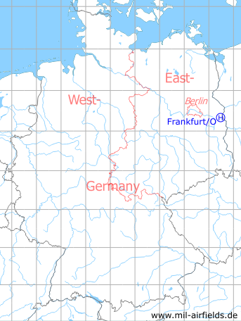
Germany during the Cold War Map
The history of the Cold War airfields: Frankfurt/O
Location of airfield
At the western citiy limits of Frankfurt/O.
Usage during the Cold War
Helipad 1015 for the Military Signals School (MtS/N) and Signals Workshop 2 (NW-2) of former East German Ministry of National Defense (MfNV).
Use today
Closed.
Runways, taxiways, aprons
Dimensions: 140 m x 300 m,
Main takeoff and landing direction: 180°,
Surface: Grass,
Capacity: 1 helicopter.
Main takeoff and landing direction: 180°,
Surface: Grass,
Capacity: 1 helicopter.
Telephone
Stabsnetz S1:
- Militärtechnische Schule Nachrichten (MtS(N)): 2532-a, Tarnname "Wunschkonzert"
- Nachrichtenwerkstatt 2 (NW-2): 2532-a, Tarnname "Alexander"
- Militärtechnische Schule Nachrichten (MtS(N)): 2532-a, Tarnname "Wunschkonzert"
- Nachrichtenwerkstatt 2 (NW-2): 2532-a, Tarnname "Alexander"
Airspace and procedures
Usable at day during good weather conditions.
Alert time: 60 minutes.
Alert time: 60 minutes.
Obstacles
Trees: direction 270°, distance 80 m, height 16 m
Power transmission line: direction 90°, distance 60 m, height 8 m
Power transmission line: direction 90°, distance 60 m, height 8 m
Airfields in the vicinity
- 123°/16km Kunice: Airfield (Lotnisko Kunice)
- 024°/18km Reitwein: Helipad 1019 (HSLP / HLP 1019)
- 154°/19km Eisenhüttenstadt: Airfield (Pohlitz)
- 306°/21km Heinersdorf: Helipad 3024 (HSLP / HLP 3024)
 Follow mil-airfields on Facebook