For historical information only, do not use for navigation or aviation purposes!
| Coordinates | N521952 E0140406 (WGS84) Google Maps |
| Federal state | Brandenburg |
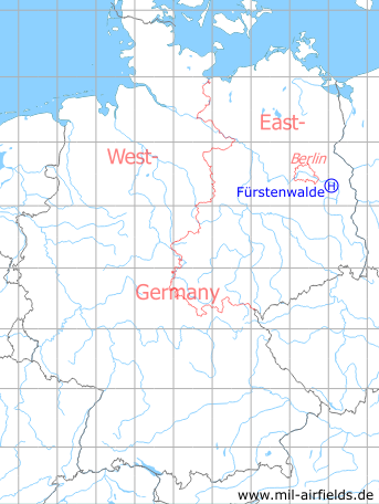
Germany during the Cold War Map
The history of the Cold War airfields: Fürstenwalde
Location of airfield
South of Fuerstenwalde.
Usage during the Cold War
Helipad 3002 for Central Command Post 14 (ZGS-14) of former East German Airforce (NVA LSK/LV).
Use today
Closed.
Runways, taxiways, aprons
Dimensions: 20 m x 15 m
Main takeoff and landing direction: takeoff 90°, landing 270°
Surface: concrete
Capacity: 1 helicopter
Main takeoff and landing direction: takeoff 90°, landing 270°
Surface: concrete
Capacity: 1 helicopter
Telephone
Stabsnetz S1 2444-88
Airspace and procedures
Usable at day and night during good weather conditions
Alert time: 60 minutes.
Alert time: 60 minutes.
Obstacles
Trees: direction 0° - 360°, height 20 m
Airfields in the vicinity
- 016°/7km Fürstenwalde: Airfield
- 258°/7km Markgrafpieske: SA-2 Missile Site (Helipad 3110)
- 154°/9km Wilmersdorf: Helipad 3023 (HSLP / HLP 3023)
- 203°/9km Reichenwalde: Helipad 3120 (HSLP 3120)
- 217°/13km Storkow: Helipad 1027 (HSLP 1027)
- 258°/13km Spreenhagen: Helipad 1013 (HSLP / HLP 1013)
- 262°/15km Spreenhagen: Highway Strip (Autobahnabschnitt ABA, Friedrichshof)
- 004°/17km Müncheberg: Eggersdorf Airfield (Eggersdorf)
- 036°/18km Heinersdorf: Helipad 3024 (HSLP / HLP 3024)
- 142°/19km Beeskow: Agricultural Airfield
- 191°/19km Limsdorf: Helipad 3011 (HSLP 3011)
- 206°/20km Kehrigk: Helipad 3071 (HSLP / HLP 3071)
- 349°/20km Waldsieversdorf: Helipad 3004 (HSLP / HLP 3004, Rotes Luch)
 Follow mil-airfields on Facebook