For historical information only, do not use for navigation or aviation purposes!
| Coordinates | N521842 E0135101 (WGS84) Google Maps |
| Elevation | 128 ft |
| Airfield Id | 2024 |
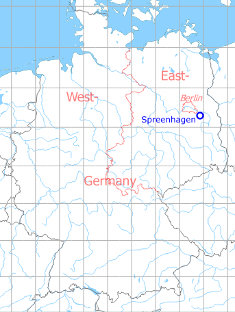
Germany during the Cold War Map
The history of the Cold War airfields: Spreenhagen
Location of airfield
The highway strip was located 16 km west-southwest of Fürstenwalde. Former Autobahn A3, now A12, between the intersections Friedersdorf and Storkow.
During the Cold War
Use
Highway Strip.
The highway strip had the airfield ID 2024. The NATO name was "Friedrichshof Highway Strip" (Friedrichshof is located southwest of the Friedersdorf intersection).
In the 1960s
Situation
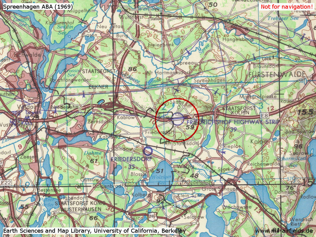
Spreenhagen Highway Strip - here named as Friedrichshof Highway Strip - on a US map from 1969
Source: Earth Sciences and Map Library, University of California, Berkeley
In the 1980s and early 1990s
Overview
Runways
- 08/26: ca. 2400 m 085°/265°
Radio beacons
Data for the 1980s:
- LOM 26: 833 "UJ", Main landing direction
- LMM 26: 198.5 "U"
- LOM 08: 833 "JU", Secondary landing direction
- LMM 08: 198.5 "U"
The radio beacons were not permanently deployed. The idents were derived from the first and the last letter of the call sign (UROSHAJ).
Communication
The radio call sign of the airfield was "UROSHAJ".
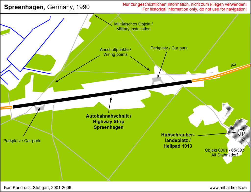
There were two wiring points to the communication network in the north of the highway strip.
Additional information
Minutes of the meeting of the former East German National Defense Council from November 11th, 1985:
Completion was planned for 1980 and done in 1984. The highway strip is categorized as not usable for the military. Reasons: symptoms of age at the paved surfaces, missing load-bearing capacity of the lateral strips and unpaved ramps (Source: Bundesarchiv).
Completion was planned for 1980 and done in 1984. The highway strip is categorized as not usable for the military. Reasons: symptoms of age at the paved surfaces, missing load-bearing capacity of the lateral strips and unpaved ramps (Source: Bundesarchiv).
Today
Use
Closed.
Airfields in the vicinity
- 108°/2km Spreenhagen: Helipad 1013 (HSLP / HLP 1013)
- 085°/8km Markgrafpieske: SA-2 Missile Site (Helipad 3110)
- 142°/11km Storkow: Helipad 1027 (HSLP 1027)
- 118°/13km Reichenwalde: Helipad 3120 (HSLP 3120)
- 285°/13km Niederlehme: Helipads 1011, 3041
- 082°/15km Fürstenwalde: Helipad 3002 (HSLP / HLP 3002)
- 308°/15km Berlin: Müggelheim Agricultural Airfield
- 159°/17km Kehrigk: Helipad 3071 (HSLP / HLP 3071)
- 062°/19km Fürstenwalde: Airfield
- 108°/20km Wilmersdorf: Helipad 3023 (HSLP / HLP 3023)
- 146°/20km Limsdorf: Helipad 3011 (HSLP 3011)
- 207°/20km Kleinköris / Löpten: Airfield (Löpten, Klein Köris)
 Follow mil-airfields on Facebook