For historical information only, do not use for navigation or aviation purposes!
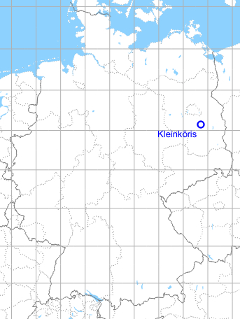
| Coordinates | N520852 E0134254 (WGS84) Google Maps |
| Elevation | 40 m / 135 ft |
| Former East Germany (GDR) | District of Potsdam |
| Federal state | Brandenburg |
| Airfield Id | 2071 |
Germany during the Cold War Map
The history of the Cold War airfields: Kleinköris / Löpten
General
Kleinköris airfield was put to operation in 1969. It was used as a reserve airfield for Fighter Wing 7 (JG-7) of the former East German Air Force (NVA LSK/LV), which was based at Drewitz Air Base. Training took place in strength of a squadron about 4 to 5 times a year. The field was also used by the helicopter unit of the former German People's Police (Deutsche Volkspolizei, VP).
In 1990 the airfield was closed and temporarily used as storage area for East German weapon systems, e.g. tanks. In 2007, one more time aircraft were flown in Kleinköris, when scenes for a historic film were taken here, including flights with a Junkers Ju-52.
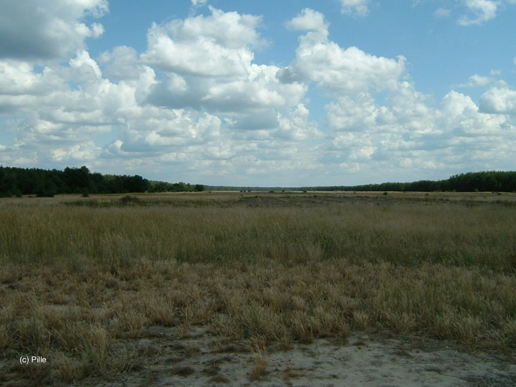
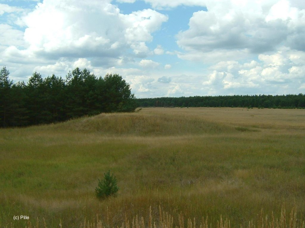
Location of airfield
6 km northwest of Maerkisch Buchholz, 20 km southwest of Storkow.
During the Cold War
In the 1960s
Use
The airfield was put into operation in 1969.
Situation
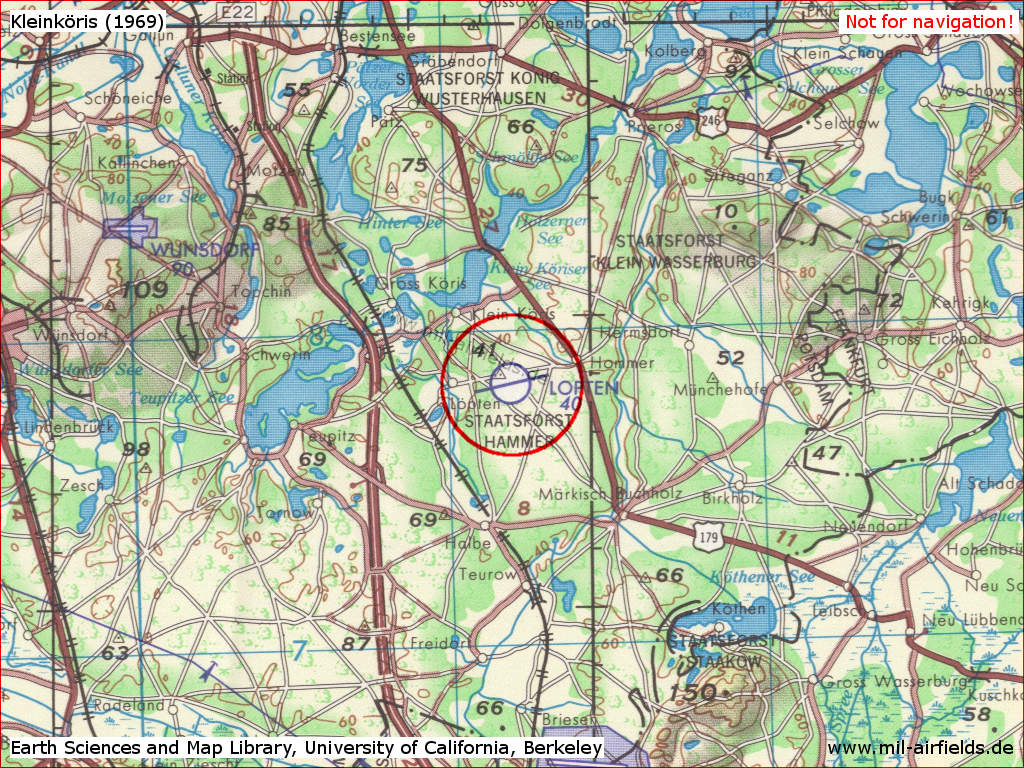
Kleinköris Airfield on a US map from 1969 - (Source: Earth Sciences and Map Library, University of California, Berkeley)
In the 1970s
Overview
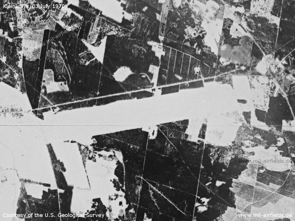
East German Kleinköris Airfield on a US satellite image from 03 March 1970 - The landscape is covered with snow, the airfield is not cleared
Source: U.S. Geological Survey
In the 1980s and early 1990s
Overview
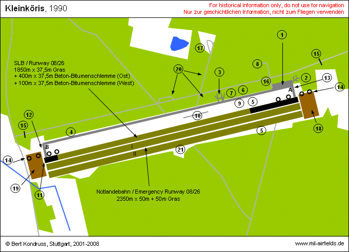
| A, B | Taxiway designator |
| (1) | Flight line |
| (2) | Dispersal for 4 aircrafts 1st flight |
| (3) | Dispersal for 4 aircrafts 2nd flight |
| (4) | Dispersal for 6 aircrafts 3rd flight |
| (5) | Helicopter landing areas |
| (6) | Control tower and command post |
| (7) | Rescue unit |
| (8) | Technical zone |
| (9) | Direction finder |
| (10) | Sprinkler system |
| (11) | Jet barrier TFF-72 |
| (12) | De-arm area for main landing direction (de-arm in direction SE) |
| (13) | De-arm area for secondary landing direction (de-arm in direction SE) |
| (14) | Flood light positions |
| (15) | Road barriers |
| (16) | Tyre cleaning |
| (17) | Support installations |
| (18) | Overrun (earth) 250m x 175m |
| (19) | Overrun (earth) 250m x 175m |
| (20) | Fuel depot |
| (21) | Prepared spot for GCA radar |
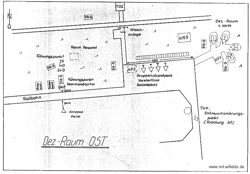
Dispersal area east.
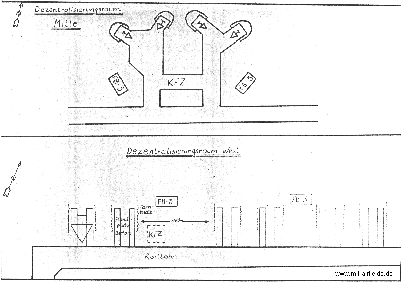
Dispersal area middle and west.
Runways
- 08/26: 2350 m x 37,5 m Concrete-Bitumen / Grass / Concrete-Bitumen
- 08/26: 2350 m x 2 x 50 m Grass
The main runway had a grass surface and paved touchdown zones. There was also a paved circular taxiway. This layout was typical for airstrips of the East German Air Force.
The airfield had a length of 2750 m (9022 ft) and a width of 250 m (820 ft). The distance between the runway and the circular taxiway - the northern safety zone - was 110 m (360 ft). In the south, the distance between the runway and the airfield limits - the southern safety zone - was 160 m (524 ft). The earth breaking areas were in a distance of 25 m (82 ft) from the runway thresholds.
The runway had a length of 2350 m (7709 ft) and a width of 37.5 m (123 ft). The touchdown zones were paved, 400 m (1312 ft) in the east and 100 m (328 ft) in the west. The surface was a bitumen-cement slurry. The part in between was grass. The emergency runway was to the south of the main runway. It had a length of 2350 m (7709 ft) and was made of two parts, each of 50 m (164 ft) width. The circular taxiway was also made of bitumen-cement slurry and had a width of 11,5 m (37 ft). The bearing capacity of the airfield was given with 9.5 .. 10 kp/cm2.
Elevation of the runway thresholds were: Threshold east 40.4 m, threshold west: 40.9 m
In main landing direction 260°, an arresting gear TFF-72 was installed, which could have been remotely operated by the flight director.
There were 3 helicopter landing spots:
1. At the group ramp of the flight line,
2. 50 m northeast of the runway and 400 m west of the touchdown point
3. 160 m south of the runway and 400 m west of the touchdown point.
1. At the group ramp of the flight line,
2. 50 m northeast of the runway and 400 m west of the touchdown point
3. 160 m south of the runway and 400 m west of the touchdown point.
Lights
Lighting during the 1980s:
- runway lighting system MLOK-2M (only in main landing direction)
- lighting for circular taxiway: MLOK-P
- coded identification beacon KNS 8
- 4 landing flood lights ARM-90
- runway lighting system MLOK-2M (only in main landing direction)
- lighting for circular taxiway: MLOK-P
- coded identification beacon KNS 8
- 4 landing flood lights ARM-90
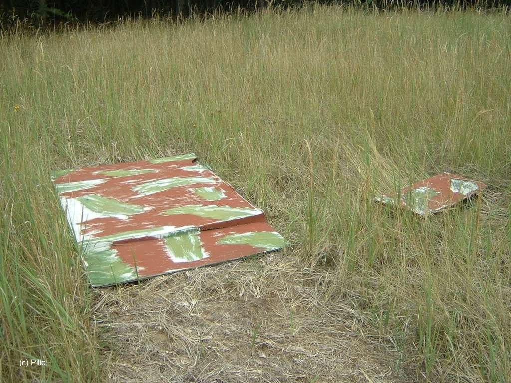
The emergency runway had no lighting. It was marked by red blankets.
Radio beacons
Data for the 1980s:
- LOM 26: 713 "LI", 4000 m to threshold 26, Type: PAR-8ss
- LMM 26: 168 "L", 750 m to threshold 26, Type: PAR-8ss
Radio beacons were deployed only in main landing direction 260°.
As common for Warsaw Pact forces, the idents of the radio beacons were derived from the first and the last character of the radio call sign. Here it was "LILLI".
Radar
Radar assistance in the area was to be provided by the Radar Company 413 (Funktechnische Kompanie 413, FuTK-413), as the airfield had no own radar. On the southern side of the airfield were earth mounds with ramps, maybe prepared to operate radar equipment.
Radio communication
The call sign of the airfield was "LILLI" with "LILLI START" for the tower and "LILLI PELENG" for the direction finder.
The direction finder was located at the field, not at the standard 1000m-point.
Equipment during the 1980s:
- Tower controller on SKP-9 mobile tower with radios R-824 and R-869,
- Technical room with 4 radios R-824,
- VHF direction finder ARP-6 with a R-824 radio.
- Tower controller on SKP-9 mobile tower with radios R-824 and R-869,
- Technical room with 4 radios R-824,
- VHF direction finder ARP-6 with a R-824 radio.
Airspace and procedures
The chief of the local signals and air traffic control unit was the tower controller. During a deployment of aircrafts to the airfield, he had the task to assure the landing of the first aircraft. The first aircraft was a double-seater, which brought along the tower controller of the deploying unit. He took over the landings of all subsequent aircrafts.
Maps
Maps from the formerly secret East German document "Verzeichnis 012" ("Directory 012").
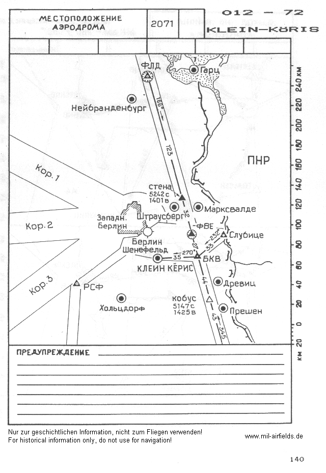
Situation
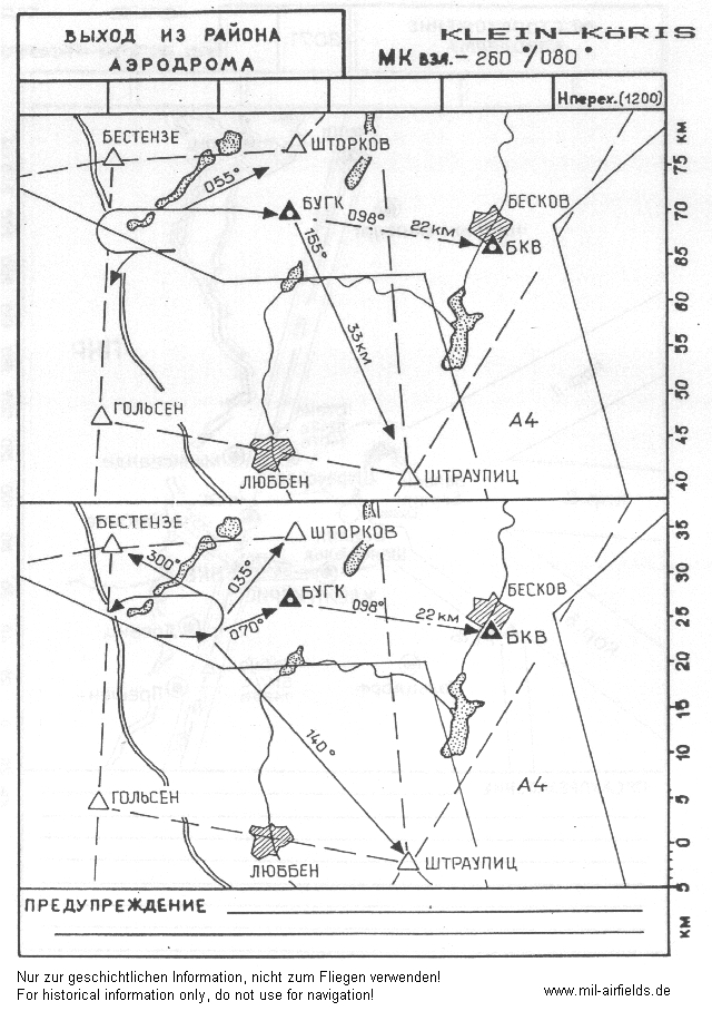
Departure routes
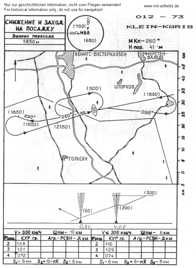
Locator approach for main landing direction 260°.
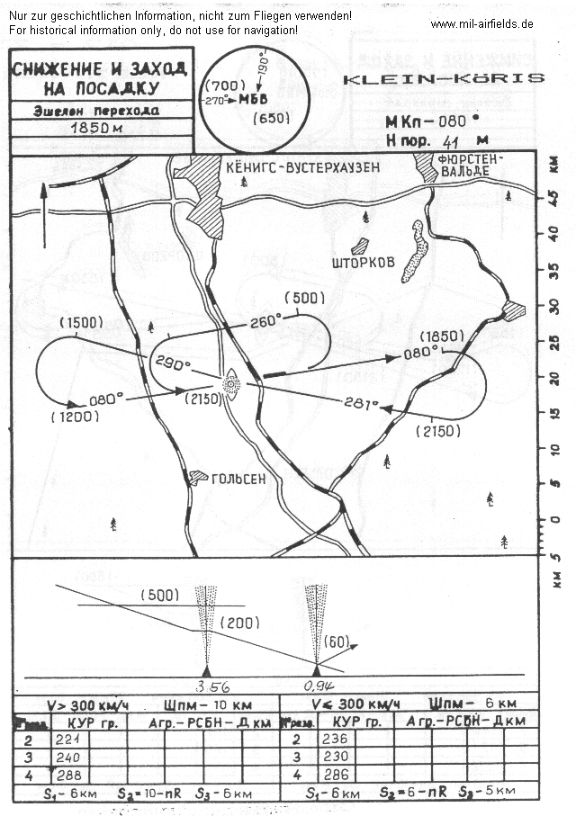
Locator approach for secondary landing direction 080°.
Units
For many years, the airfield belonged to the Fighter Wing 7 (Jagdgeschwader 7, JG-7). After disbanding this unit, the field was presumably assigned to Fighter Wing 1 (JG-1). The operating unit was the Reserve Airfield Detachment 7 (Feldflugplatzkommando 7, FFpK-7, post box 44131).
There were ca. 40 soldiers at the field, as guards and for operating the signals- and air traffic control equipment.
Real property
The airfield had the National People's Army installation ID 04/063.
The area was not fenced. The road to the nearby villages Löpten and Hammer as well as the road to Halbe could be closed by barriers.
There are some FB-3 bunkers at the area.
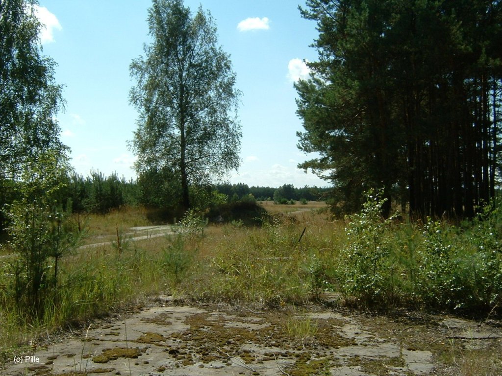
Today
Use
Closed.
Images
The following pictures were taken in 2006 and were provided by Pille. Thank you very much for this extensive documentation!
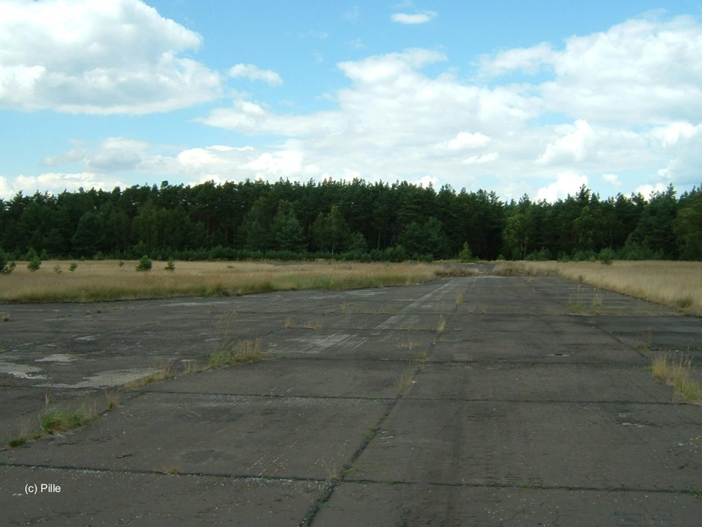
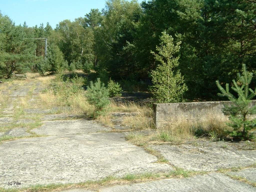
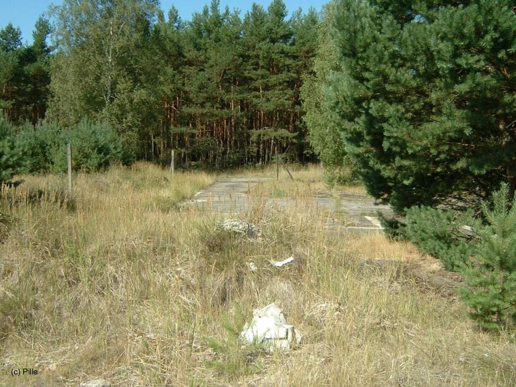
Runways and Taxiways
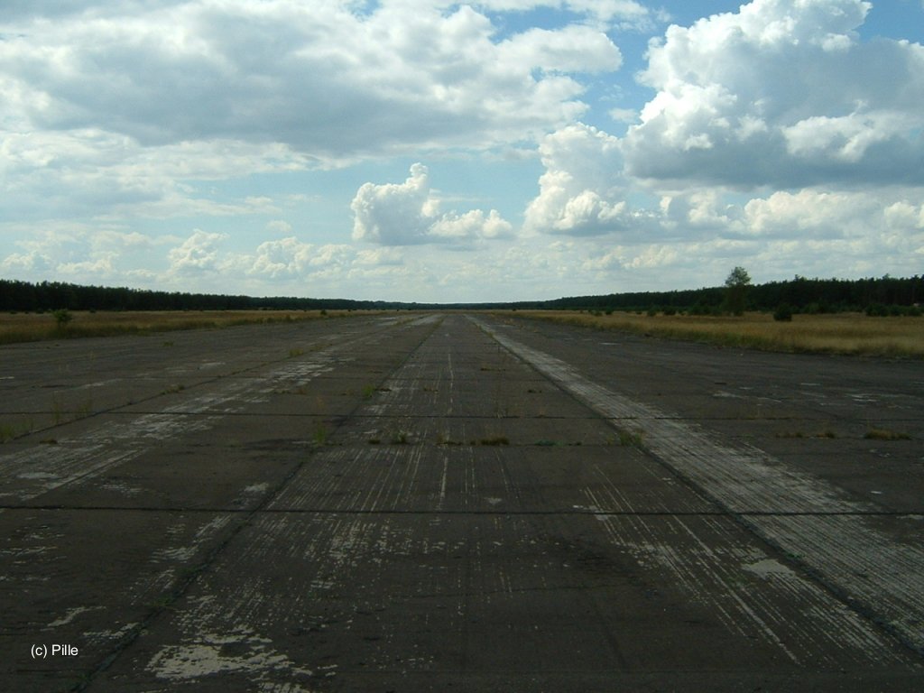
Eastern end of the runway, looking west ...
... and looking north to the taxiway.
Western end of the runway, looking east ...
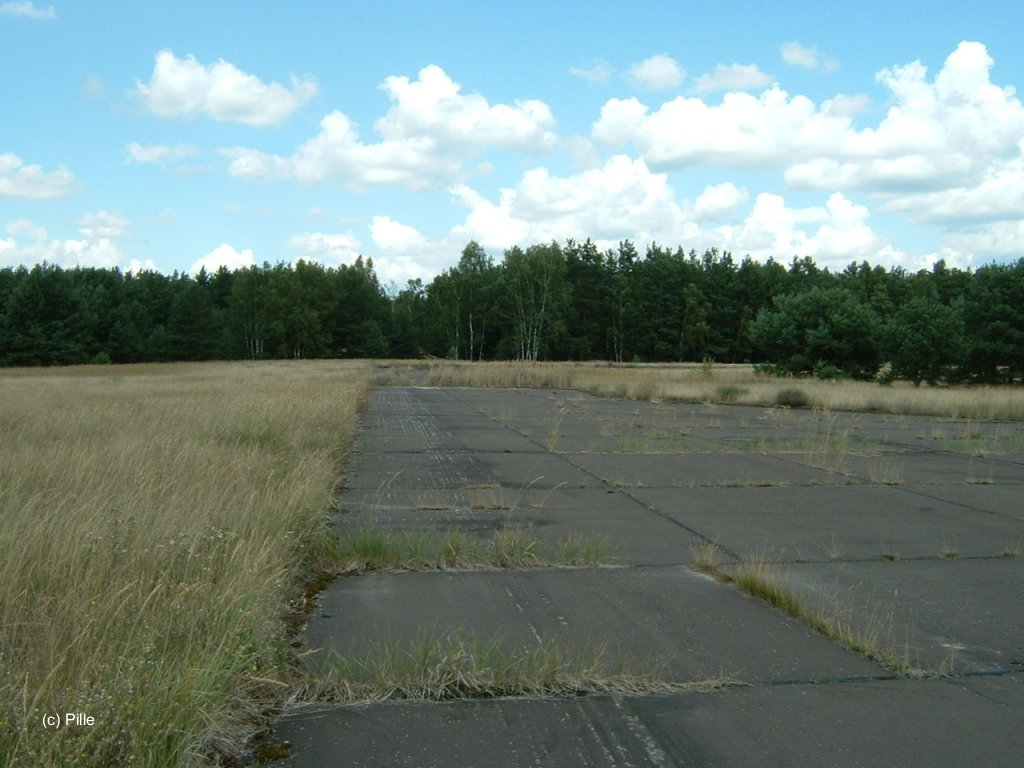
... and looking north to the taxiway.

Taxiway parallel to the runway.

Flight ramp / flight line, looking east.
Dispersal area "East" (east of flight line)
Dispersal area "Center"
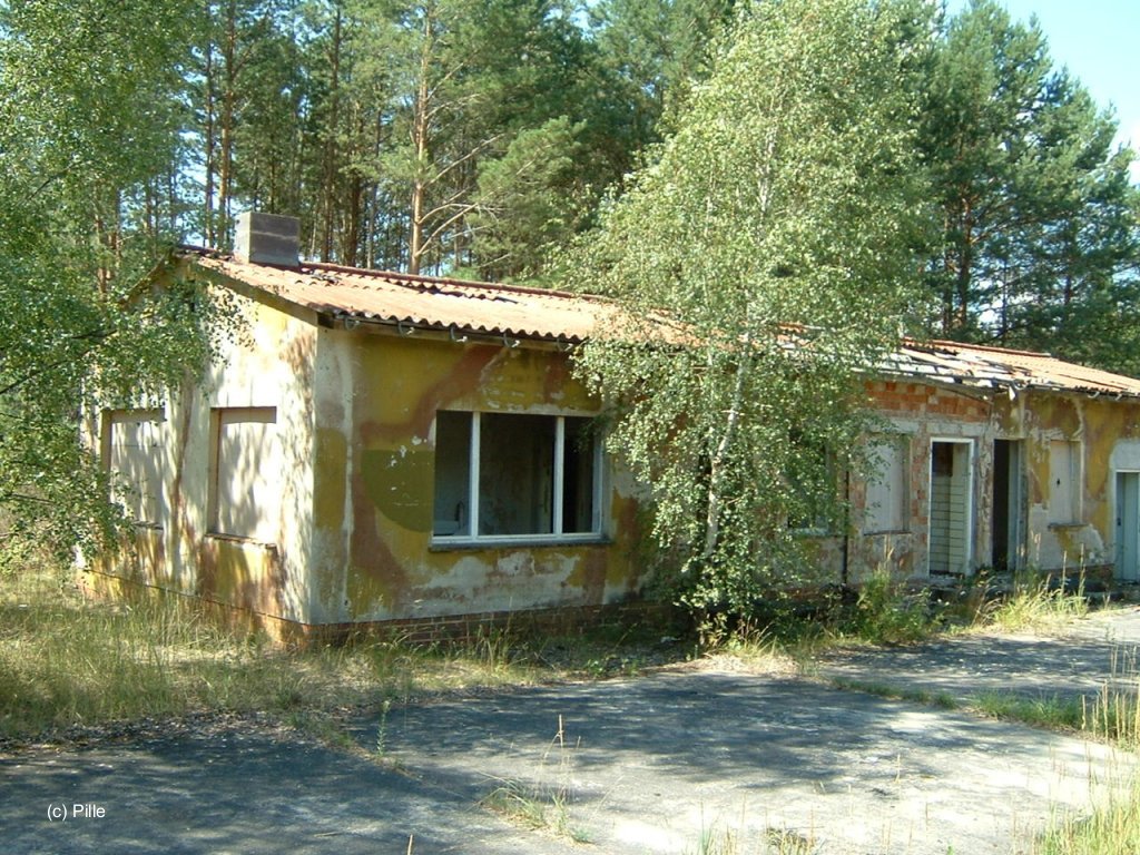
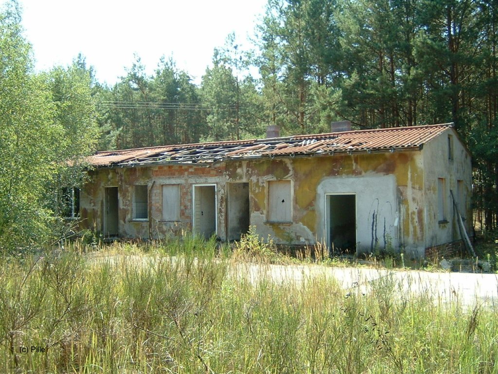
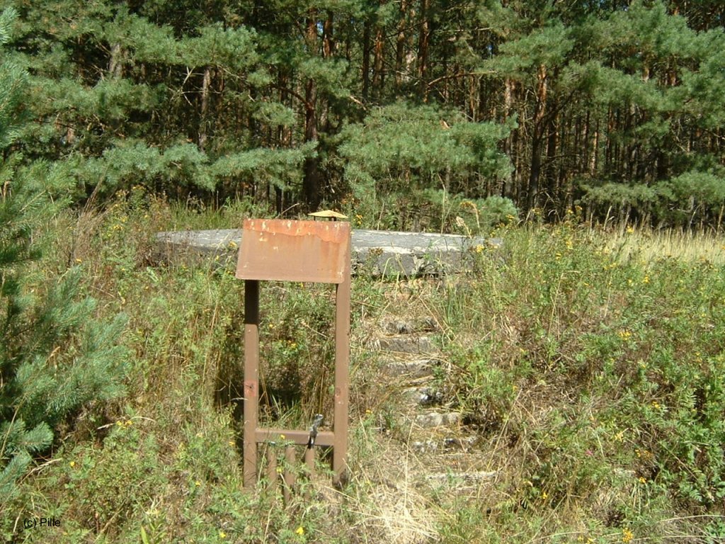
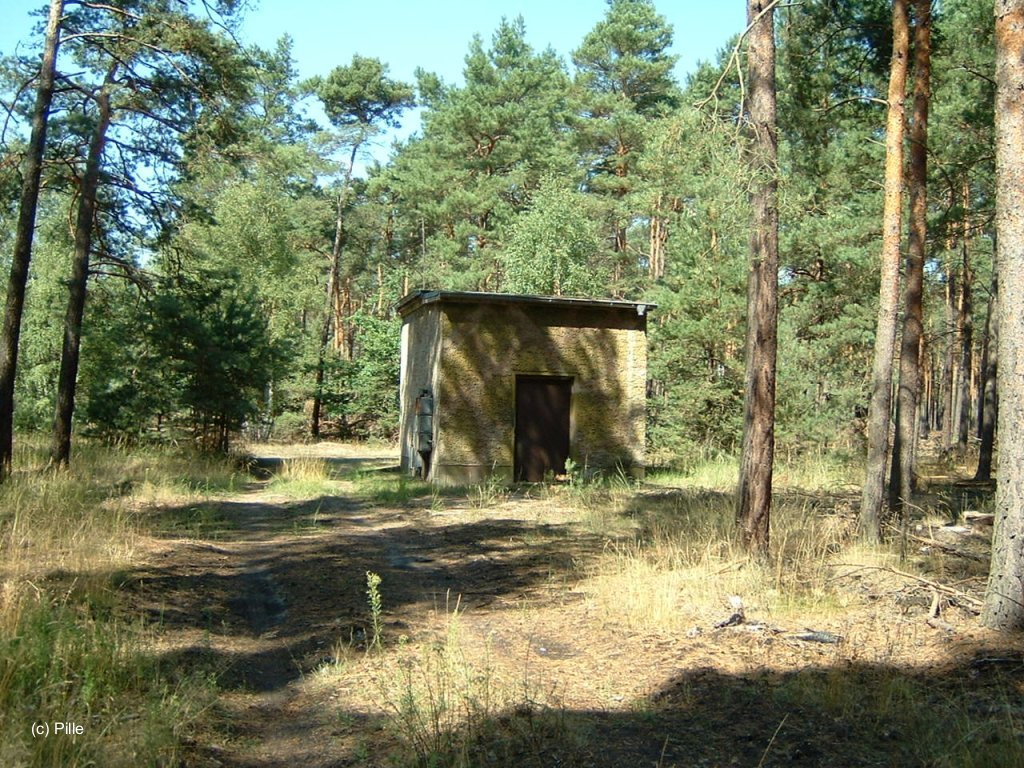
Control Tower
At Kleinköris, there was a solid building for the flight director. It was connected to a bunker.
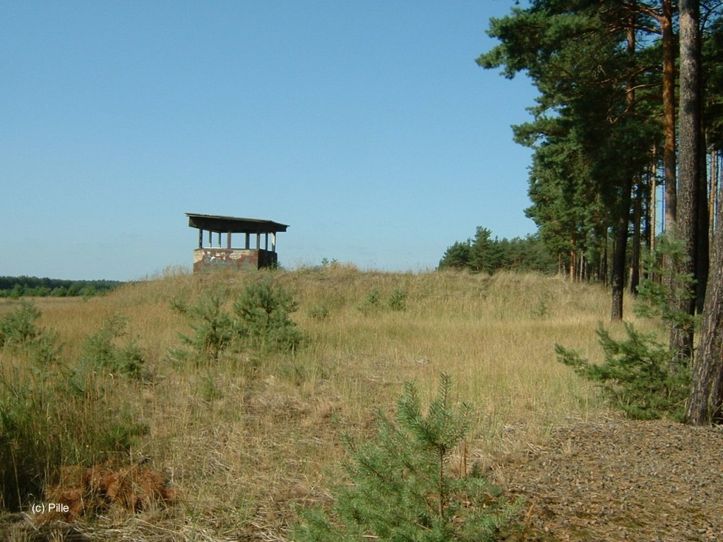
View from east
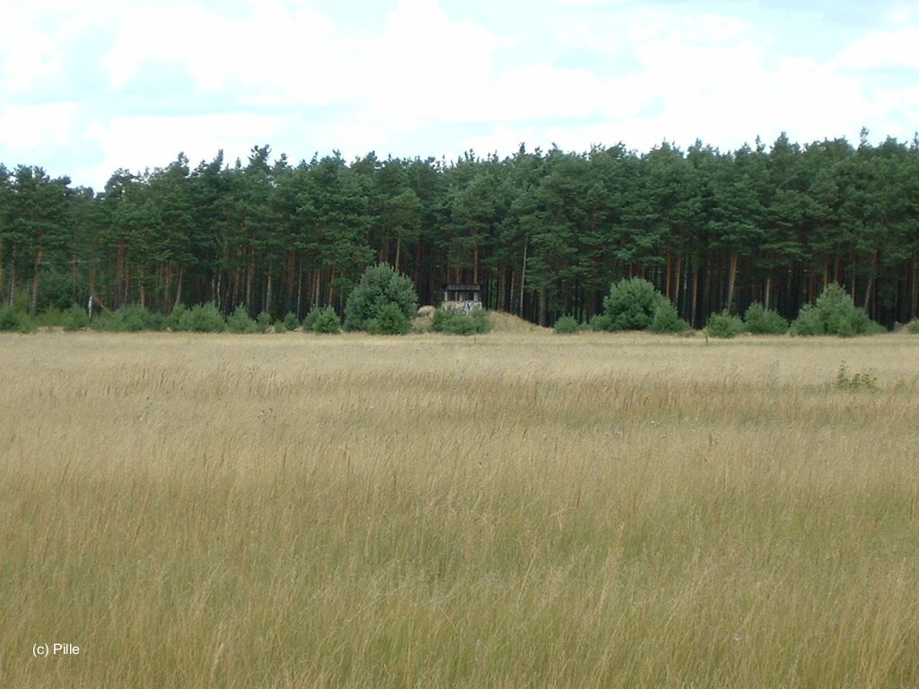
View from runway, from the south
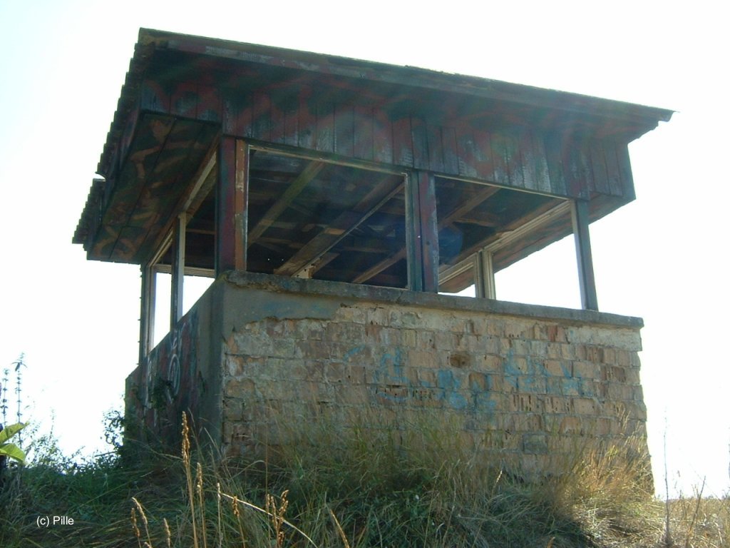
View from west

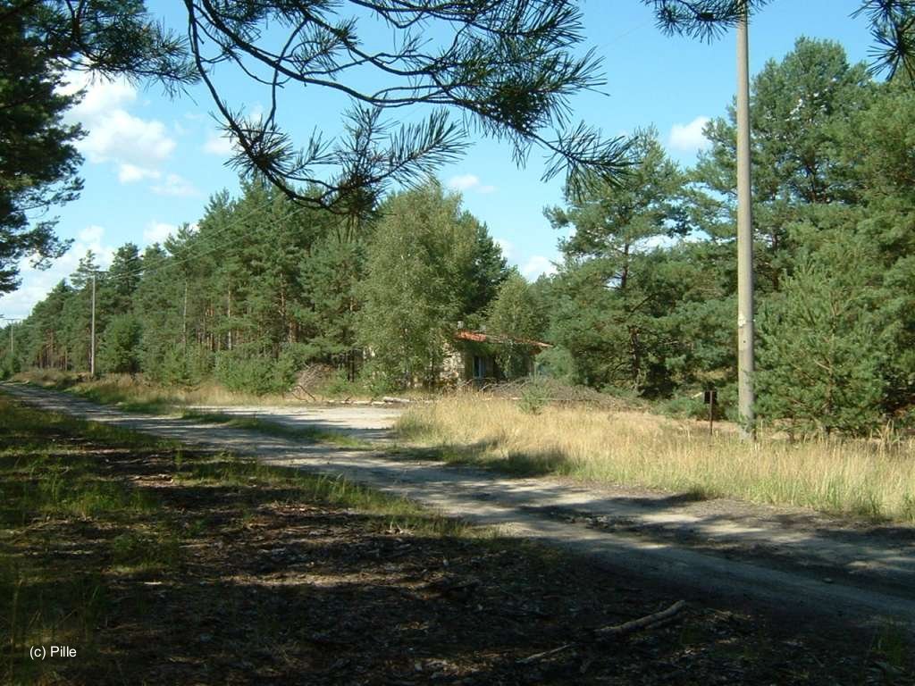
Access
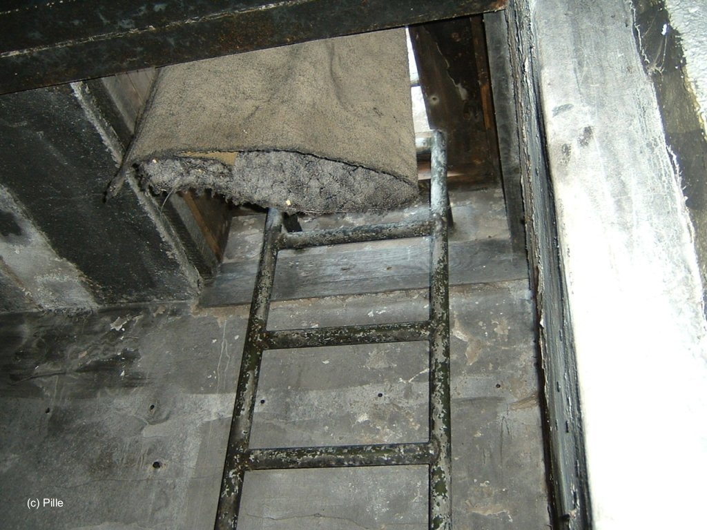
Ascend
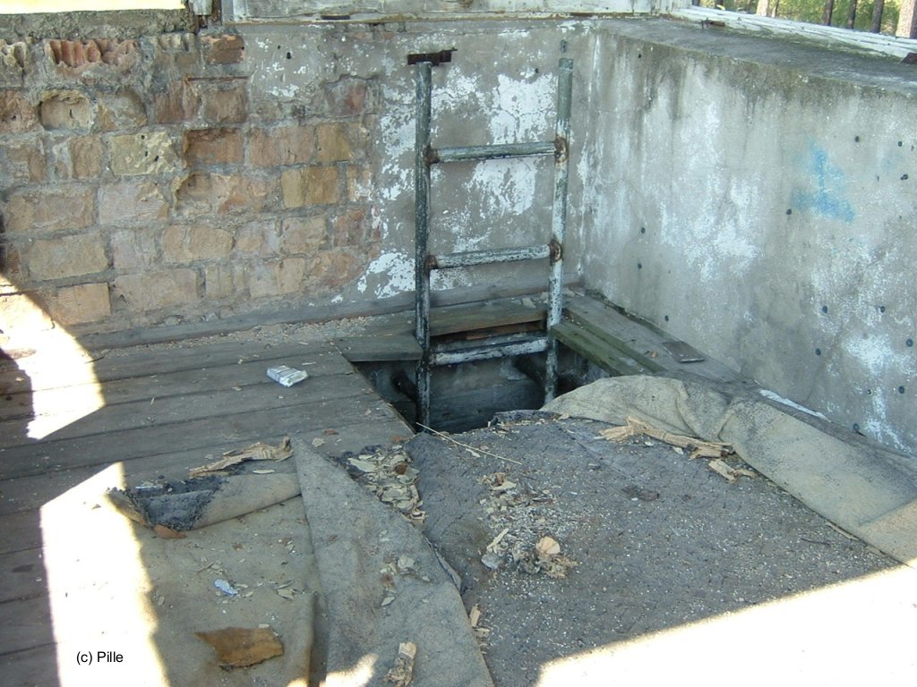
Inside
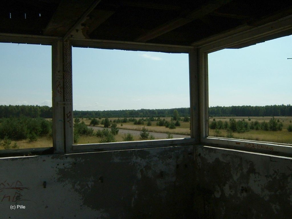
Looking east
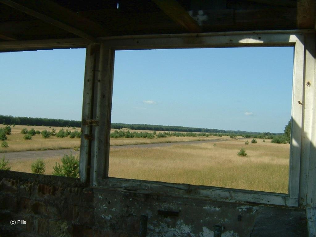
Looking west
Access to the taxiways and ramps
Western access, looking south
Set-up area, looking north
Set-up area with access, looking west
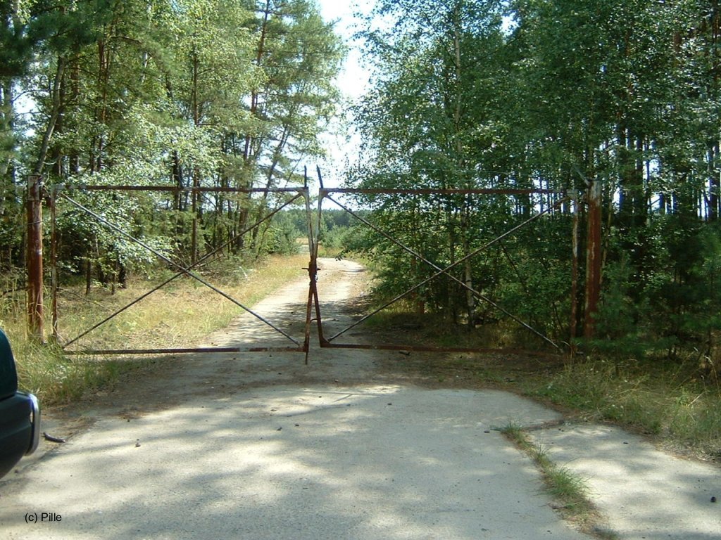
Eastern access
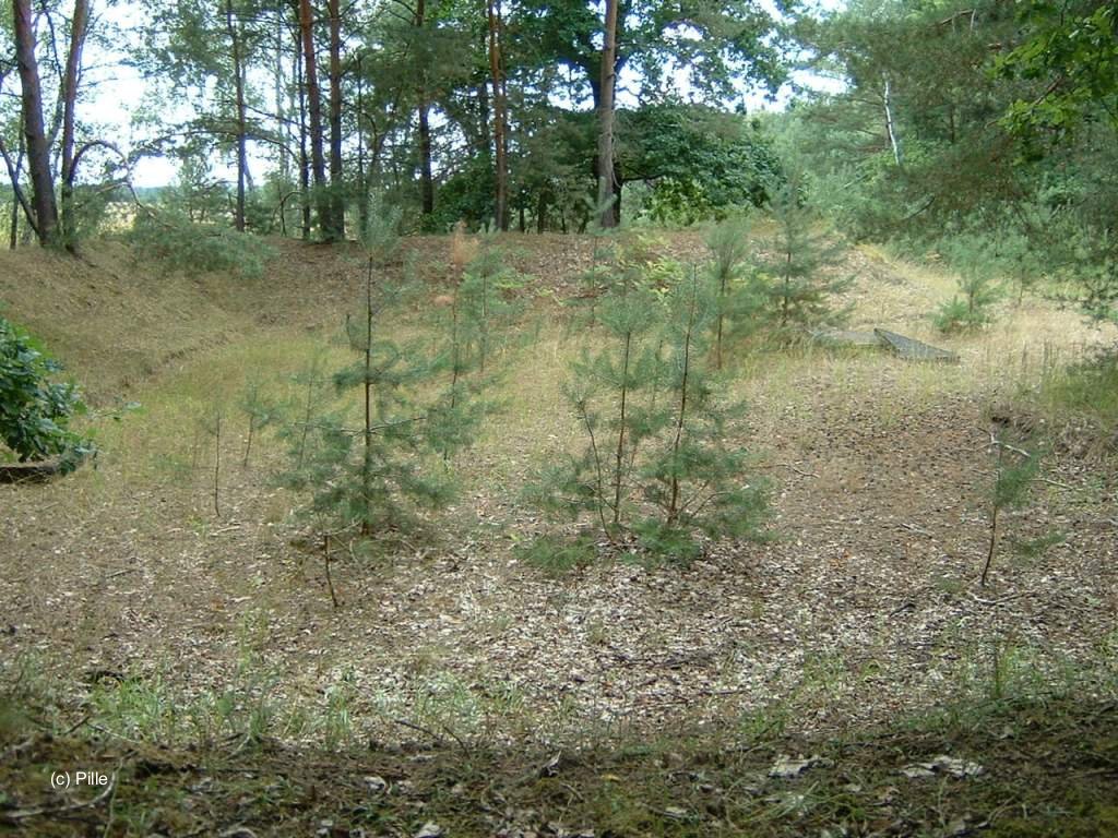
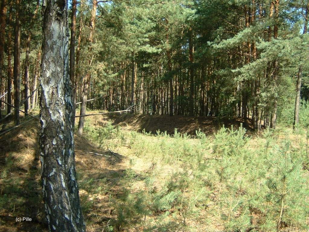
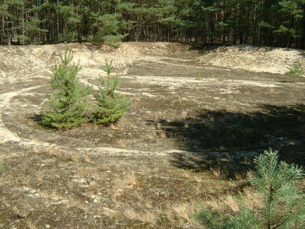
Earth mounds
South of the runway were two mounds with ramps. They were probably prepared to house radar equipment.
Both earth mounds, as seen from the nothern side of the airfield.
Western earth mound, as seen from the eastern mound
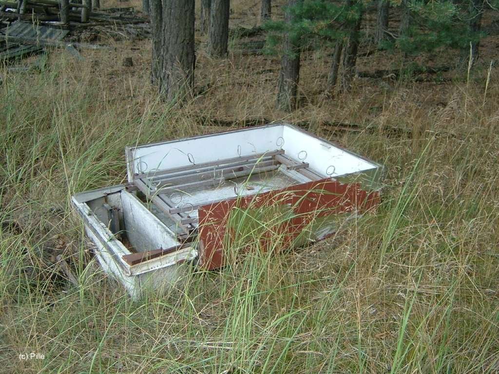
Relics of a switchboard between the mounds
Fuel Depot
Access to the fuel depot, view from the east.
Building, view from the south
Building, view from the east

Building, view from the north
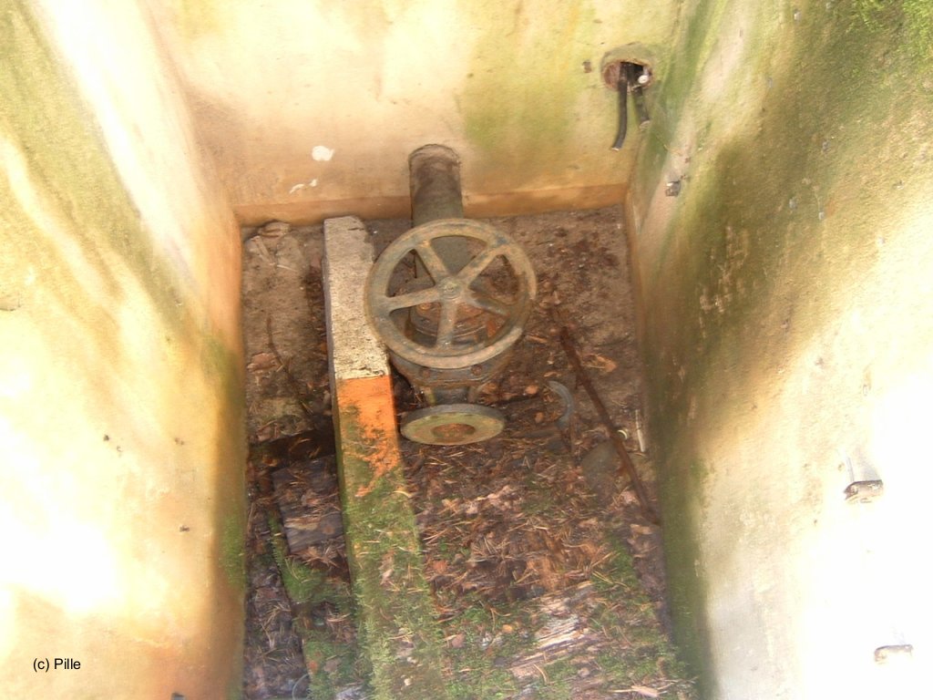
Water basin at the access, near the building
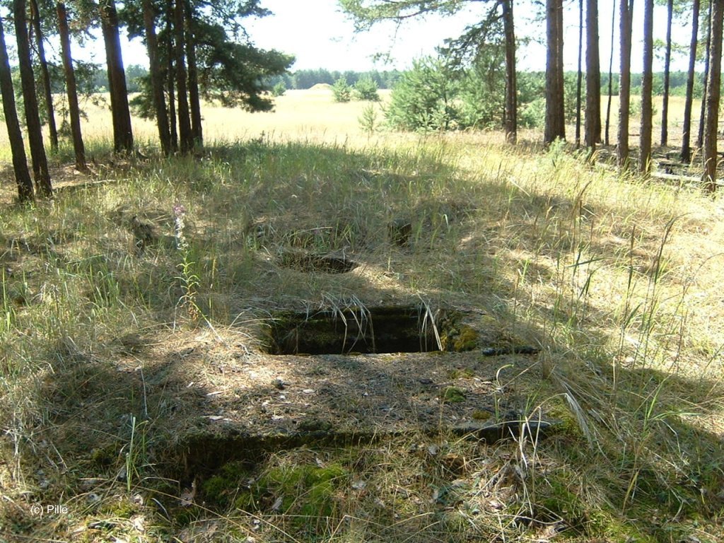
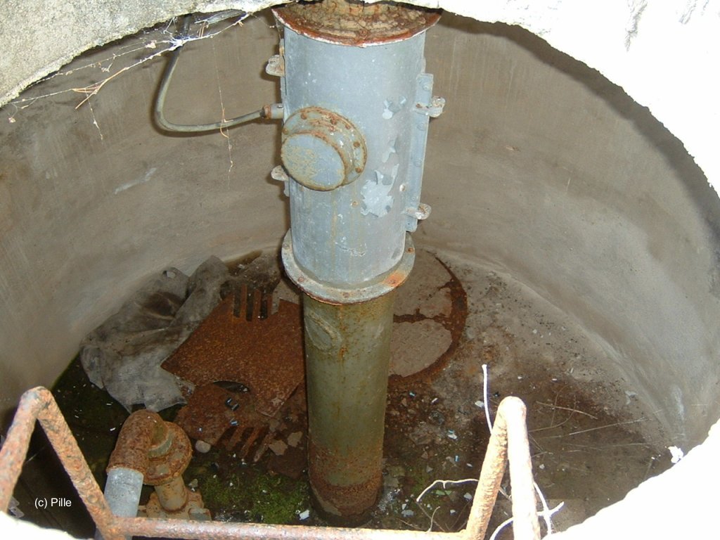
Shafts
There were 6 shafts on the area. Here are three of them:
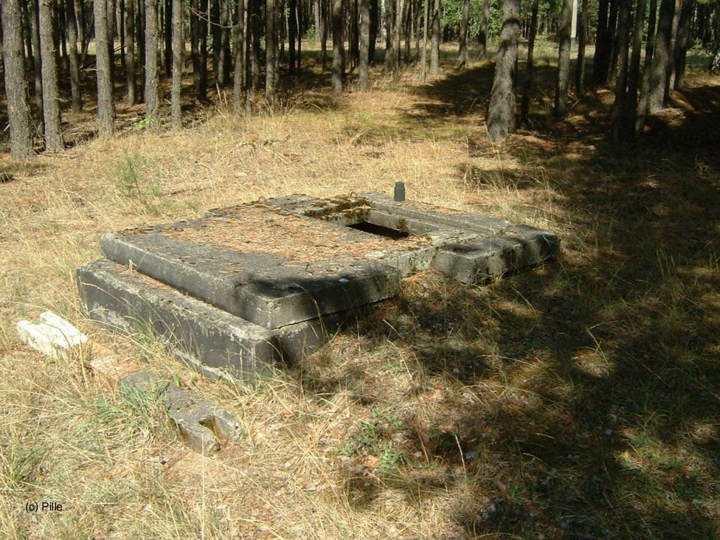
A shaft outside ...
... and inside
Another shaft ...
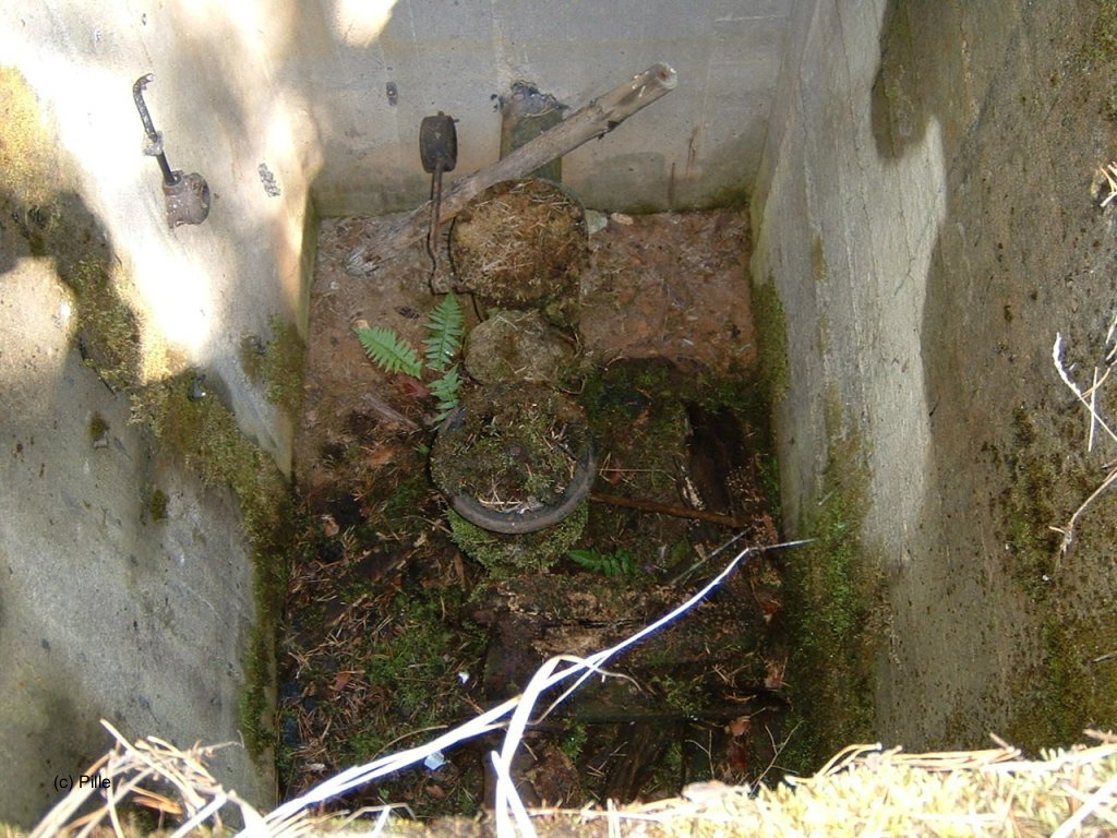
... and from inside
Fountain from outside (1)
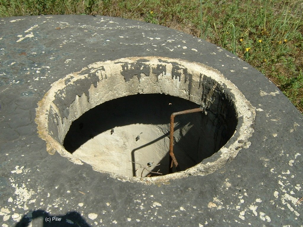
(2)
Fountain inside
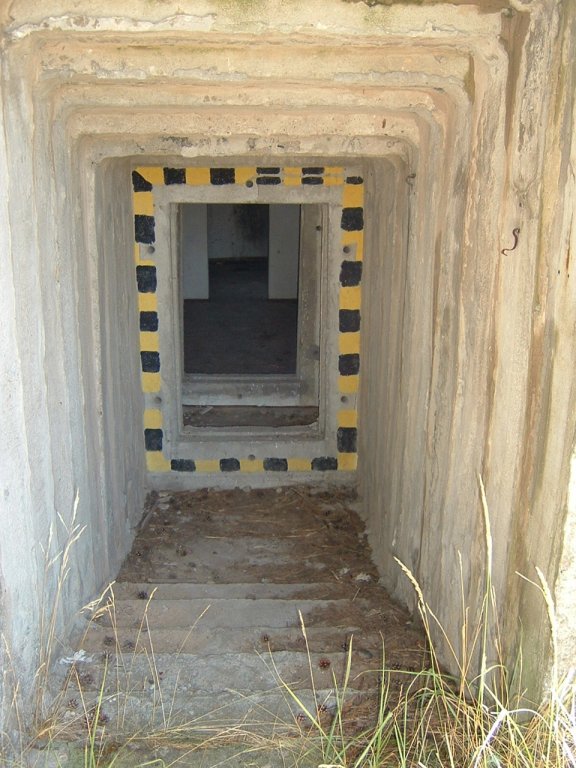
Bunker
There were 12 bunkers FB-3 at the airfield:
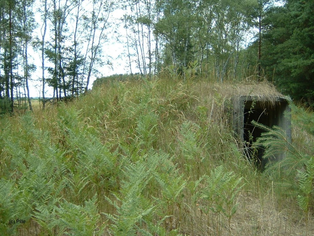
Bunker FB-3, located immediately south of dispersal area "East".
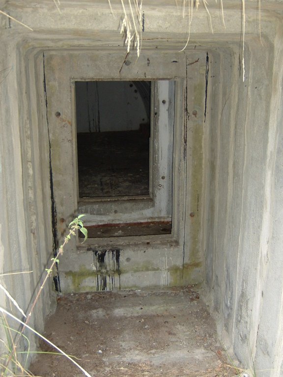
Same bunker, entry ...
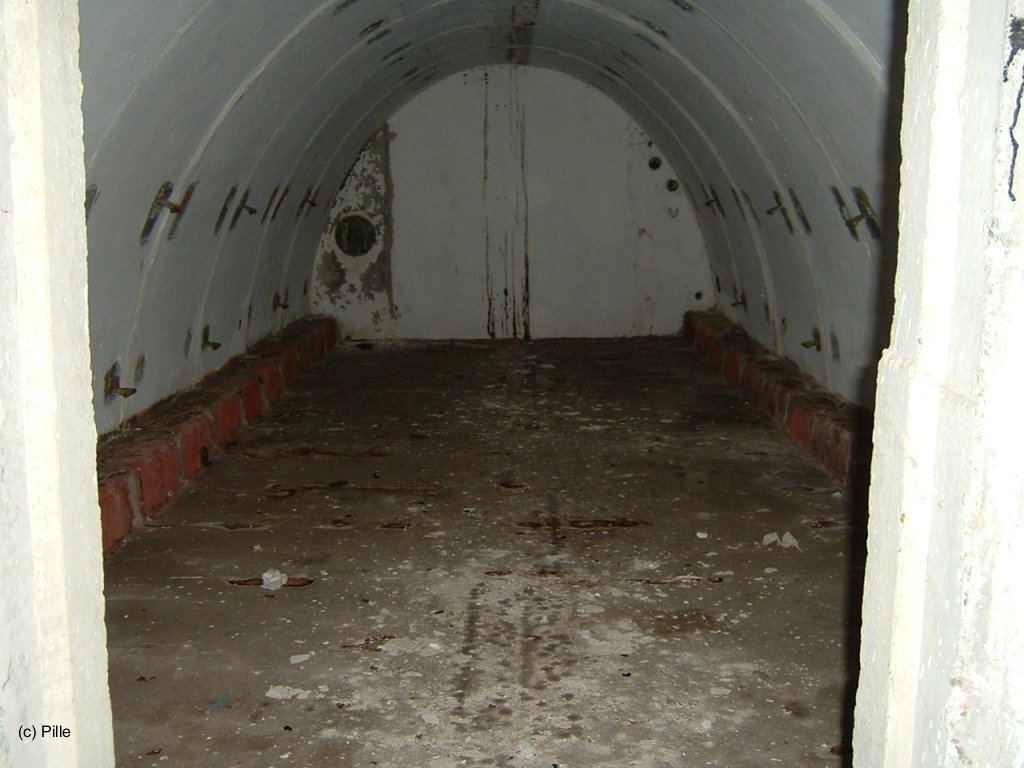
and inside view.
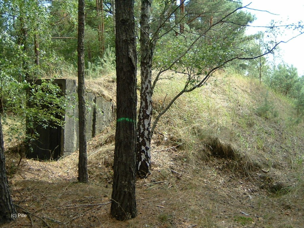
Nothern bunker FB-3 of dispersal area "East", view from west.

Bunker FB3 between flight line and tower, view from east.
Entry to this bunker.

Bunker FB-3 northwest of tower, view from east.
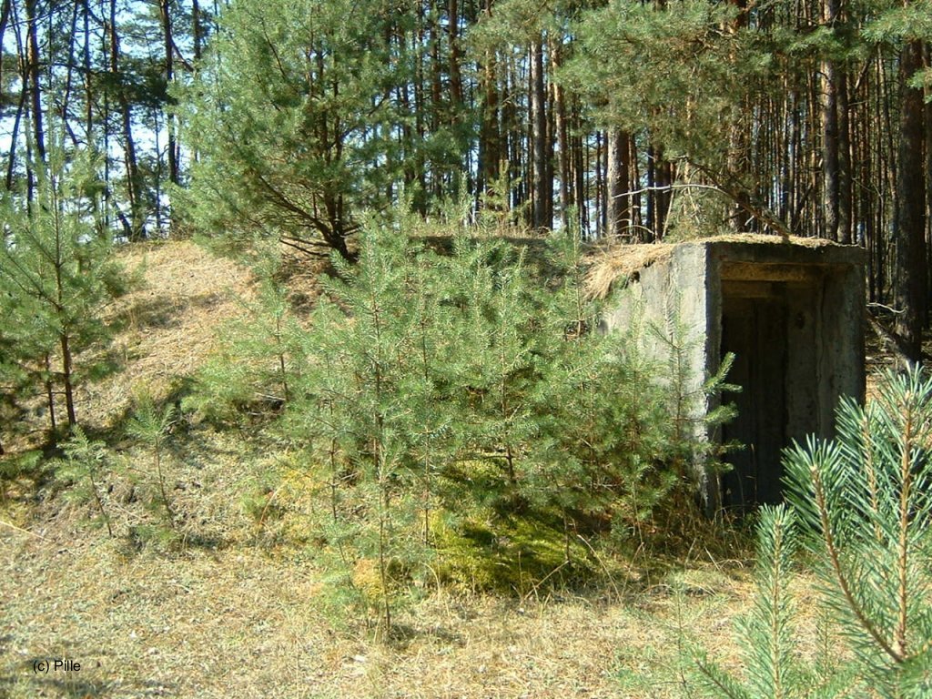
Bunker FB-3 located west of dispersal area "Center".

Bunker within the "Technical Service Area"
Others
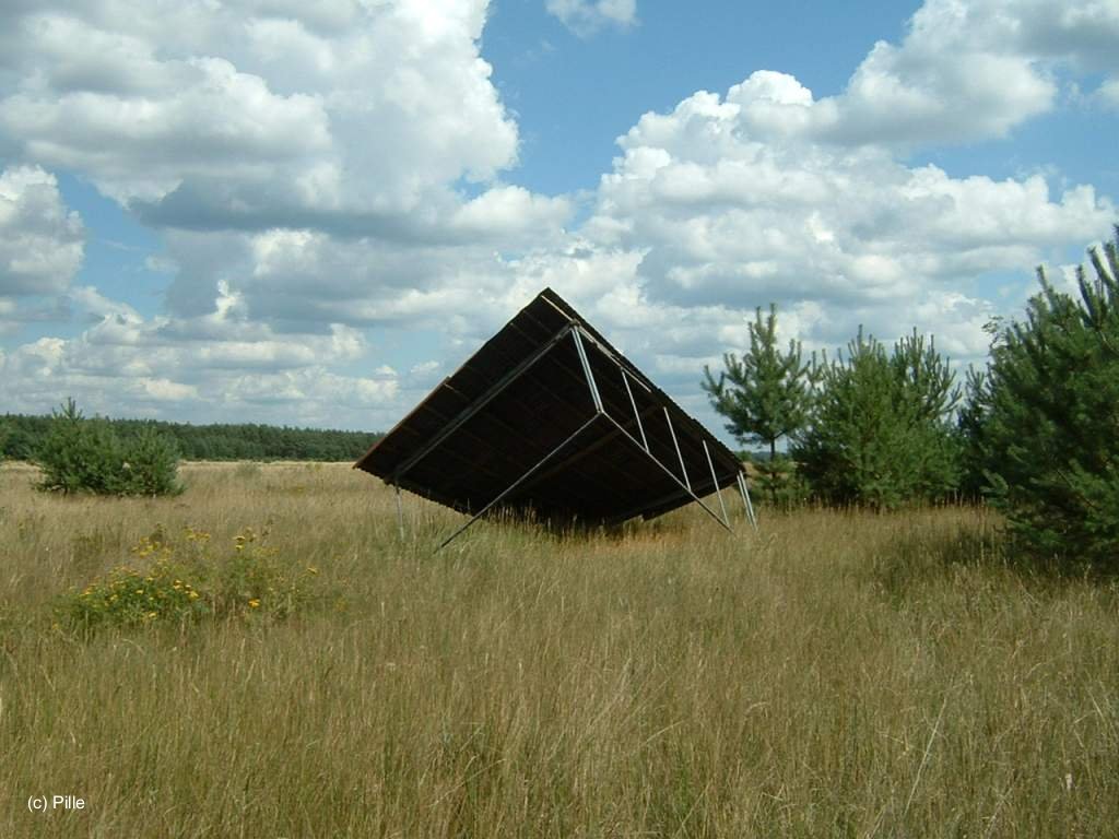
Shelder, south of the western runway end
Transformer building on the northern part of the airfield
One of 3 switchboards on the southern part of the airfield. It was located between the mounds and the western limit
Panoramic pictures of the airfield
The pictures were composed of multiple images, Because of the process, some artifacts and distortions are shown which do not exist in reality.
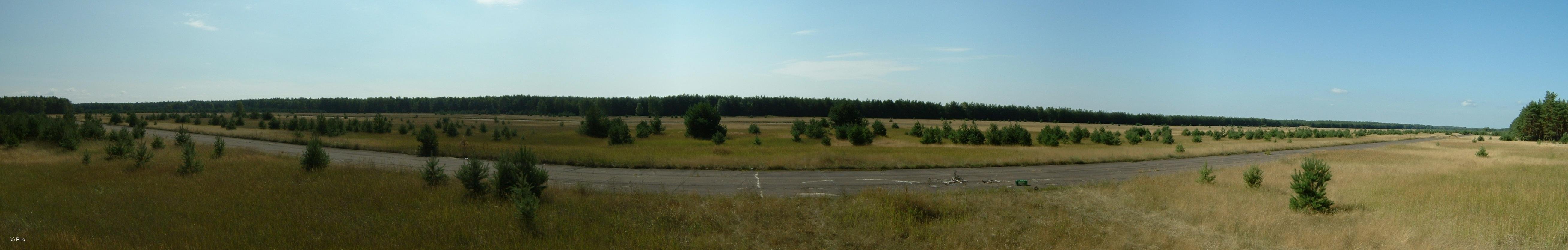
View from the tower, to the east (left) to west (right), composed of 6 images
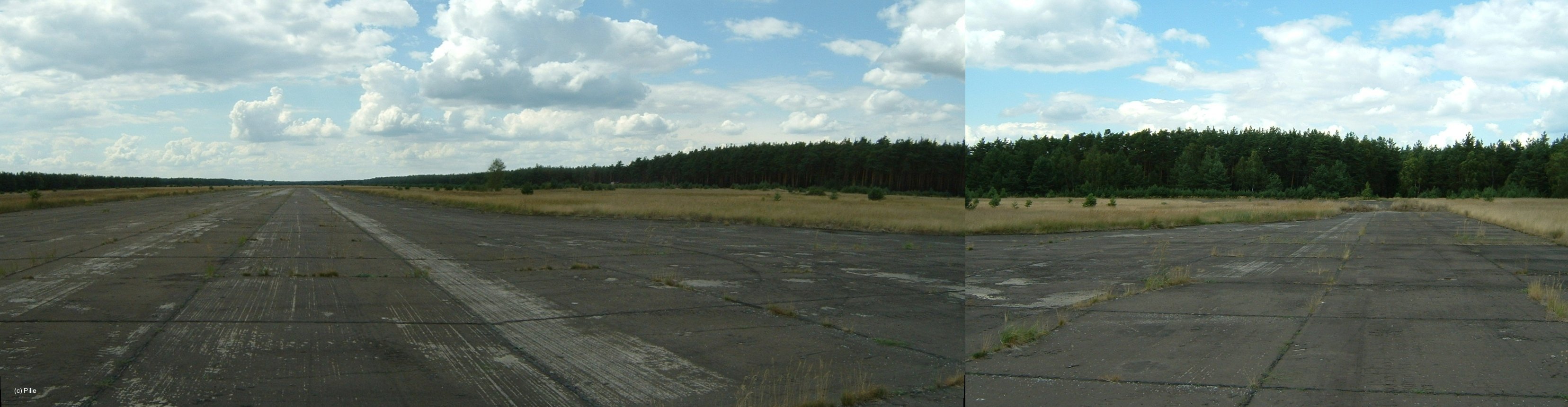
Eastern end of the runway, looking west (left) to north (right). Composed of 3 images.
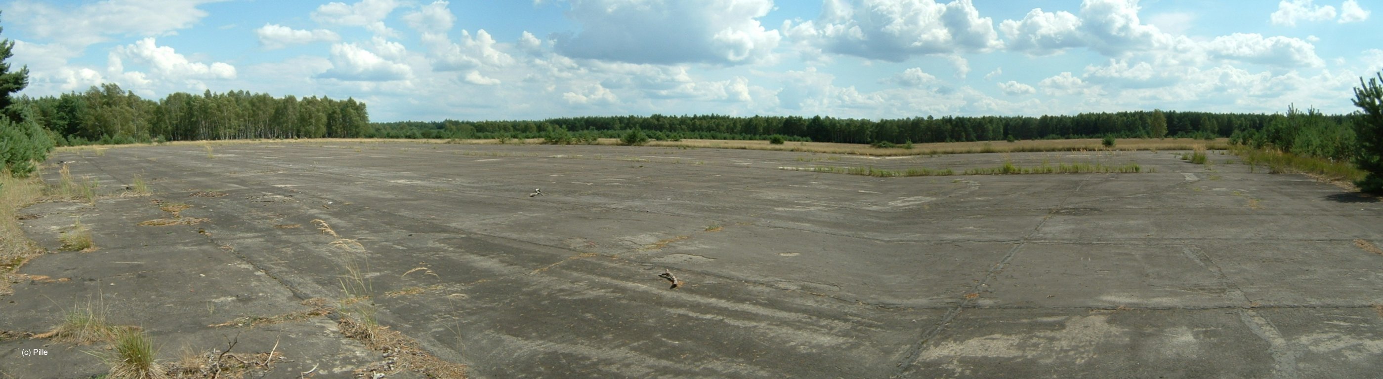
Panoramic view of the flight line. Looking east (left) to south (right). The "bump" right of the center does not really exist, it is an artifact from composing 3 images.
Links
- http://www.history.hqusareur.army.mil/uslmannual.htm (offline): USMLM Unit History 1969 - Short notice from the USMLM concerning the construction of the Loepten airfield: "... but, to date, no flying activity has been observed ..."
- Sachsenbunker
Bibliography
- Bergner, Paul: "Atombunker im Kalten Krieg und das PROGRAMM DELPHIN" Heinrich-Jung-Verlagsgesellschaft mbH, Zella-Mehlis/Meiningen, 2007 - Kurze Beschreibung des Flugplatzes. Allerdings erscheinen insbesondere die Ausführungen zu einer Freund-Feind-Kennung am Nahmarkierungspunkt hinterfragenswert.
Airfields in the vicinity
- 170°/13km Brand: Air Base (Brand-Briesen, Аэродром Бранд)
- 293°/14km Zossen/Wünsdorf
- 081°/16km Kehrigk: Helipad 3071 (HSLP / HLP 3071)
- 059°/19km Storkow: Helipad 1027 (HSLP 1027)
- 027°/20km Spreenhagen: Highway Strip (Autobahnabschnitt ABA, Friedrichshof)
- 033°/21km Spreenhagen: Helipad 1013 (HSLP / HLP 1013)
- 086°/21km Limsdorf: Helipad 3011 (HSLP 3011)
 Follow mil-airfields on Facebook