Zossen/Wünsdorf
For historical information only, do not use for navigation or aviation purposes!
| Coordinates | N521152 E0133114 (WGS84) Google Maps |
| Former East Germany (GDR) | District of Potsdam |
| Federal state | Brandenburg |
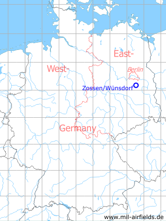
Germany during the Cold War Map
The history of the Cold War airfields: Zossen/Wünsdorf
General
Zossen/Wünsdorf was a small landing site at the headquarters of the Soviet occupation troops in Germany, located south of Berlin. It was used by liaison planes and helicopters. Today the field is closed.
During the Cold War
Use
Landing ground at the Soviet HQ.
In the 1950s
History
CIA report from May/July 1957
1. A new landing ground appears to have been constructed at a point approximately 3 km due east of the Stammlager. The landing ground is on a section of high ground to the east of the Kallinchen-Zehrensdorf road.
2. During the last week of May 1957, three helicopters were seen using the landing ground each day.
3. Three aerial masts approximately 15 to 20 meters high were positioned close to a "T"-shaped building on the landing ground. Wires from the masts led into the building.
4. In a section between the "T"-shaped building and the new airfield there were five box-trailers each with a basket-shaped aerial array mounted on the roof.
5. The following Soviet officers were employed in building No. 64:
Lt. Col. Kyruchin
Major Petrotovaka
Major Andreva
Lt. Col. Kyruchin
Major Petrotovaka
Major Andreva
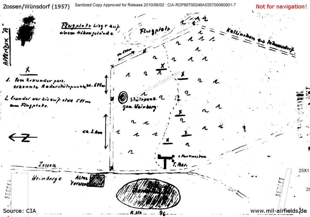
Sketch from the CIA report from 1957. North is left. - Shown are the mentioned airfield, the T-shaped building and the 5 antenna objects. Source: CIA
Texts:
| Kallinchen - Zehrensdorf | (Road) |
| Flugplatz liegt auf einem Höhengelände | The airfield is located on a high ground |
| Vom Erkunder pers. erkannte Radarstützpunkte | From the spotter personally recognized radar sites |
| Erkunder war bis auf etwa 500 m am Flugplatz | The spotter was up to 500 m to the airfield |
| Funkmasten | Radio masts |
Source: /CIA RDP80T00246A035700080001-7/
CIA report about 10 August 1957
1. Attached at Appendix "A" is a sketch showing the location of a landing ground at present in use near ZOSSEN. The runway is approx 1 km in length and 50-60 m in breadth and is constructed from PSP (Pierced Steel Planking).
2. There are no hangars on the landing ground but one large barrack block measuring 10 x 50 m has been constructed to house flying personnel and a construction unit.
3. At the point marked "X" on Appendix "A", there is an aerial array constructed on a wooden platform. Sketches of this array are given at Appendix "B". From the location of this aerial array, overland cables run to the T-shaped building in the STAMMLAGER, ZOSSEN.
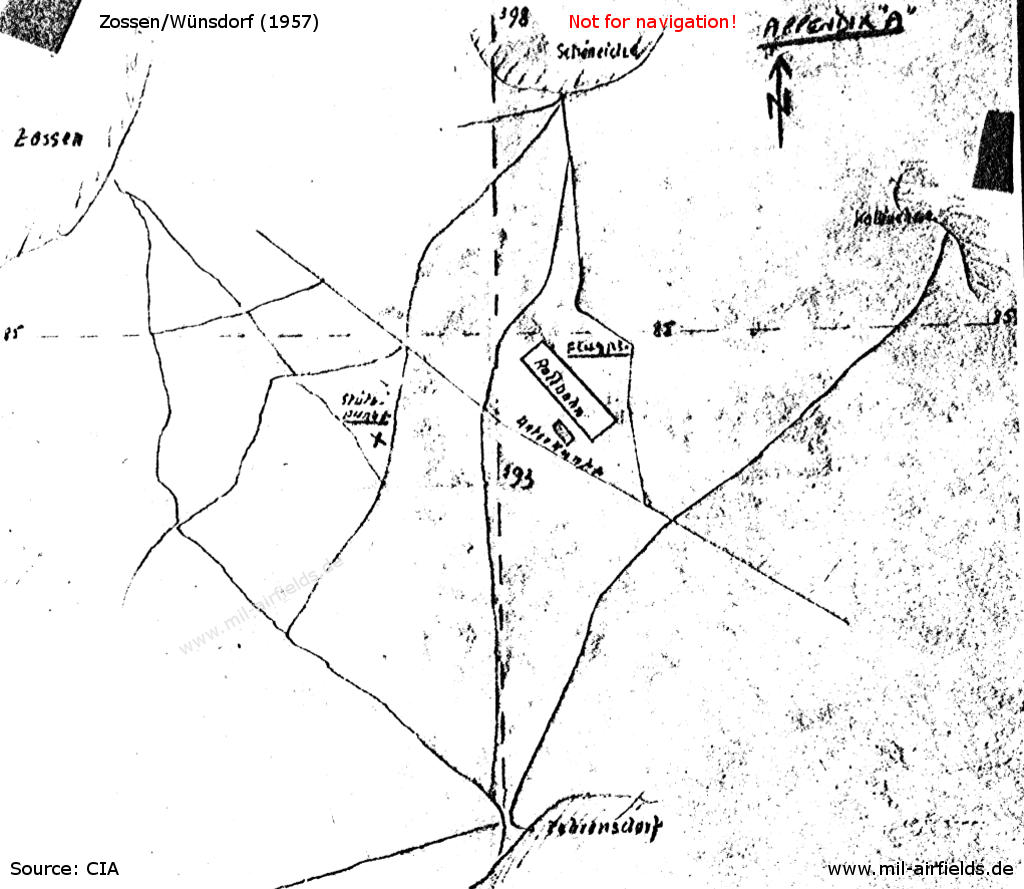
Appendix "A": Sketch from the CIA report from 1957.
Texts:
| Flugpl. | Airfield |
| Kallinchen | (Village) |
| Rollbahn | Runway |
| Schöneiche | (Village) |
| Stützpunkt | Site |
| Unterkunft | Billet |
| Zehrensdorf | (Village) |
| Zossen | (Village) |
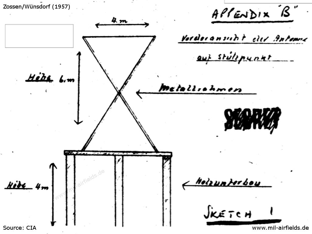
Appendix "B", Sketch 1 - Antenna on base
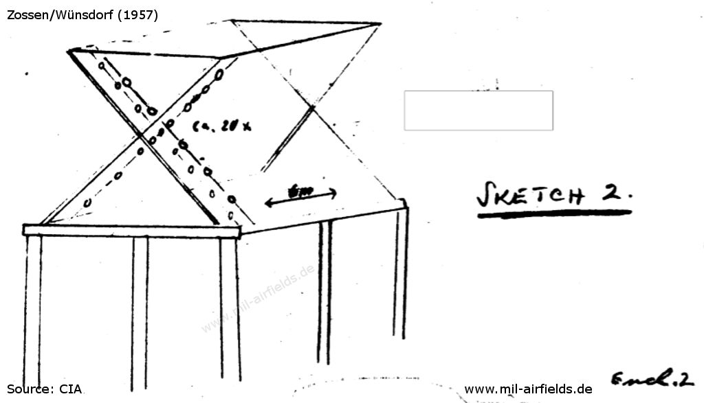
Appendix "B", Sketch 2 - Antenna
Texts:
| Höhe | Height |
| Holzunterbau | Wooden base |
| Metallrahmen | Metal frame |
| Vorderansicht der Antenne auf Stützpunkt | Front view of antenna on base |
Source: /CIA RDP80T00246A037500190001-5/
CIA report about August 1957
(a) At present there is a concrete runway approx 300 m in length. The remainder of the runway is plain earth which has been levelled and rolled. Levelling work is still being carried out on the WESTern edge of the runway.
(b) At the beginning of August 1957, a total of 13 aircraft with twin piston engines were seen on the landing ground. Other equipment seen was as follows:
- 1 vehicle used as flying control;
- 1 ... set up as an office;
- 1 ... ZIS 151;
- 5 W/T trucks with whip aerials.
- 1 vehicle used as flying control;
- 1 ... set up as an office;
- 1 ... ZIS 151;
- 5 W/T trucks with whip aerials.
(c) A barrack block is being constructed on the NORTHern edge of the landing ground.
Source: /CIA RDP80T00246A037500200001-3/
In the 1960s
Situation
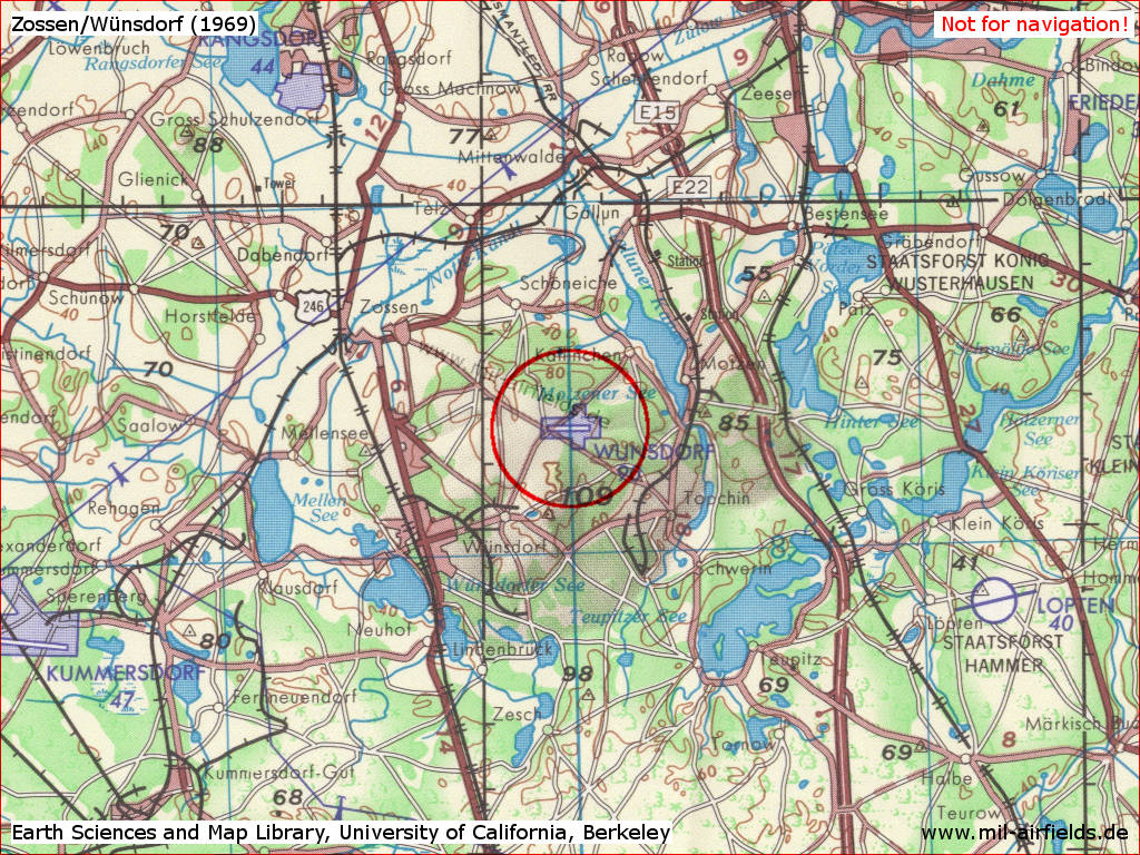
Zossen/Wünsdorf Airfield on a US map from 1969
Source: Earth Sciences and Map Library, University of California, Berkeley)
Overview
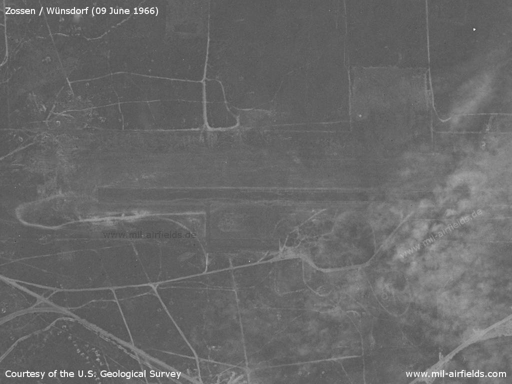
The landing ground on a US satellite image from 09 June 1966
Source: U.S. Geological Survey
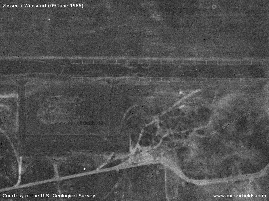
Enlargement of runway and parking area with enhanced contrast - The runway shoulders show white lines
Source: U.S. Geological Survey
Runways
- 10/28: 1200 m Grass?
Today
Use
Closed.
Aerial image 2019
The following aerial photo was taken by Frank B., whom I thank very much!
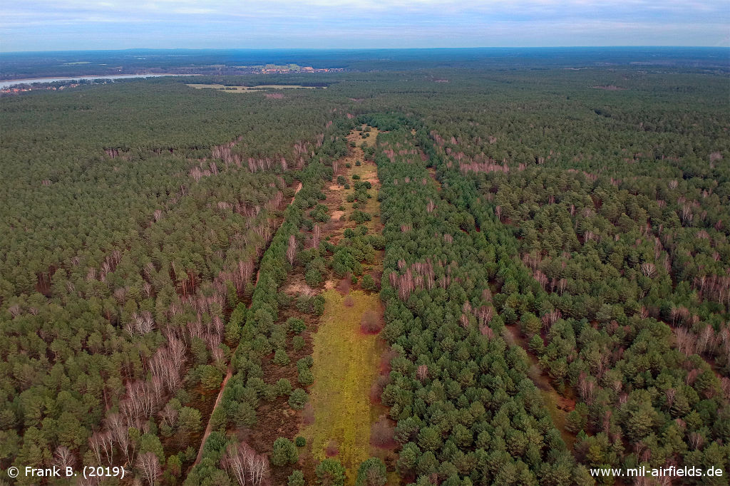
Aerial picture from 2019 - The viewing direction is east. The old structures with runway, edge of the airfield and parking area (right) are still recognizable by missing or different vegetation.
Source: Frank B.
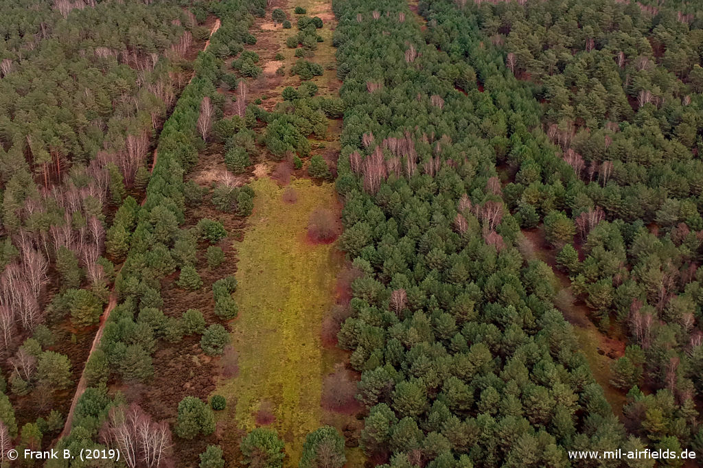
Enlargement: Runway
Source: Frank B.
Sources
- https://www.cia.gov/ - Central Intelligence Agency
- https://www.usgs.gov/ - USGS U.S. Geological Survey
Bibliography
- Freundt, Lutz (Hrsg.), Büttner, Stefan: "Rote Plätze - Russische Militärflugplätze in Deutschland 1945 - 1994" AeroLit Verlag, 2007
Airfields in the vicinity
- 326°/11km Rangsdorf: Airfield (Аэродром Рангсдорф)
- 113°/14km Kleinköris / Löpten: Airfield (Löpten, Klein Köris)
- 245°/16km Sperenberg: Air Base (Kummersdorf, Аэродром Шперенберг)
- 032°/19km Niederlehme: Helipads 1011, 3041
- 360°/20km Berlin: Schönefeld Airport (Zentralflughafen Berlin-Schönefeld, SXF)
Categories
Military Airfields GermanyMilitary Airfields in former East GermanyAirfields of the Soviet Forces in GermanyRecommended
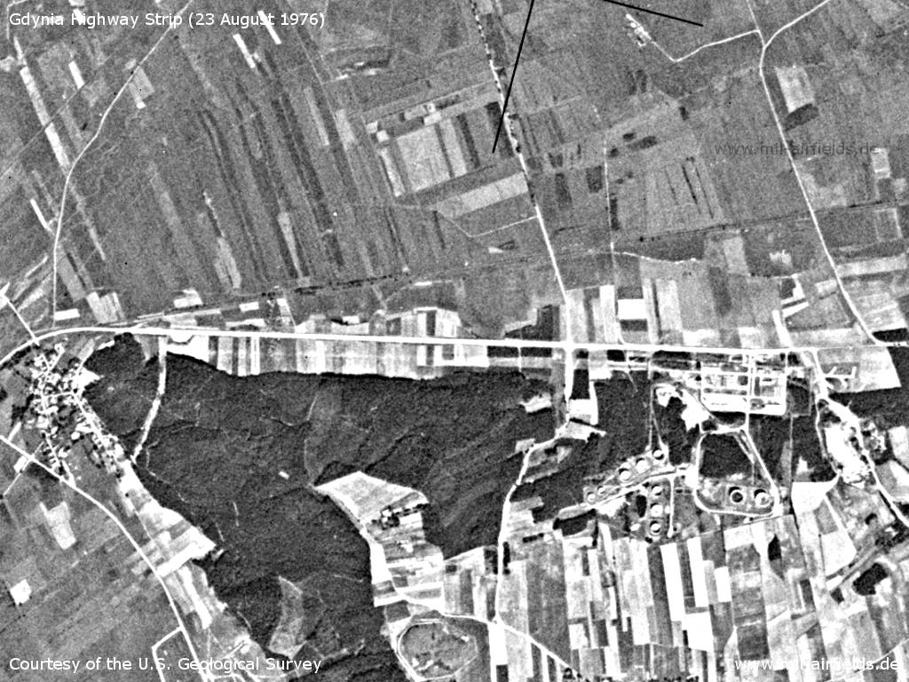
Image credits are shown on the respective target page, click on the preview to open it.
 Follow mil-airfields on Facebook