For historical information only, do not use for navigation or aviation purposes!
| Coordinates | N520813 E0131822 (WGS84) Google Maps |
| Federal state | Brandenburg |
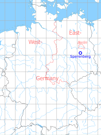
Germany during the Cold War Map
The history of the Cold War airfields: Sperenberg
During the Cold War
Use
Soviet / Russian airfield until 1994.
In the 1960s
Situation
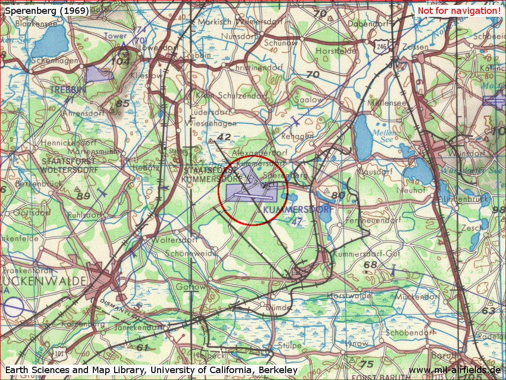
Sperenberg Air Base on a US map from 1969 - (Source: Earth Sciences and Map Library, University of California, Berkeley)
In the 1970s
Situation
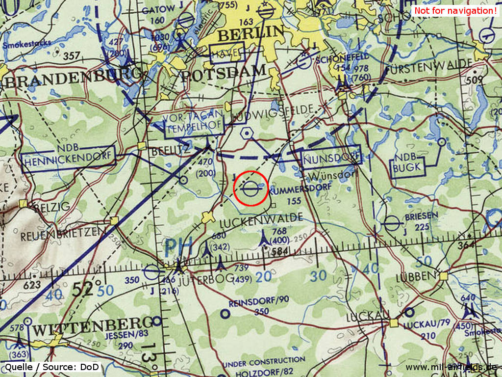
Sperenberg Air Base on a map of the US Department of Defense from 1972 - (ONC E-2 (1972), Perry-Castañeda Library Map Collection, University of Texas at Austin /PCL MC/)
Overview
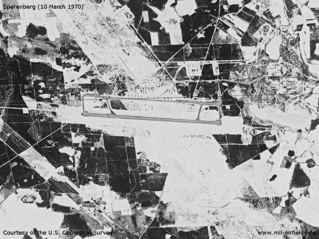
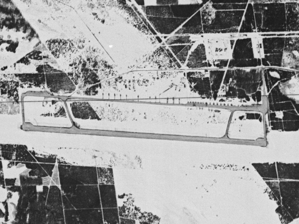
Sperenberg Air Base on a US satellite image from ... - The landscape is covered with snow. Clearly visible are the lanes extending from the runway to the west and east.
Source: U.S. Geological Survey
Sperenberg Airfield - At this time, the parking areas in the north are still missing.
Source: U.S. Geological Survey
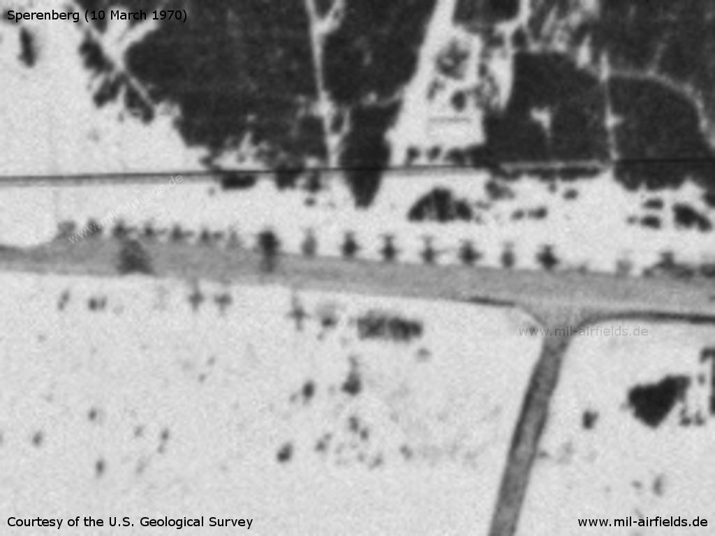
Enlargement: Parked aircraft
Source: U.S. Geological Survey
Radio beacons
Data for the 1970s:
- LOM 27: 454 "ChC"
- LMM 27: 221 "Ch"
- LOM 09: 454 "NZ"
- LMM 09: 221 "N"
In the 1980s and early 1990s
Overview
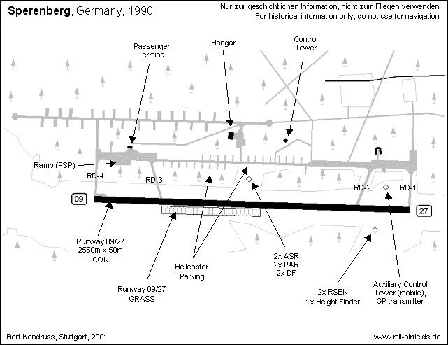
Runways
Data for the year 1990:
- 09/27: 2500 m
Radio beacons
Data for the 1980s:
- LOM 27: 221 "ChM"
- LMM 27: 254 "Ch"
Radio communication
The airfield radio call sign was SOUVENIR (СУВЕНИР).
Units
Units in the year 1990: 113 OVE: Mi-6, Mi-8, Mi-9, Mi-24; 226 OSAP: An-12, An-24, An-26, Tu-134; 39 ORAO: Il-20, Il-22
Installations
Railway siding from Sperenberg.
Images
The following pictures were taken in 1994
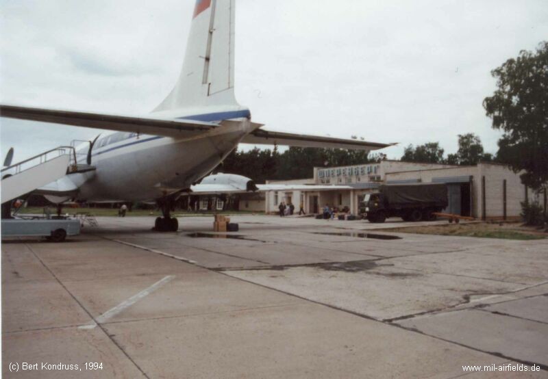
Terminal building in the western part of the field. Note the name "SPERENBERG" written in cyrillic.
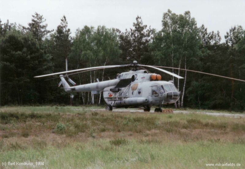
Two of the northern parking positions, occupied by an An-12 and Mi-8.
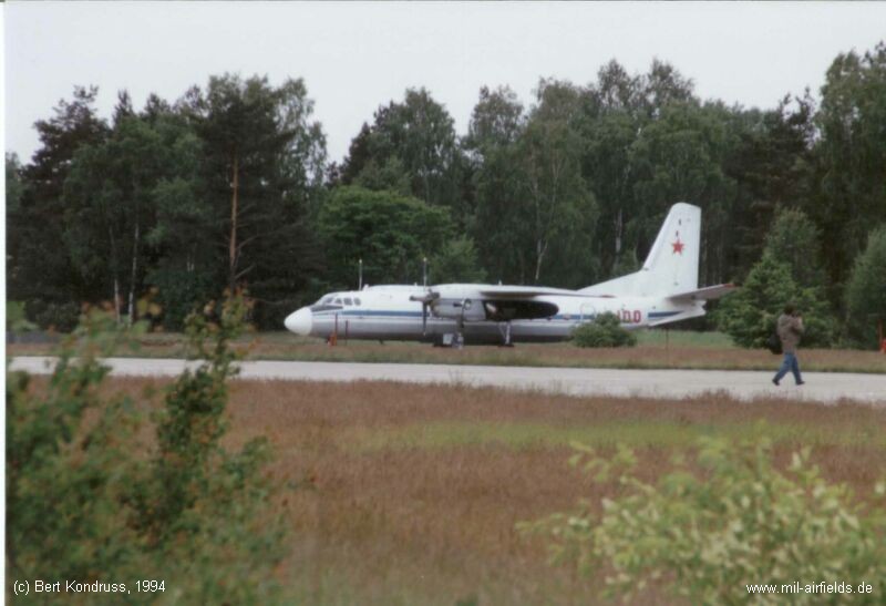
An-24 on one of the northern parking positions.
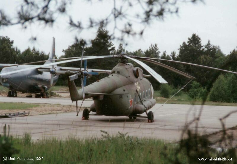
A Mi-8 parked at the main taxiway, near the crossing of taxiway RD-3.
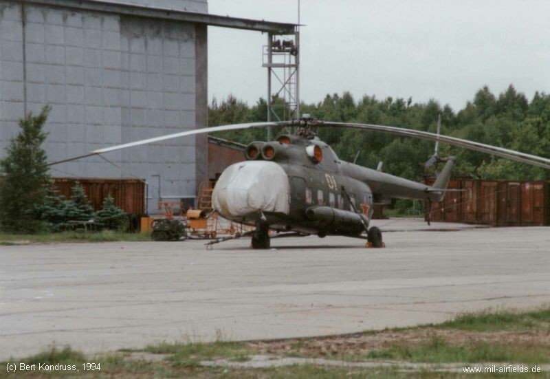
Mi-8 in front of the hangar
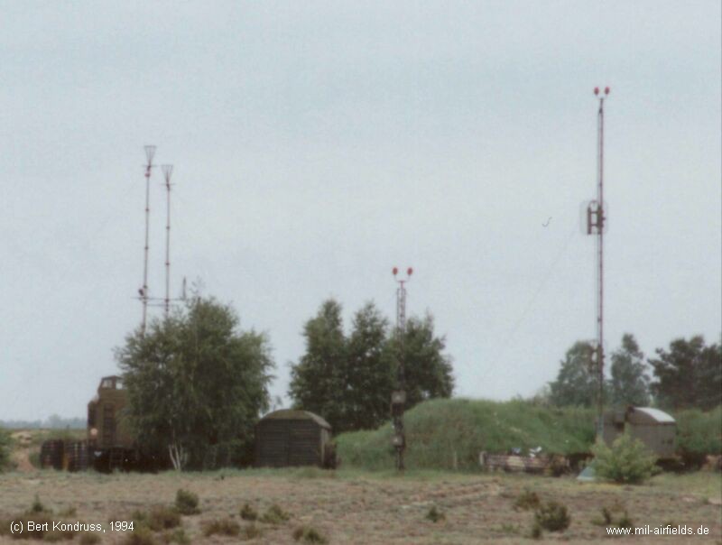
Mobile control tower, located between the taxiways RD-1 and RD-2. Note the two different glide path antennas.
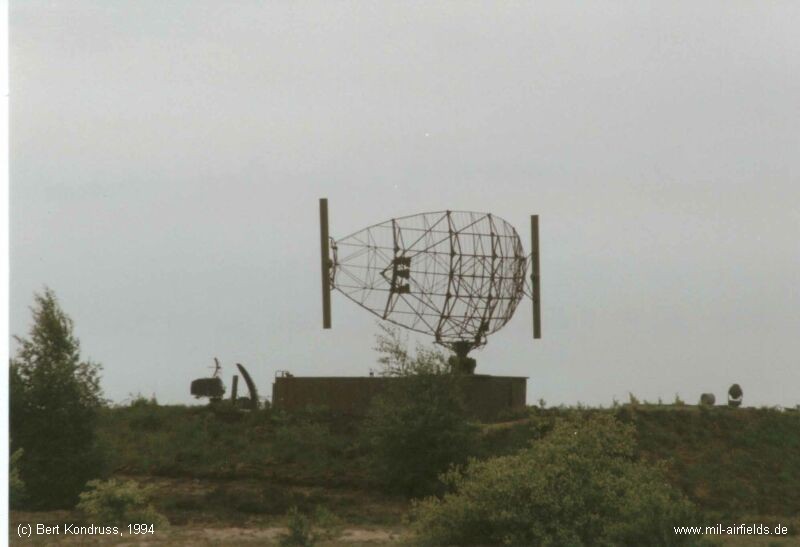
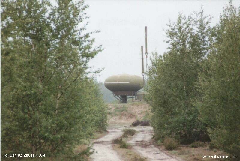
One of the two airport surveillance radars, located north of the center of the runway. To the left you can see one of the two precision approach radars.
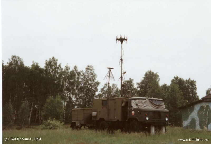
Vehicle with a radio direction finder (DF), seen near the radar site.
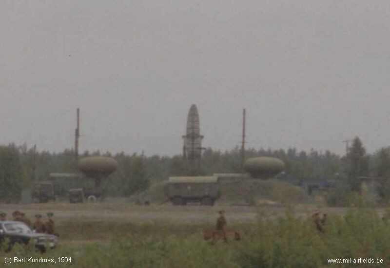
Looking across the runway to the southeastern corner of the airbase. Here are one height finder and two RSBN navigation systems.
One of the two RSBN antennas.
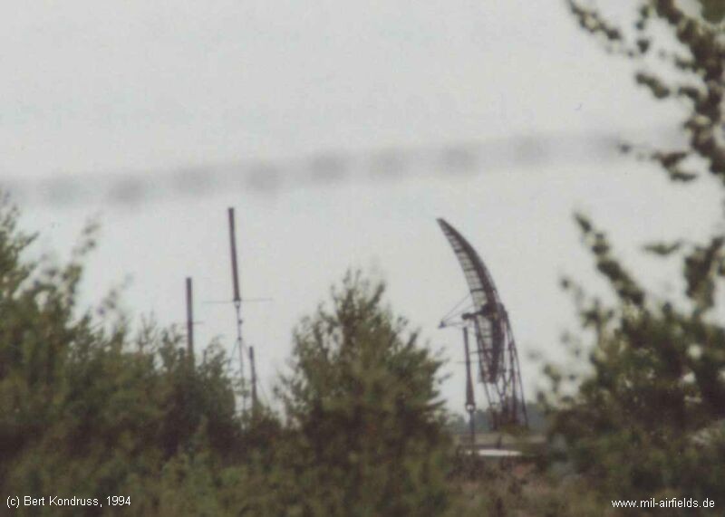
Height finder.
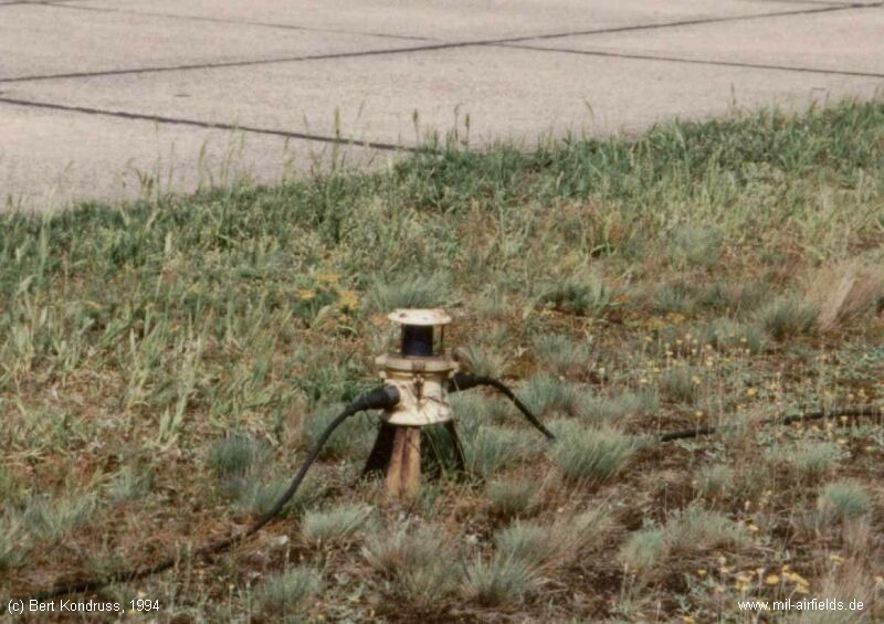
Mobile taxiway light.
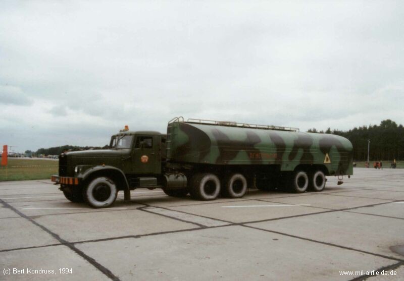
Fuel truck.
Today
Use
Closed.
Images
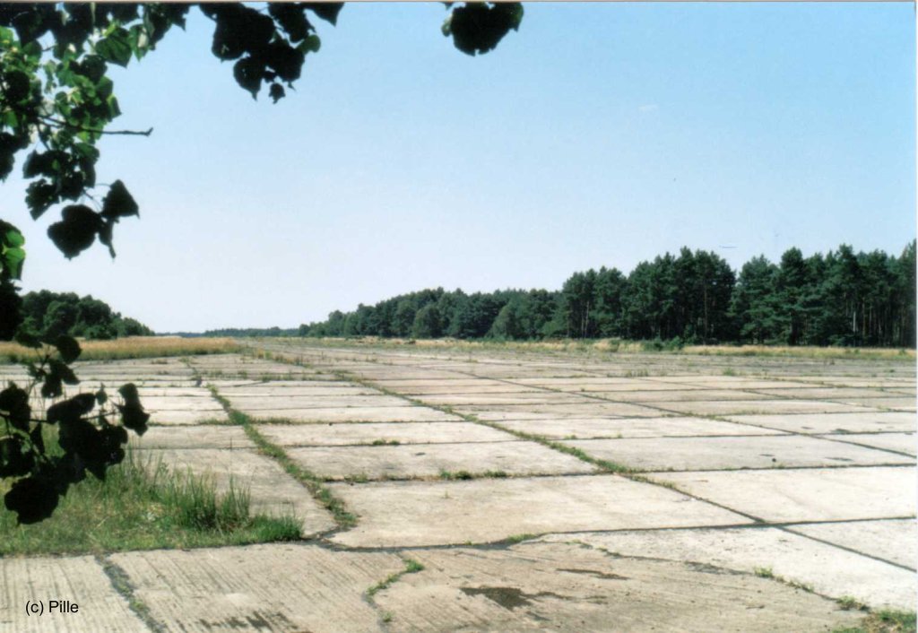
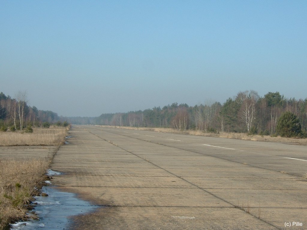
Sperenberg in 2003/2004
These pictures show the airfield about 10 years after closing. Courtesy of Pille - thank you very much!
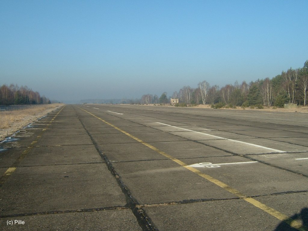
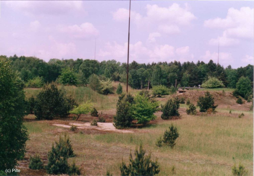
Runways and taxiways
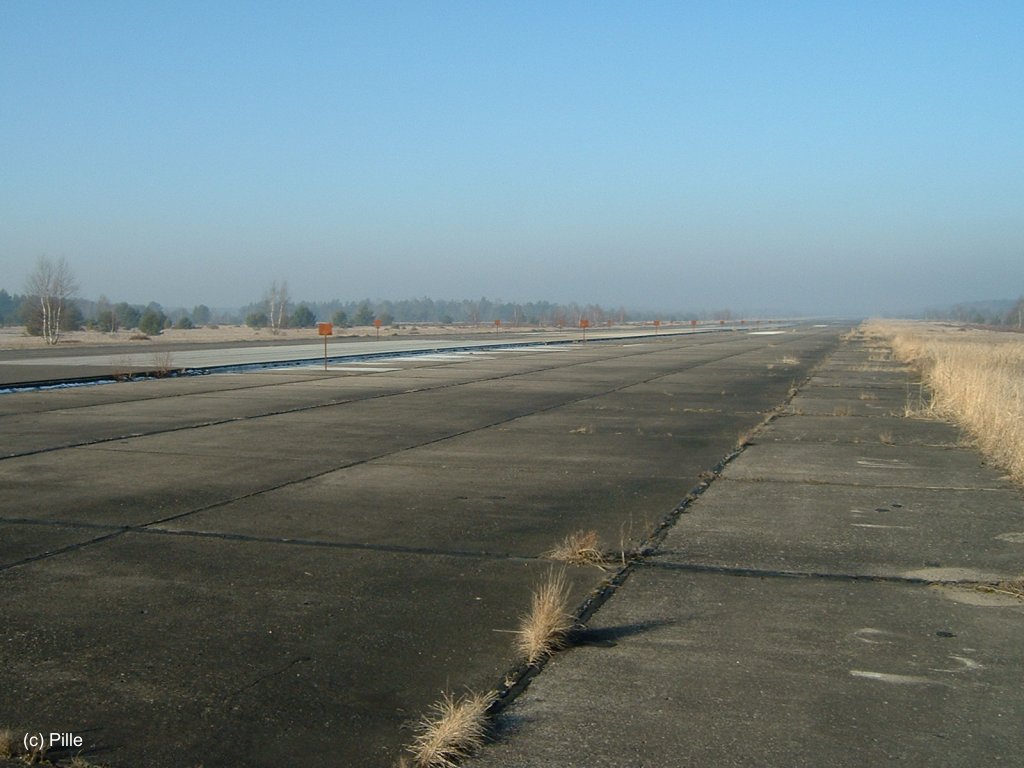
Runway (1)
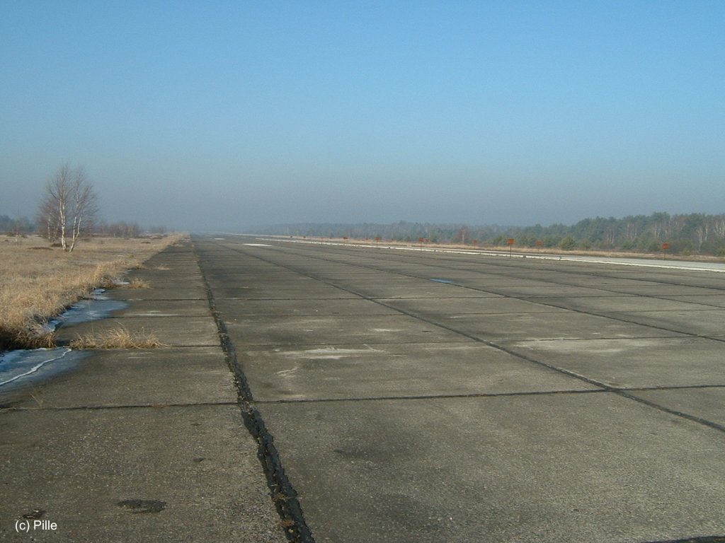
(2)
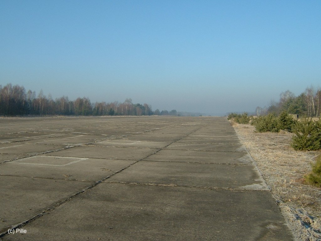
Main taxiway (1)
(2)
(3)
Northern taxiway (1)
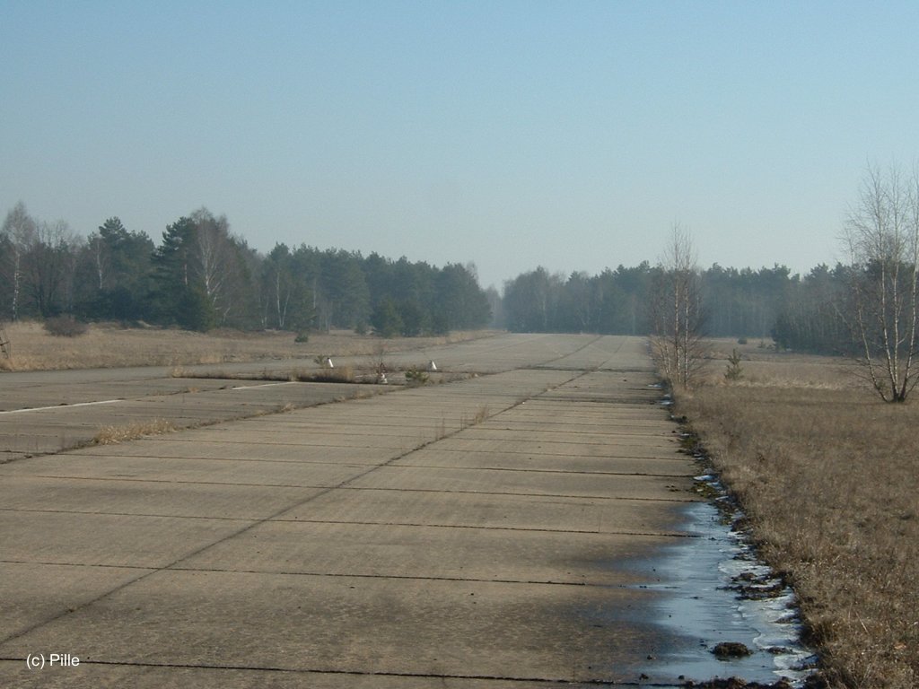
(2)
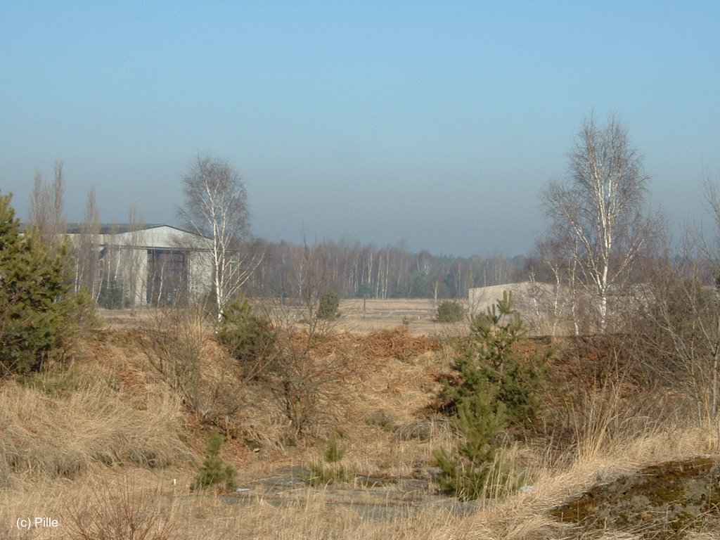
Hangar
Fuel Depot
Fuel depot (1)

(2)
(3)
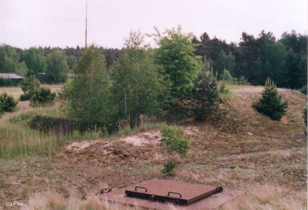
(4)
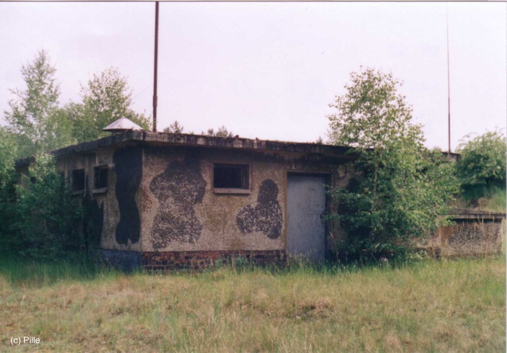
Technical building (1)
(2)
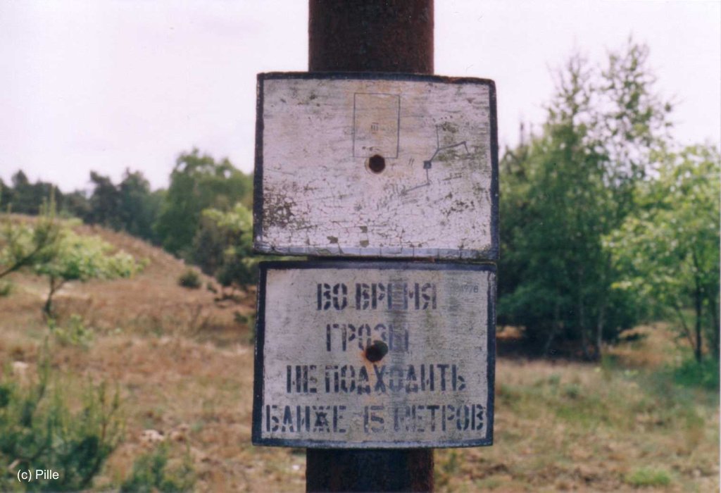
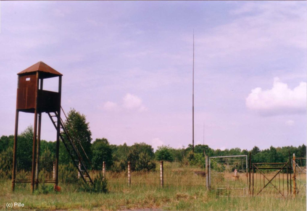
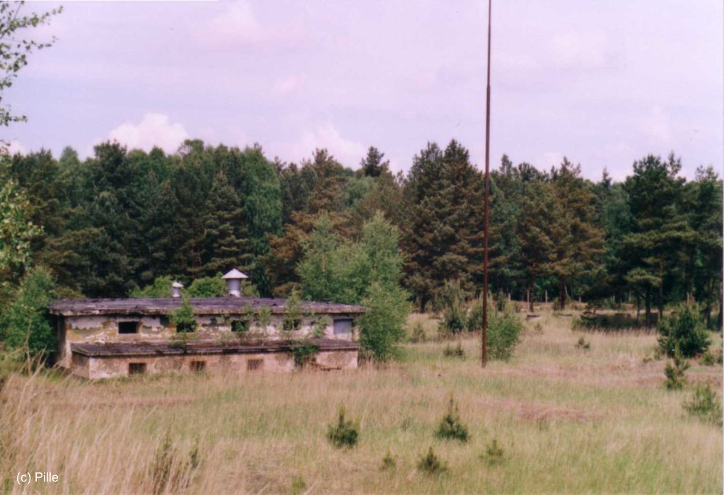
Lightning protection
Tank (1)
(2)
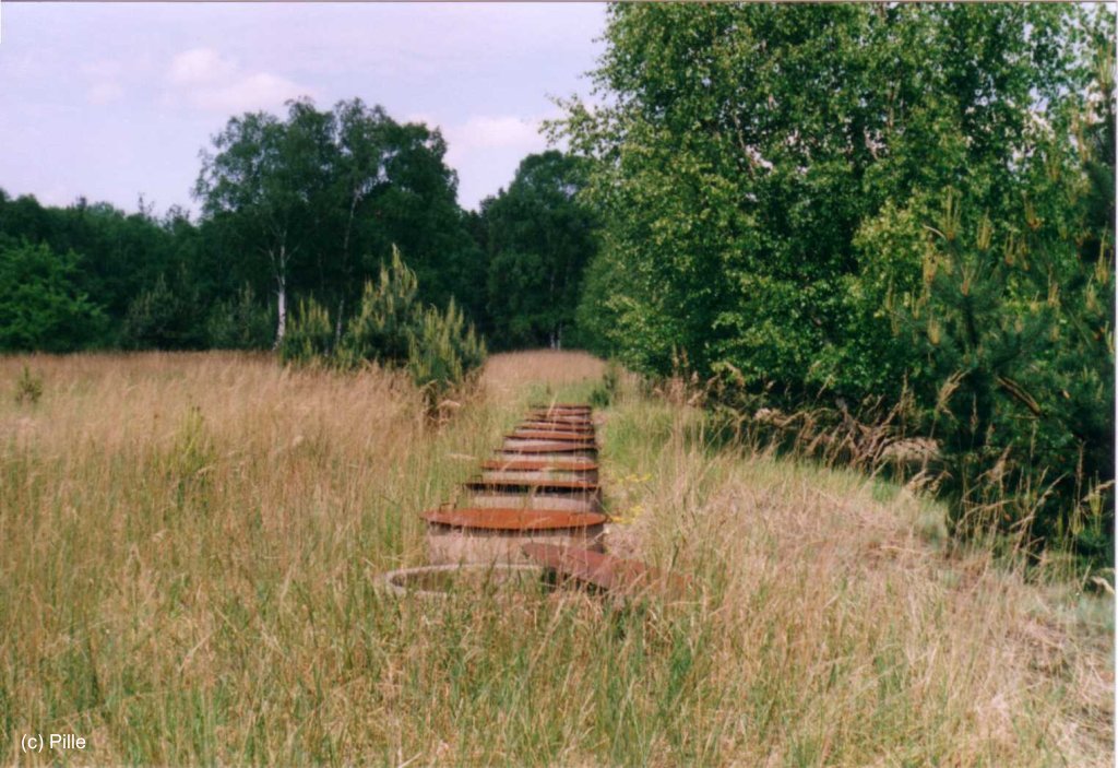
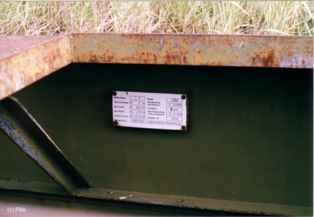
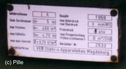
Small tanks (1)
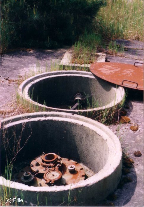
(2)
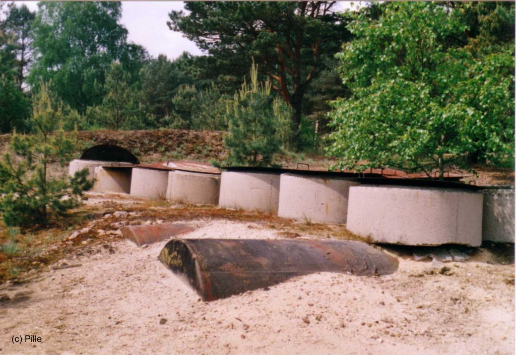
(3)
Links
Bibliography
- Freundt, Lutz: "Sowjetische Fliegerkräfte in Deutschland 1945-1994, Band 3" Edition Freundt Eigenverlag, Diepholz 1999 - Description, aerial pictures, pictures.
- Freundt, Lutz: "Sowjetische Fliegerkräfte in Deutschland 1945-1994, Band 4" Edition Freundt Eigenverlag, Diepholz 2000 - Additions
- Stefan Büttner: "Abzug per "Möbelwagen" - Die letzten Tage von Sperenberg" Fliegerrevue 12/94 - Description, pictures, aerial photo
- M. Winkler: "Do Swidanja Sperenberg" Luftfahrt Journal Oktober 1994 - Report from an aircraft spotter
- : "Red Stars over Germany (Part 2)" World Air Power Journal (R), Volume 21, Aerospace Publishing Ltd., London, 1995 - Description and pictures
Airfields in the vicinity
- 065°/16km Zossen/Wünsdorf
- 343°/17km Ludwigsfelde: Helipad 1012 (HSLP 1012)
- 028°/18km Rangsdorf: Airfield (Аэродром Рангсдорф)
- 223°/24km Jüterbog: Damm Airfield (Jüterbog Damm Air Base)
- 324°/24km Saarmund: Airfield (Eichberg, Wilhelmshorst)
- 196°/27km Reinsdorf: Airfield (Werbig, Аэродром Вербиг)
- 235°/27km Altes Lager: Air Base (Jüterbog, Jueterbog, Аэродром Альтес-Лагер)
- 087°/28km Kleinköris / Löpten: Airfield (Löpten, Klein Köris)
 Follow mil-airfields on Facebook