For historical information only, do not use for navigation or aviation purposes!
| Coordinates | N521517 E0140745 ca. (WGS84) Google Maps |
| Former East Germany (GDR) | District of Frankfurt/O |
| Federal state | Brandenburg |
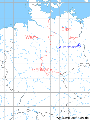
Germany during the Cold War Map
The history of the Cold War airfields: Wilmersdorf
Location of airfield
0.6 km southwest of Wilmersdorf.
Usage during the Cold War
Helipad 3023 for Microwave Site 3 (RFB-3) of former East German Airforce (NVA LSK/LV).
Use today
Closed.
Runways, taxiways, aprons
Dimensions: 60 m x 50 m,
Main takeoff and landing direction: 225°,
Surface: Grass,
Usable without crop damage,
Capacity: 1 helicopter.
Main takeoff and landing direction: 225°,
Surface: Grass,
Usable without crop damage,
Capacity: 1 helicopter.
Telephone
Stabsnetz S1 2444-471
Airspace and procedures
Usable at day during good weather conditions
Alert time: 60 minutes.
Alert time: 60 minutes.
Obstacles
Trees: distance 30 m, height 15 m
Airfields in the vicinity
- 272°/8km Reichenwalde: Helipad 3120 (HSLP 3120)
- 334°/9km Fürstenwalde: Helipad 3002 (HSLP / HLP 3002)
- 131°/10km Beeskow: Agricultural Airfield
- 260°/12km Storkow: Helipad 1027 (HSLP 1027)
- 216°/13km Limsdorf: Helipad 3011 (HSLP 3011)
- 302°/13km Markgrafpieske: SA-2 Missile Site (Helipad 3110)
- 157°/14km Ranzig: Helipad 3003 (Beeskow)
- 351°/15km Fürstenwalde: Airfield
- 234°/16km Kehrigk: Helipad 3071 (HSLP / HLP 3071)
- 289°/18km Spreenhagen: Helipad 1013 (HSLP / HLP 1013)
- 124°/19km Schneeberg: Helipad 3043 (HSLP / HSLP 3043)
- 289°/20km Spreenhagen: Highway Strip (Autobahnabschnitt ABA, Friedrichshof)
 Follow mil-airfields on Facebook