For historical information only, do not use for navigation or aviation purposes!
| Coordinates | N520938 E0142118 (WGS84) Google Maps |
| Former East Germany (GDR) | District of Frankfurt/O |
| Federal state | Brandenburg |

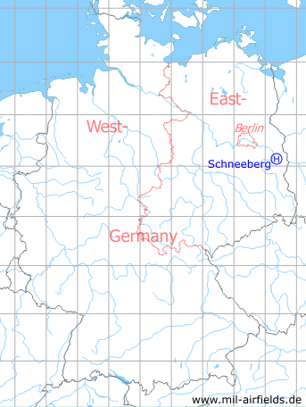
Germany during the Cold War Map
The history of the Cold War airfields: Schneeberg
Location of airfield
2 km east-southeast of Schneeberg.
Usage during the Cold War
Helipad 3043, Ammunition Dump 14 (Munitionslager 14, ML-14) of former East German Airforce (NVA LSK/LV).
Use today
Closed
Runways, taxiways, aprons
Dimensions: 80 m x 165 m,
surface: sand, overgrown; parking pad: concrete 20 m x 16 m,
main take-off and landing direction: 265°,
usable without crop damage,
capacity: 1 helicopter
surface: sand, overgrown; parking pad: concrete 20 m x 16 m,
main take-off and landing direction: 265°,
usable without crop damage,
capacity: 1 helicopter
Telephone
Stabsnetz S1 2734-761-311
Airspace and procedures
Usable during day at good weather conditions (TEWB).
Alert time: 60 minutes.
Alert time: 60 minutes.
Obstacles
Woods: distance 20 m, height 10 m;
Masts: distance 100 m, height 10 m.
Masts: distance 100 m, height 10 m.
Airfields in the vicinity
- 297°/9km Beeskow: Agricultural Airfield
- 257°/10km Ranzig: Helipad 3003 (Beeskow)
- 163°/12km Weichensdorf: Helipad 1033 (HSLP / HLP 1033)
- 077°/17km Eisenhüttenstadt: Airfield (Pohlitz)
- 304°/19km Wilmersdorf: Helipad 3023 (HSLP / HLP 3023)
 Follow mil-airfields on Facebook