For historical information only, do not use for navigation or aviation purposes!
| Coordinates | N542735 E0093101 (WGS84) Google Maps |
| Elevation | 73 ft |
| Federal state | Schleswig-Holstein |
| Location indicator | DEJG (195x), EDCS (196x-1995), ETNS (1995-) |
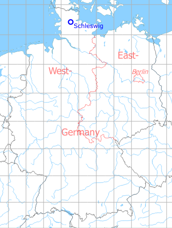
Germany during the Cold War Map
The history of the Cold War airfields: Schleswig
General
Schleswig has been built in the 1930s as a Luftwaffe airbase (Fliegerhorst). After the end of the war in 1945, the Royal Air Force took over the field. In the late 1950s, Jagel was returned to German administration and became a naval aviation base, used by Marinefliegergeschwader 1 (Naval Wing 1). In 1994, Jagel became a German Air Force base and home of the Aufklärungsgeschwader 51 (Reconnaissance Wing 51), which was later renamed to Taktisches Luftwaffengeschwader 51 (Tactical Air Force Wing 51).
During World War II
Use
Luftwaffe air base.
Situation
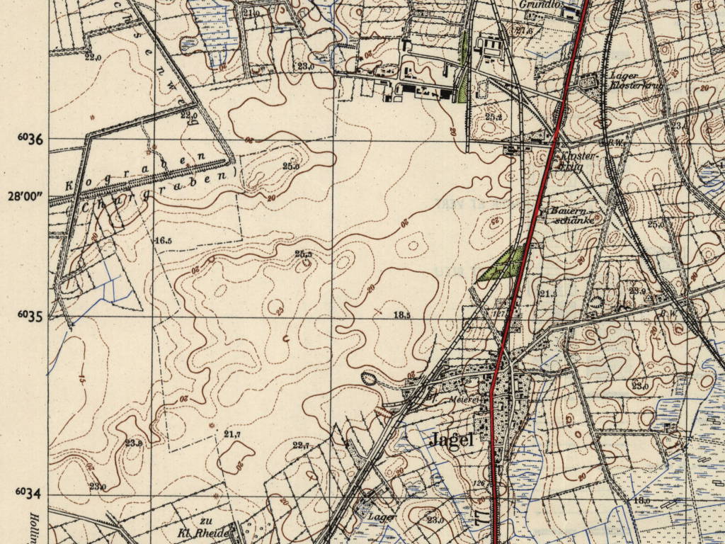
Schleswig Land Air Base in World War II on a US map from 1943 - (McMaster University Library Digital Archive, License: Creative Commons Attribution-NonCommercial 2.5 CC BY-NC 2.5 CA /MULDA/)
Overview
Former Schleswig Luftwaffe Air Base on a US map from 1954 - (AMS M841 GSGS 4414, Courtesy Harold B. Lee Library, Brigham Young University /BYU/)
During the Cold War
In the 1940s
Situation
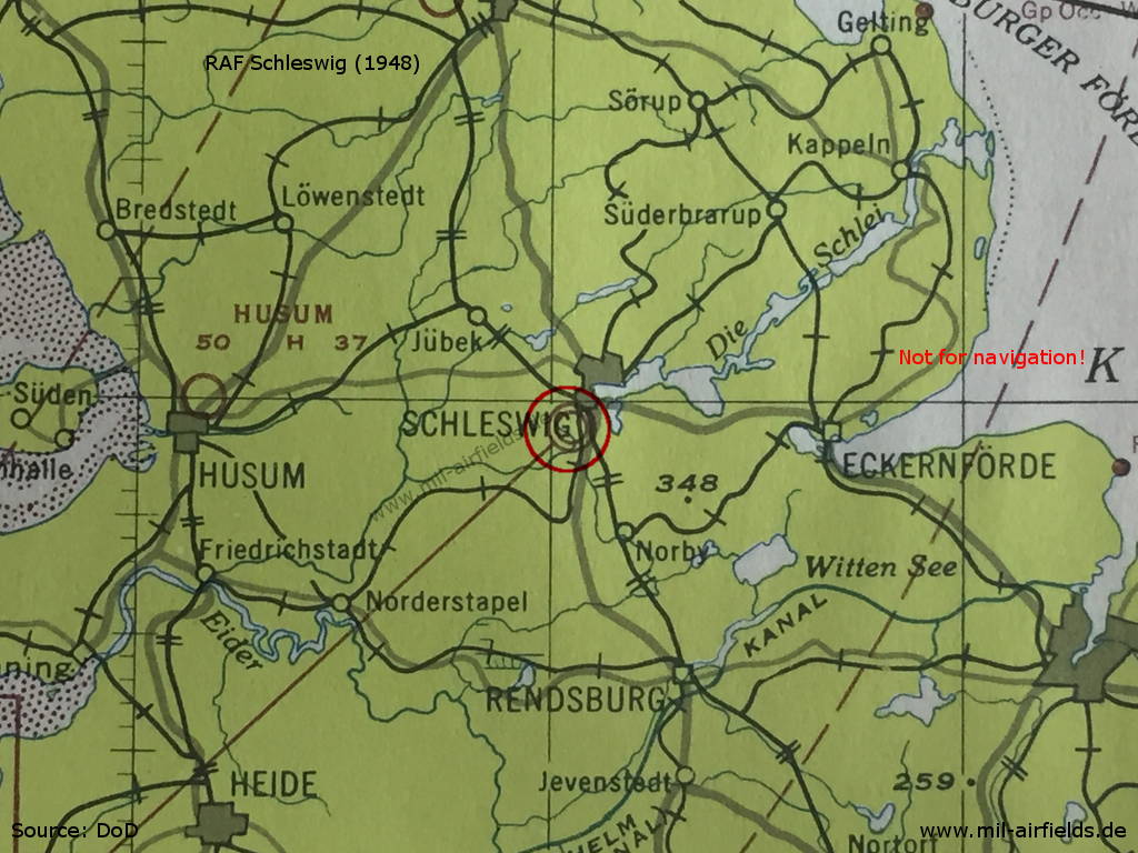
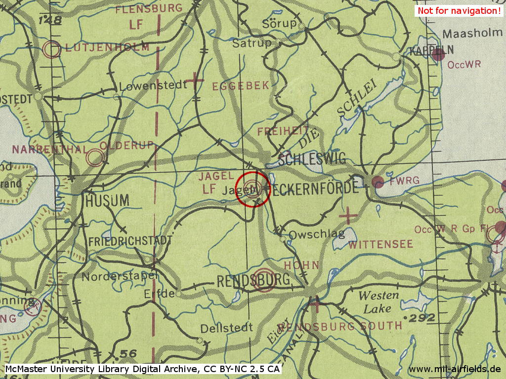
RAF Schleswigland on a map from 1948
In the 1950s
Location of airfield
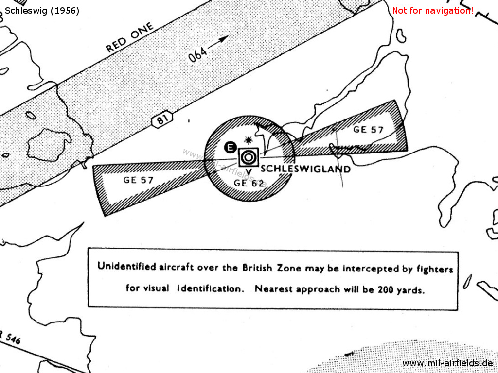
RAF Schleswig on a map from 1956 - The airfield and the approach areas are protected by the restricted areas GE 57 and GE 62. The white "E" in the circle symbolizes the Eureka radio beacon, used by the British at this time. The square around the airport symbol with the "V" underneath shows an VHF direction finder. The black star stands for the coded beacons which is characteristical for British airfields. Eggebek, Hohn, Husum and Leck are not shown yet, those fields will be (re-)opened later. The airway RED ONE led from Helgoland radio beacon to Roskilde beacon in Denmark.
Use
Royal Air Force base. The airfield had the characteristical installations for RAF airfields like a red identification beacon with morse code and an Eureka beacon.
Lights
Identification beacon with morse code SD.
No night flying facilities.
Radio beacons
- Eureka: 225R, 235T "SD", at field
Radio communication
- Approach 109.8
- Tower 107.82, 109.8, 131.58, 117.9
VHF direction finder
In the 1970s
Situation
Schleswig Jagel Air Base on a map of the US Department of Defense from 1972 - (ONC E-2 (1972), Perry-Castañeda Library Map Collection, University of Texas at Austin /PCL MC/)
In the 1980s
Overview
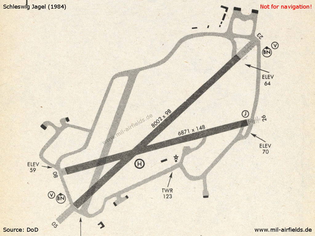
Schleswig Jagel Air Base in 1984
Runways
- 05/23: 2439 m x 30 m Asphalt
- 08/26: 2094 m x 45 m Asphalt
Radio beacons
- TACAN: CH 55 "SWG", at field
Airfields in the vicinity
- 117°/6km Brekendorf: Highway Strip
- 175°/16km Hohn: Air Base (Rendsburg)
- 345°/19km Bollingstedt: Highway Strip (Notlandeplatz NLP)
Categories
Military Airfields GermanyMilitary Airfields in former West GermanyRoyal Air Force (RAF) Bases in GermanyRecommended
Image credits are shown on the respective target page, click on the preview to open it.
 Follow mil-airfields on Facebook