For historical information only, do not use for navigation or aviation purposes!
| Coordinates | N515110 E0123806 ca. (WGS84) Google Maps |
| Former East Germany (GDR) | District of Halle |
| Federal state | Sachsen-Anhalt (Saxony-Anhalt) |
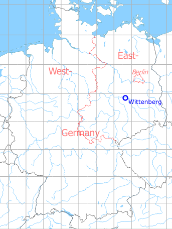
Germany during the Cold War Map
The history of the Cold War airfields: Wittenberg
Lutherstadt Wittenberg: An abandoned airfield in Germany
Location of airfield
About 2 km south of Wittenberg; southwest of Bruckenkopf-Kaserne.
During World War II
Usage until 1945
Luftwaffe landing ground.
During the Cold War
Use
Landing ground for the Southern Corps of the Soviet Air Force in Germany.
Aerial / satellite images
1965
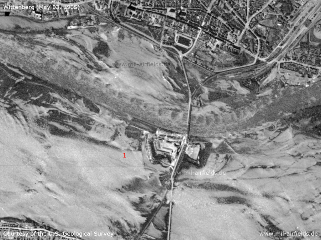
Satellite image from May 03, 1965: Flooding of the Elbe river - The areas on both sides of the river are flooded, the airfield (1) is not recognizable. The wooden bridge visible here, built in 1945 by the Soviet army, is replaced 6 days later by a new one, which is then used until 2000.
Source: U.S. Geological Survey
1969
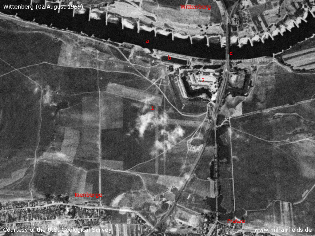
Brückenkopf barracks and Wittenberg airfield on a US satellite image from 02 August 1969 - (1): airstrip; (2): barracks. a: Elbe river; b: harbor; c: road and railway bridges. Places: Kienberge, Pratau.
Source: U.S. Geological Survey
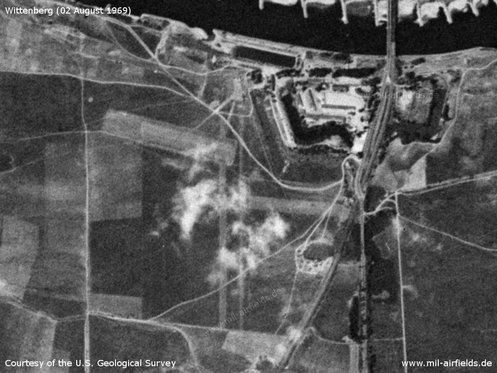
Enlargement
Source: U.S. Geological Survey
1972
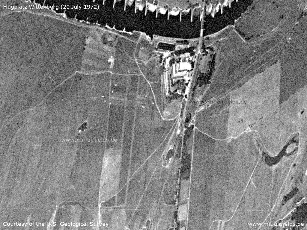
Satellite image from July 20, 1972 - The shot is distorted by the perspective, the viewer looks obliquely down to the left
Source: U.S. Geological Survey
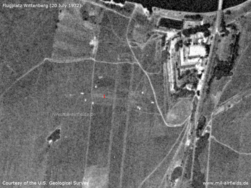
Enlargement - (1) The white dots seem to mark a runway approximately in east-west direction
Source: U.S. Geological Survey
1973
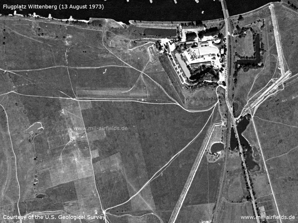
Satellite image from August 13, 1973
Source: U.S. Geological Survey
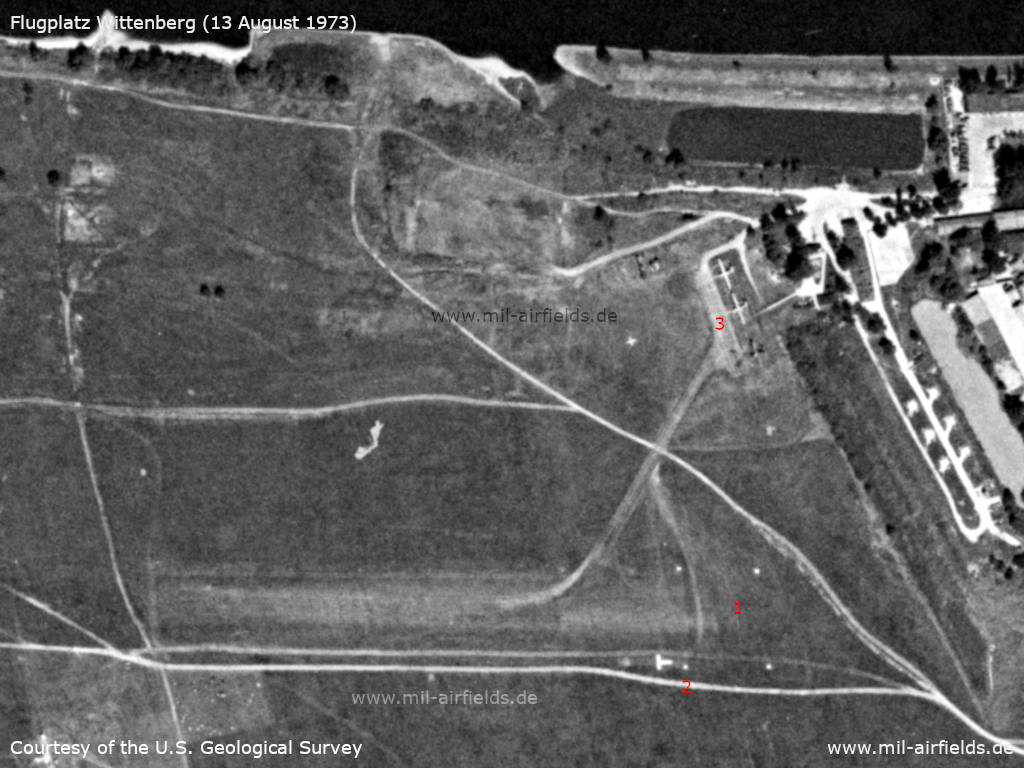
Enlargement - (1) The beginning of the runway is marked by 4 white markers. (2) South of the runway is the landing T. (3) To the northeast, three aircraft are parked next to the barracks. The darker aircraft to the south appears to have a tailwheel and has a wingspan of about 18 meters. This fits well with an Antonov An-2. The two lighter aircraft look like gliders at first glance. However, they have a wingspan of 21 m, which would be quite large for gliders (a PZL SZD-9 Bocian has about 18 m, many other models less)
Source: U.S. Geological Survey
1975
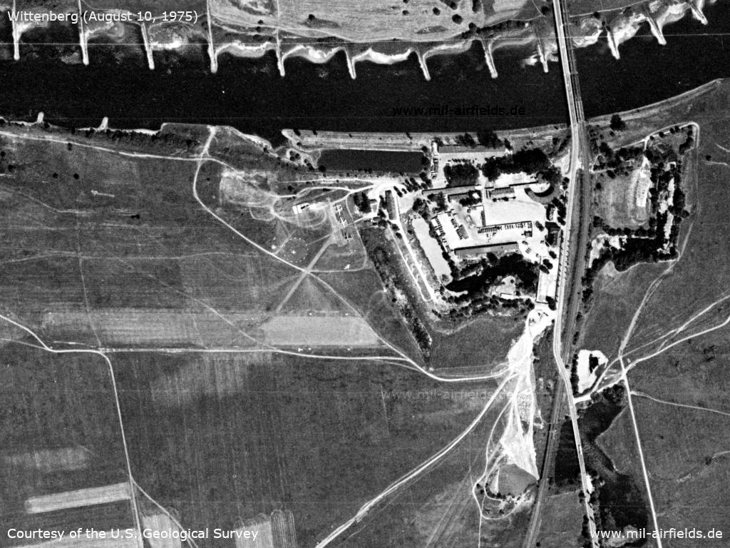
Satellite image from August 10, 1975 - Compared to 1973, the target cross has moved slightly to the south and is now surrounded by a dashed circle.
Source: U.S. Geological Survey
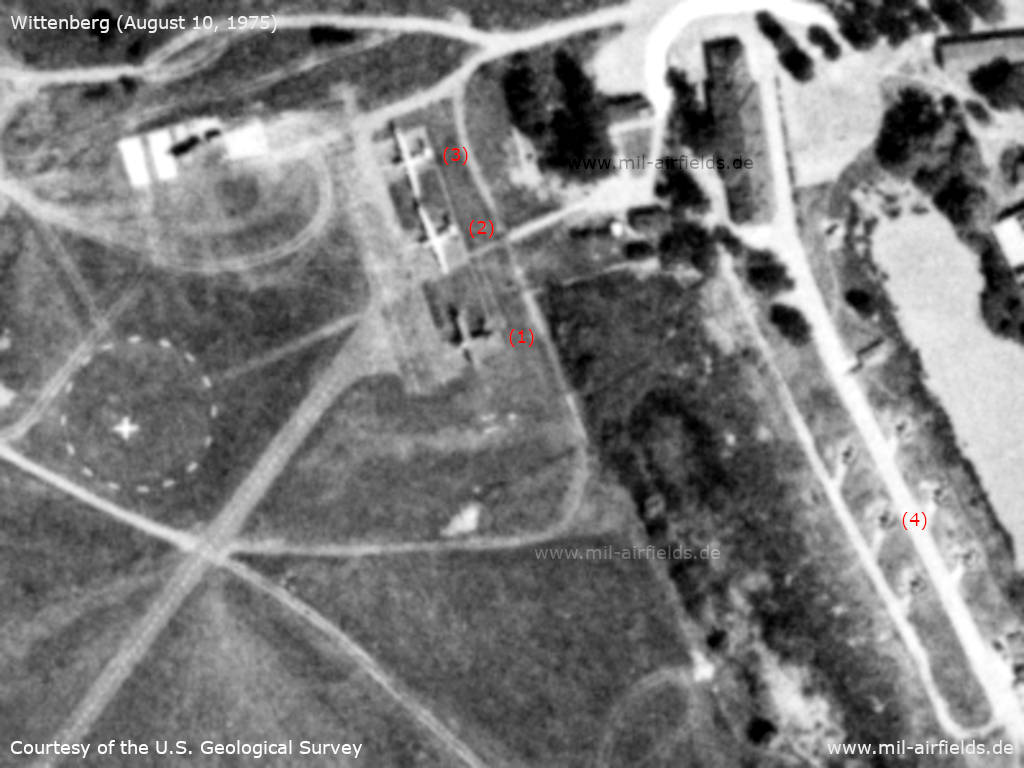
Enlargement - (1): Aircraft Antonov An-2; The two aircraft (2) and (3) appear to have engines on the wings. The length and wingspan of the two match that of an Antonov An-14, although the tail sections of the aircraft does not quite fit here. All three aircraft appear to be on paved parking pads. The taxiway to the runway has a marked centerline. (4): The six surfaces on the western edge of the Brückenkopf barracks are occupied, and the objects look like anti-aircraft missiles. Whereas the arrangement in two adjacent rows would be unusual for the Eastern Bloc.
Source: U.S. Geological Survey
Some memories and observations from H2O
"The landing site there was on the Elbe meadows on the southern bank (flood area) of the Elbe. In former times the road F 2 led past it and one could observe the hustle and bustle there. The field was directly at the Brückenkopfkaserne barracks (old Prussian building), which was used by the Red Army. A windsock was present and mostly parked a Yak-12, from time to time a helicopter Mi-4. In my opinion it was a liaison airfield.
Location of the windsock was south of the barracks, approx. 150 m from the road. In similar distance were the airplanes parked, I would mean even closer at the road, because one could see even the tactical numbers clearly. The runway could only have been south of the barracks, because north of the barracks there is only a narrow strip to the Elbe river. I saw the airplanes and the windsock personally, in the years 1948-1958.
Today the barracks became the centre of a camping site with attached marina. The airfield is the annual venue of the airfield festival of the local aviation sports club and is otherwise no longer used."
Thank you very much for this vivid report, H2O!
Today
Use
Closed.
Bibliography
- Freundt, Lutz: "Sowjetische Fliegerkräfte in Deutschland 1945-1994, Band 3" Edition Freundt Eigenverlag, Diepholz 1999 - Short description
Airfields in the vicinity
- 246°/22km Oranienbaum: Airfield
- 129°/23km Düßnitz: Agricultural Airfield
- 181°/27km Bad Düben: Helipad 3061 (HSLP / HLP 3061)
- 056°/29km Altes Lager: Air Base (Jüterbog, Jueterbog, Аэродром Альтес-Лагер)
Categories
Military Airfields GermanyMilitary Airfields in former East GermanyAirfields of the Soviet Forces in GermanyRecommended
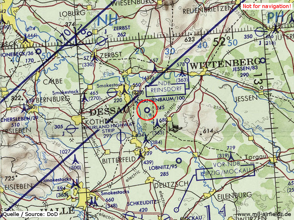
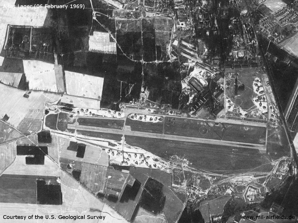
Image credits are shown on the respective target page, click on the preview to open it.
 Follow mil-airfields on Facebook