Nordholz: Naval Air Base
For historical information only, do not use for navigation or aviation purposes!
| Coordinates | N534603 E0083927 (WGS84) Google Maps |
| Elevation | 74 ft |
| Federal state | Niedersachsen (Lower Saxony) |
| Location indicator | EDCN (196x-1995), ETMN (1995-) |
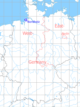
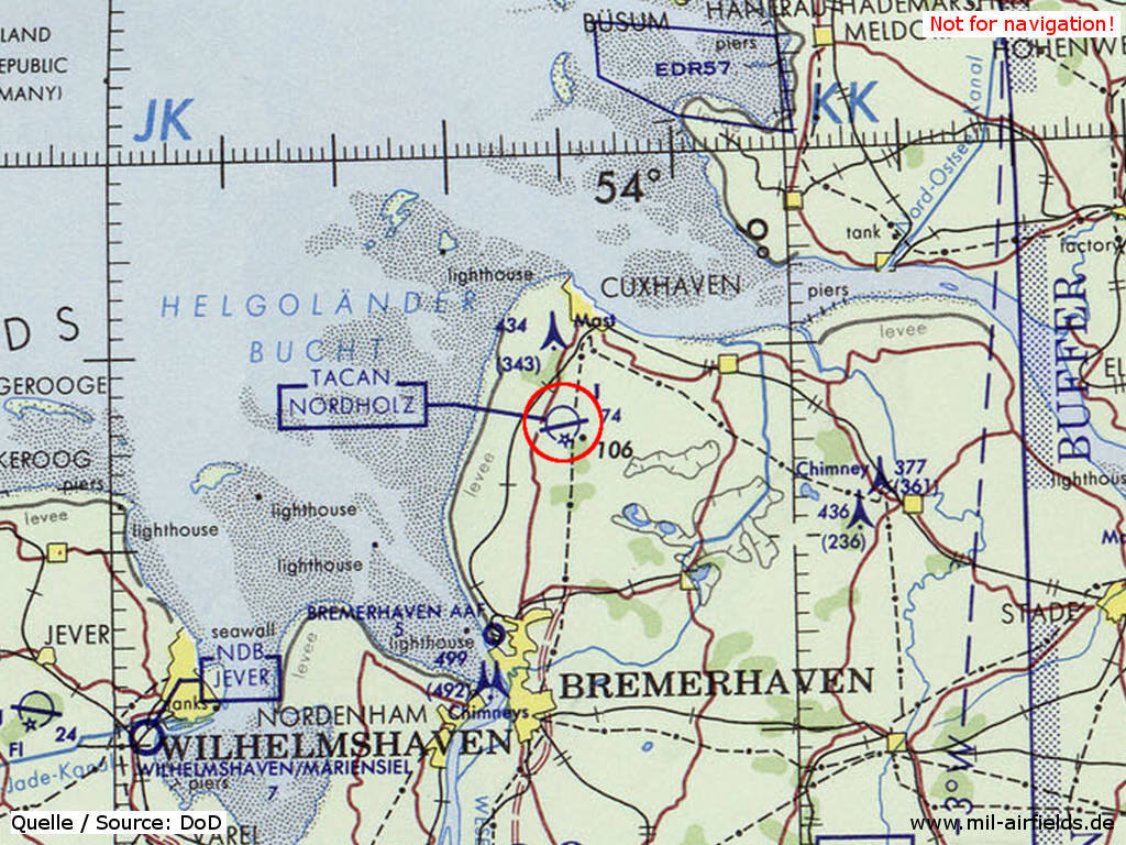
Germany during the Cold War Map
The history of the Cold War airfields: Nordholz
German Empire until 1918
Use
Airship base for the Imperial German Navy.
During World War II
Use
Luftwaffe airfield.
Situation

Nordholz Luftwaffe AIrfield in World War II on a US map from 1943 - (McMaster University Library Digital Archive, License: Creative Commons Attribution-NonCommercial 2.5 CC BY-NC 2.5 CA /MULDA/)
Overview
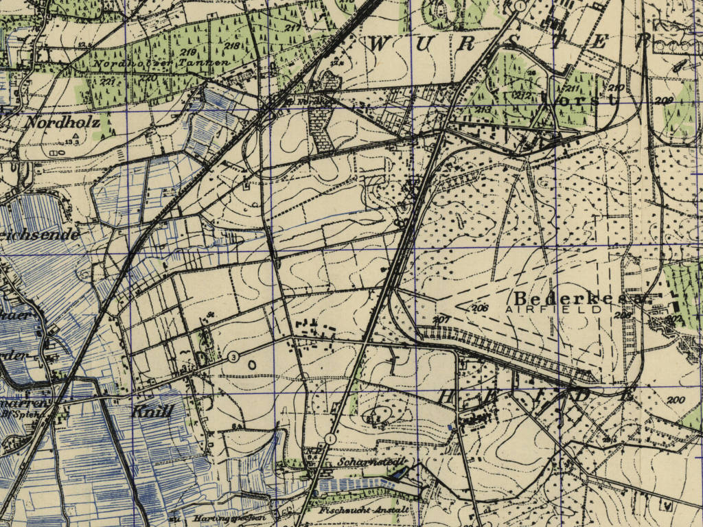
Former Nordholz operational airfield on a US map from 1951 - Good visible are the three former runways, the ladder-shaped ramps and the railway siding (AMS M841 GSGS 4414, Courtesy Harold B. Lee Library, Brigham Young University /BYU/)
During the Cold War
Use
German Navy air base.
In the 1940s
Situation
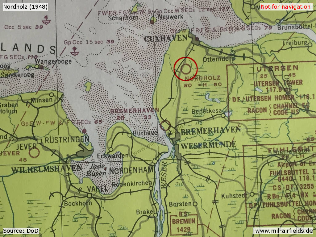
Nordholz Airfield on a map 1948
Overview
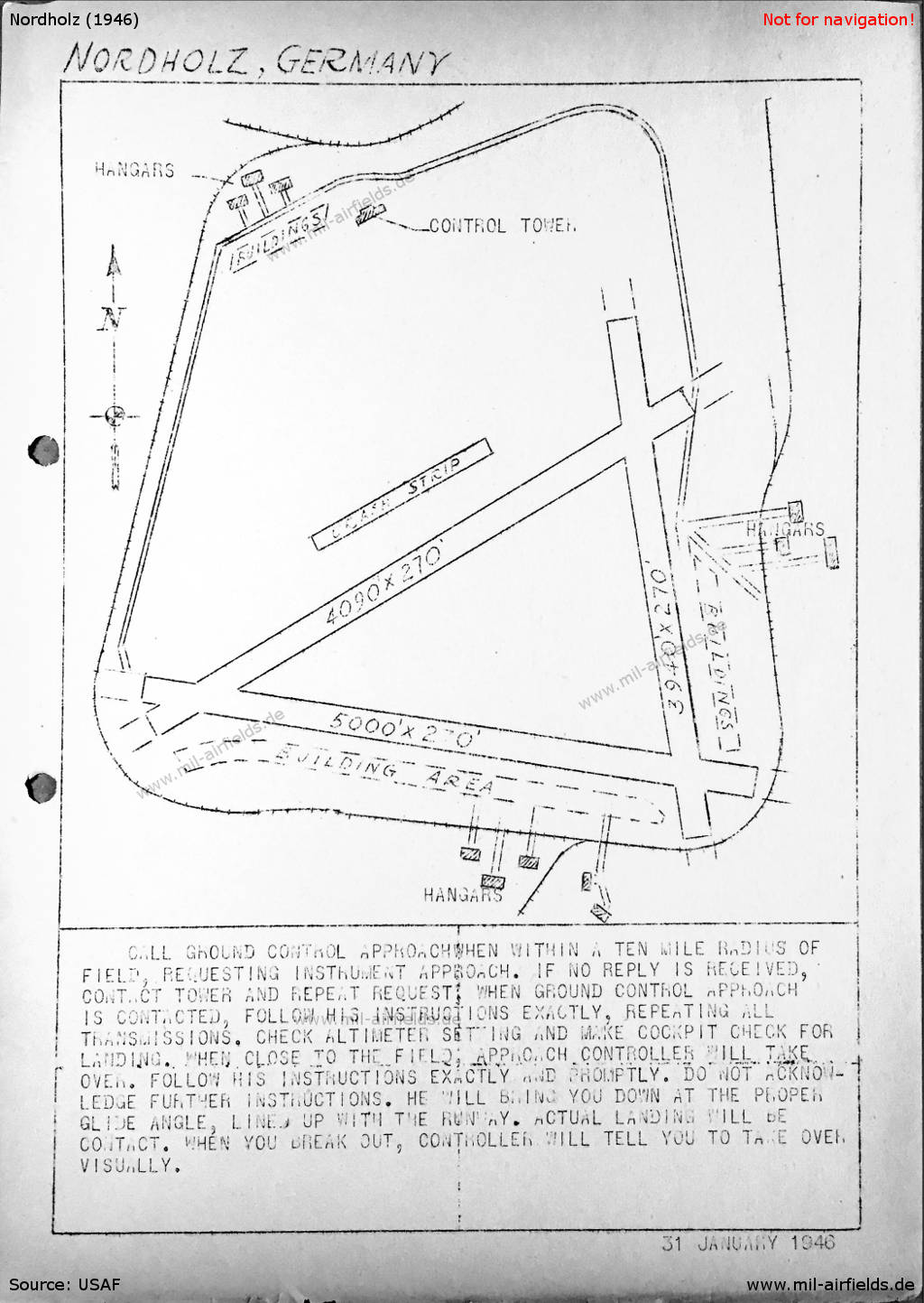
Nordholz Airfield on a US map from 1946
In the 1970s
Situation
Nordholz Naval Air Base on a map of the US Department of Defense from 1972 - (ONC E-2 (1972), Perry-Castañeda Library Map Collection, University of Texas at Austin /PCL MC/)
In the 1980s and early 1990s
Overview
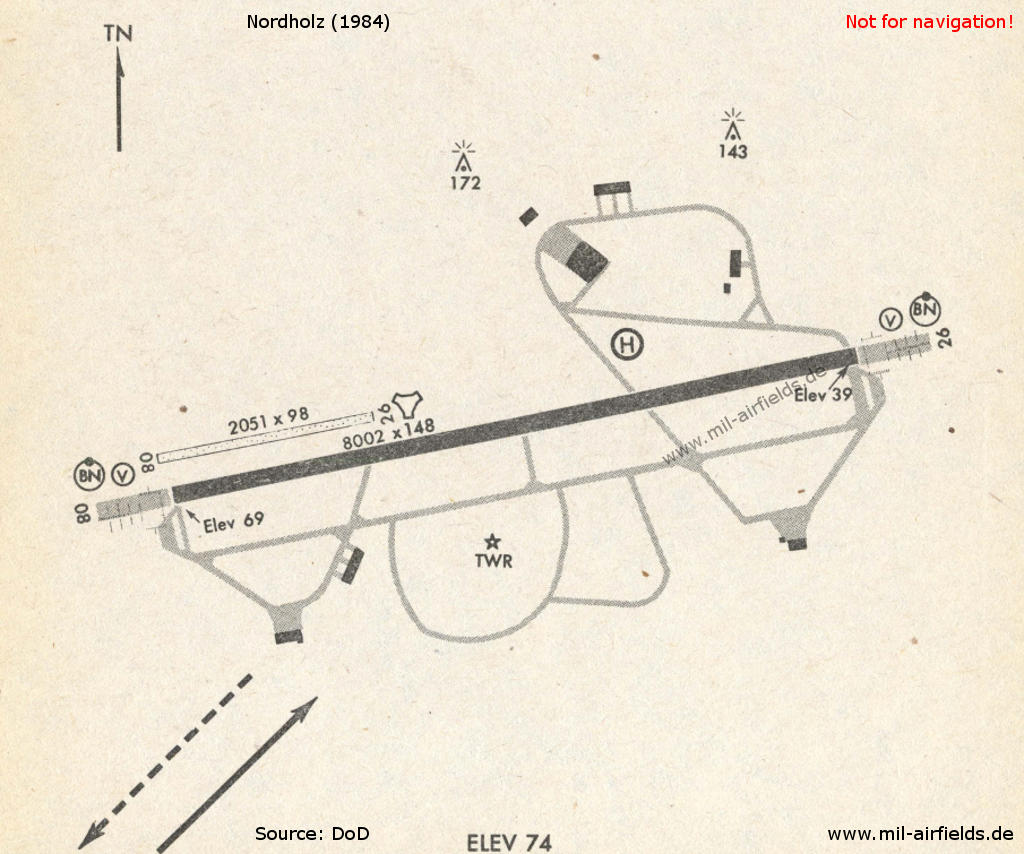
Nordholz Air Base in 1984 - At the western end of the runway is the grass strip of the Nordholz-Spieka airfield.
Runways
- 08/26: 2439 m x 30 m Concrete
Radio beacons
- NDB: 372 "NDO", 260° / 5.4 NM to field
- TACAN: CH 118 "NDO"
- ILS 26: 111.9 "NDO"
Today
Use
Naval Air Station with civilian use.
Links
- http://www.relikte.com/nordholz/index.htm - Der Einsatzhafen Nordholz
- http://www.sea-airport.de - Sea-Airport & Sea-Airpark Cuxhaven / Nordholz
- http://www.aeronauticum.de/ - Aeronauticum Nordholz (Museum)
Airfields in the vicinity
Recommended
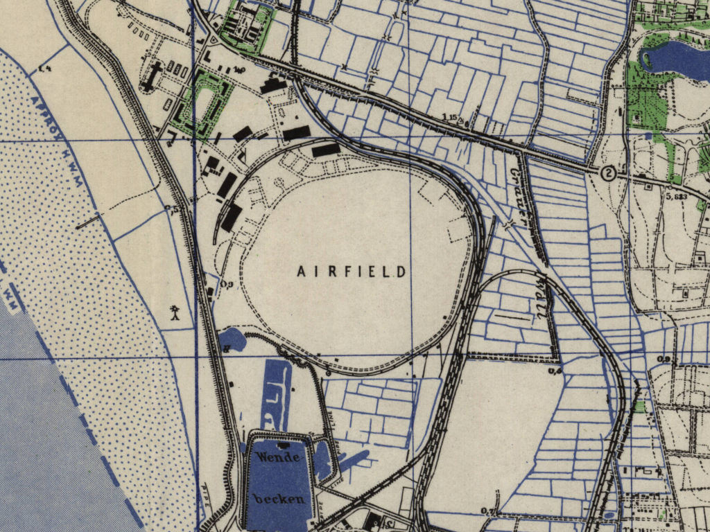

Image credits are shown on the respective target page, click on the preview to open it.
 Follow mil-airfields on Facebook