For historical information only, do not use for navigation or aviation purposes!
| Coordinates | N533500 E0083325 (WGS84) Google Maps |
| Elevation | 5 ft |
| Federal state | Freie Hansestadt Bremen (Free Hanseatic City of Bremen) |
| Location indicator | EDEO |
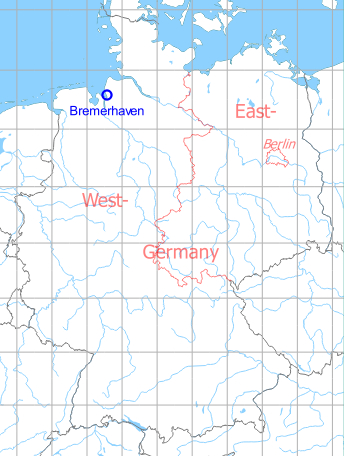
Germany during the Cold War Map
The history of the Cold War airfields: Bremerhaven
Contents
During the 1920s/1930s
Information in the German Aeronautical Information Publication from 1928
Use
Airport.
Situation
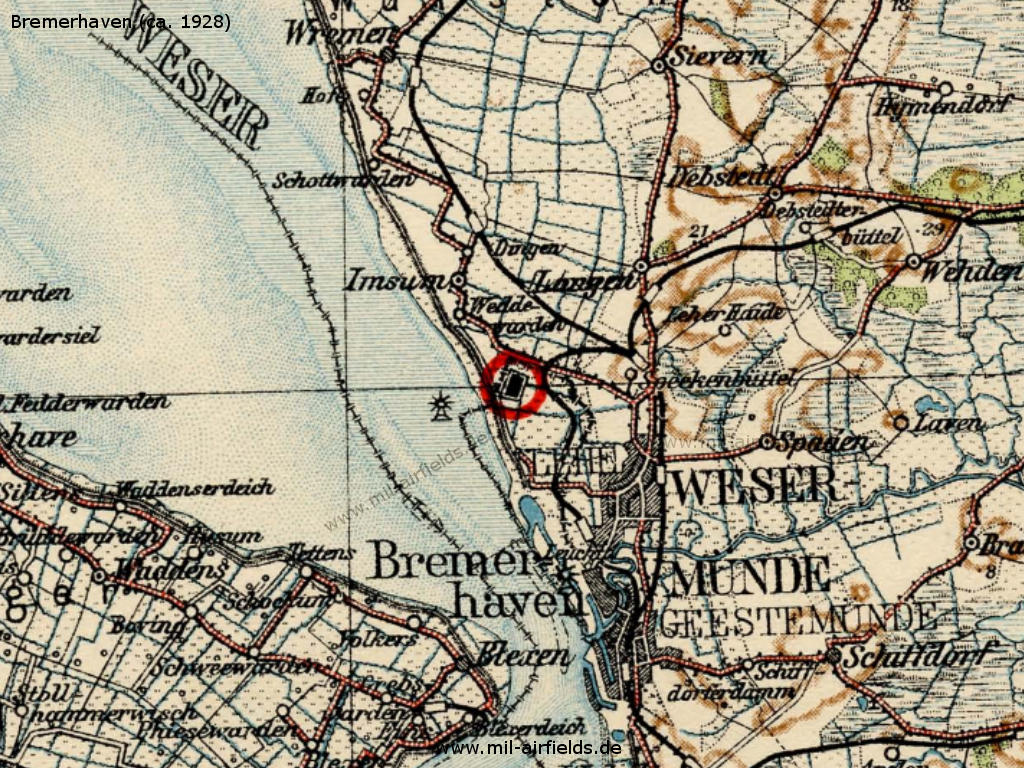
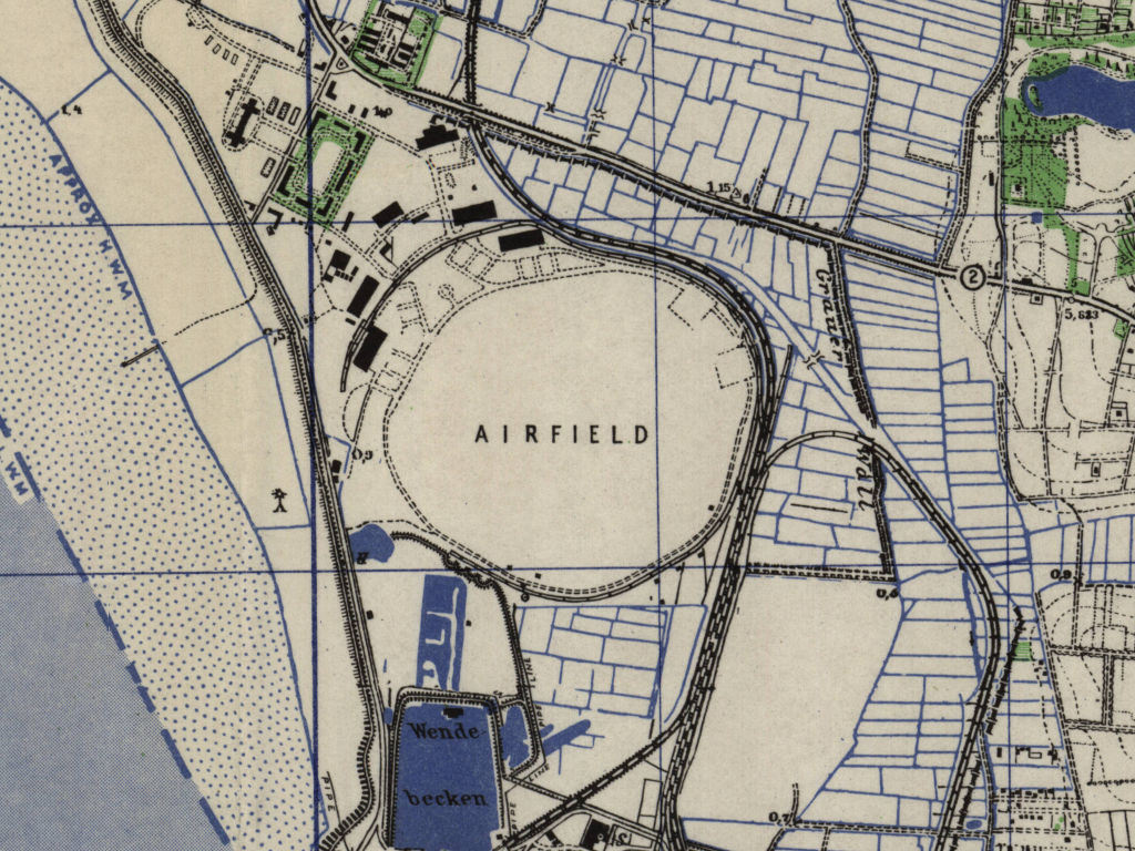
Bremerhaven airport on a map from the late 1920s.
Source: Flughandbuch 1928
Overview
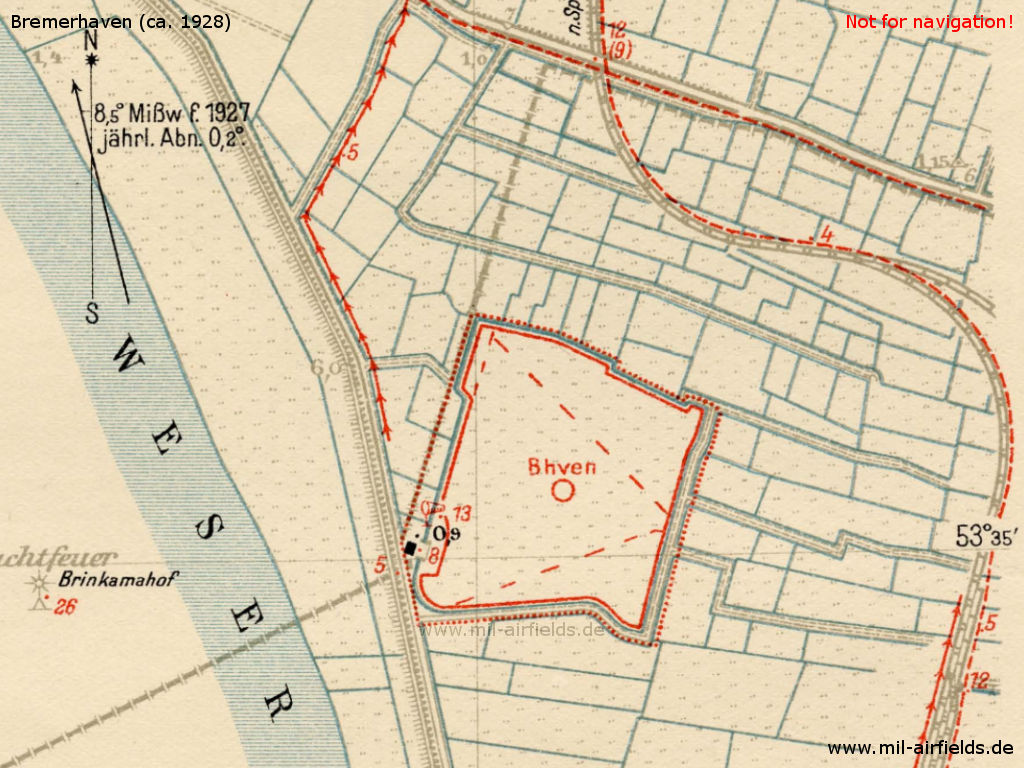
Map with the airfield
Source: Flughandbuch 1928
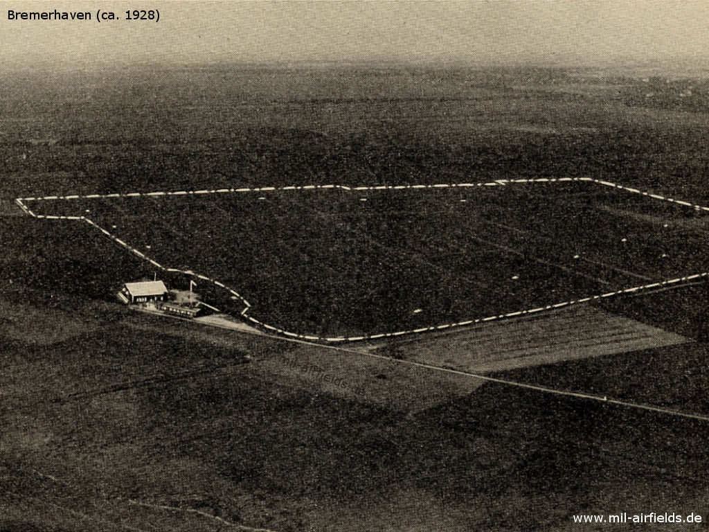
Aerial picture from the late 1920s
Source: Flughandbuch 1928
Airfield characteristics at daytime
Characteristics of the airfield at daytime: Lighthouse Brinkamahof 0,8 km west of the movement area. White triangle of the movement area with white landing circle and the inscription "B haven" in the center. Landing sign is always deployed. Windsock west of the aircraft hangar. Movement area boundary indicated by white plates.
Airfield characteristics at night
Characteristics of the airfield at night: No permanent night-time lighting available. On request at the police station, green, white and red landing fires in line parallel to the wind direction. Land from green over white to red, to the right of the row.
Runways
Good sod on dehydrated marsh ground. Shortest rolling length in east-west direction 520 m.
Hangars
Hangars: 1 aircraft hangar 20 x 25 m.
Workshops
Workshops: Do not contain any special equipment. Spare parts for Focke-Wulf aircraft in stock.
Fuel equipment
Fuel equipment: 1200 l of standard fuel of the Deutsche Luft Hansa A. G. in barrel storage in stock.
First aid in the case of accidents
First aid in the case of accidents: first aid box and stretcher are available at the police station. Nearest doctor in Bremerhaven (4.5 km distance).
Customs, post office, passport
Passport: Passport inspection by police watch.
Accommodation of passengers
Accommodation of passengers: In the city.
Connections
Connections: Shuttle service at times of scheduled departures and landings. Taxi cabs available on call.
During World War II
Use
Luftwaffe air base (Fliegerhorst).
Situation
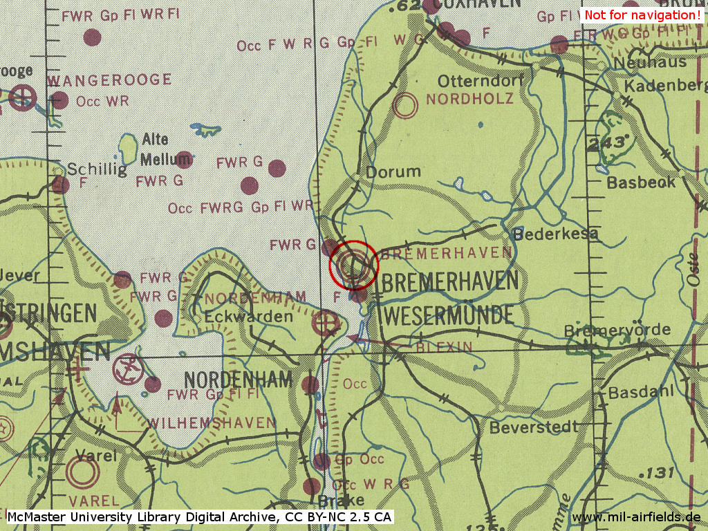
Bremerhaven Air Base in World War II on a US map from 1943
Source: McMaster University Library Digital Archive, Lizenz: Creative Commons Attribution-NonCommercial 2.5 CC BY-NC 2.5 CA
Overview
Bremerhaven Army Airfield AAF on a US map from 1951
Source: AMS M841 GSGS 4414, Courtesy Harold B. Lee Library, Brigham Young University
During the Cold War
Use
US Army airfield, later heliport only.
In the 1970s
Situation
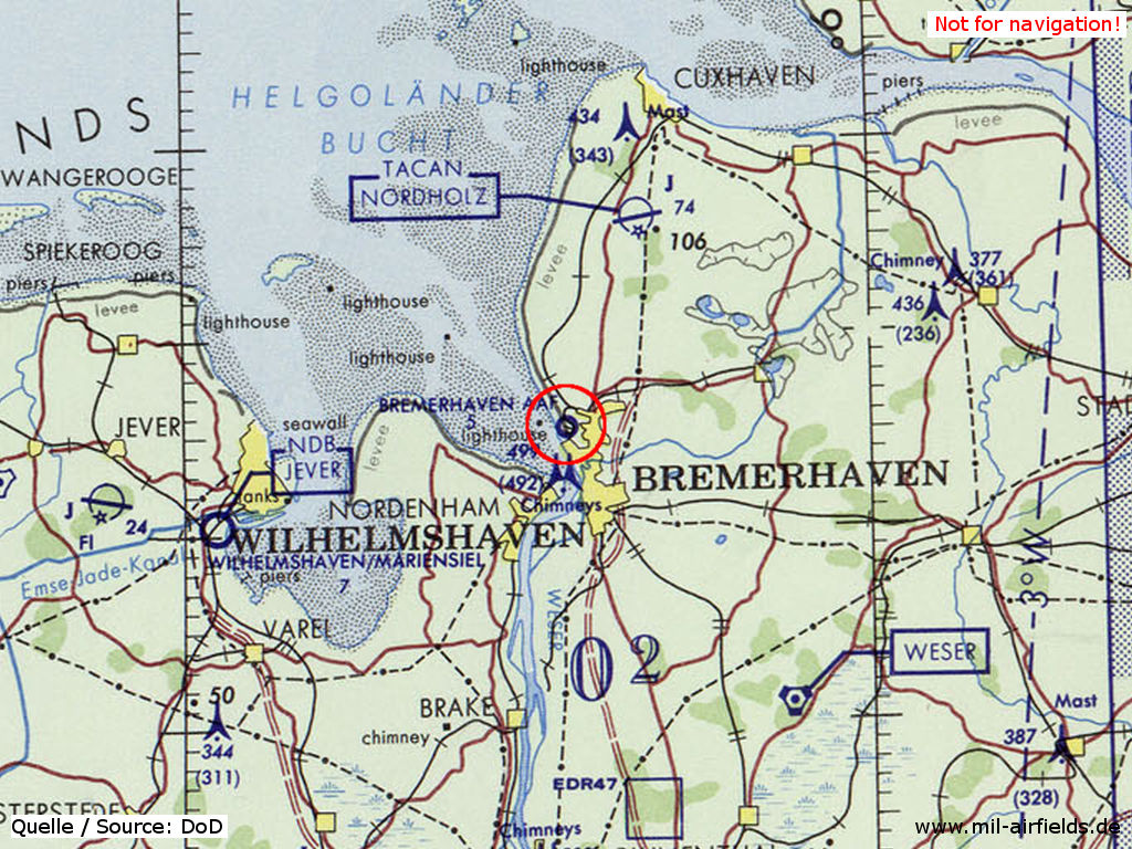
Bremerhaven Army Airfield AAF on a map of the US Department of Defense from 1972
Source: ONC E-2 (1972), Perry-Castañeda Library Map Collection, University of Texas at Austin
Runways
- 06/24: 792 m x 91 m Grass
In the 1980s and early 1990s
Overview
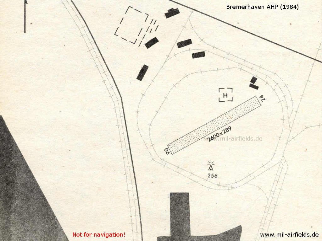
Bremerhaven 1984 - In the meantime, the airfield has been downgraded from an Army Airfield (AAF) to an Army Heliport (AHP). Nevertheless, the runway is still being shown on the map.
Runways
- Helipad
- 06/24: closed
Radio communication
Call sign: "PARAGON CON"
Telephone
DSN 342-8xxx
Today
Use
Closed.
Links
- http://www.bing.com/maps/?v=2&cp=sxxf7chqcrcn&lvl=... - Aerial Picture
- http://www.relikte.com/bhv_weddewarden/index.htm - Der Seefliegerhorst/Land Bremerhaven-Weddewarden
Airfields in the vicinity
Categories
Military Airfields GermanyMilitary Airfields in former West GermanyUS Army Airfields and Heliports in GermanyRecommended
Image credits are shown on the respective target page, click on the preview to open it.
Contents
 Follow mil-airfields on Facebook