Bremgarten: Air Base
For historical information only, do not use for navigation or aviation purposes!
| Coordinates | N475413 E0073705 (WGS84) Google Maps |
| Elevation | 701 ft |
| Federal state | Baden-Württemberg |
| Location indicator | EDSG (1990), EDTG (201x) |
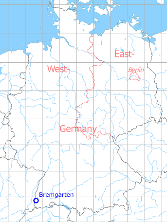
Germany during the Cold War Map
The history of the Cold War airfields: Bremgarten
During the Cold War
Use
French Armée de l'air base, later German Air Force airbase.
Situation
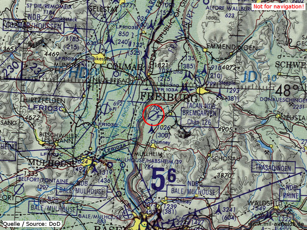
Bremgarten Air Base on a map of the US Department of Defense from 1981
Source: ONC F-2 (1981), Perry-Castañeda Library Map Collection, University of Texas at Austin
Overview
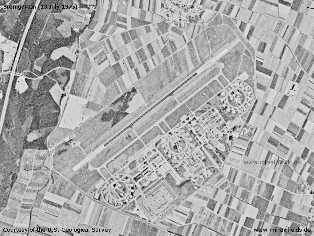
Bremgarten Air Base on a US satellite image from 13 July 1977
Source: U.S. Geological Survey
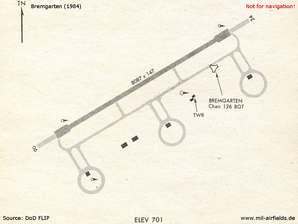
Bremgarten in 1984
Runways
Data for the year 1990:
- 05/23: 2465 m x 45 m Asphalt
Units
AG 51 RF-4E (1990)
Installations
Railway siding from Heitersheim to the south eastern part of the airfield.
Images
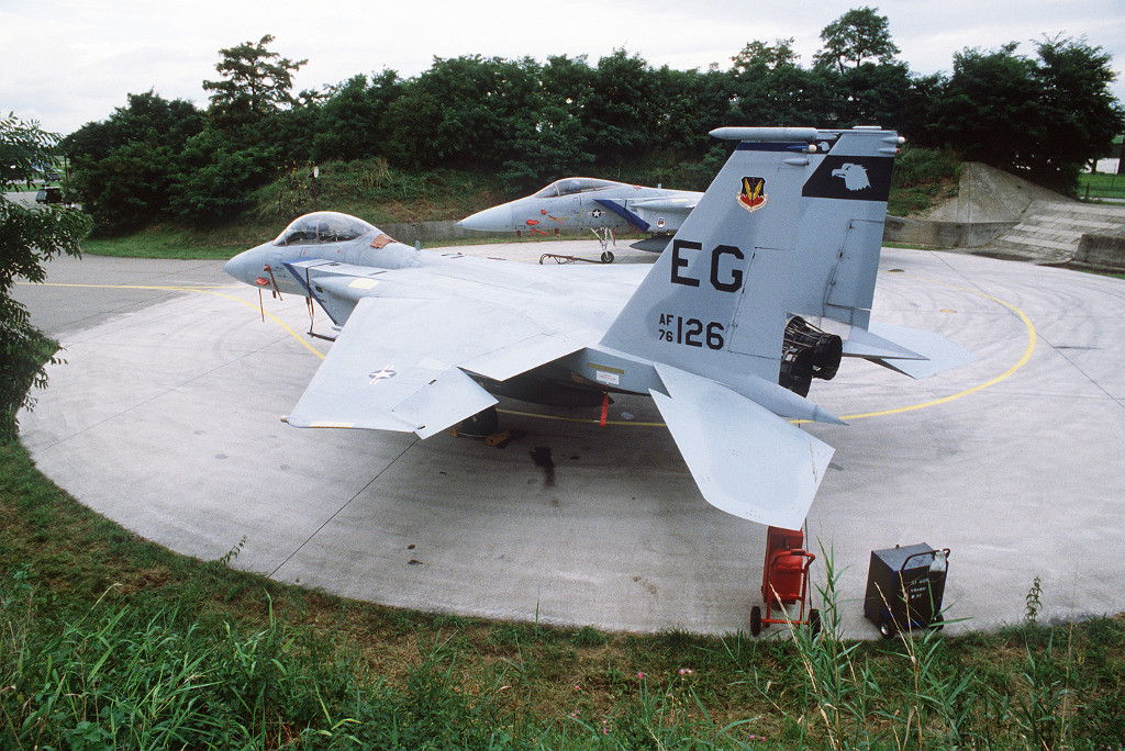
An F-15B Eagle aircraft and an F-15A Eagle aircraft are parked on a circular parking pad during Exercise CHECKERED FLAG '82.
Source: DoD photo by: TSGT JOSE LOPEZ JR., Date Shot: 30 Aug 1983
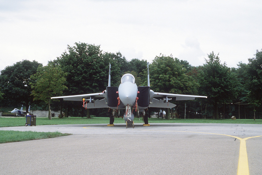
An F-15 Eagle aircraft rests on a parking pad during Exercise CHECKERED FLAG '82.
Source: DoD photo by: TSGT JOSE LOPEZ JR., Date Shot: 30 Aug 1982
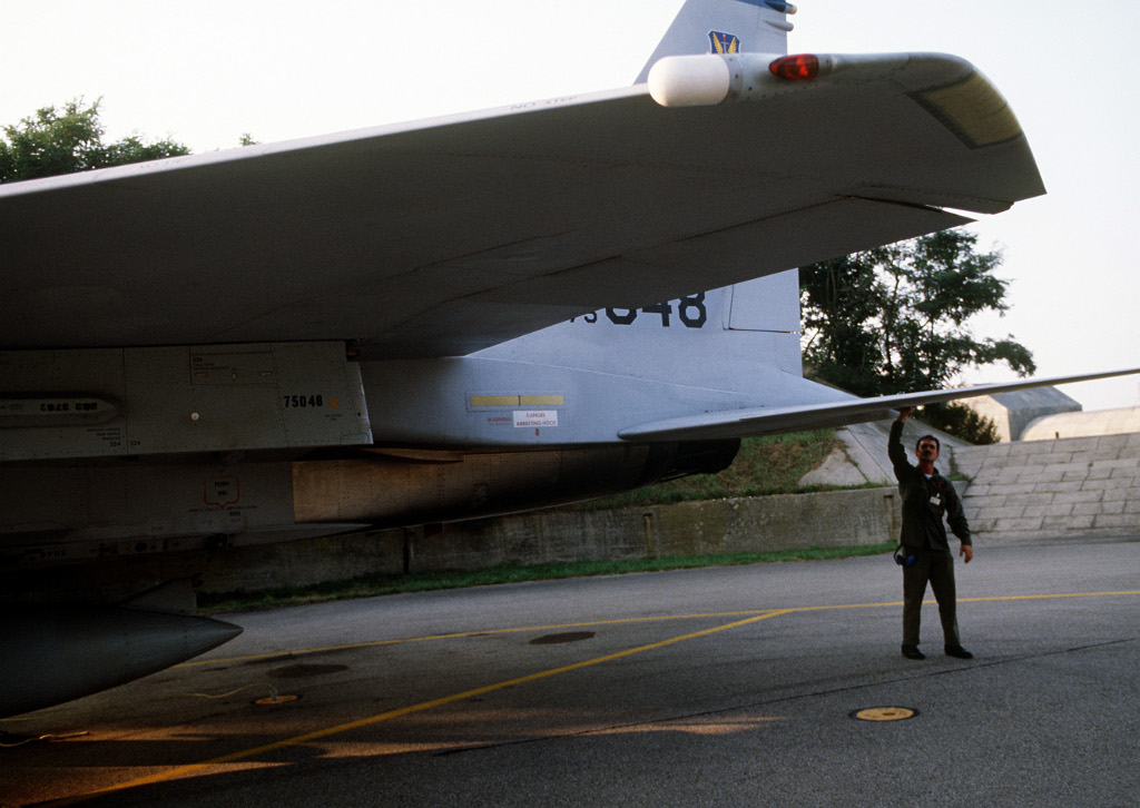
A ground crewman prepares an F-15 Eagle aircraft for flight during Reforger-Crested Cap II.
Source: DoD photo by: TSGT KEN HAMMOND, Date Shot: 9 Aug 1983
Today
Use
General aviation.
Links
- http://www.gewerbepark-breisgau.de/Flugplatz - Flugplatz Bremgarten
- http://www.ag51i.de/ - Traditionsverein Aufklärungsgeschwader 51 "Immelmann" Bremgarten e.V.
- http://de.wikipedia.org/wiki/Flugplatz_Bremgarten - Airfield history (German language)
Airfields in the vicinity
Categories
Military Airfields GermanyMilitary Airfields in former West GermanyGerman Air Force Air BasesAirfields of the French Forces in GermanyRecommended
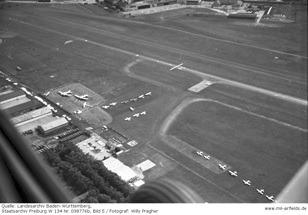

Image credits are shown on the respective target page, click on the preview to open it.
 Follow mil-airfields on Facebook