For historical information only, do not use for navigation or aviation purposes!
| Coordinates | N474017 E0093042 (WGS84) Google Maps |
| Elevation | 1365 ft |
| Location indicator | EDFL (196*, 197*), EDGL (GAR), EDTY (-1995), EDNY (1995-) |
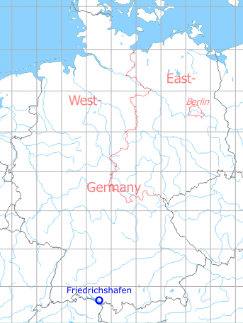
Germany during the Cold War Map
The history of the Cold War airfields: Friedrichshafen
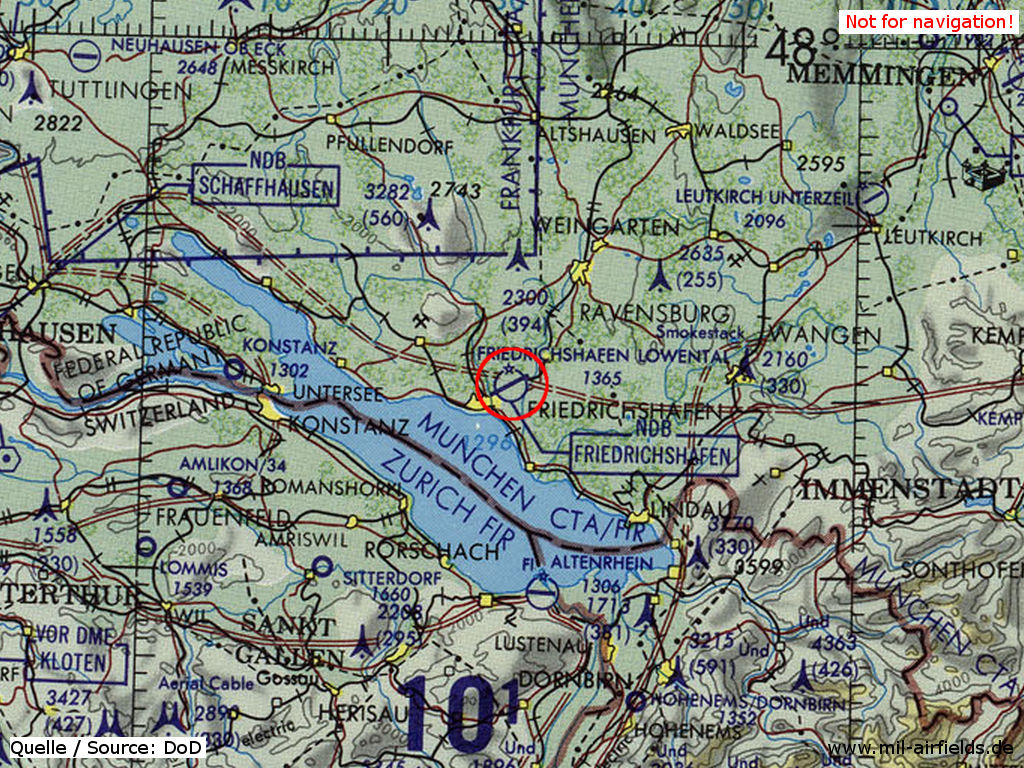
Location of airfield
At the northeastern edge of Friedrichshafen.
During the 1920s/1930s
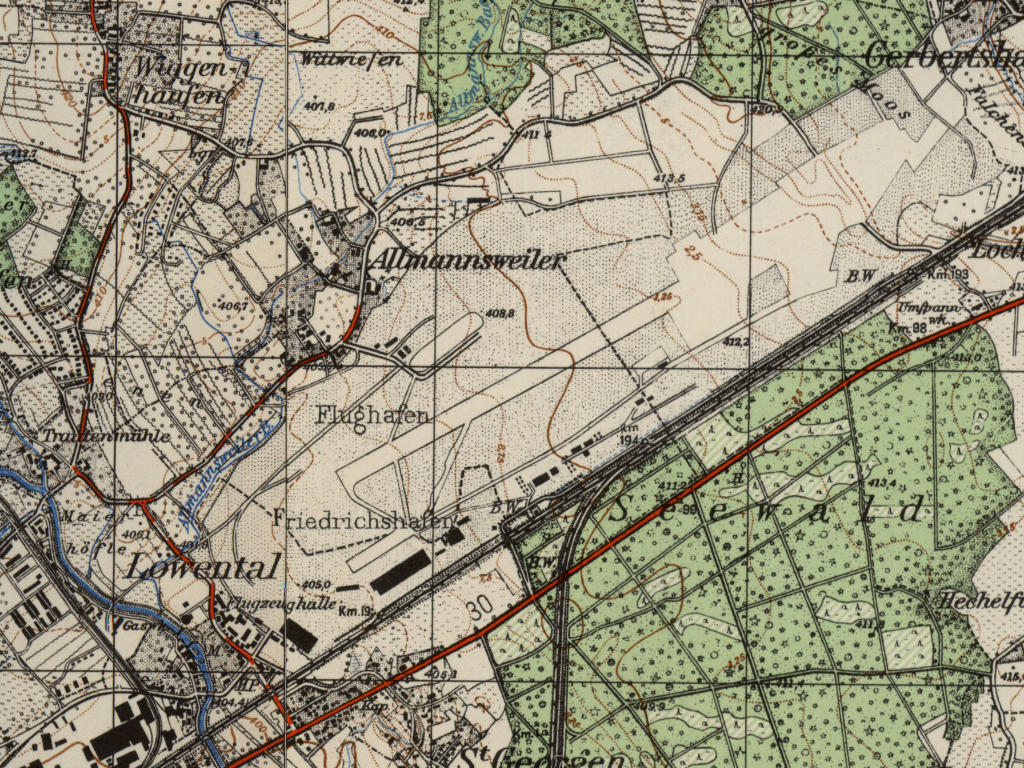
Location of airfield
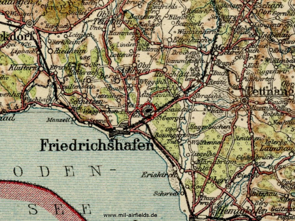
The location of the airfield on a map from the 1930s
Source: FHB 1928
Overview
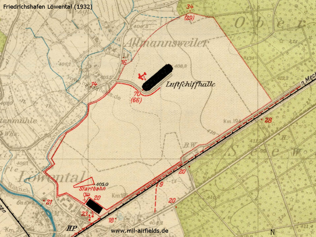
Airfield map 1932
Source: FHB 1928
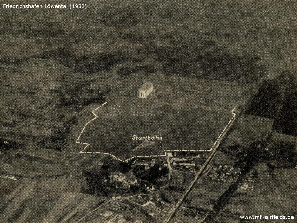
Aerial picture from the 1920s or 1930s - The view is northeast
Source: FHB 1928
Airfield characteristics at daytime
The movement area is located 3 km north-east of the city Friedrichshafen near Löwenthal, north of the Friedrichshafen-Ravensburg railway line. The aircraft hangar is located in the south-west, an airship hangar in the north of the movement area. On the airplane hangar is a white inscription "Friedrichshafen". Landing signs for airplanes is constantly deployed, also the smoke oven is in operation at daytime. In the south-west concrete runway *). For airships, a landing crew and technical preparation of the landing are to be requested at Luftschiffbau Zeppelin G. m. b. H. Friedrichshafen (Lake Constance). The movement area boundary is marked by red-white panels. 2 km west of the movement area is the the airship hangar of the Luftschiffbau Zeppelin G. m. b. H., on the northern edge of the city.
*) Concrete runway: Largest length approx. west-east 150 m, width at the east side 57 m, width at the west side 15 m.
Airfield characteristics at night
No permanent night lighting, landing lights made of green, white and red fires in the wind direction are to be requested:
A) for airplanes: at the administrator, landings are to be performed from green over white to red, to the right of the row.
B) for airships: at Luftschiffbau Zeppelin G. m. b. H., Friedrichshafen (Lake Constance). On request at the police watch, also neon fires on both radio towers.
A) for airplanes: at the administrator, landings are to be performed from green over white to red, to the right of the row.
B) for airships: at Luftschiffbau Zeppelin G. m. b. H., Friedrichshafen (Lake Constance). On request at the police watch, also neon fires on both radio towers.
Runways
Good sod on clay soil. Shortest rolling length: 800 m in northwest-southeast direction.
Hangars
1 aircraft hangar 100,98 x 46,40 m, height 15,34 m, door width 2 x 44,0 x 7,5 m,
1 airship hangar 270,0 x 58,9 m. clear height 53.0 m, door width 2 x 52.0 m, door height 49.0 m.
The aircraft hangar contains 3 trolleys each with a load capacity of 1 t, the airship hangar 8 trolleys each with a load capacity of 3 t.
1 airship hangar 270,0 x 58,9 m. clear height 53.0 m, door width 2 x 52.0 m, door height 49.0 m.
The aircraft hangar contains 3 trolleys each with a load capacity of 1 t, the airship hangar 8 trolleys each with a load capacity of 3 t.
Workshops
Contain all machinery and equipment necessary for the repair of wood and metal aircraft; mobile autogenous welding system, three-phase current of 220/380 volts. Construction company for metal aircraft and for airships at the field.
Fuel equipment
In barrel storage approx. 2000 l of petrol and benzene in stock at any time. Gas for airships in stock.
Railway siding
Available.
First aid in the case of accidents
Provided by the police station. Medical room available. Nearest doctor in Friedrichshafen (2 km distance).
Accommodation of passengers
In the hotels in the city of Friedrichshafen.
Connections
Shuttle service at times of scheduled air travel with airplanes and airships. Taxi cabs on call at any time.
/FHB 1928/
Timetable
Timetable in spring 1939
In the spring of 1939, Friedrichshafen is served by one scheduled flight:
Stuttgart (Böblingen) - Friedrichshafen
Weekdays, operated by Lufthansa with Junkers Ju 52 aircraft.
Departure - arrival:
Stuttgart 13:20 - 14:00 Friedrichshafen
Friedrichshafen 16:50 - 17:30 Stuttgart
Stuttgart 13:20 - 14:00 Friedrichshafen
Friedrichshafen 16:50 - 17:30 Stuttgart
Fares in Reichsmark Single flight / return / excess baggage per kg
Stuttgart: 15, - / 27, - / 0,15 RM
Children up to 3 years of age pay 10% of the fare, children up to 7 years of age pay 50%.
Free luggage allowance 15 kg
Stuttgart: 15, - / 27, - / 0,15 RM
Children up to 3 years of age pay 10% of the fare, children up to 7 years of age pay 50%.
Free luggage allowance 15 kg
Images
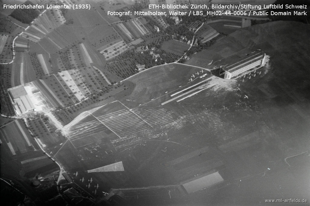
Aerial picture from 11 July 1935
Source: ETH
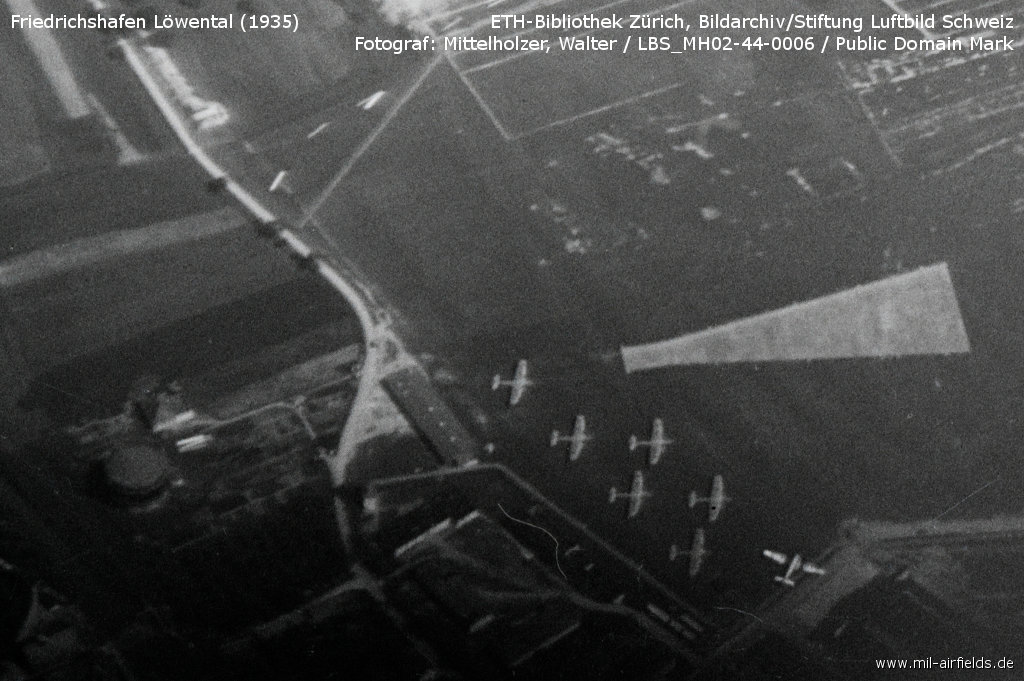
Enlargement: Airport installations in the southestern corner - Gas works (left), buildings and aircraft (center), runway (right), hangar (bottom right)
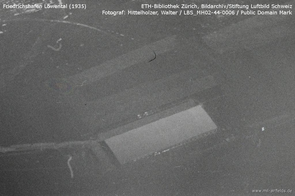
Enlargement: Building in the south next to the railway line
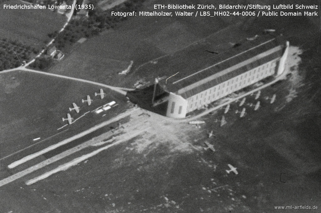
Enlargement: Airship hangar
During World War II
Use
Luftwaffe airfield.
Situation
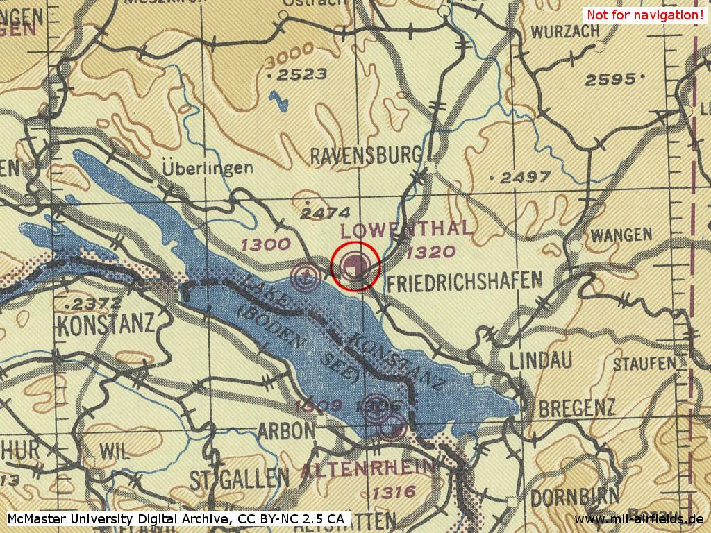
Löwental during World War II on a US map from February 1945
Source: McMaster University Library Digital Archive, Lizenz: Creative Commons Attribution-NonCommercial 2.5 CC BY-NC 2.5 CA
During the Cold War
After World War II, Friedrichshafen was first used by the French Air Force, followed by German army aviation and finally by French army helicopters.
Units
1949-1953: EC 4 (De Haviland Vampire)
bis 1959: Luftwaffe training unit (Do-27)
1959-1966: German Army Aviation Heeresfliegerstaffel (LL) 9 (1966 renamed to Heeresfliegerstaffel 10 and moved to Neuhausen ob Eck airfield)
1973-1992: French Army Aviation, 1990: 2e RHC mit EHAC-3, EHAC-4, EHAC-5, EHAP-2, EHLR-1, EHM-6 (SA 342M, SA 341F, SA 330B)
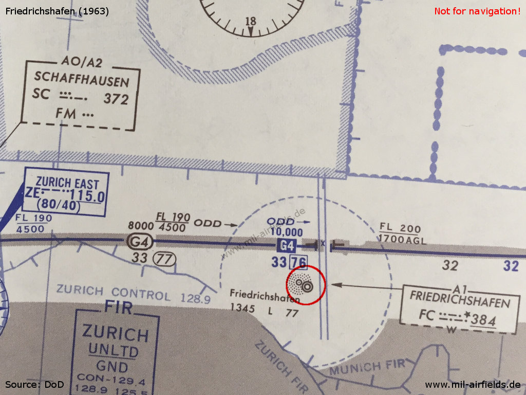
In the 1950s
Situation
The French Friedrichshafen air base on a map from 1956 - Northwest of the field is a direction finding station LIGHTENECH marked. It is very likely that this is Lichtenegg (Illmensee).
Overview
Friedrichshafen Löwental Airfield on a US map from 1955
Source: AMS M841 GSGS 4414, Courtesy Harold B. Lee Library, Brigham Young University
Radio communication
- Approach 119.7
- Airport 3270, 119.7, 121.5
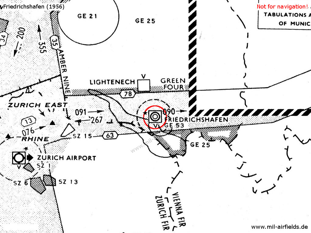
In the 1960s
Situation
Friedrichshafen military airfield on a map from 1963
Radio beacons
- NDB: 384 "FC"
Radio communication
- Tower 117.9, 119.7
- Radio 34.6
Air traffic control (ATC) service provided by French Air Force. ATC service provided by German Army for German military aircraft only.
Telephone
4141-44
In the 1970s
Overview
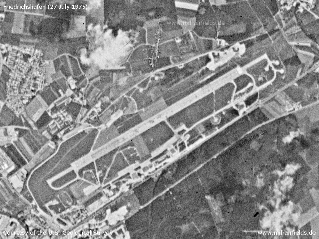
Friedrichshafen Airfield on a US satellite image from 27 July 1977
Source: U.S. Geological Survey
In the 1980s and early 1990s
Situation
Friedrichshafen Löwental Airport on a map of the US Department of Defense from 1981
Source: ONC F-2 (1981), Perry-Castañeda Library Map Collection, University of Texas at Austin
Runways
Data for the year 1990:
- 06/24: 2355 m x 30 m Asphalt
Today
Today, Friedrichshafen is a regional airport.
Links
- http://www.bodensee-airport.eu/ - Bodensee-Airport Friedrichshafen
Sources
- /ETH/:
http://www.e-pics.ethz.ch/ - E-Pics
Airfields in the vicinity
- 170°/21km Altenrhein: Airfield
- 346°/44km Mengen: Airfield (Hohentengen, Aérodrome de Mengen)
Categories
Military Airfields GermanyMilitary Airfields in former West GermanyGerman Army AirfieldsAirfields of the French Forces in GermanyRecommended
Image credits are shown on the respective target page, click on the preview to open it.
 Follow mil-airfields on Facebook