Fritzlar: Airfield
For historical information only, do not use for navigation or aviation purposes!
| Coordinates | N510652 E0091710 (WGS84) Google Maps |
| Elevation | 568 ft |
| Federal state | Hessen (Hesse) |
| Location indicator | DEFL (195x), EDPF (196x-199x), ETHF (199x-) |
The history of the Cold War airfields: Fritzlar
Location
Federal State of Hesse.
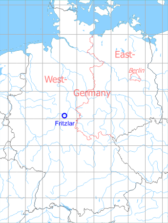
Germany during the Cold War
During World War II
Situation
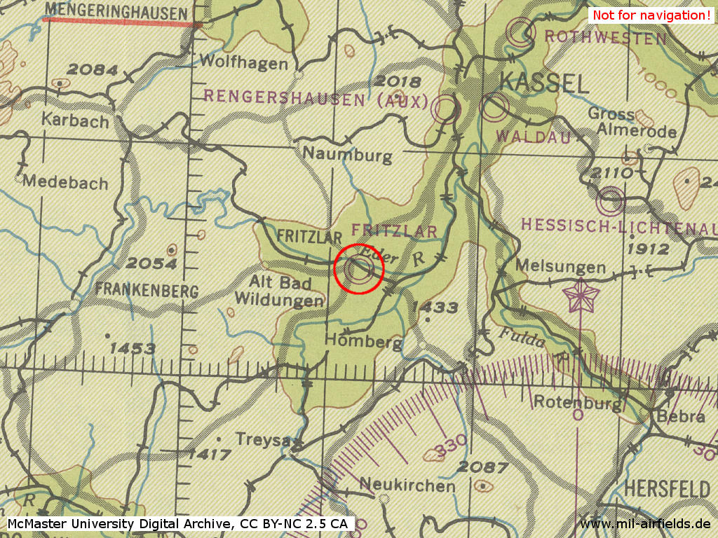
Fritzlar air base in World War II on a US map from 1944 - (McMaster University Library Digital Archive, License: Creative Commons Attribution-NonCommercial 2.5 CC BY-NC 2.5 CA /MULDA/)
During the Cold War
Use
German Army airfield.
Situation
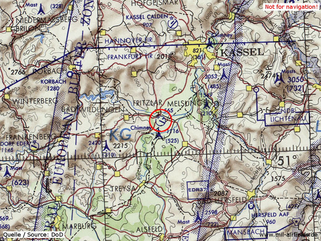
Fritzlar Airfield on a map of the US Department of Defense from 1972 - (ONC E-2 (1972), Perry-Castañeda Library Map Collection, University of Texas at Austin /PCL MC/)
Overview
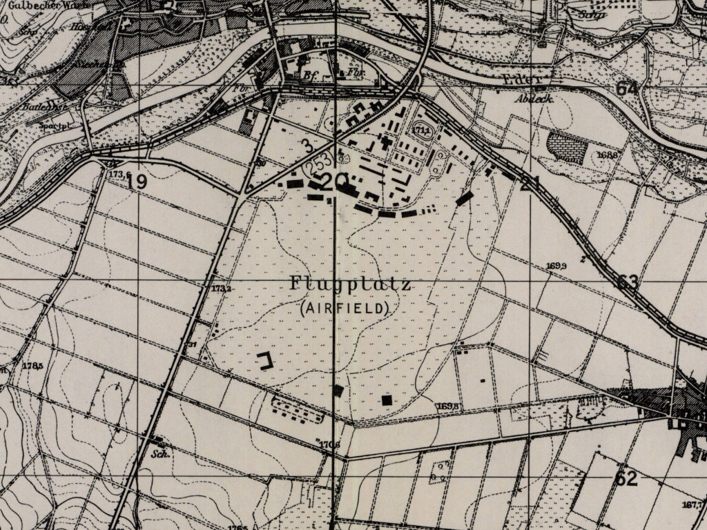
Fritzlar Airfield on a US map from 1951 - (AMS M841 GSGS 4414, Courtesy Harold B. Lee Library, Brigham Young University /BYU/)
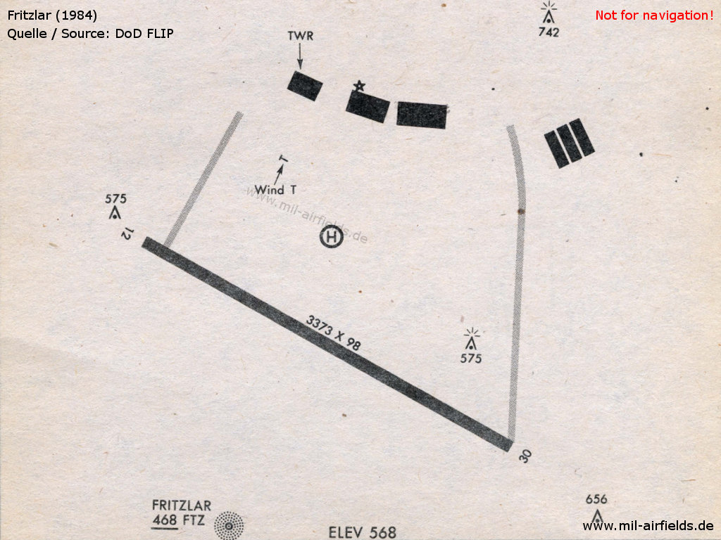
Fritzlar 1984
Links
- http://www.luftfahrt-bibliothek.de/flugplatz-fritz... - 70 Jahre Flugplatz Fritzlar von 1938 bis 2008 Digitale Luftfahrt-Bibliothek
Airfields in the vicinity
- 030°/35km Rothwesten: Airfield
- 025°/37km Rothwesten: Gunpost Army Heliport
- 135°/42km Bad Hersfeld: Army Airfield AAF (Army Heliport AHP, Werve Thompson)
 Follow mil-airfields on Facebook