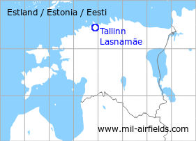
Tallinn: Airfield / Air Base Lasnamäe
For historical information only, do not use for navigation or aviation purposes!
| Coordinates | N592647 E0245113 ca. (WGS84) Google Maps |
The history of the Cold War airfields: Tallinn Lasnamäe
General
The capital Tallinn is located in the north of Estonia. The Lasnamäe Air Base was in the northeast of the city During the Cold War, Lasnamäe was an air base of the Soviet Air Force. Today, the airfield is closed.
During World War II
Overview
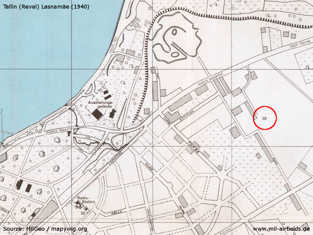
Map with the Tallinn Lasnamäe airfield on a MilGeo city map from 1940
Source: mapywig.org
During the Cold War
Use
Military aerodrome.
In the 1950s
History
- CIA report from July 1955
Since the end of World War II, the airfield has been extended toward the southeast. It has asphalt runways, and the normal take-off direction is north-northwest. During 1954, the former Narva Road, which ran along the northern edge of the field, was closed to all traffic. - In February 1955, three jet aircraft ... MiG fighters, were seen taking off, and 10 more were parked on the ground. The aircraft were painted grey. There was not much daytime flying from this airfield; the busiest time was at dusk. The prewar control tower was still in use. No hangars were seen, but 20 to 25 new wooden huts for troops had been built along the southeast side of the airfield.
- On 29 March 1955, four trucks, equipped with rod aerials, and driven by soldiers, were seen driving toward the airfield from the east.
- October 1957
US agencies count at the airfield 15 to 20 fighter aircraft, possibly MiG-19 and 3 to 4 transport aircraft, possibly Li-2. (Source: CIA)
In the 1960s
Situation
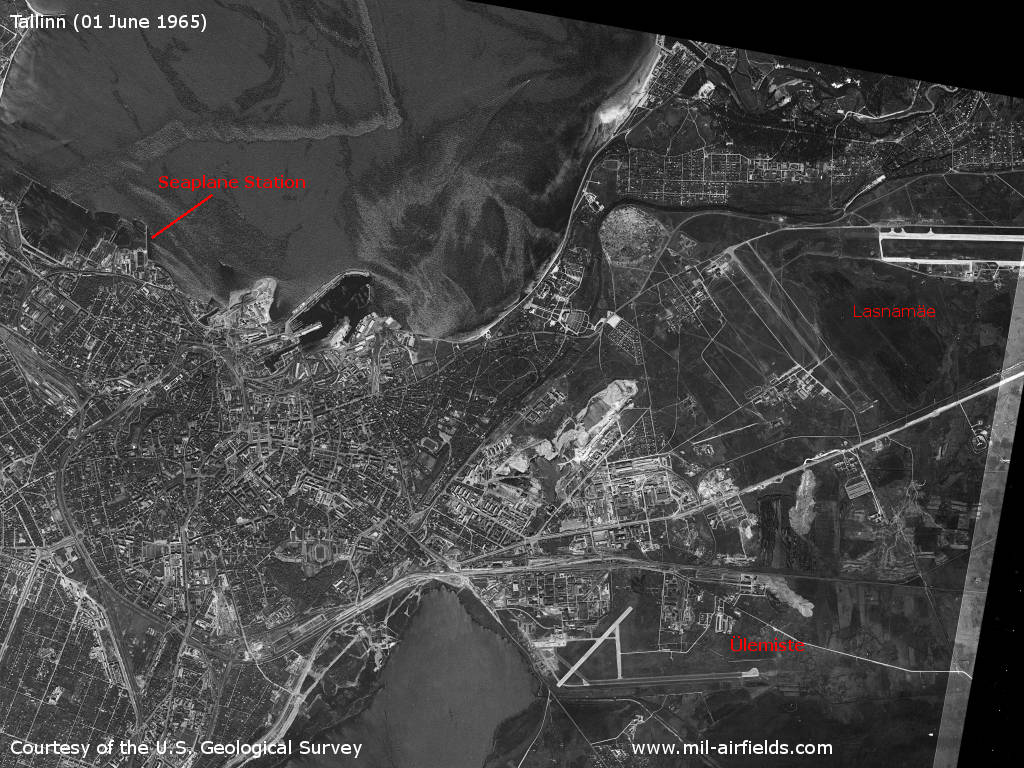
The Tallinn airfields Lasnamäe and Ülemiste and the seaplane station on a satellite picture from February 8,1967
Source: U.S. Geological Survey
Overview
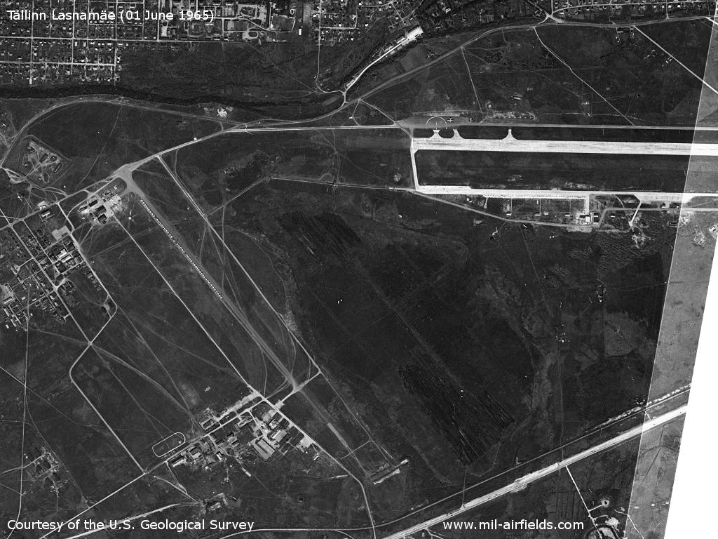
General view of the western part of the airport, which consists of two clearly separated areas. - In total, about 95 fighter planes, one Il-14 and 5 small aircraft are visible on this section.
Source: U.S. Geological Survey
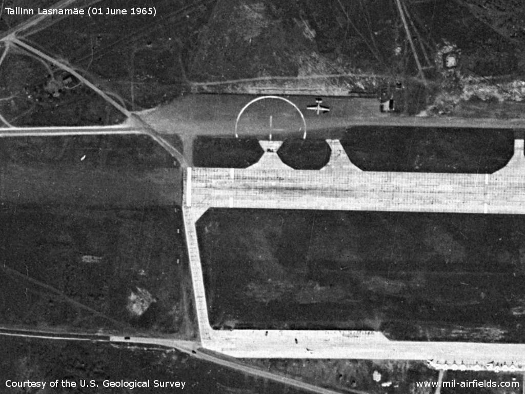
The plane on the upper ramp looks like an Il-14 CRATE. On the area in the south, a fighter plane is visible, which will presumably taxiing to the right to the flight line.
Source: U.S. Geological Survey
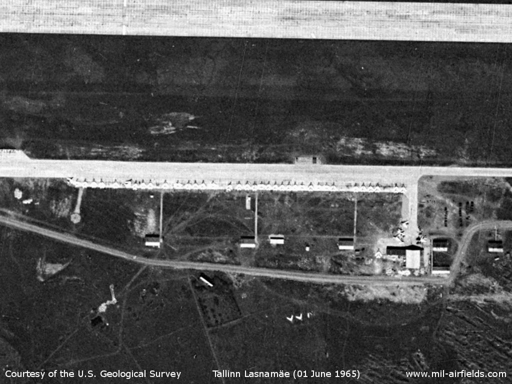
There are 37 fighter planes on the flight line and another 4 or 5 aircraft around the building at the east. The arrow-shaped objects south of the path could be decommissioned aircraft.
Source: U.S. Geological Survey
Source: U.S. Geological Survey
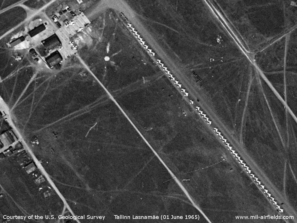
In the western area there are 48 fighter aircraft on the flight line and 6 near the buildings. In addition, there are 2 small aircraft on the flight line, one near the buildings and two on the free area.
Source: U.S. Geological Survey
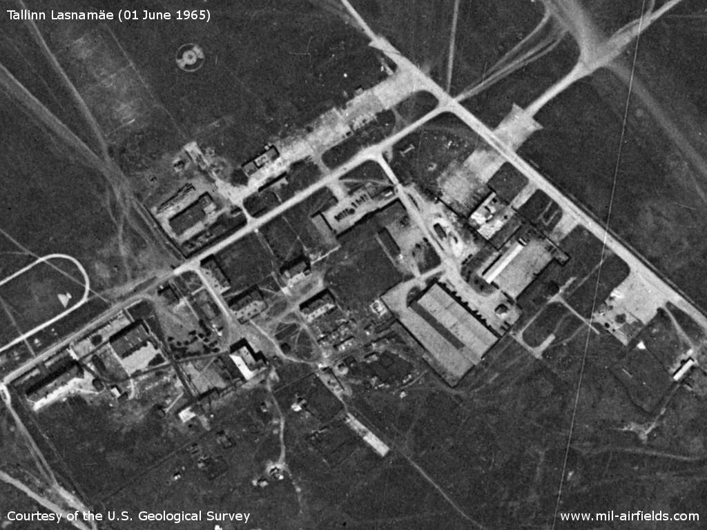
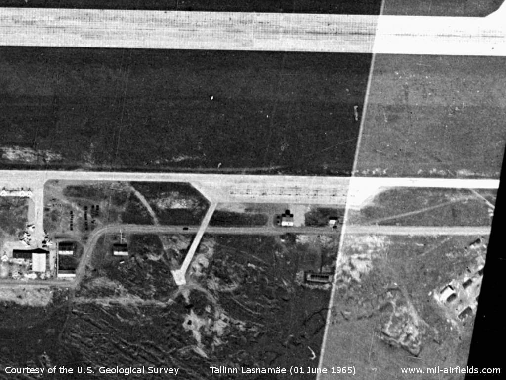
Buildings in the south-western area of the airfield
Source: U.S. Geological Survey
In the 1970s
Situation
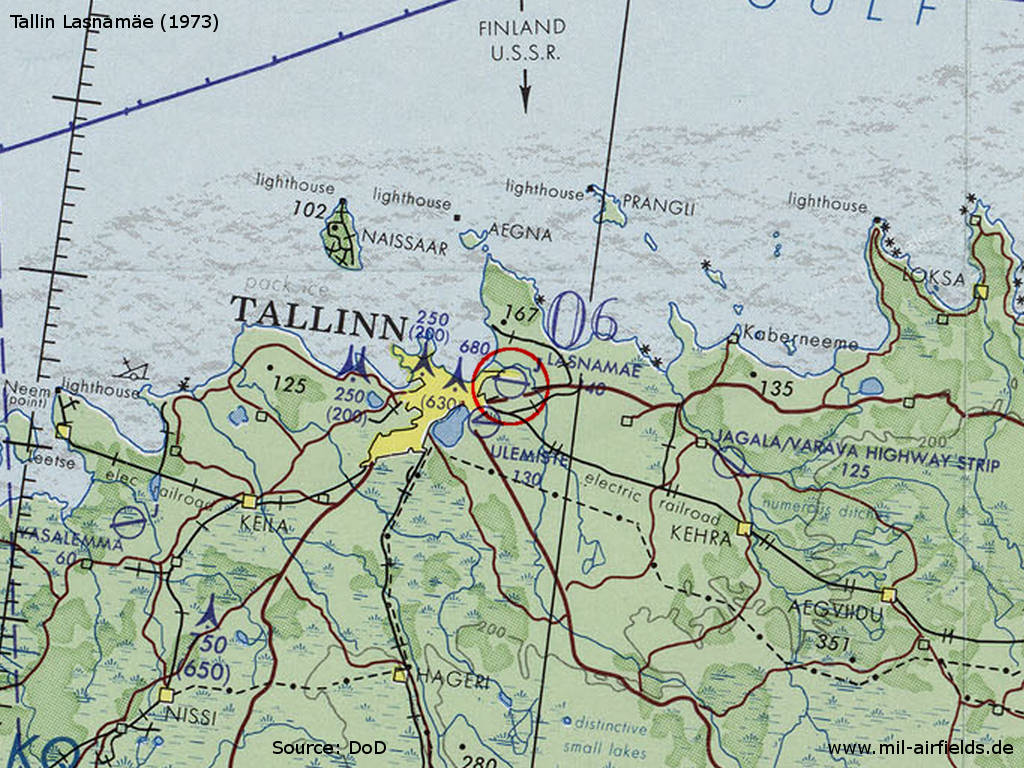
Tallinn Lasnamäe Airfield on a map of the US Department of Defense from 1973
Source: ONC D-3 (1973), Perry-Castañeda Library Map Collection, University of Texas at Austin /PCL MC/
Today
Use
Closed.
Sources
- http://www.mapywig.org/ - Archiwum Map Wojskowego Instytutu Geograficznego 1919 - 1939
- https://www.usgs.gov/ - USGS U.S. Geological Survey
 Follow mil-airfields on Facebook