For historical information only, do not use for navigation or aviation purposes!
| Coordinates | N515232 E0072014 (WGS84) Google Maps |
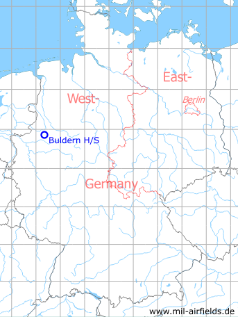
| Federal state | Nordrhein-Westfalen (North Rhine-Westphalia) |
Germany during the Cold War Map
The history of the Cold War airfields: Buldern
Location of airfield
Autobahn A43 between intersections Nottuln and Dülmen-Nord.
Usage during the Cold War
Prepared highway strip on Autobahn.
Use today
Not usable anymore, dismantling took place probably between 1998 and 2001.
Runways
Data for the year 1990:
- 06/24: 2700m
 Follow mil-airfields on Facebook