Burg: Airfield
For historical information only, do not use for navigation or aviation purposes!
| Coordinates | N521425 E0115131 (WGS84) Google Maps |
| Former East Germany (GDR) | District of Magdeburg |
| Federal state | Sachsen-Anhalt (Saxony-Anhalt) |
| Location indicator | EDBG |
Germany during the Cold War Map
The history of the Cold War airfields: Burg
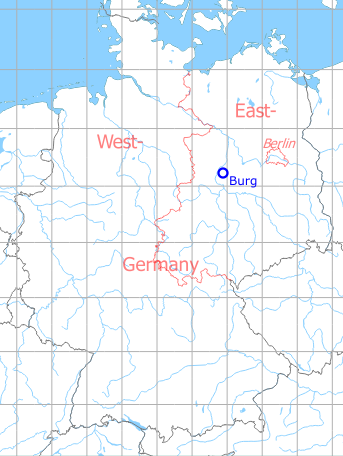
Location of airfield
3 km south of Burg city center. The airfield is not to be confused with the former Burg airbase (Fliegerhorst), which was 2.5 km to the northeast.
During the Cold War
Use
Parachute training by the former East German National People's Army (NVA).
In the 1960s
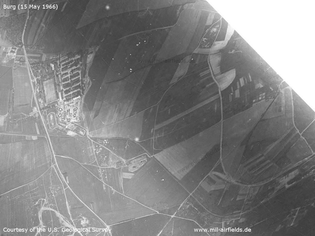
Overview
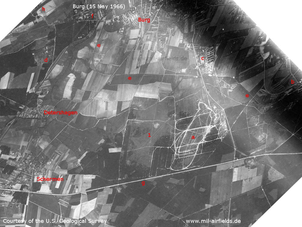
Burg bei Magdeburg on a US satellite image from 15 May 1966 - 1: Burg airfield. Other objects: a: training area; b: former Fliegerhorst Burg (air base), now East German National People's Army barracks "Waldfrieden"; c: Soviet barracks; d: Soviet depot; e: railway siding from Burg zur Waldfrieden barracks; f: VEB Walzwerk Burg rolling mill; g: Autobahn Hannover-Berlin: h: Elbe-Havel-Kanal. Places: Detershagen, Schermen.
Source: U.S. Geological Survey
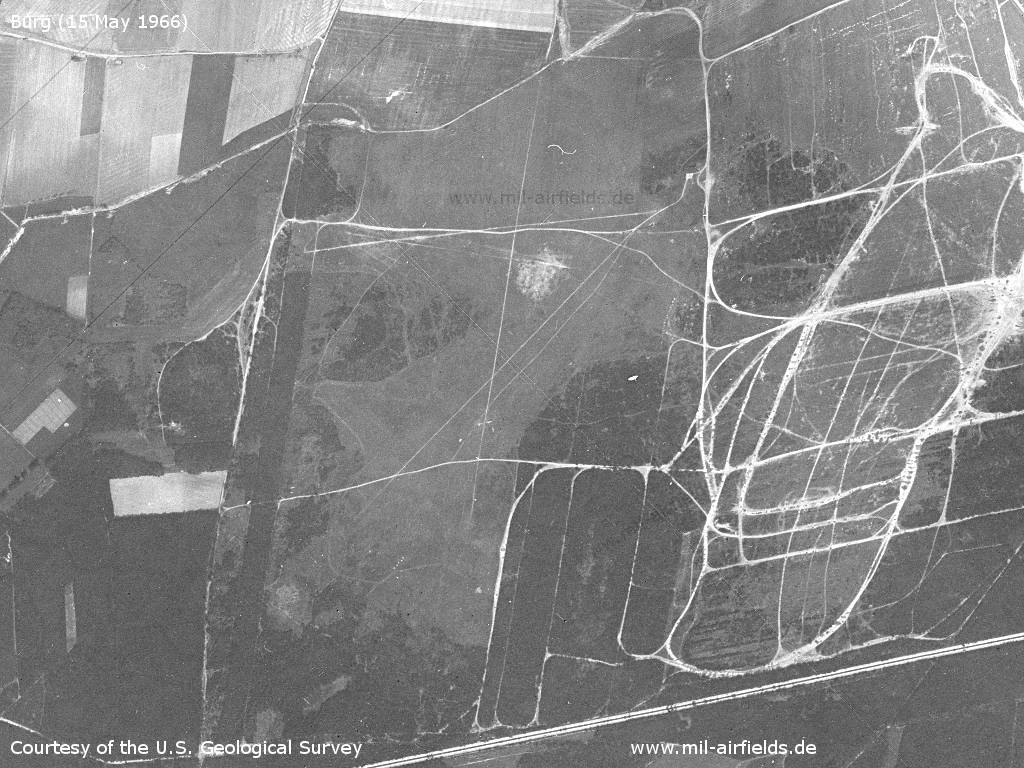
The airfield
Source: U.S. Geological Survey
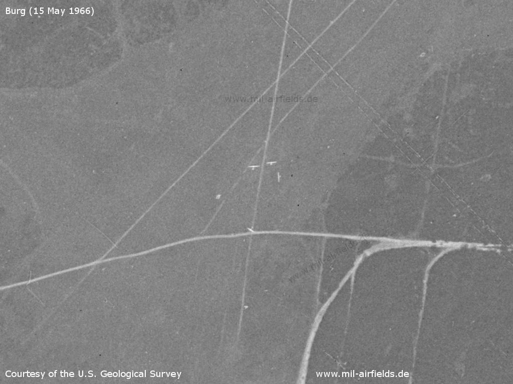
There are some gliders on the field this Sunday.
Source: U.S. Geological Survey
Soviet barracks Burg - The barracks are not directly connected to the airfield.
Source: U.S. Geological Survey
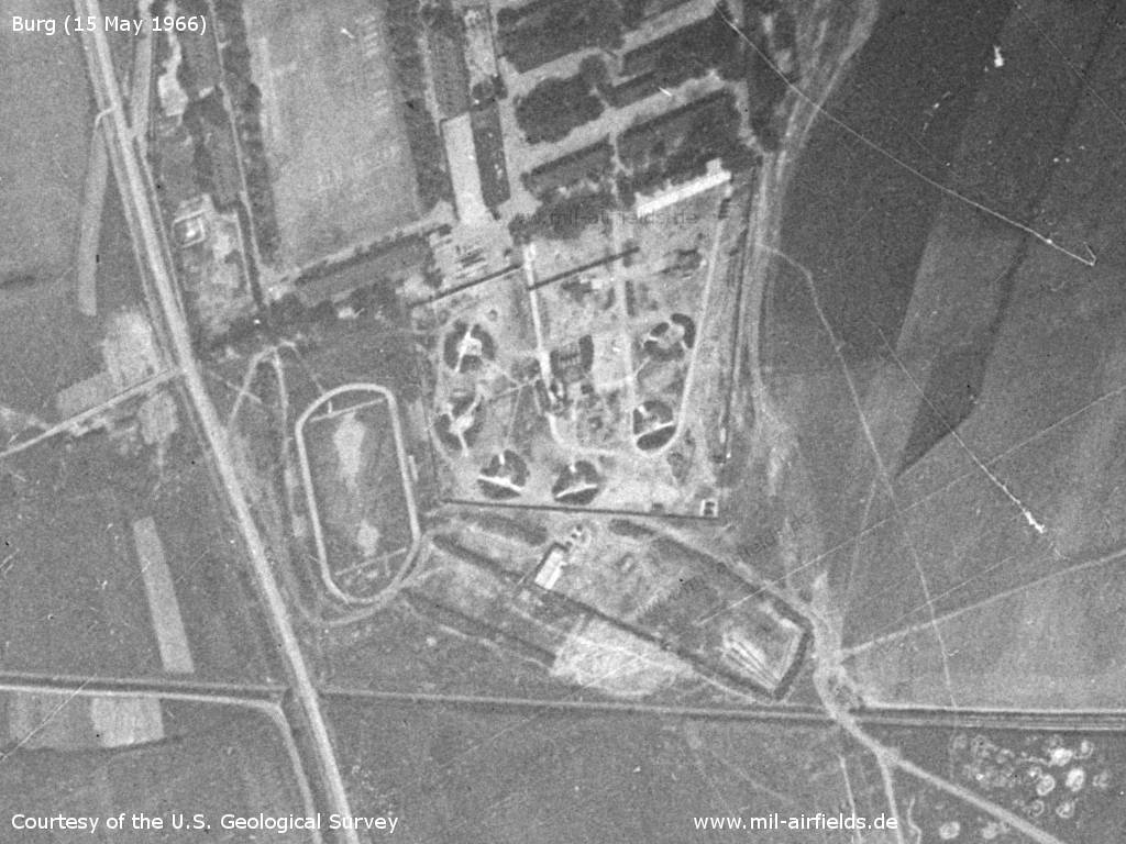
There is a surface-to-air missile (SAM) site in the southern part of the barracks. - It has six circularly arranged launching positions (center of the image).
Source: U.S. Geological Survey
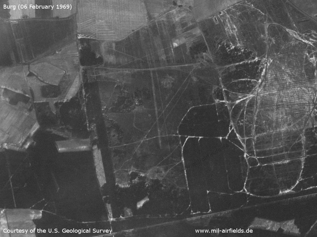
The airfield on Thursday 06 February 1969
Source: U.S. Geological Survey
In the 1970s
Overview
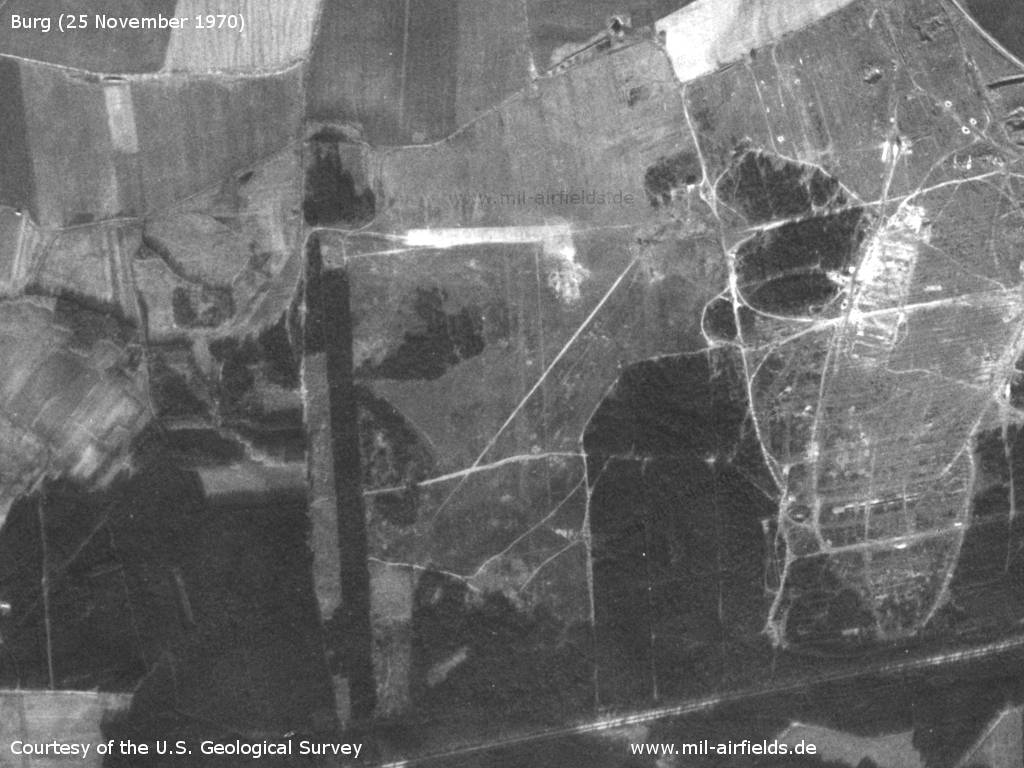
Wednesday, 25 November 1970 - The bright strip in the north indicates earthworks or extensive use of the soil.
Source: U.S. Geological Survey
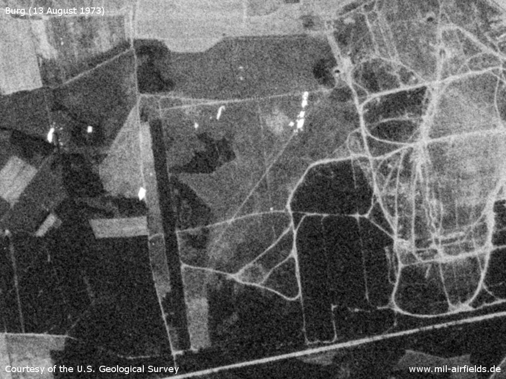
Monday, 13 August 1973
Source: U.S. Geological Survey
1980s
Runways
- 03/21: 1250m Grass
- 10/28: 900m Grass
- 18/36: 1200m Grass
Radio beacons
- Airfield locator BURG-I: 279,5 "ZU", Krähenberge, at TP 77,7
- Airfield locator BURG-II: 920,5 "UZ"
"The radio and navigation aids at the airfield can only be used for parachute training."
Radio communication
The call sign was UNTERPUTZ.
Units
Paratrooper training base 40 (Fallschirmjägerausbildungsbasis 40, FJABas-40, Postbox 77030). It was established 1982-05-01.
Real property
The former National People's Army installation id for the airfield was 07/023.
Today
Use
General aviation.
Related topics
Airfields in the vicinity
- 352°/17km Mahlwinkel: Air Base
- 119°/23km Groß Lübars: Airfield (Altengrabow)
Categories
Military Airfields GermanyMilitary Airfields in former East GermanyAir bases of former National People's ArmyRecommended
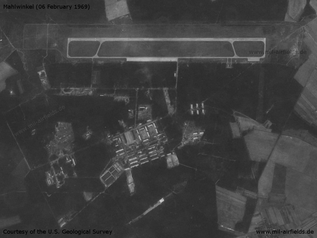
Image credits are shown on the respective target page, click on the preview to open it.
 Follow mil-airfields on Facebook