For historical information only, do not use for navigation or aviation purposes!
| Coordinates | N523704 E0130935 (WGS84) Google Maps |
| Former East Germany (GDR) | District of Potsdam |
| Federal state | Brandenburg |
| Region | Havelland |
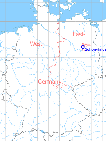
Germany during the Cold War Map
The history of the Cold War airfields: Schönwalde
General
Schönwalde was built in the 1930s as a Luftwaffe air base. After the end of World War II, the field was taken over by the Soviet occupation troops which continued operations, first with airplanes, later with helicopters. Finally, only the barracks were used, until they were abandoned in the early 1990s when the Russians withdrew. The airfield is also closed today.
Until 1945
Use
Luftwaffe air base.
Situation
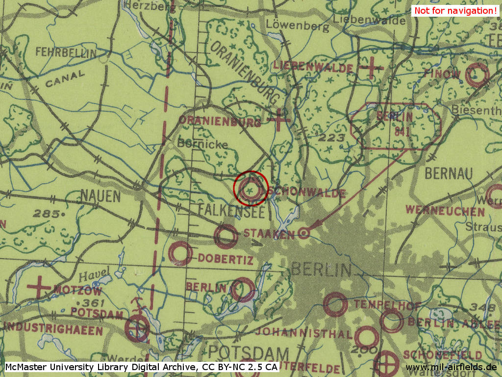
Schönwalde Air Base in World War II on a US map from 194x
Source: McMaster University Library Digital Archive, License: Creative Commons Attribution-NonCommercial 2.5 CC BY-NC 2.5 CA
During the Cold War
Use
Soviet airfield, later the airfield was closed and only the barracks were used.
History
- 01 June 1949
The airfield barracks is occupied by about 1000 men of an armoured unit, mainly equipped with T-34 tanks. There are also supposed to be 800 men of a unit equipped with 85 mm Anti-Aircraft Artillery stationed in the vicinity. On the airfield 6 Dakotas (probably Li-2) were seen. - 26 and 27 August 1949
Withdrawal of the Soviet flying unit from Schönwalde and transfer to Staaken. It is probably a training unit of the 3rd Bomber Corps with Li-2 and Pe-2, which was possibly already stationed in Staaken from 1946 to 1947. With the withdrawal there were no more planes in Schönwalde and the barracks were largely vacated. - 1949
Stationing of a ground attack unit - 14 April 1951
In the Luckau/Dahme area a larger number (16 or even 43) of Soviet aircraft crashes. These are probably aircraft of type Il-10 of the Schönwalde ground attack regiment. - October 1951
Withdrawal of the Soviet ground attack unit to Stendal. - October 1951
Stationing of a target-towing unit with 10 to 12 aircraft Tupolev Tu-2 - May 1953
Withdrawal of the target-towing unit with aircraft Tupolev Tu-2. It is unclear where the aircraft have moved to, possibly they were distributed to different airfields. On the ground, freight trains drove from Bötzow to Welzow, arriving there on 11, 14 and 18 May 1953. - 13 and 15 May 1953
After the withdrawal of the target-towing unit, the aviation fuel is also removed:
3 tank cars with 44 tons from Bötzow to Brandenburg
4 tank cars with 65 tons from Bötzow to Falkenberg
2 tank cars with 28 tons from Bötzow to Stendal - 1953-1954
The barracks are mainly occupied by ground troops: An anti-aircraft unit and a rocket launcher unit. - September 1954
Training aircraft Po-2, which were probably stationed in Oranienburg before, are transferred to Schönwalde.
Sources: CIA
In the 1950s
Situation
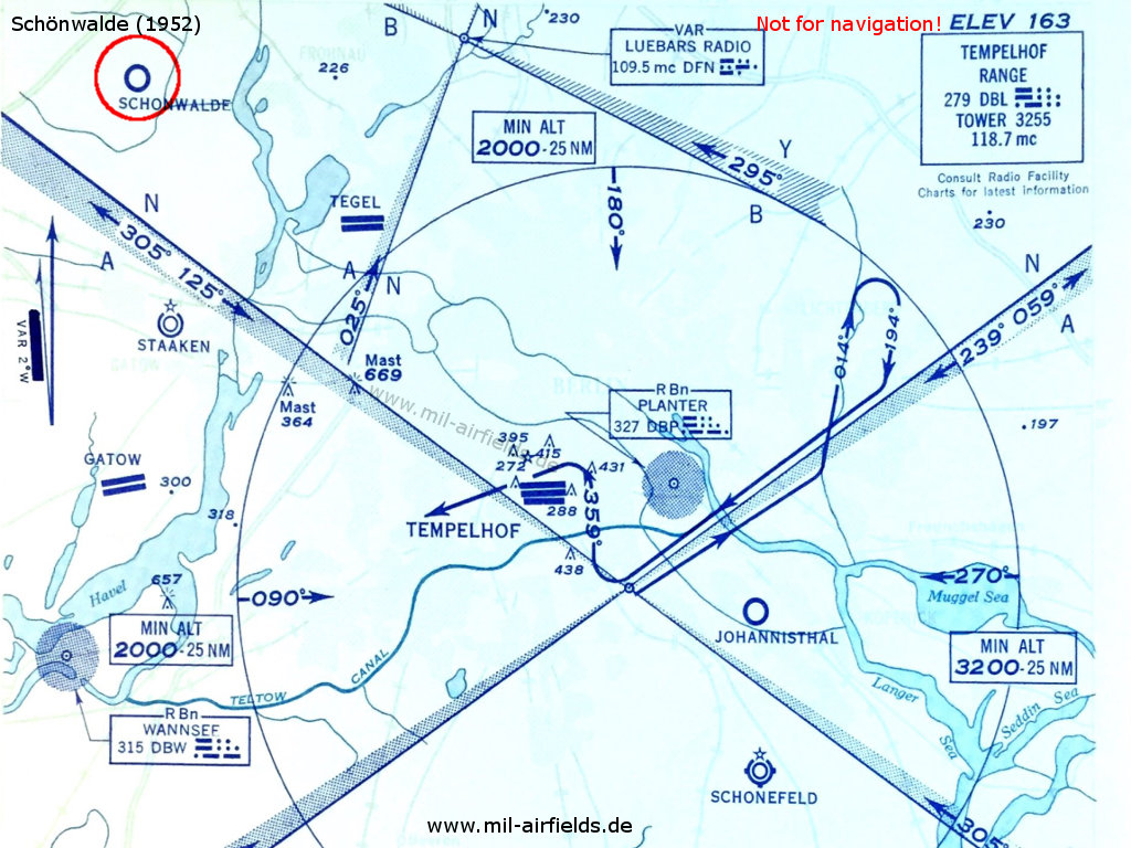
Schönwalde airfield on a USAF map from 1952
Overview
Schönwalde Airfield on a US map from 1952 - From the north-east a railway siding leads to the airfield, which which branches off the Berlin-Spandau - Bötzow railway line and ends on the west side of the barracks.
Source: AMS M841 GSGS 4414, Courtesy Harold B. Lee Library, Brigham Young University
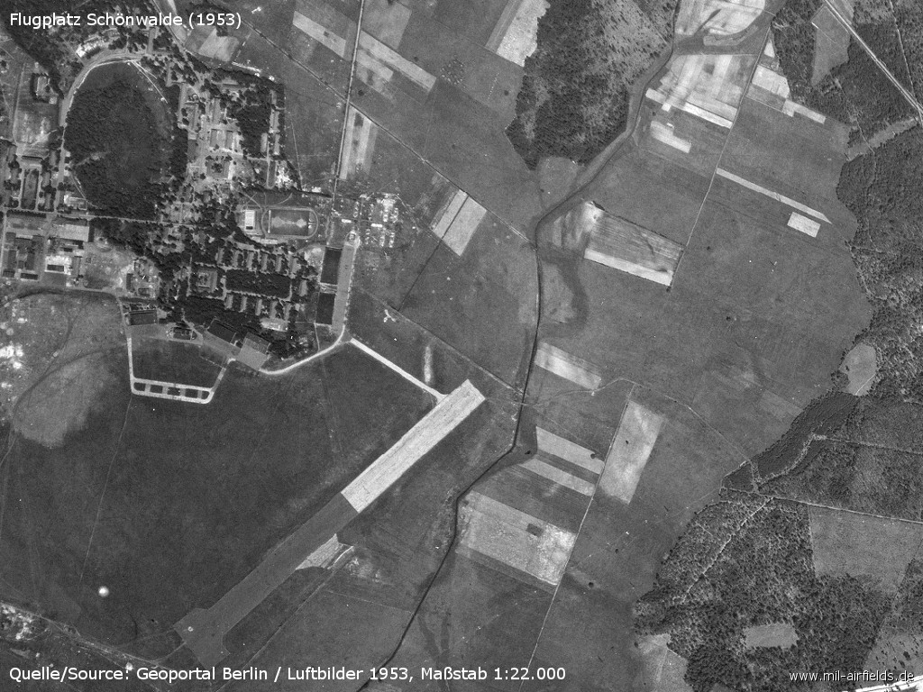
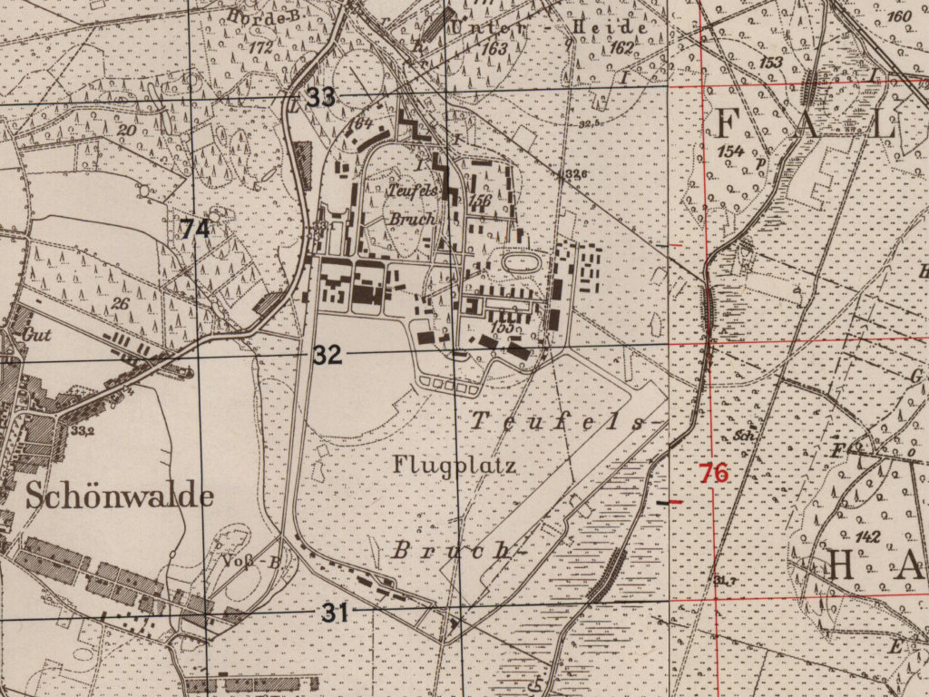
Aerial picture from 1953 with barracks and airfield
Source: Geoportal Berlin / Luftbilder 1953, Maßstab 1:22 000
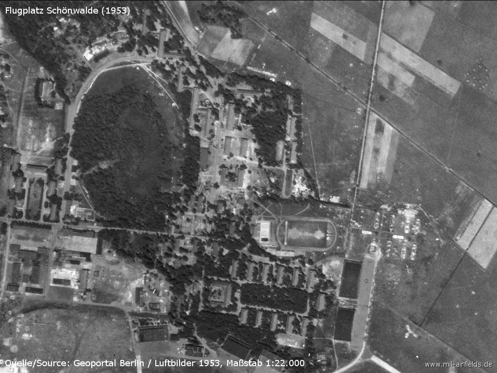
Soviet barracks
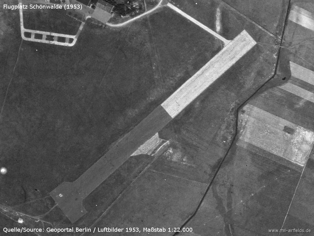
Airfield with the 1100m-long runway
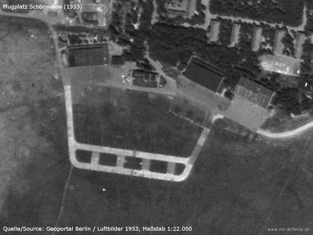
Enlargement: Parking areas
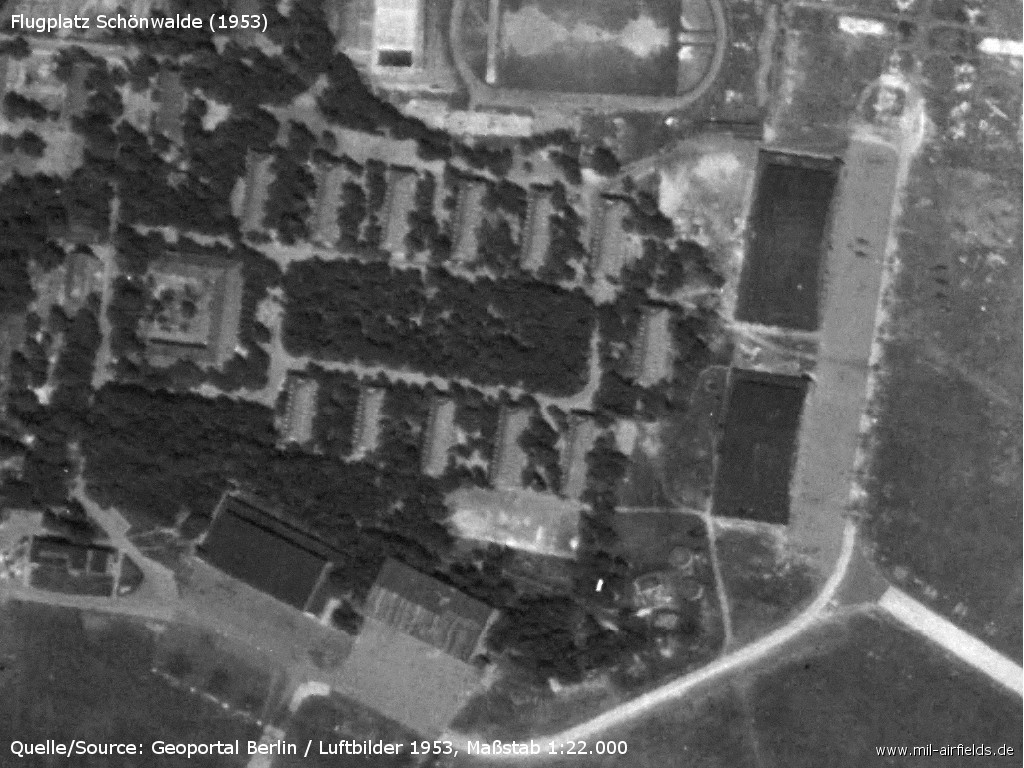
Enlargement: Barracks and hangars - There seem to be planes at the eastern edge of the paved area in front of the two hangars.
Runways
- 04/22: 1100 m Concrete
In the 1960s
Situation
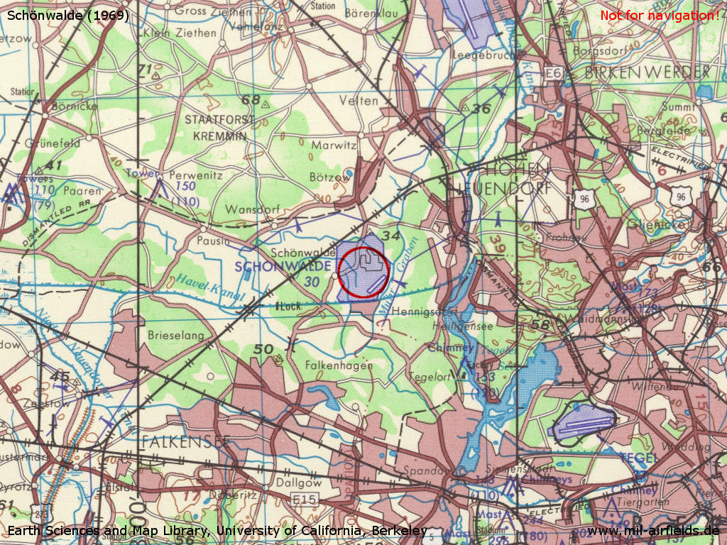
Schönwalde Airfield on a US map from 1969
Source: Earth Sciences and Map Library, University of California, Berkeley
Overview
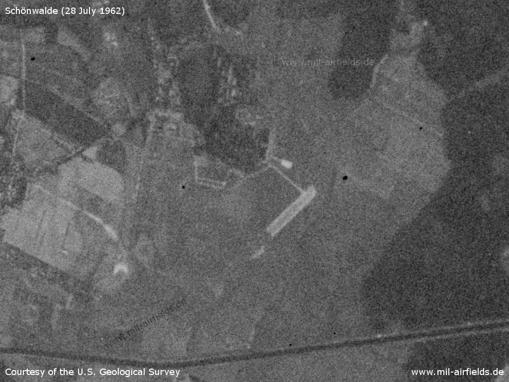
Schönwalde Airfield on a US satellite image from 28 July 1962
Source: U.S. Geological Survey
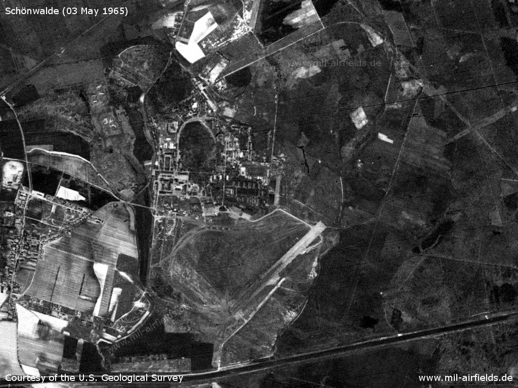
Schönwalde airfield and barracks on a US satellite image from 03 May 1965
Source: U.S. Geological Survey
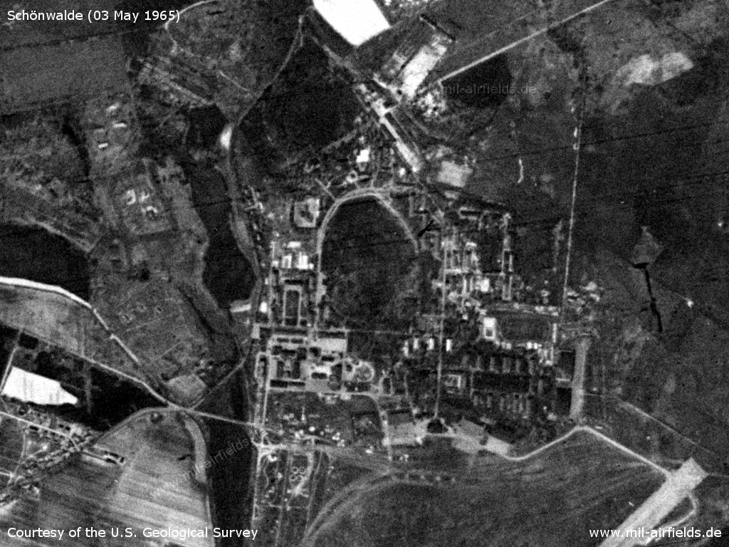
Barracks
Source: U.S. Geological Survey
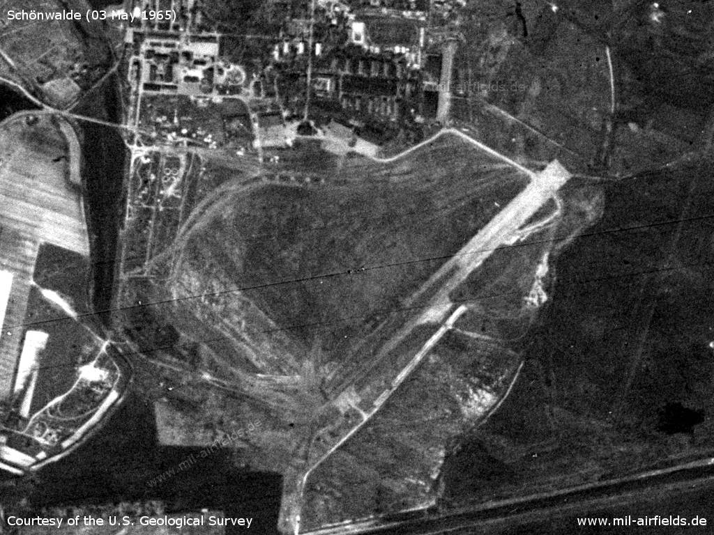
Airfield with runway and hangars
Source: U.S. Geological Survey
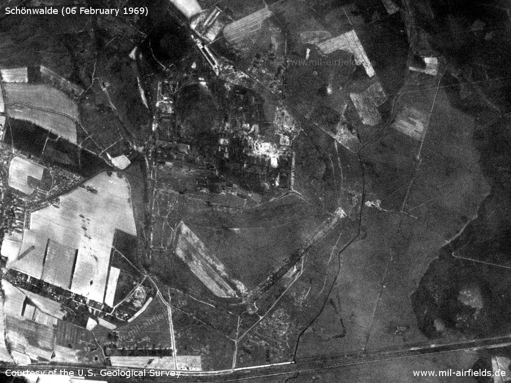
Satellite image from 06 February 1969 - The partially existing patches are probably residual snow.
Source: U.S. Geological Survey
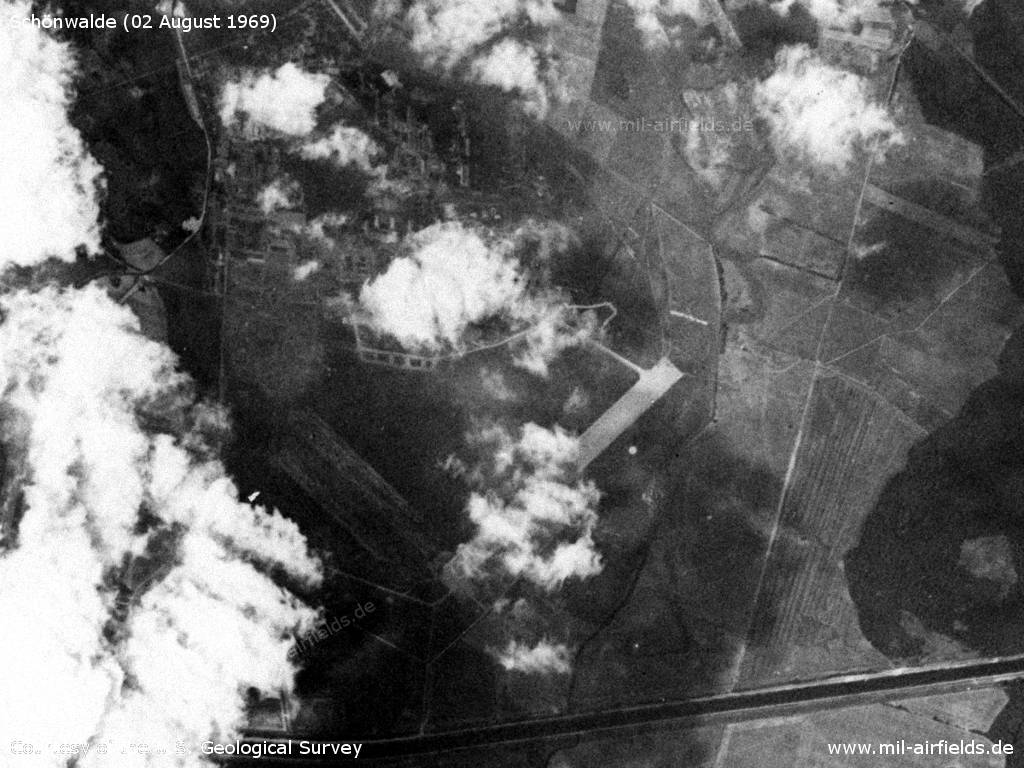
Satellite image from 02 August 1969 - The installations are partly covered by clouds.
Source: U.S. Geological Survey
In the 1970s
Overview
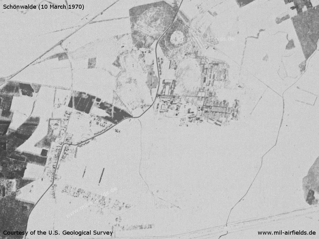
On 10.03.1970 the landscape is covered with snow
Source: U.S. Geological Survey
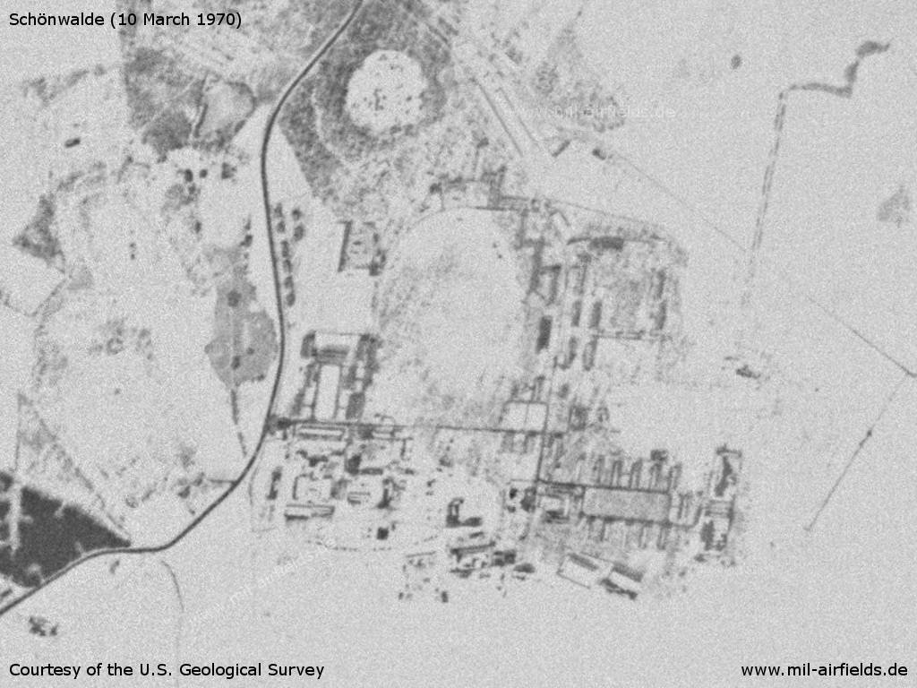
Enlargement: Barracks
Source: U.S. Geological Survey
In the 1980s and early 1990s
Overview
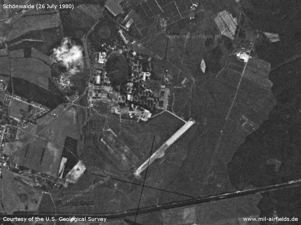
Barracks and airfield on 26 July 1980 - The old runway is still clearly visible.
Source: U.S. Geological Survey
Today
Use
Closed.
Links
- http://www.vimudeap.de/212.html - vimudeap
Airfields in the vicinity
Categories
Military Airfields GermanyMilitary Airfields in former East GermanyAirfields of the Soviet Forces in GermanyRecommended
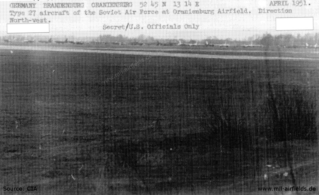
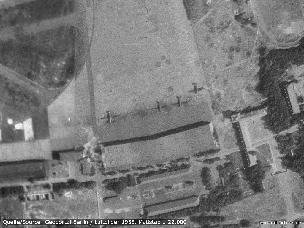
Image credits are shown on the respective target page, click on the preview to open it.
 Follow mil-airfields on Facebook