For historical information only, do not use for navigation or aviation purposes!
| Coordinates | N510053 E0113719 (WGS84) Google Maps |
| Former East Germany (GDR) | District of Erfurt |
| Federal state | Thüringen (Thuringia) |
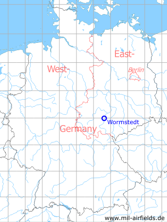
Germany during the Cold War Map
The history of the Cold War airfields: Wormstedt
Location of airfield
The airfield was located about 14 km southeast of Apolda, 2 km southeast of Wormstedt and about 500 m northwest of Zimmern.
During the Cold War
Use
Reserve airfield.
Runways
- 05/23: 3000 m Grass
In the 1970s
Overview
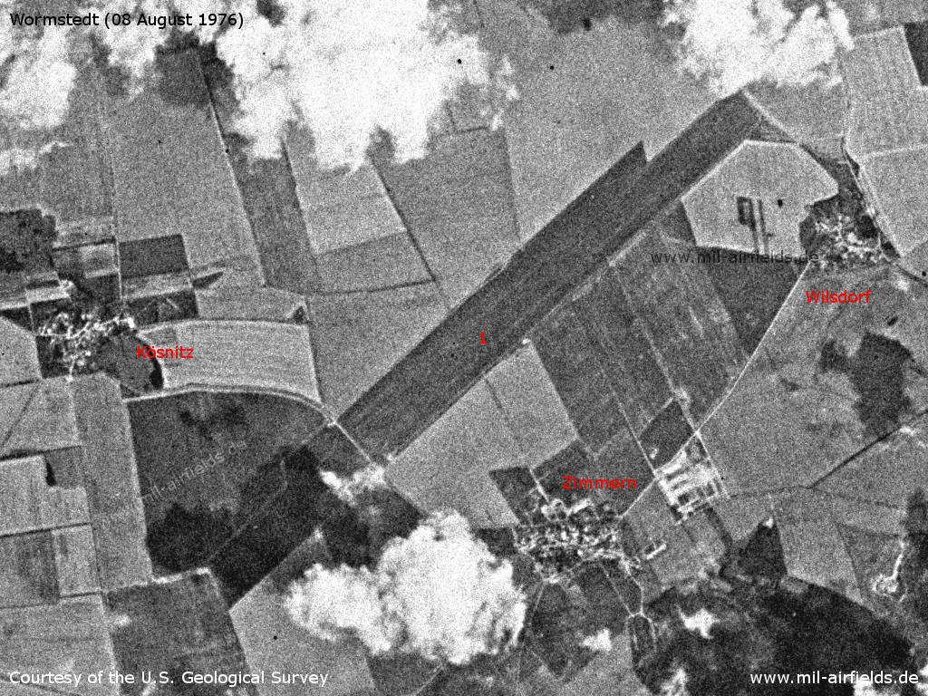
Wormstedt Airfield on a US satellite image from 08 August 1976 - 1: Runway
Source: U.S. Geological Survey
In the 1980s and early 1990s
Overview
Aerial image from 19 April 1982
Source: GDI-Th, Freistaat Thüringen, TLVermGeo, www.geoportal-th.de
Datenlizenz Deutschland – Namensnennung – Version 2.0, www.govdata.de/dl-de/by-2-0
Datenlizenz Deutschland – Namensnennung – Version 2.0, www.govdata.de/dl-de/by-2-0
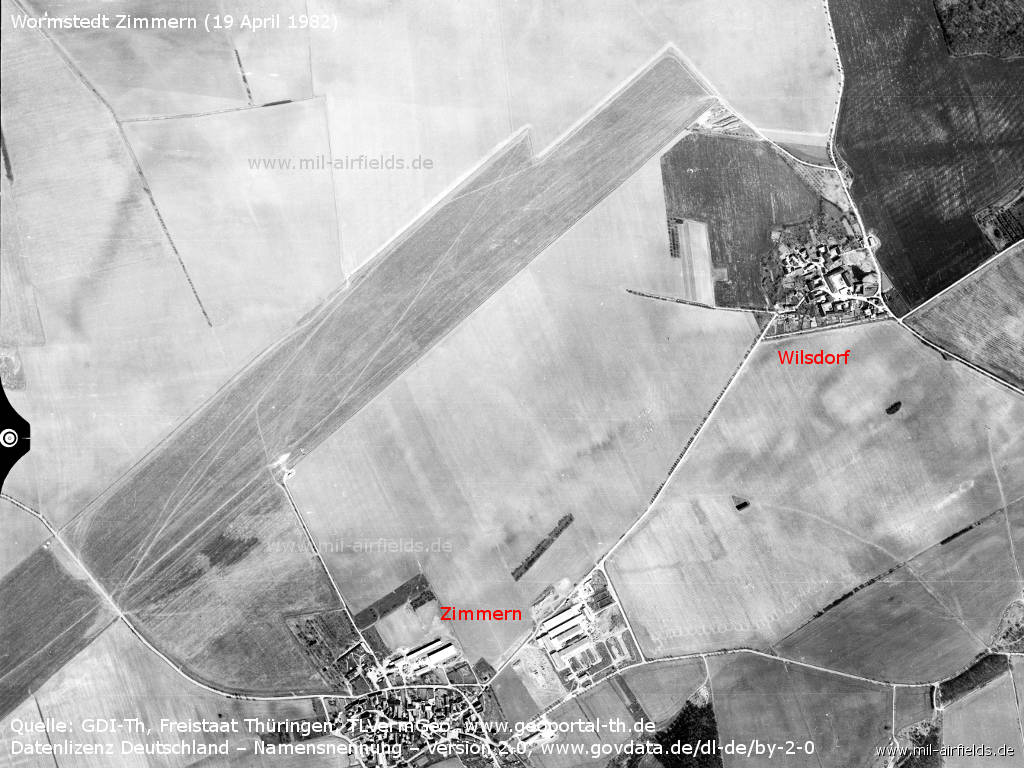
The airfield northwest of Zimmern and Wilsdorf
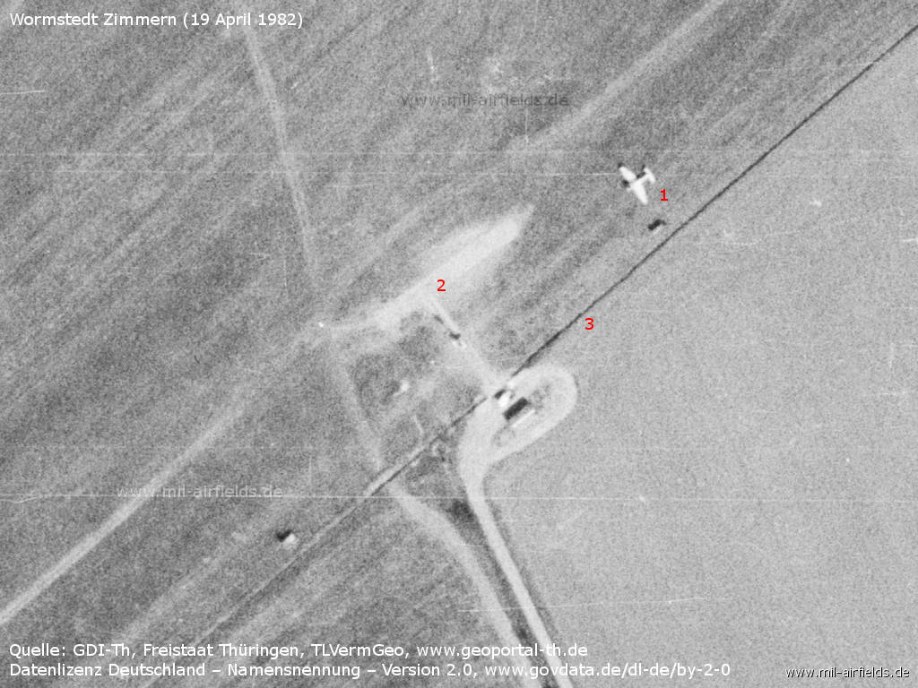
On this Monday the airfield is used by an agricultural aircraft. - 1: Airplane Let Z-37 Čmelák; 2: Loading and take-off platform; 3: Apparently the area is fenced in.
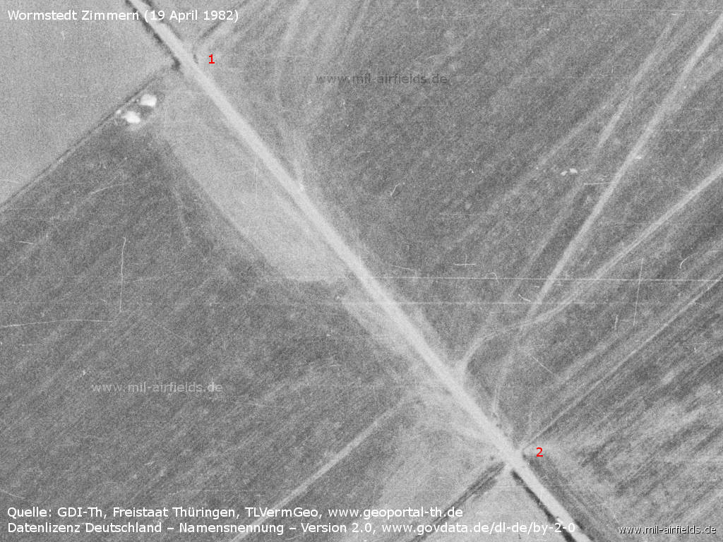
The road from Kösnitz to Zimmern crosses the runway. - The fence leads up to the road, both north (1) and south (2). Probably the road can be closed during flight operations.
Aerial image 1987
Source: GDI-Th, Freistaat Thüringen, TLVermGeo, www.geoportal-th.de
Datenlizenz Deutschland – Namensnennung – Version 2.0, www.govdata.de/dl-de/by-2-0
Datenlizenz Deutschland – Namensnennung – Version 2.0, www.govdata.de/dl-de/by-2-0
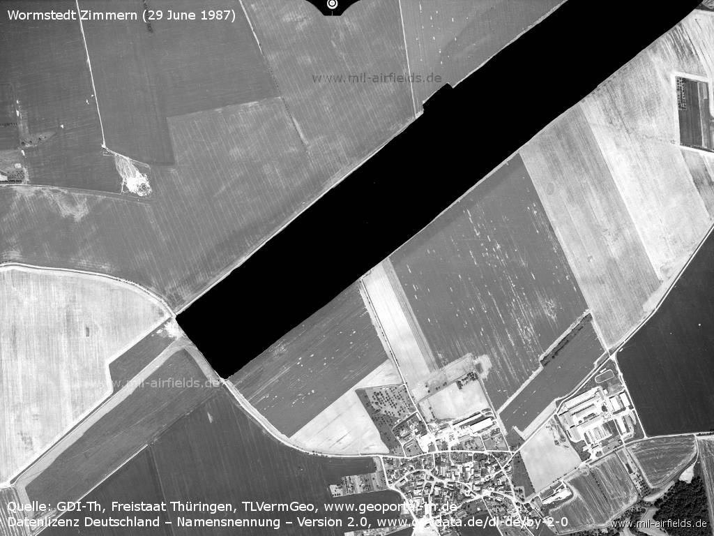
Aerial image from Monday 29 June 1987 - Although the aerial photograph was not intended for publication, but only used by East German authorities, military objects were nevertheless blackened. This time it was also considered necessary for the Wormstedt airfield.
Today
Use
Closed.
Overview
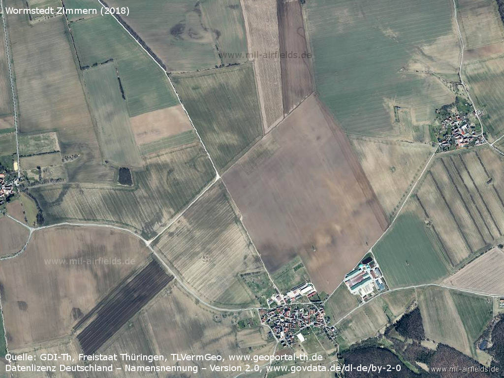
Aerial picture 07 April 2018 - The structure of the former runway has largely disappeared.
Source: GDI-Th, Freistaat Thüringen, TLVermGeo, www.geoportal-th.de
Datenlizenz Deutschland – Namensnennung – Version 2.0, www.govdata.de/dl-de/by-2-0
Sources
- https://www.usgs.gov/ - USGS: U.S. Geological Survey
- https://www.geoportal-th.de/ - Geoportal Thüringen
Airfields in the vicinity
- 186°/18km Rothenstein: Helipad
- 186°/20km Schöps: Agricultural Helipad
- 277°/20km Großobringen: Helipad 3012 (HSLP / HLP 3012)
- 221°/26km Blankenhain: Airfield (Kottenhain)
- 261°/26km Nohra: Airfield (Weimar-Nohra)
- 097°/31km Lonzig: Airfield (Zeitz Airfield)
- 289°/32km Sprötau: Helipad 3140 (HSLP / HLP 3140)
Categories
Military Airfields GermanyAgricultural Airfields in former East GermanyMilitary Airfields in former East GermanyRecommended
Image credits are shown on the respective target page, click on the preview to open it.
