For historical information only, do not use for navigation or aviation purposes!
| Coordinates | N530813 E0131901 (WGS84) Google Maps |
| Former East Germany (GDR) | District of Neubrandenburg |
| Federal state | Brandenburg |
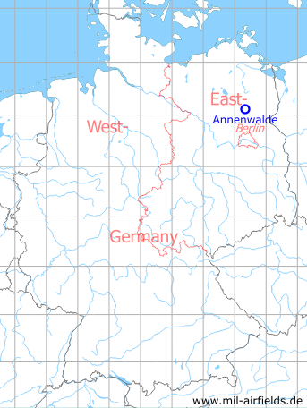
Germany during the Cold War Map
The history of the Cold War airfields: Annenwalde
General
Annenwalde is a village about 11 km west of Templin, in the north of today's federal state Brandenburg. During the Cold War, the area belonged to East Germany and about 4 km west of Annenwalde was a reserve airfield on the training ground of the Soviet armed forces. Over time, NATO has given the airstrip several names: Annenwalde, Templin 2 and Bredereiche. The field had a approx. 3 km long runway with grass surface in approximate northwest-southeast orientation. There were no other facilities. A concrete aeronautical use is unknown to me. Today, the airfield is closed.
Location of airfield
The airfield was located ca. 13 km west of Templin and ca. 13 km south-southeast of Fürstenberg.
During the Cold War
Use
Reserve airfield with soft runway on a Soviet training ground.
In the 1960s
Situation
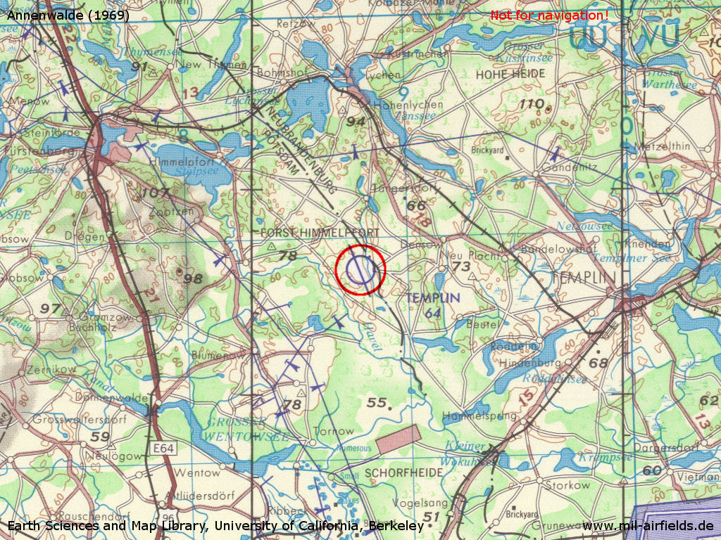
Annenwalde Airfield on a US map from 1969 - (Source: Earth Sciences and Map Library, University of California, Berkeley)
Source: Earth Sciences and Map Library, University of California, Berkeley
Overview
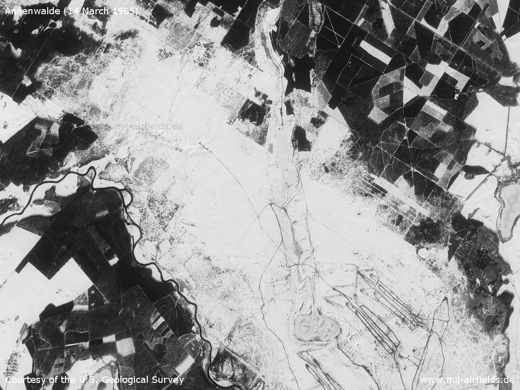
On this still wintery satellite picture of the military training area from 14.03.1965 nothing can be seen of the airfield.
Source: U.S. Geological Survey
Runways
- 16/34: 3000 m Gras
In the 1980s and early 1990s
Overview
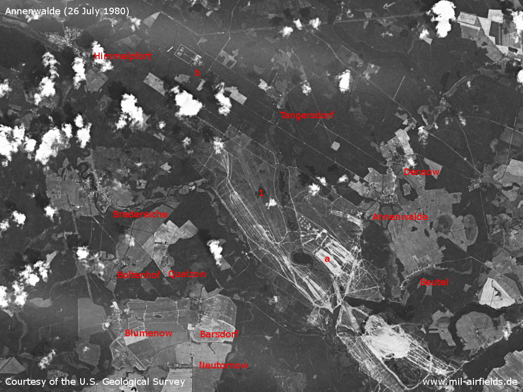
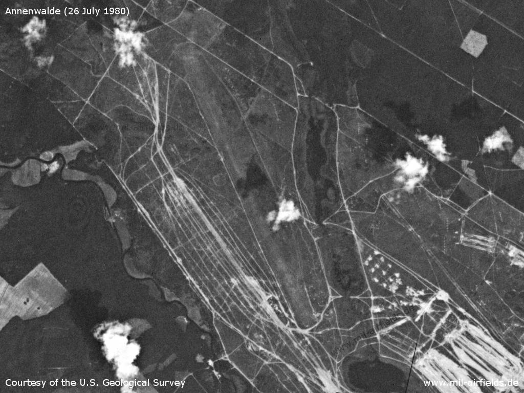
Annenwalde airfield on a US satellite image from 26 July 1980 - 1: airfield; a: Tangersdorfer Heide military training area; b: Himmelpfort special weapons storage; Places: Barsdorf, Beutel, Blumenow, Boltenhof, Bredereiche, Densow, Neutornow, Qualzow, Tangersdorf.
Source: U.S. Geological Survey
Annenwalde airfield
Source: U.S. Geological Survey
Today
Use
Closed.
Bibliography
- Freundt, Lutz: "Sowjetische Fliegerkräfte in Deutschland 1945-1994, Band 3" Edition Freundt Eigenverlag, Diepholz 1999 - Short description.
Airfields in the vicinity
- 128°/19km Templin: Air Base (Schorfheide, Groß Dölln)
- 242°/19km Wolfsruh: Helipad 1034 (HSLP / HLP 1034)
- 198°/20km Badingen: Helipad 3109 (HSLP / HLP 3109)
- 224°/21km Schönermark: Helipad 3117 (HSLP / HLP 3117)
- 044°/24km Buchenhain: Agricultural Airfield
- 046°/28km Weggun: Helipad 3338 (HSLP / HLP 3338)
- 021°/30km Wendorf: Helipad 3027 (HSLP / HLP 3027)
Categories
Military Airfields GermanyMilitary Airfields in former East GermanyAirfields of the Soviet Forces in GermanyRecommended

Image credits are shown on the respective target page, click on the preview to open it.