For historical information only, do not use for navigation or aviation purposes!
| Coordinates | N513950 E0143802 (WGS84) Google Maps |
| Former East Germany (GDR) | District of Cottbus |
| Federal state | Brandenburg |
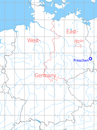
Germany during the Cold War Map
The history of the Cold War airfields: Preschen
General
Highlights:
- On the border with Poland
- Direct connection to the nearby highway strip
- Used for introduction of new aircraft types (MiG-19, MiG-29)
During the Cold War
Use
Former East German Airforce (NVA LSK/LV) air base.
In the 1960s
Overview
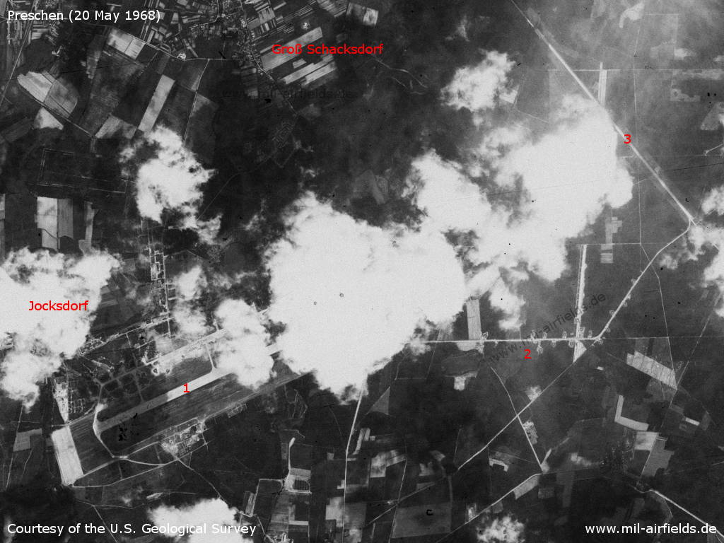
Preschen Air Base and Forst Highway Strip on a US satellite image from 20 May 1968 - 1: Airfield (partially in clouds); 2: taxiway to the highways strip; 3: Forst Highway Strip. Places: Jocksdorf, Groß Schacksdorf
Source: U.S. Geological Survey
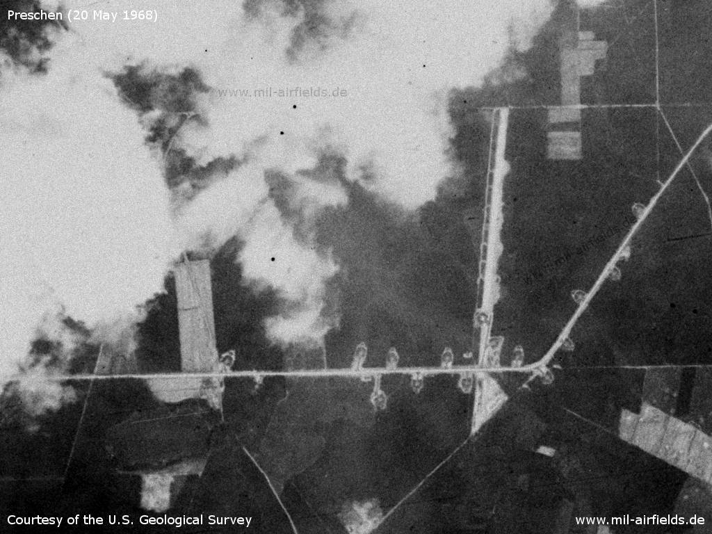
The open aircraft revetments along the taxiway seem to have been built only recently. - The wide aisle leading north is also interesting.
Source: U.S. Geological Survey
In the 1970s
Situation
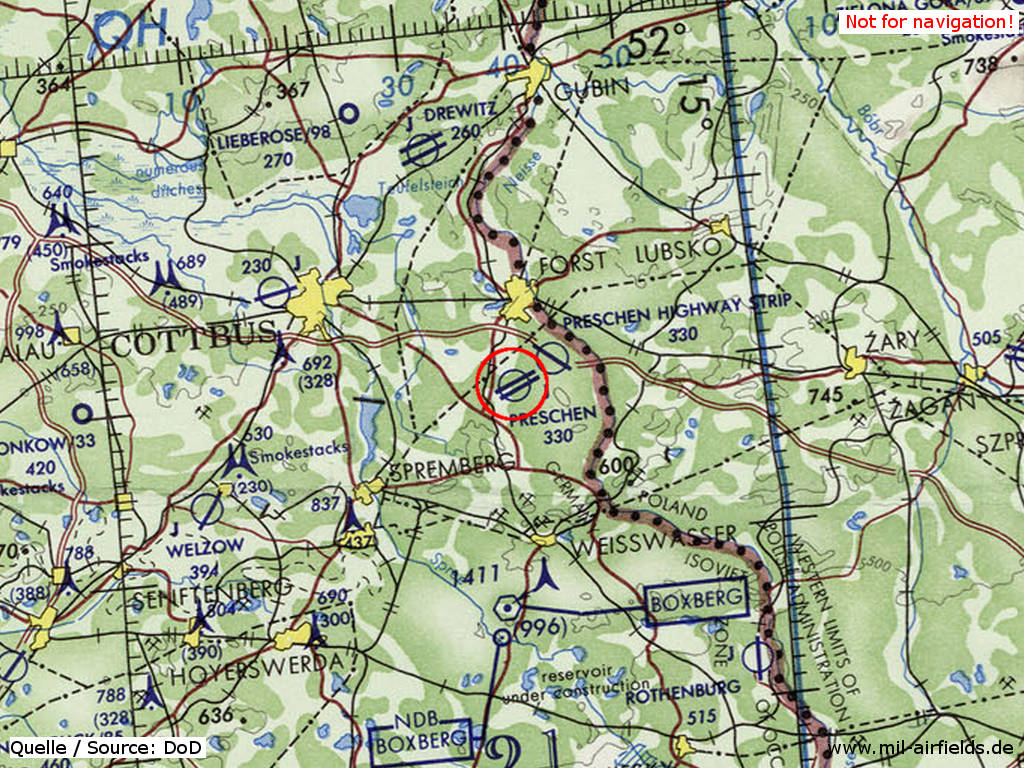
Preschen Air Base on a map of the US Department of Defense from 1972 - Well recognizable is the location close to the border to Poland (
Source: ONC E-2 (1972), Perry-Castañeda Library Map Collection, University of Texas at Austin
Overview
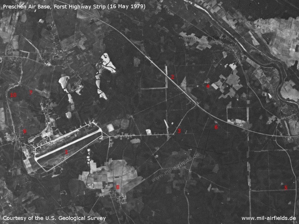
Preschen on 16 May 1979 - 1: Preschen Air Base; 2: Forst Highway Strip; 3: Taxiway between the air base and the highway strip; 4: Approach lane and outer marker Preschen; 5: Outer marker highway strip; 6: Middle Marker highway strip; 7: railway siding; 8: Preschen village; 9: Jocksdorf village; 10: Connecting road under construction, possibly because of a bypass of the storage area in the north. In the upper right corner you can see the Neisse river, which forms the border to Poland.
Source: U.S. Geological Survey
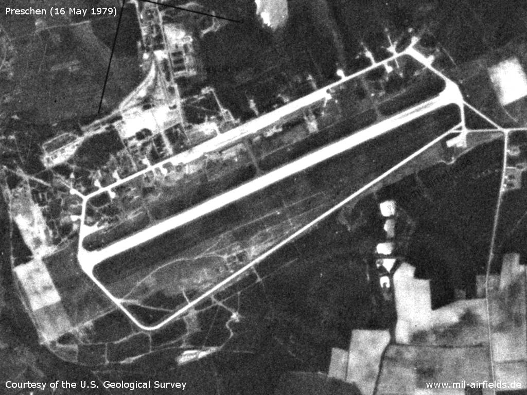
Airfield - The field has numerous aircraft shelters.
Source: U.S. Geological Survey
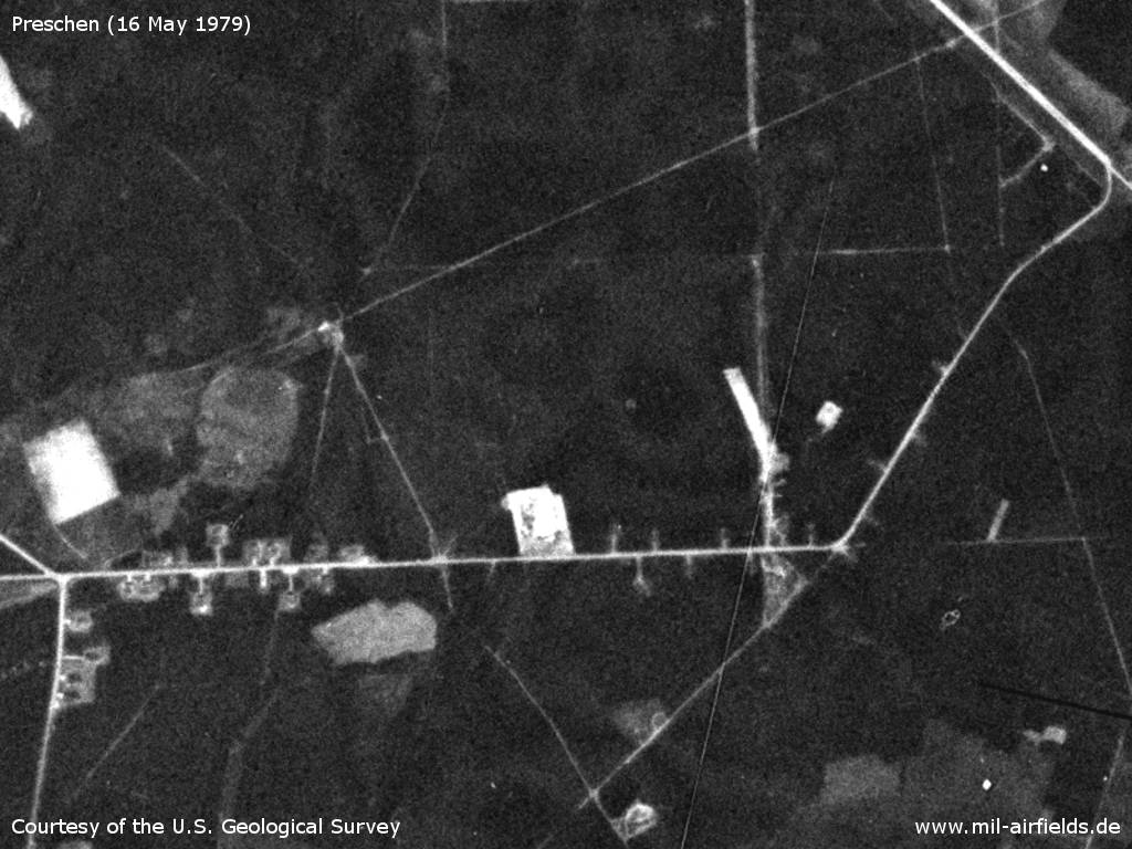
Taxiway
Source: U.S. Geological Survey
Radio beacons
- LOM 25: 294 "KL"
- LMM 25: 607 "K"
In the 1980s and early 1990s
Overview
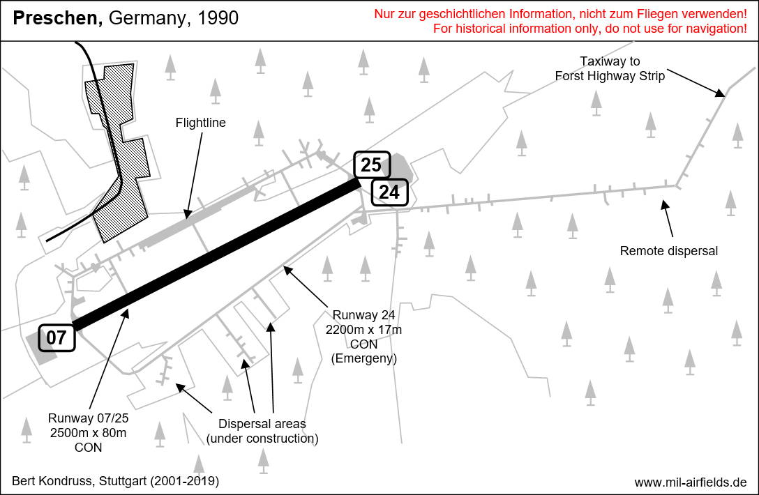
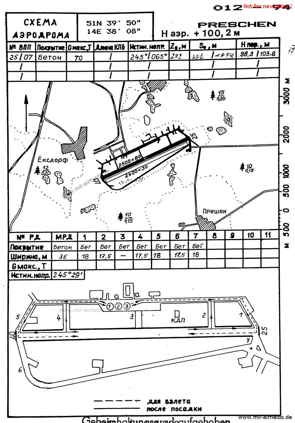
Runways
- 07/25: 2500 m x 80 m Concrete
- 07/25: 2400 m x 50 m Grass
- 24 southern taxiway
Radio beacons
- LOM 25: 466 "KL", 4000 m to threshold 25
- LMM 25: 947 "K", 1100 m to threshold 25
- LOM 07: 466 "LK", 4320 m to threshold 07
- LMM 07: 947 "L", 960 m to threshold 07
Maps
Maps from the former East German military airfield manual "Verzeichnis 012" (formerly "secret").
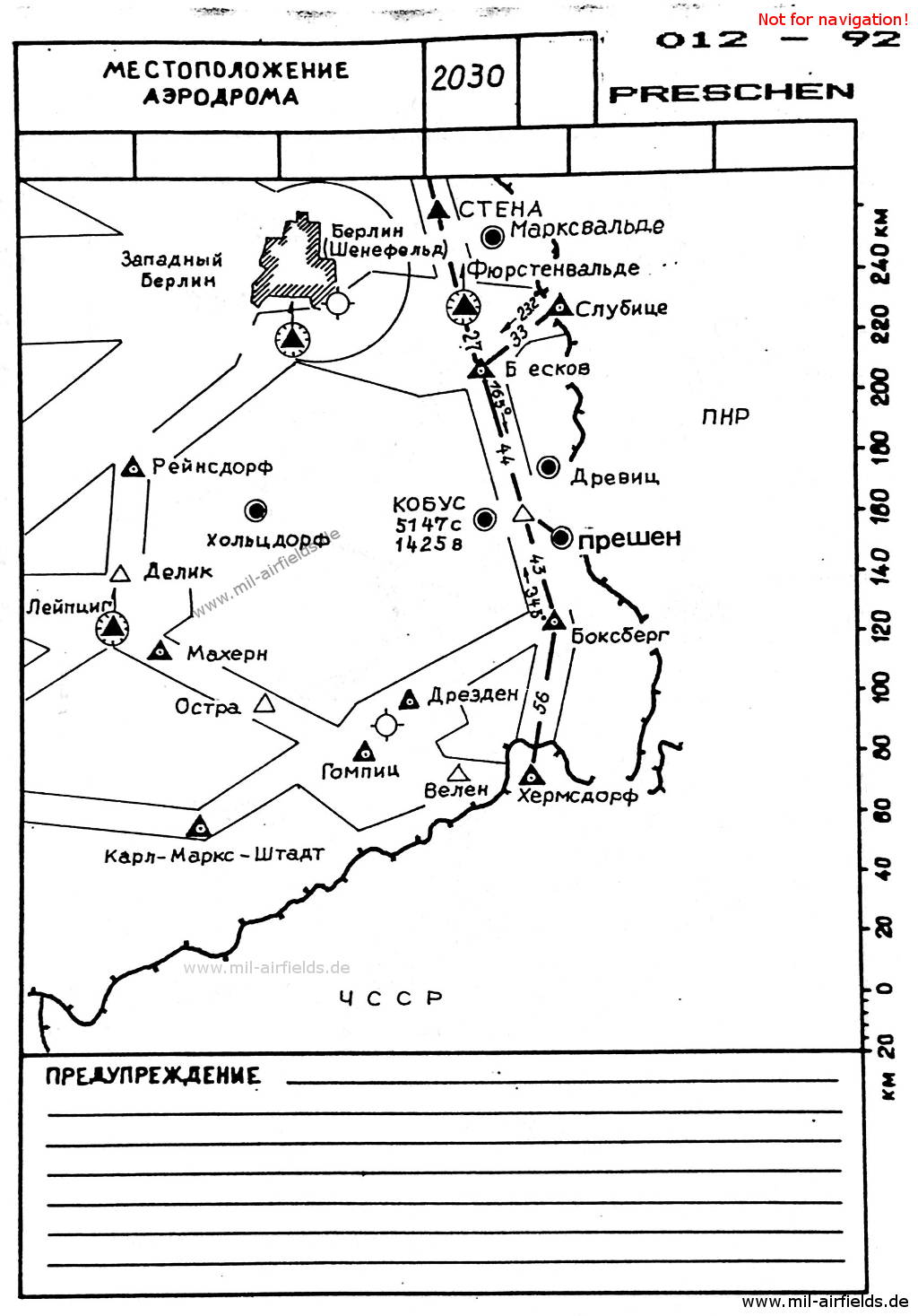
Location of Preschen Airfield - Shown is the airspace in the southern part of East Germany ("GDR") with the allied air corridors as well as the East German airways and radio beacons. Typical for the misleading East German style is that only the western part of Berlin is particularly characterized.
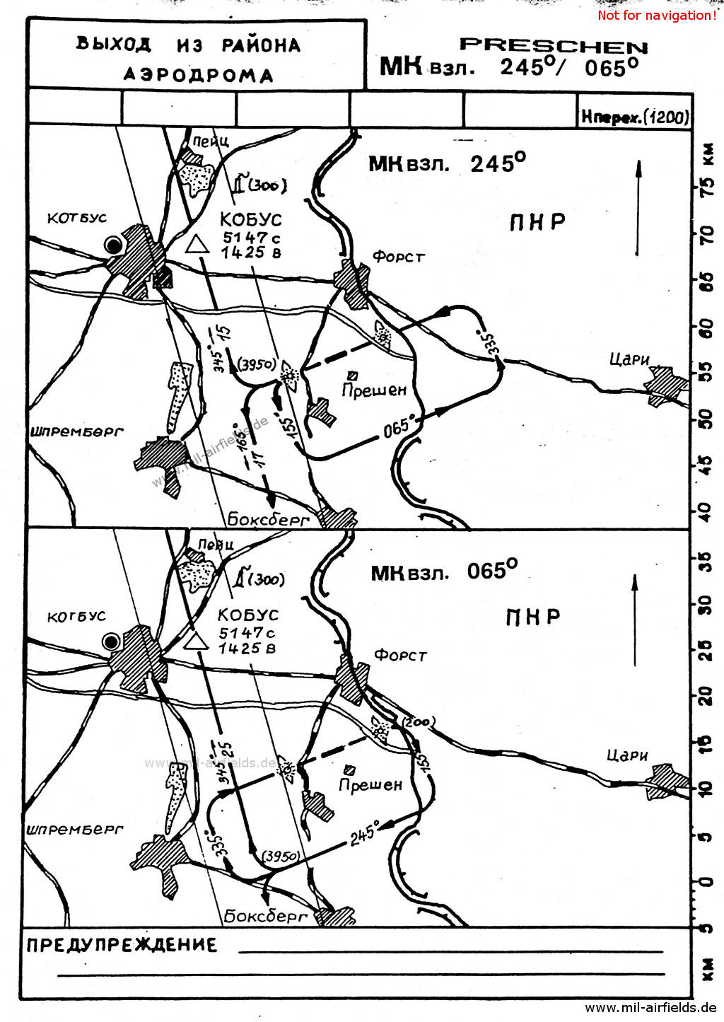
Departure routes
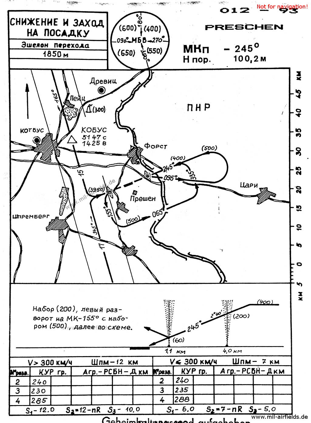
Approach routes in main landing direction
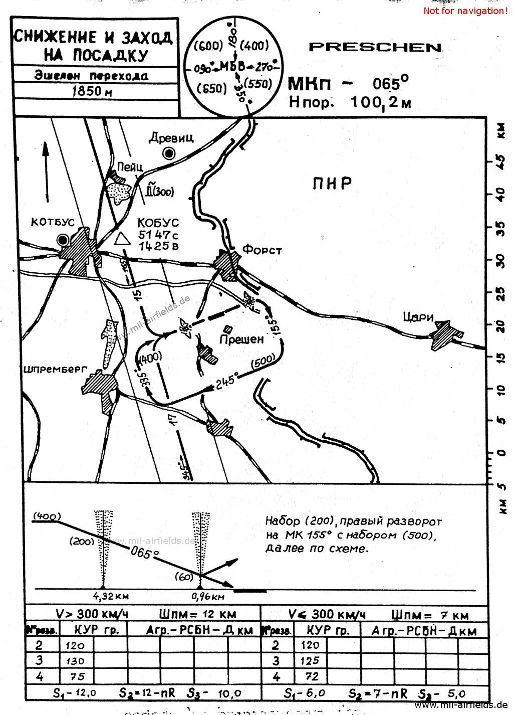
Approach routes in secondary landing direction
Preschen Air Base
Today
Use
Closed.
Airfields in the vicinity
Categories
Military Airfields GermanyMilitary Airfields in former East GermanyAir bases of former National People's ArmyRecommended
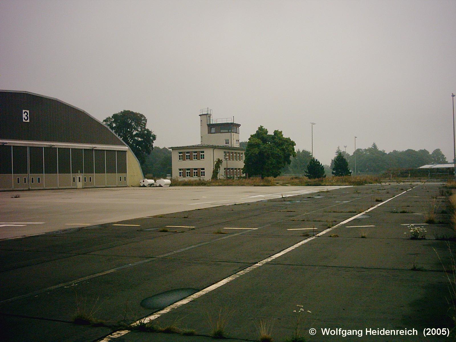
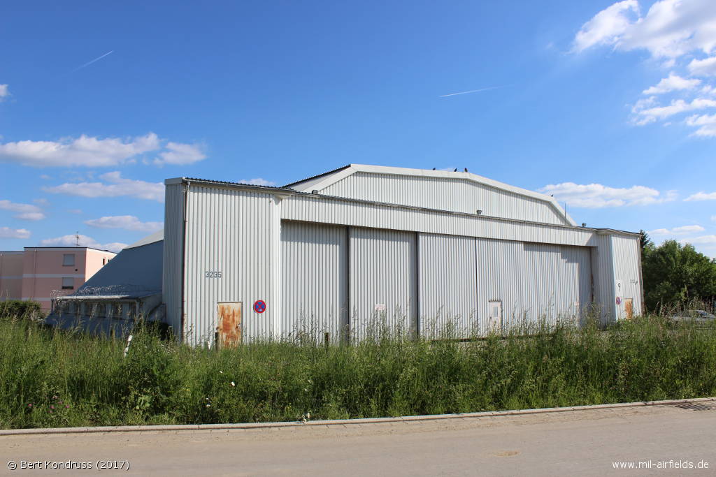
Image credits are shown on the respective target page, click on the preview to open it.
 Follow mil-airfields on Facebook