For historical information only, do not use for navigation or aviation purposes!
| Coordinates | N542350 E0183614 (WGS84) Google Maps |
| Elevation | 49 ft |
| Location indicator | EPGD |
The history of the Cold War airfields: Gdańsk
During the 1920s/1930s
Information from the International Aeronautical Handbook 1931
For historical information only, do not use for navigation or aviation purposes!
Use
Danzig-Langfuhr Airport.
Operator
Owner: The Free Town of Danzig, telephone Danzig 41-441 and 45
Overview
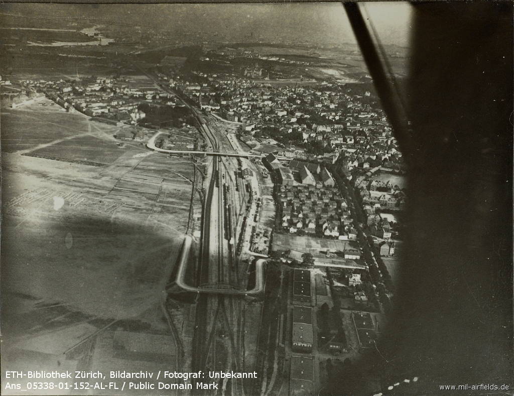
Aerial view, probably 1920s
Source: ETH-Bibliothek Zürich, Bildarchiv / Fotograf: Unbekannt / Ans_05338-01-152-AL-FL / Public Domain Mark
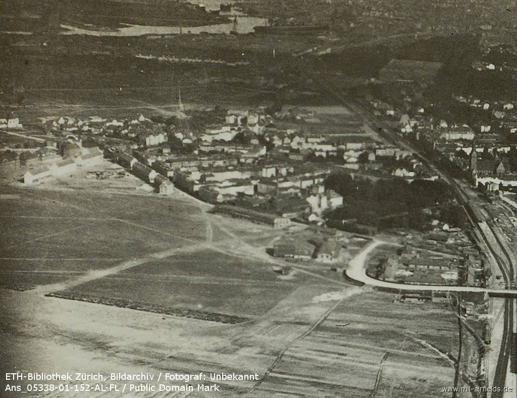
Enlargement: Building on the south-east edge
Source: ETH-Bibliothek Zürich, Bildarchiv / Fotograf: Unbekannt / Ans_05338-01-152-AL-FL / Public Domain Mark
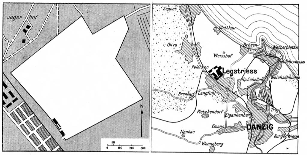
The airport on a map from 1931
Source: Internationales Flughandbuch (1931)
Airfield characteristics at daytime
4 wireless masts at Glettkau, smoke wind indicator, wind sleeve.
Airfield characteristics at night
Neufahrwasser and Hela beacons.
Glettkau and Goldkrug flashing lights.
Indicators outlining the landing area.
Illuminated chain of lights, set parallel to the direction of the wind.
Glettkau and Goldkrug flashing lights.
Indicators outlining the landing area.
Illuminated chain of lights, set parallel to the direction of the wind.
Runways, taxiways, aprons
Landing area: 600 m x 1000 m
Radio communication
Call sign: YMB
Weather station
Weather report office, telephone Danzig 41-113
Obstacles
east: Firing range buildings, height 5 m,
east: telephone wires,
south: houses,
southwest: buildings and viaduct
east: telephone wires,
south: houses,
southwest: buildings and viaduct
Installations
Hangar, repair workshop.
Refuelling: Petrol.
Refuelling: Petrol.
Customs, post office, passport
Wireless services: Wireless telegraphy, telephone Danzig 41-441
Connections
Principal stations Danzig and Zoppot. Trams Danzig - Oliva. Motor buses Danzig - Zoppot.
Timetable
Spring/Summer 1939
The timetable for spring/summer of 1939 shows the following scheduled flights:
(Days: 1=Monday ... 7=Sunday)
(Days: 1=Monday ... 7=Sunday)
2: Danzig (Langfuhr) - Stettin (Altdamm) - Hamburg (Fuhlsbüttel)
- Deutsche Lufthansa, Junkers Ju 160:
123456– | Danzig 07:55 - 09:20 Stettin 09:30 - 11:00 Hamburg
(15 June - 31 August 1939) - Deutsche Lufthansa, Junkers Ju 160:
123456– | Hamburg 11:20 - 12:40 Stettin 12:50 - 14:05 Danzig
(15 June - 31 August 1939)
3: Berlin (Tempelhof) - Danzig (Langfuhr) - Königsberg (Devau)
- Deutsche Lufthansa, Junkers Ju 52:
123456– | Berlin 12:00 - 14:00 Danzig 14:15 - 15:00 Königsberg - Deutsche Lufthansa, Junkers Ju 52:
––––––7 | Berlin 09:10 - 11:10 Danzig 11:25 - 12:10 Königsberg - Deutsche Lufthansa, Junkers Ju 52:
1234567 | Königsberg 16:00 - 16:45 Danzig 17:00 - 19:10 Berlin
4: Berlin (Tempelhof) - Danzig (Langfuhr) - Königsberg (Devau)
- Deutsche Lufthansa, Junkers Ju 52:
123456– | Berlin 19:20 - 21:20 Danzig 21:35 - 22:20 Königsberg - Deutsche Lufthansa, Junkers Ju 52:
123456– | Königsberg 07:00 - 07:45 Danzig 07:55 - 10:05 Berlin
14: Berlin (Tempelhof) - Danzig (Langfuhr)
- Deutsche Lufthansa, Junkers Ju 160:
123456– | Berlin 07:30 - 09:20 Danzig - Deutsche Lufthansa, Junkers Ju 160:
123456– | Danzig 12:20 - 14:20 Berlin
PF177: Berlin (Tempelhof) - Danzig (Langfuhr) - Königsberg (Devau)
- Deutsche Lufthansa, Junkers Ju 52:
1234567 | Berlin 23:25 - 01:20 Danzig 01:35 - 02:20 Königsberg
Air mail and freight transport only. - Deutsche Lufthansa, Junkers Ju 52:
1234567 | Königsberg 22:15 - 23:00 Danzig 23:15 - 01:20 Berlin
Air mail and freight transport only.
Departures and arrivals by time
| Days | Time | Dep/Arr | Route | Operator | Aircraft type | to/from |
|---|---|---|---|---|---|---|
| 1234567 | 01:20 | Arr | PF177 | Deutsche Lufthansa | Junkers Ju 52 | Berlin |
| 1234567 | 01:35 | Dep | PF177 | Deutsche Lufthansa | Junkers Ju 52 | Königsberg |
| 123456– | 07:45 | Arr | 4 | Deutsche Lufthansa | Junkers Ju 52 | Königsberg |
| 123456– | 07:55 | Dep | 4 | Deutsche Lufthansa | Junkers Ju 52 | Berlin |
| 123456– | 07:55 | Dep | 2 | Deutsche Lufthansa | Junkers Ju 160 | Stettin - Hamburg |
| 123456– | 09:20 | Arr | 14 | Deutsche Lufthansa | Junkers Ju 160 | Berlin |
| ––––––7 | 11:10 | Arr | 3 | Deutsche Lufthansa | Junkers Ju 52 | Berlin |
| ––––––7 | 11:25 | Dep | 3 | Deutsche Lufthansa | Junkers Ju 52 | Königsberg |
| 123456– | 12:20 | Dep | 14 | Deutsche Lufthansa | Junkers Ju 160 | Berlin |
| 123456– | 14:00 | Arr | 3 | Deutsche Lufthansa | Junkers Ju 52 | Berlin |
| 123456– | 14:05 | Arr | 2 | Deutsche Lufthansa | Junkers Ju 160 | Hamburg - Stettin |
| 123456– | 14:15 | Dep | 3 | Deutsche Lufthansa | Junkers Ju 52 | Königsberg |
| 1234567 | 16:45 | Arr | 3 | Deutsche Lufthansa | Junkers Ju 52 | Königsberg |
| 1234567 | 17:00 | Dep | 3 | Deutsche Lufthansa | Junkers Ju 52 | Berlin |
| 123456– | 21:20 | Arr | 4 | Deutsche Lufthansa | Junkers Ju 52 | Berlin |
| 123456– | 21:35 | Dep | 4 | Deutsche Lufthansa | Junkers Ju 52 | Königsberg |
| 1234567 | 23:00 | Arr | PF177 | Deutsche Lufthansa | Junkers Ju 52 | Königsberg |
| 1234567 | 23:15 | Dep | PF177 | Deutsche Lufthansa | Junkers Ju 52 | Berlin |
Images
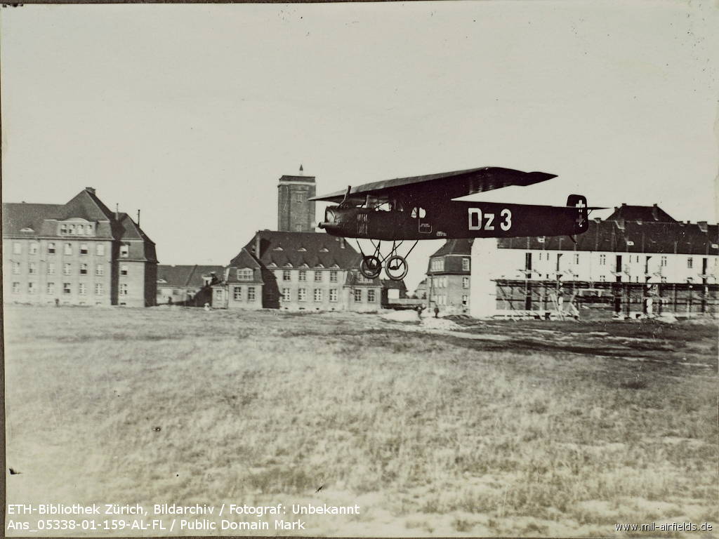
Landing of a Fokker F II in Danzig
Source: ETH-Bibliothek Zürich, Bildarchiv / Fotograf: Unbekannt / Ans_05338-01-159-AL-FL / Public Domain Mark
During World War II
Situation
Danzig-Langfuhr Airport in World War II on a US map from 194x
Source: McMaster University Library Digital Archive, License: Creative Commons Attribution-NonCommercial 2.5 CC BY-NC 2.5 CA
Overview
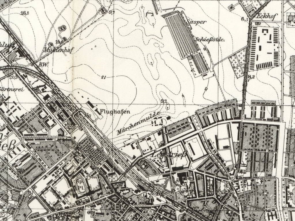
The airport on a "Messtischblatt" map from 1942
Source: mapywig.org
During the Cold War
Use
Civilian airport for Gdańsk until 1974.
In the 1960s
Overview
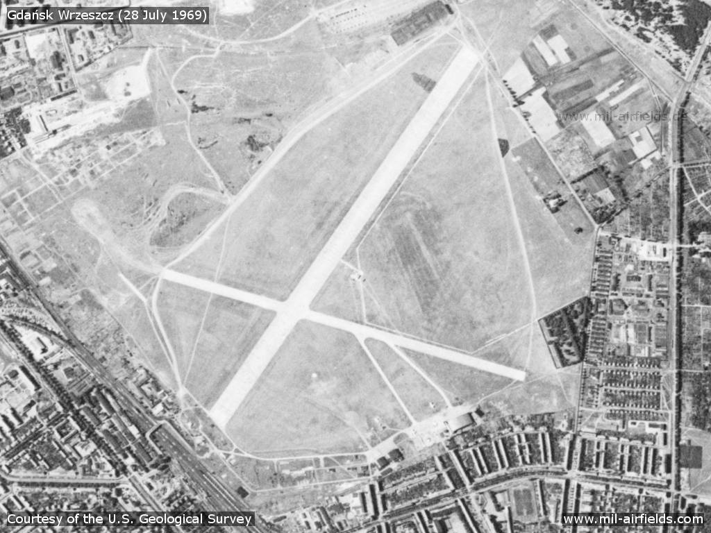
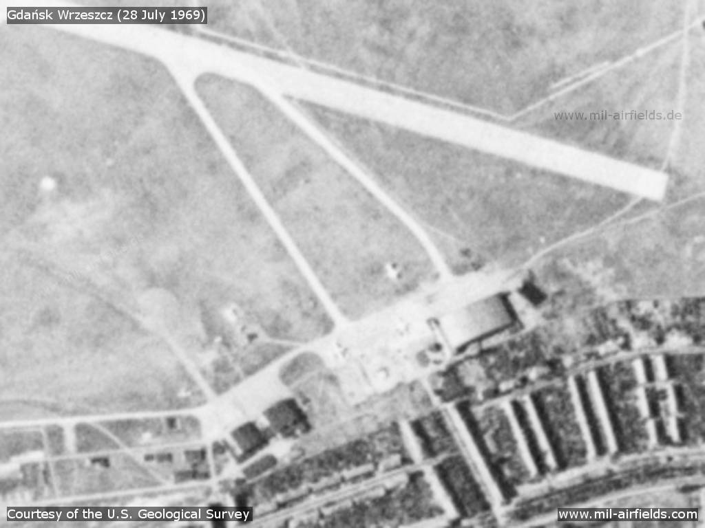
Gdańsk Wrzeszcz Airfield on a US satellite image from 28 July 1969
Source: U.S. Geological Survey
Buildings, hangar, aircraft
Source: U.S. Geological Survey
Runways
- 03/21: 1800 m
- 07/25: 1400 m
Lights
Aerodrome beacon white/green
Radio beacons
- NDB: 322 "AL", 212°/0.9 NM
Radio communication
- Tower 118.1, 3023.5
- Homer 118.1
In the 1970s
Situation
Gdańsk Wrzeszcz Airfield on a map of the US Department of Defense from 1973
Source: ONC E-3 (1973), Perry-Castañeda Library Map Collection, University of Texas at Austin
Overview
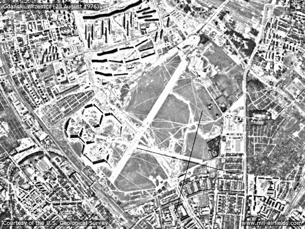
Former Gdańsk Wrzeszcz Airport on a US satellite image from 23 August 1976 - The picture was taken about two years after the closure of the field. Houses have been built on the site. Both runways are still visible.
Source: U.S. Geological Survey
Today
Use
Closed.
Sources
- https://www.e-pics.ethz.ch/ - ETH E-Pics
- http://english.mapywig.org/news.php - Map Archive of Wojskowy Instytut Geograficzny 1919 - 1939
- https://www.usgs.gov/ - USGS U.S. Geological Survey
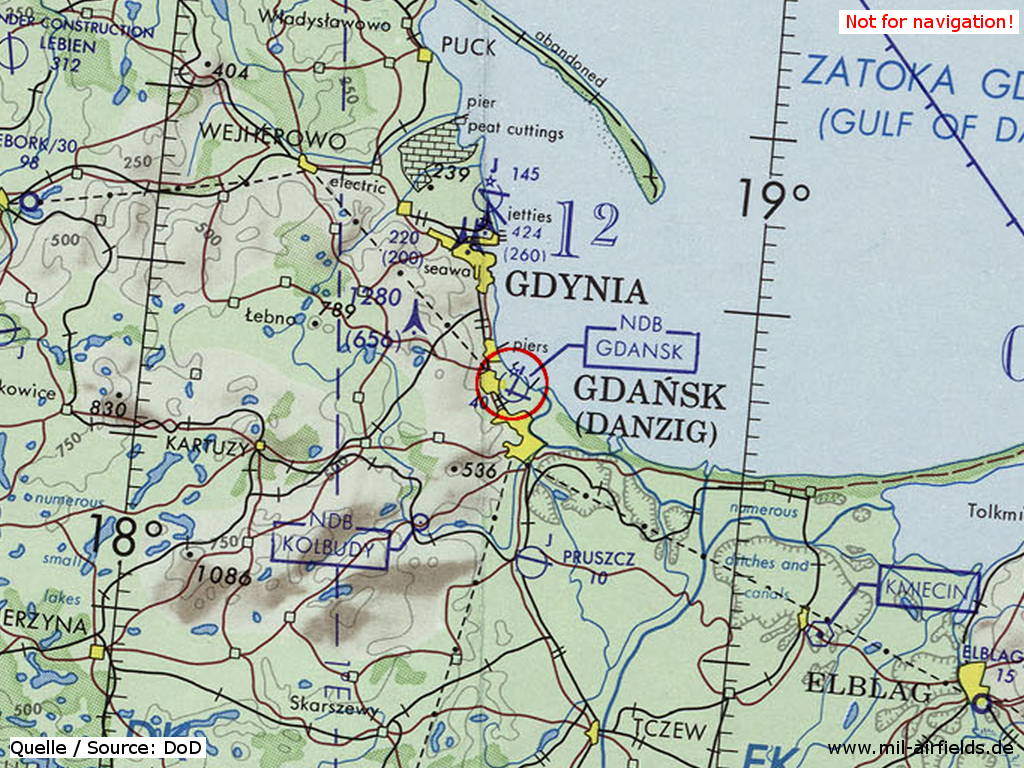
Airfields in the vicinity
Recommended
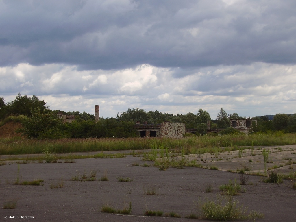
Image credits are shown on the respective target page, click on the preview to open it.
 Follow mil-airfields on Facebook