For historical information only, do not use for navigation or aviation purposes!
| Coordinates | N582416 E0264626 (WGS84) Google Maps |
| Elevation | 200' |
The history of the Cold War airfields: Tartu
General
Tartu is located in the east of Estonia. North of the city was an aerodrome. During the Cold War, there was a large air base of the Soviet Air Force for bomber and transport aircraft. Today, the airfield is closed.
During the Cold War
Use
Soviet airbase for long-range bombers transport aircraft.
In the 1960s
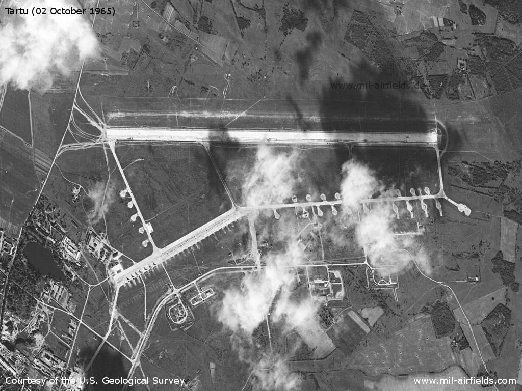
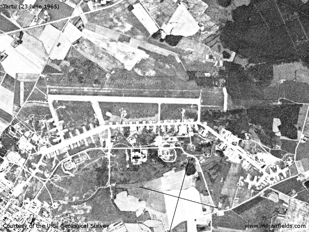
Overview
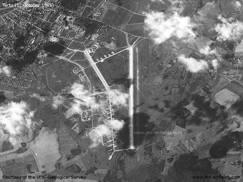
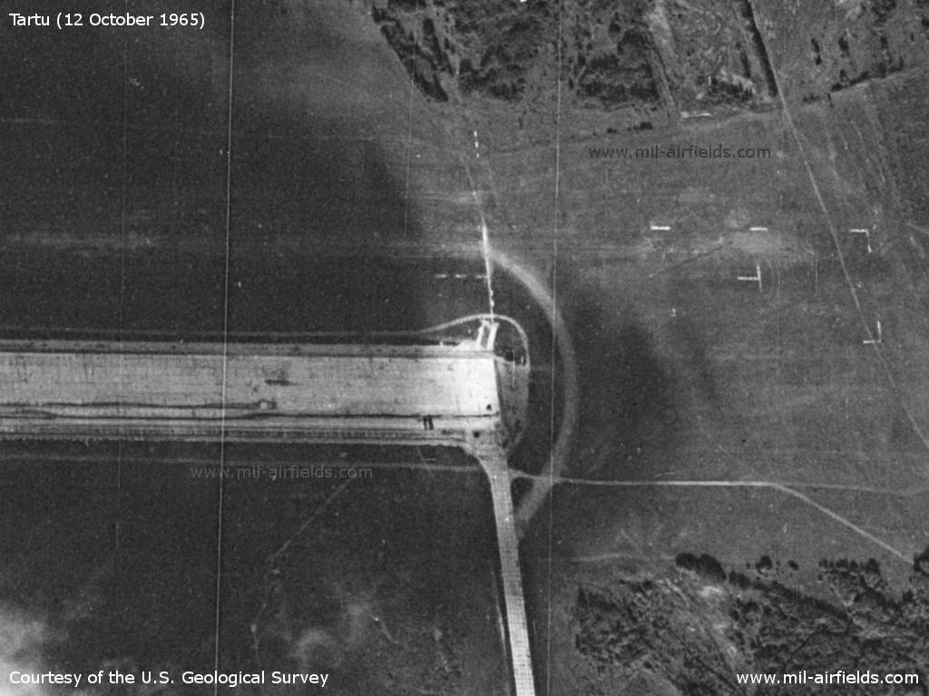
Satellite picture from October 1965, direction of view approximately west
Source: U.S. Geological Survey
The same image northed, but now very distorted. - At this point in time, the runway is 2500 m long
Source: U.S. Geological Survey
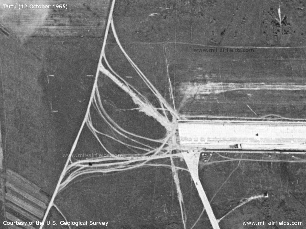
West end of runway - A grass runway is marked with dotted lines to the north of the paved runway.
Source: U.S. Geological Survey
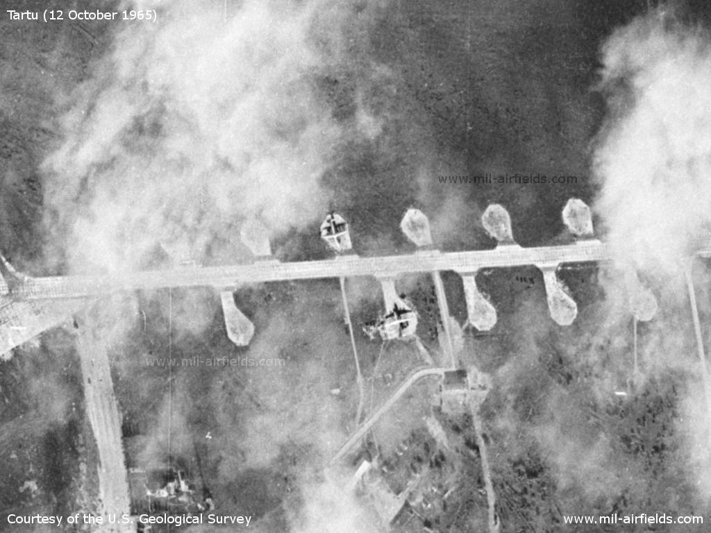
East end of runway - Here, too, the markings of the grass runway are recognizable
Source: U.S. Geological Survey
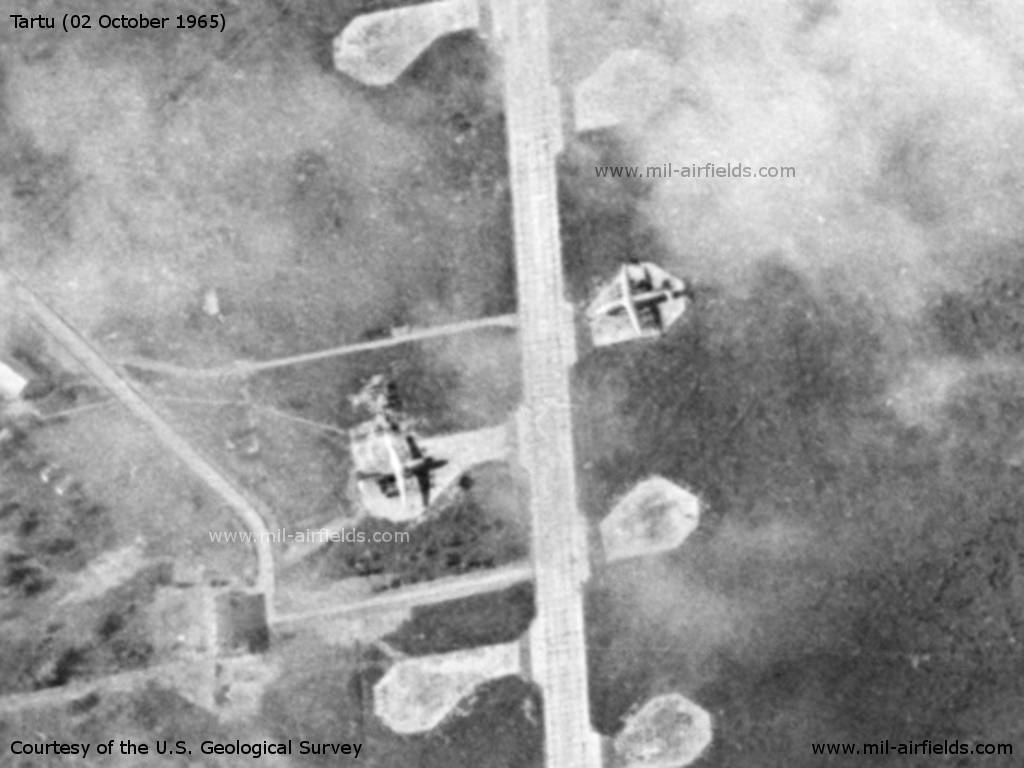
Two transport aircraft, presumably Antonov An-12
Source: U.S. Geological Survey
For better visibility, the two planes are seen in the correct perspective and magnified.
Source: U.S. Geological Survey
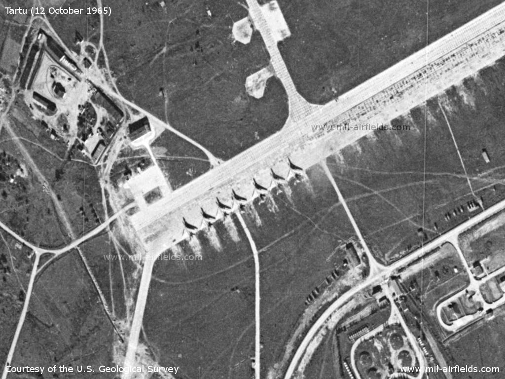
There are 7 Tupolev Tu-16 on the flight line.
Source: U.S. Geological Survey
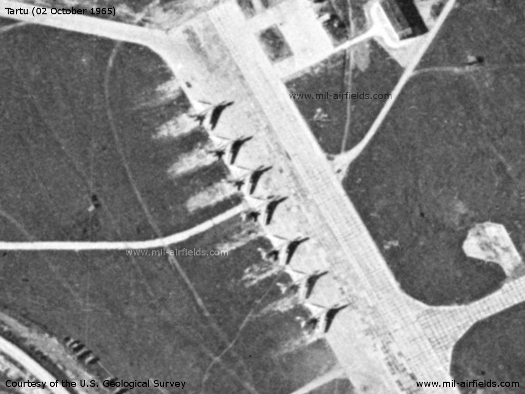
These aircraft in the right perspective, too
Source: U.S. Geological Survey

There are 8 more planes in this area, probably also Tu-16
Source: U.S. Geological Survey
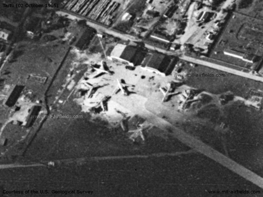
Image in correct perspective
Source: U.S. Geological Survey
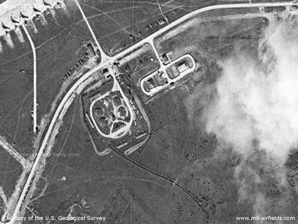
Tank farm and other facilities
Source: U.S. Geological Survey
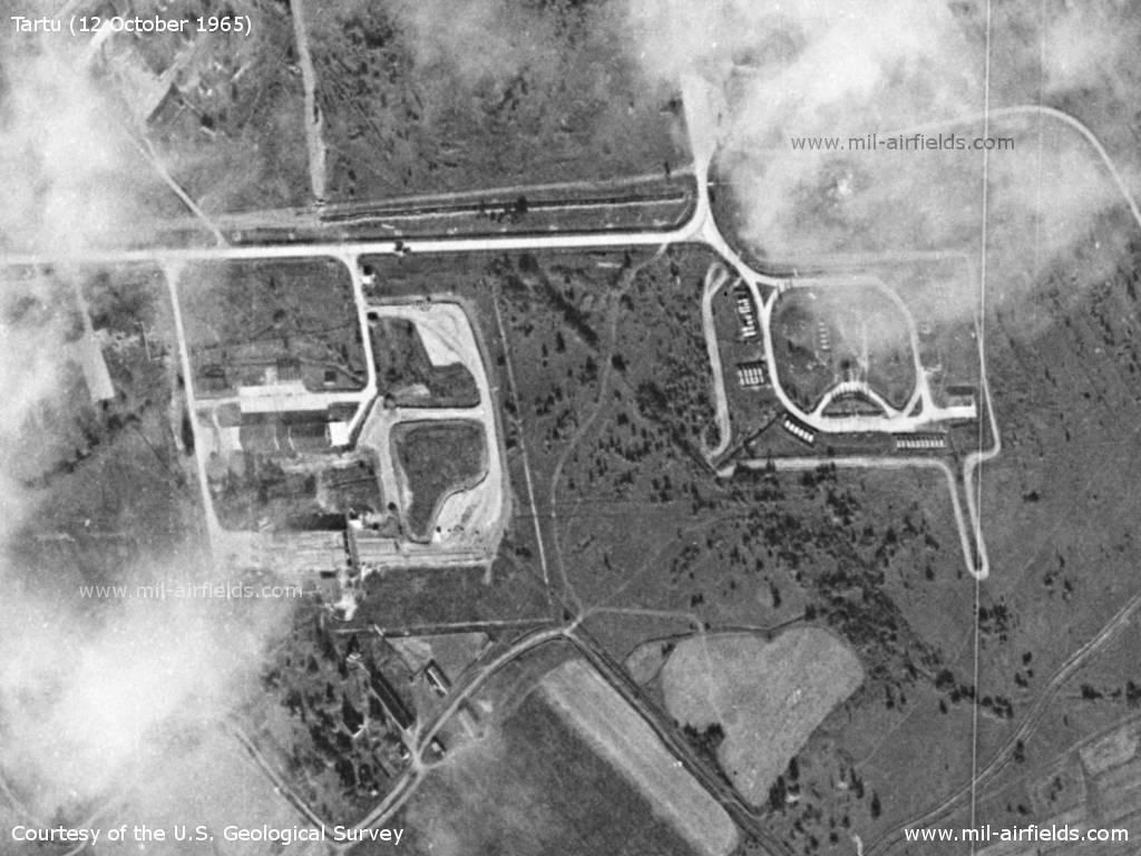
Installations
Source: U.S. Geological Survey
History
- July 1965
US agencies count at the airfield 2 medium swept-wing, 3 possible medium swept-wing and 7 light straight-wing aircraft. (Source: CIA)
In the 1970s
Situation
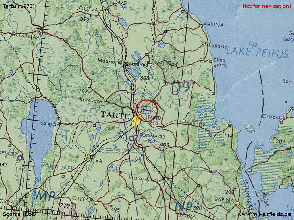
Tartu Air Base on a map of the US Department of Defense from 1973
Source: ONC D-3 (1973), Perry-Castañeda Library Map Collection, University of Texas at Austin /PCL MC/
Overview
US satellite image from June 1975 - Compared to the 1965 picture, the ramp areas were extended and a new parking area was added in the southeast.
In the 1980s and early 1990s
Runways
- 09/27: 3000 m x 60 m Concrete
Units
132 TBAP: Tu-22M3, Tu-16 (1990).
Installations
Runway; main taxiway in the south; flight line and several large open parking pads. Obviously, the airfield did not have a direct railway connection.
Today
Use
Closed.
Sources
- https://www.usgs.gov/ - USGS U.S. Geological Survey
Links
- http://www.odrap.ru/katastrofe_tu-16.html - Crash Tu-16 10jul1959
- (offline): http://forums.eagle.ru/showthread.php?t=34216&page=24 - Crash Tu-16 10nov1990
- http://www.airliners.net/photo//1230579/L/ - Runway
Airfields in the vicinity
- 011°/42km Mustvee: Highway Strip
- 167°/54km Ridali: Airfield (Ridali lennuväli, Ojasaare)
- 244°/54km Obriku: Airfield (Mustla, Torva North, Аэродром Обрику)
 Follow mil-airfields on Facebook