For historical information only, do not use for navigation or aviation purposes!
| Coordinates | N484123 E0091320 (WGS84) Google Maps |
| Federal state | Baden-Württemberg |
| Location indicator | DDSG (195x), EDDS (civ), EDAT (USAF), EDOC (US Army), ETOC |
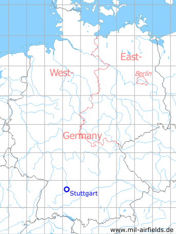
Germany during the Cold War Map
The history of the Cold War airfields: Stuttgart
Contents
Page 1: From the beginnings to the 1990s ← you are here
Page 2: Current pictures
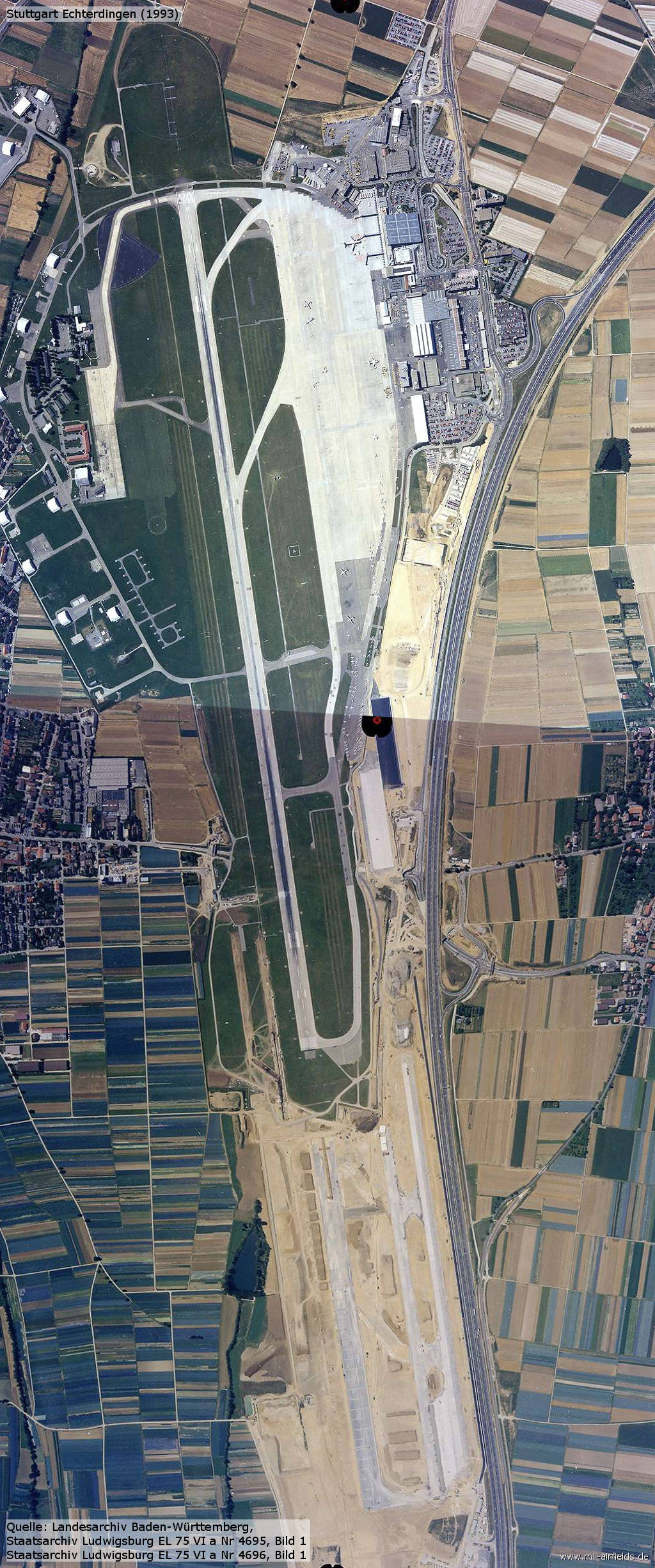
Page 3: Stuttgart Airport
General
The first aviation use of the area near Echterdingen was the unplanned landing of the airship LZ4 in 1908. In the 1930s the Echterdingen airport was built to replace the existing one at Böblingen. In 1945 the field was occupied by US troops, stationing military aircraft here. In the following years, civil aviation again developed. The military base remained, serving in particular the US EUCOM and the VII. US corps.
Today, Echterdingen is an international airport with a small US base.
German Empire until 1918
First aviation use
On 05 August 1908, the airship LZ4 had to land west of today's airport due to a technical defect. Later that day, the airship was destroyed during a thunderstorm.
In the same year a Zeppelin memorial has been erected at Echterdingen, see current pictures on page 2.
Images
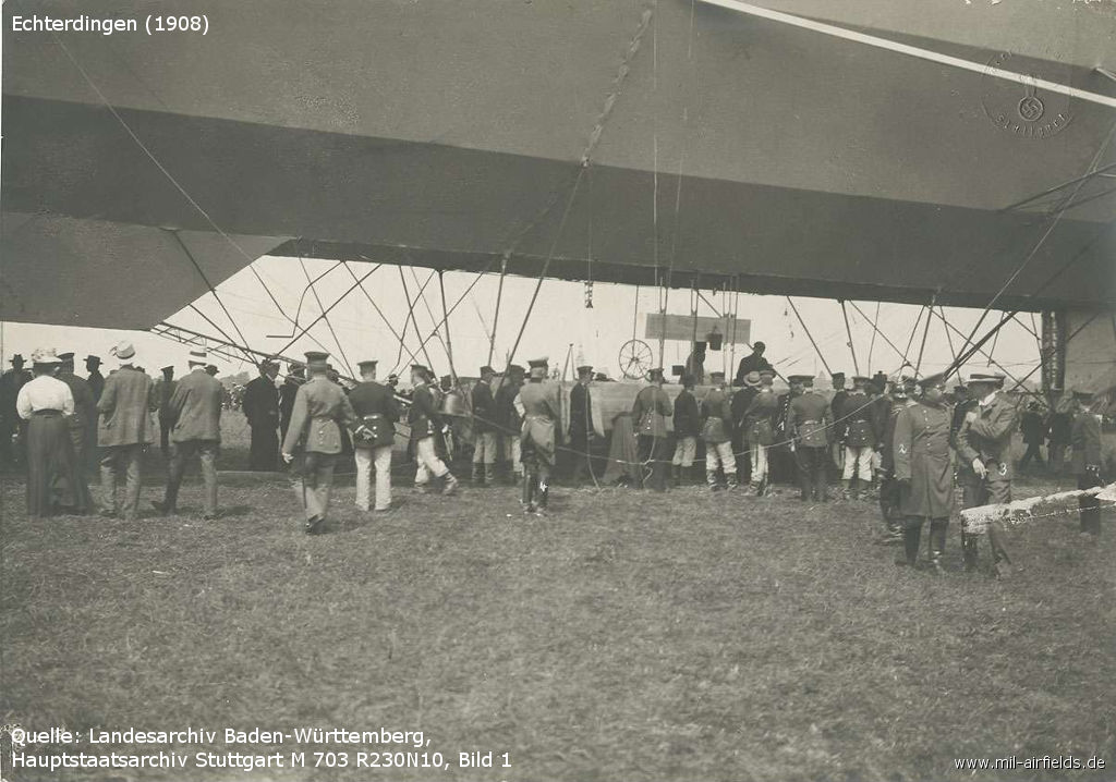
Airship Zeppelin LZ4 after landing near Echterdingen. - Title "Prior to the Zeppelin disaster in Echterdingen, 05 August 1908, Hauptmann Bauer asked von Breuning by telephone to call up two companies from the Bergkaserne to reinforce the fastening crew" /LABW 1-116183-1/ (Darstellung wie im Original, ausschließlich zur Berichterstattung über Vorgänge des Zeitgeschehens)
In World War II
Use
Stuttgart airport and Luftwaffe airfield.
Situation
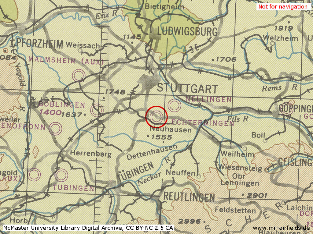
Stuttgart Airport, Army Airfield in World War II on a US map from 1944
Source: McMaster University Library Digital Archive, License: Creative Commons Attribution-NonCommercial 2.5 CC BY-NC 2.5 CA
Overview
Stuttgart Airport on a US map from 1951 - (AMS M841 GSGS 4414, Courtesy Harold B. Lee Library, Brigham Young University /BYU/)
Images
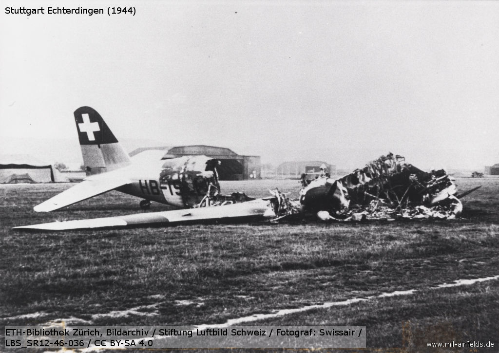
Swissair Douglas DC-2-115-D HB-ISI in Stuttgart-Echterdingen, destroyed by an air strike of the Allies (09 August 1944) - /ETH/
During the Cold War
In the 1940s
Situation
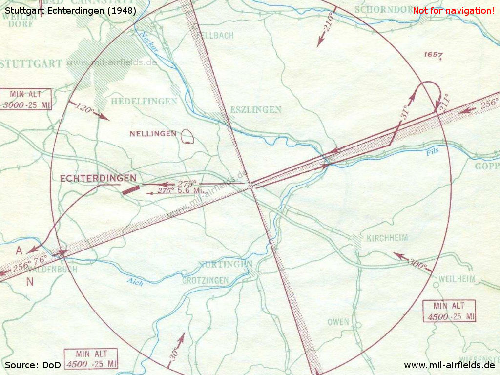
Approach chart from August 1948. The Stuttgart Range radio beacon was not located on the extended centerline.
Overview
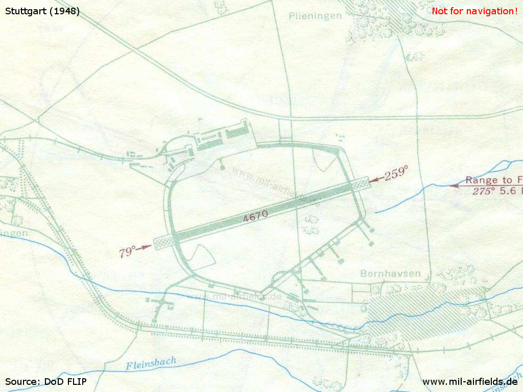
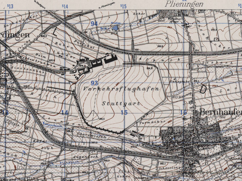
Map of Stuttgart airfield from 1948 - The airfield was stiill oriented at the old take-off pads. Hence the runway had a length of 1423 m (4670 ft) only.
Runways
- 08/26: 1423 m
Radio beacons
- Range: 310 "SG"
Radio communication
- Tower 6440, 126.18
In the 1950s
Situation
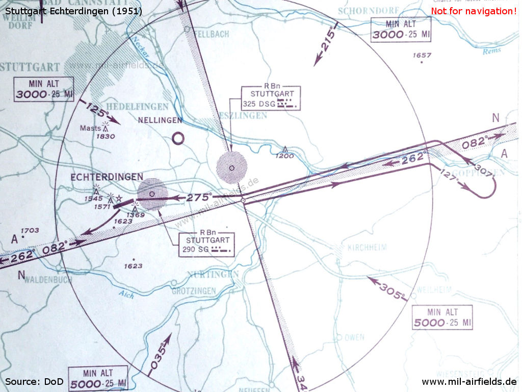
Compared to the state of August 1948 (above), two radio beacons DSG and SG have been added for the approach from the east. - In addition, the frequencies of the range and the control tower have changed.
Overview
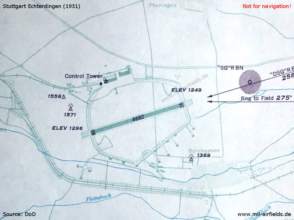
Karte des Flughafens Stuttgart aus dem Jahr 1951
Map of Stuttgart airport from 1953 - The runway has been extended to 1800 m (5906 ft)
Runways
- 08/26: 1800 m (5906 ft) x 50 m (166 ft) Concrete
- 08/26: 900 m (2953 ft) x 46 m (150 ft) Grass
- 15/33: 440 m (1444 ft) x 30 m (100 ft) Grass
South of the main runway was a practice area for military helicopters.
Lights
Rotating aerodrome light white
Identification beacon white/green
Approach Lights 26: Simplified Calvert system (580 m) with 4 crossbars.
Radio beacons
- NDB (OM): 422 "DLG", 258°/4.55 NM
- LMM: 306 "SG", 258°/0.64 NM
- VOR: 112.3 "DDG", 257°/9.75 NM
- ILS 26: 109.9 "DLG"
Radio communication
- HF for Approach and Tower 3023.5
- Stuttgart Approach 126.7, 362.3, 243.0
- Stuttgart Tower 118.1, 122.7, 362.3, 243.0
- Stuttgart Taxi 121.9
A VHF direction finder was located ca. 1000 m in front of the threshold 26.
Telephone
79551 - 79555
In the 1960s
Overview
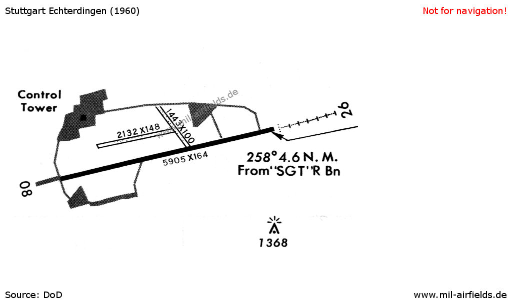
The airport in 1960 - The two grass runways in the north were already put to operation in the 1950s
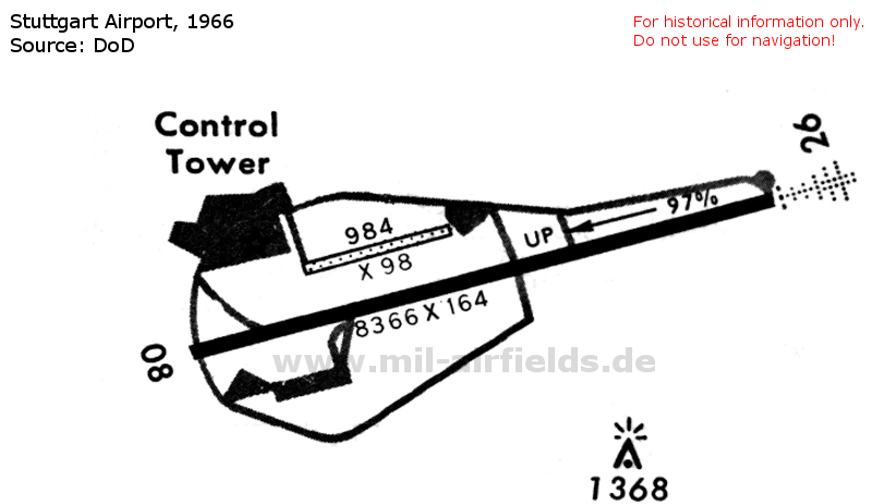
The airport in 1966 - In the meantime, the main runway has a length of 2550 m (8366 ft)
Runways
- 08/26: 2550 m (8366 ft) x 50 m (164 ft) Concrete
- 08/26: 300 m (984 ft) x 30 m (98 ft) Grass
Radio communication
- Approach 119.2, 119.7, 391.6, 322.3
- Tower 118.8, 119.7, 391.6, 257.8
- Ground 121.9
- Pilot/Dispatcher 360.8
- Metro 344.6, 140.3
- SING SONG (IFF/SIF check) 375.9
Images
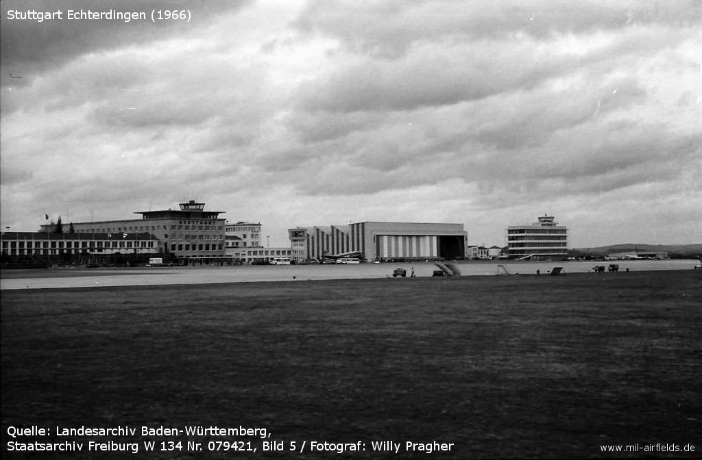
The civil part of the airport in the north in 1966 - /LABW 5-2040768-1/
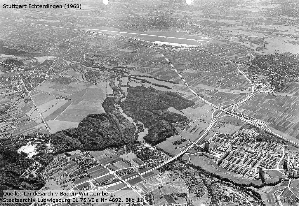
Aerial view 1968, looking southeast - /LABW 2-1133052-1/
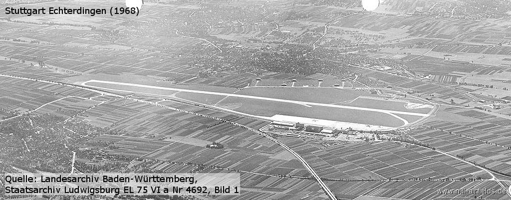
Enlargement - Highspeed taxiway E is only a stub so far.
In the 1970s
Situation
Stuttgart Airport / Army Airfield on a map of the US Department of Defense from 1972 - (ONC E-2 (1972), Perry-Castañeda Library Map Collection, University of Texas at Austin /PCL MC/)
Overview
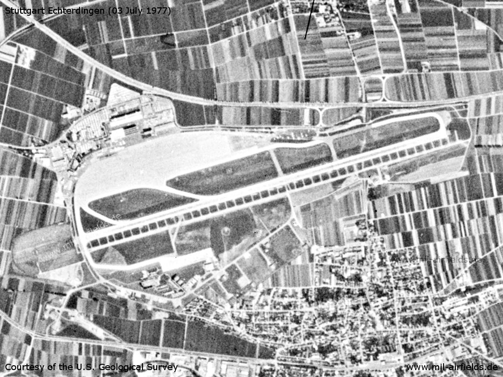
Stuttgart Airport, Army Airfield on a US satellite image from 03 July 1977 - Where do the ladder-shaped structures immediately south of the runway come from?
Source: U.S. Geological Survey
Radio beacons
- LOM 26: 306 "SG"
- LOM 08: 384 "SY"
- ILS 26
Radio communication
- ATIS 109.2, 112.5
- Approach/Radar 125.05, 119.2, 118.6, 119.7, 398.5, 244.3
- Tower 118.8, 122.7, 119.7, 355.2
- Ground 121.9
- Pilot to Dispatcher 360.8
- Metro 344.6
- Army Ops 360.8, 33.2
Telephone
Army Ops: Mil 2723-4-201/212/249
In the 1980s and early 1990s
Overview
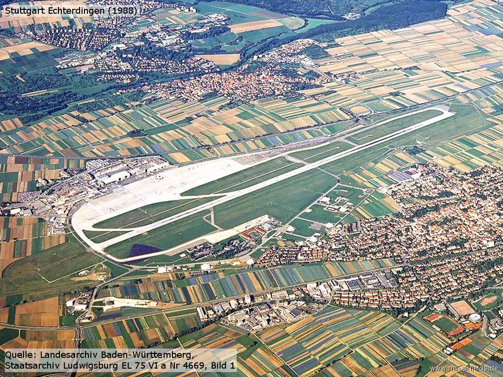
Aerial picture 1988 - At this time the paved parking spots for helicopters are still missing on the southern side. /LABW 2-1133029-1/
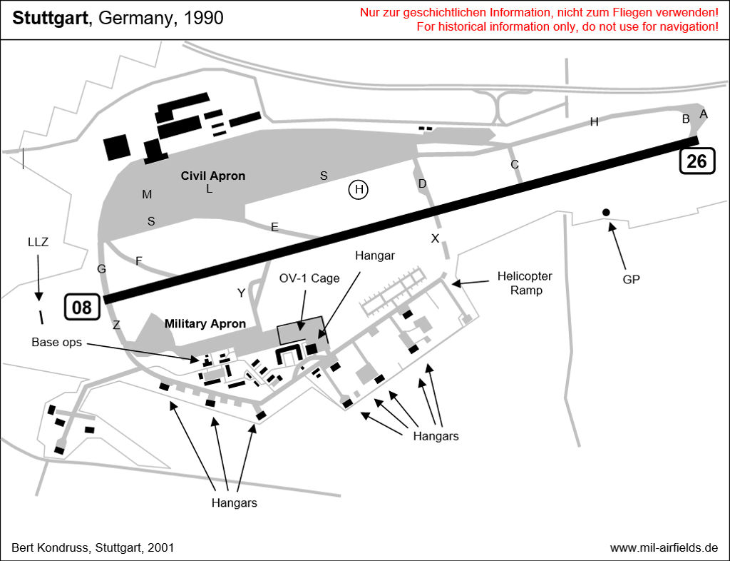
Situation around 1990
Runways
- 08/26: 2550 m x 50 m Concrete
Radio beacons
- LOM 26: 306 "SG"
- MM 26: 75
- LOM 08: 384 "SY"
- ILS 26: 109.9 "DLG"
Units
US Army units at Stuttgart Army Airfield ca. 1990:
1st Avn Det: 4 UH-1H, 2 C-12C
2nd MIB: 6 RC-12D, 8 OV-1D Mohawk, 7 RV-1D Mohawk
4th Battalion, 159th Aviation Regiment (4-159 Avn): 30 UH-1H, 15 OH-58D, 1 C-12C, 1 U-21A
Additional information
Reconnaissance flights along the inner German border
For the VII. US corps, reconnaissance aircraft of the types OV-1D Mohawk, RV-1D Mohawk and later RC-12D Guardrail were stationed in Stuttgart. They were parked in a separate fenced-in area of the military apron, in the "Hawk Cage". The airplanes flew regularly along the inner-German border as well as along the border with the CSSR, in order to assess the situation on the other side, using various sensors (IR, side-looking radar, ELINT). Typical flight routes are shown on this page: www.fumema.de .
Comparable missions for the V. Corps were flown from Wiesbaden.
Lutrans in Stuttgart
Lutrans was a scheduled military air transport service, which was provided by the German Air Force over the airfields Ahlhorn, Hohn, Köln, Landsberg and Stuttgart across the entire Federal Republic of Germany. It was operated from the mid-1970s until the 1980s with aircraft C-160 Transall.
Routing Monday, Tuesday, Thursday, Friday:
Landsberg - Stuttgart - Cologne - Ahlhorn - Hohn
Hohn - Ahlhorn - Cologne - Stuttgart - Landsberg
Landsberg - Stuttgart - Cologne - Ahlhorn - Hohn
Hohn - Ahlhorn - Cologne - Stuttgart - Landsberg
Routing Wednesday:
Landsberg - Stuttgart - Cologne - Landsberg
Hohn - Ahlhorn - Cologne - Hohn
Landsberg - Stuttgart - Cologne - Landsberg
Hohn - Ahlhorn - Cologne - Hohn
The aircraft from Landsberg arrived at Stuttgart at about 1200 local and departed to Cologne at 1245. In the afternoon, the aircraft arrived at about 1545 local an departed 1630.
The station at Stuttgart had 6 ground people and was used for distributions into the area between Freiburg, Kaiserslautern, Saarbrücken, Frankfurt/M, Würzburg und Reutlingen.
Images
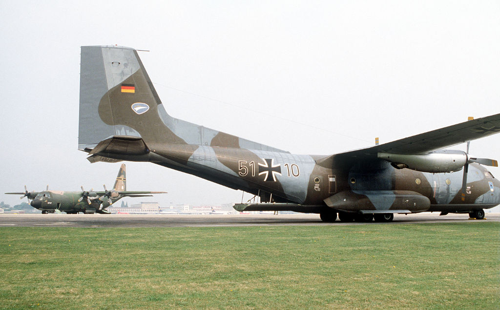
A German Air Force C-160 Transall and a US Air Force C-130 Hercules in Stuttgart during Exercise Reforger 81 - (Source: DoD, Scene Camera Operator: SSGT Bill Thompson)
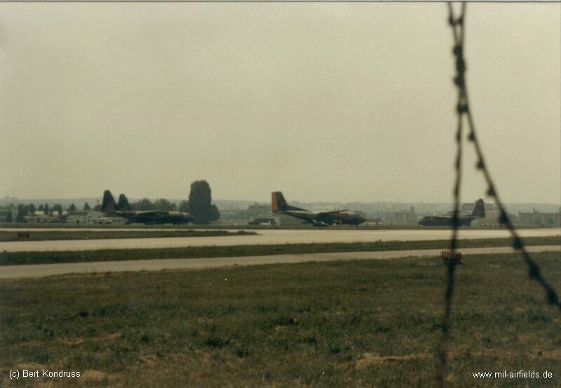
German Air Force C-160 Transall and USAF C-130 Hercules
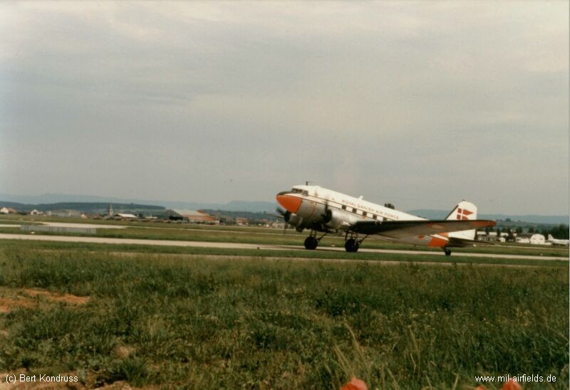
Danish Air Force C-47
Aiport extension
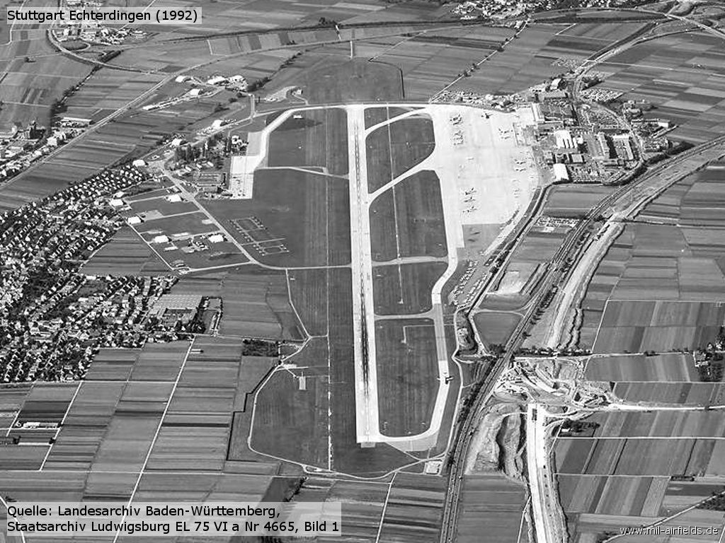
Über viele Jahre war die Weidacher Höhe westlich des Flugplatzes ein Hindernis, das den Flugverkehr einschränkte. Starts in Richtung Westen waren im Abfluggewicht begrenzt. Außerdem konnte für Anflüge aus Richtung Westen kein Instrumentenlandesystem betrieben werden. Deshalb begannen Anfang der 1990er Jahre Arbeiten, um die am Flughafen vorbeiführende Autobahn nach Norden zu verlegen. Damit konnte die Start- und Landebahn nach Osten verschoben und verlängert werden.
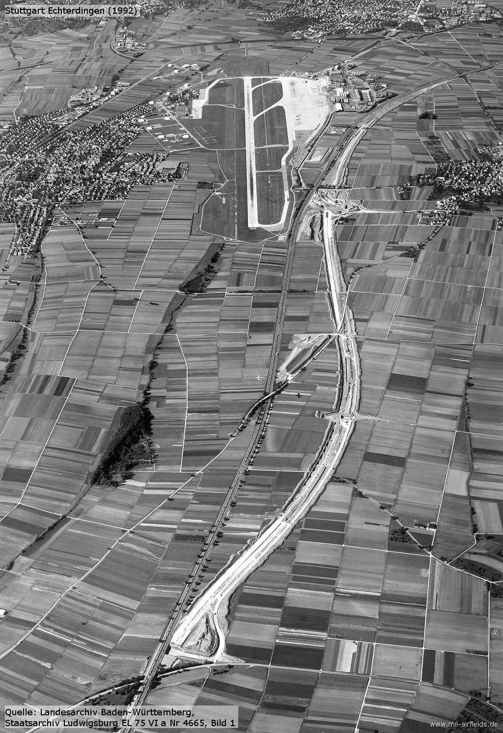
In preparation for the extension of the runway, the A8 autobahn is moved north (1992) - /LABW 2-1133025-1/
Enlargement
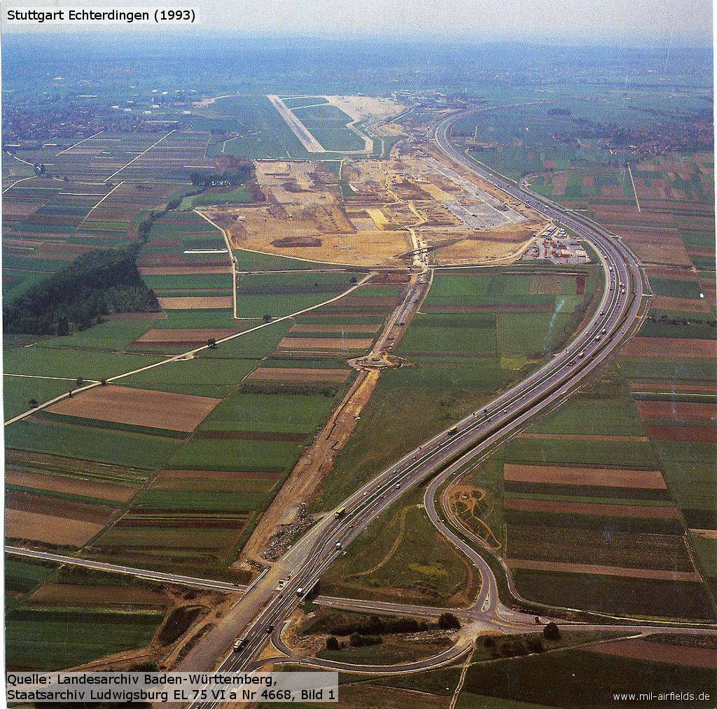
Aerial picture 1993, looking west - In the meantime, the new autobahn is in operation, the old route is still recognizable. Work to shift and extend the runway is in progress. /LABW 2-1133028-1/
Aerial picture 1993 with the new part of the runway under construction - /LABW 2-1133055-1/, /LABW 2-1133056-1/
Contents
Page 1: From the beginnings to the 1990s ← you are here
Page 2: Current pictures
Page 3: Stuttgart Airport
 Follow mil-airfields on Facebook