Aachen: Merzbrück Airfield
For historical information only, do not use for navigation or aviation purposes!
| Coordinates | N504924 E0061111 (WGS84) Google Maps |
| Elevation | 623' |
| Federal state | Nordrhein-Westfalen (North Rhine-Westphalia) |
| Location indicator | EDCM (-1995), ETBA (planned), EDKA (1995-) |
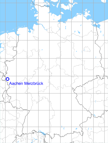
Germany during the Cold War Map
The history of the Cold War airfields: Aachen
Location of airfield
5 NM northeast of Aachen.
During the 1920s/1930s
Information from the Aeronautical Information Publication as of June 1932
II. Level Airport Aachen
Business owner / Administrator
Flughafengesellschaft m. b. H., Aachen, Haus Grenzwacht, cable address: Flughafengesellschaft Aachen.
Overview
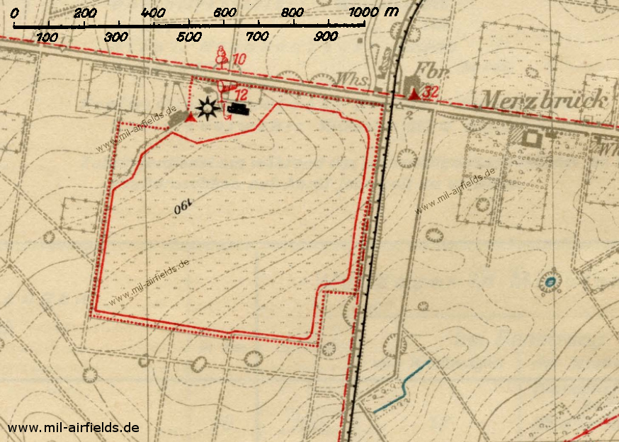
Map 1932 - The airfield has an aviation light (black sun) and an aircraft hangar (black symbol). The red numbers indicate the height in meters above the airfield.
Source: Aeronautical information publication (Flughandbuch) 1932
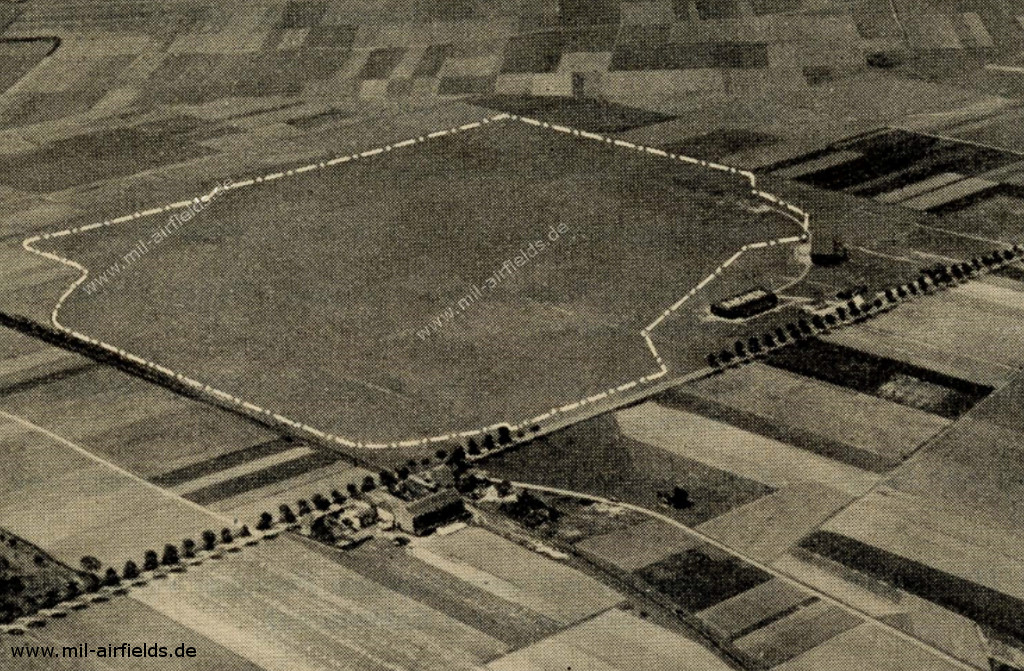
Aerial picture 1932 - The viewing direction is approximately southwest.
Source: Aeronautical information publication (Flughandbuch) 1932
Airfield characteristics at daytime
The airfield is located about 9 km northeast of Aachen in the southwestern corner of the highway Weiden - Eschweiler and the railway line Höngen - Stolberg. On the black roof of the brown aircraft hangar white inscription "Aachen". Next to the hangar is a red and white observation tower, in the northeast corner from the Tegestraße is a 220 m tree gap. Yellow-white administration building. Windsock, landing signal is constantly on display. Airport border in the north by trunk road, in the east by railway embankment, tarmac border marked by red-white roof riders.
Airfield characteristics at night
No permanent night lighting, but:
A. Approach beacon
- Installation on a quadrangular lattice mast, extended to an observation tower, directly next to the dark brown aircraft hangar on the north side of the harbour. The red and white lattice mast is 12.50 m above the ground to the ridge of the roof on which the rotating beacon, 1.50 m high, is erected.
- Terrain height above sea level: 188 m.
- Identification: flashing beacon white. Flashing 0.18 s, pause 3.82 s, return 4.00 s.
- Height of fire above ground level: 14 m.
- Type of light source: Electric light bulb.
- Luminous intensity in Hefner candles: 900 000.
- Mean range of fire: 40 km.
- Operating times: 1 April to 30 September from 11 p.m. until brightness is reached; otherwise on request.
- The fire is guarded by the air police station.
- When an aircraft lands, the fire is switched off to avoid glare. There are two red warning lights on the roof of the lattice mast.
B. Warning beacons
8 red warning beacons on the buildings pp. on the north side of the airport which could be an aviation obstacle. 2 light rings each with 3 red warning beacons on the 27 m high factory chimney Merzbrück, 100 m from the north-east corner of the airport, marked as an obstacle near the airport. Operating times as for A, otherwise on request.
C. Landing lights
Landing lights of green, white and red fires in wind direction. It has to land from green over white to red to the right of the row. Landing light operating times: as for A, otherwise on request.
Runways, taxiways, aprons
Good sod on clay soil.
Shortest rolling length: 600 m in nord-south direction.
Shortest rolling length: 600 m in nord-south direction.
Hangars
1 aircraft hangar 60 x 20 m, 9 m high, gate width 18 x 5.10 m.
Workshops
Suitable for smaller repairs. Electricity: 220 Volt 25 Amp. alternating current.
Fuel equipment
3 petrol stations (Shell, Olex, Dapolin) each 5000 l, petrol, benzene and lubricants are kept in stock.
First aid in the case of accidents
Medical room with trained personnel available. Next doctor in Vorweiden (2 km away).
Customs
Customs clearance possible, passport check by air police station.
Post office
Merzbrück is equipped with a telephone.
Accommodation of passengers
At the airport in Weiden (2 km away) and in Aachen.
Connections
Shuttle service only during scheduled air traffic, otherwise taxi cabs are on call at any time.
During World War II
Use
Luftwaffe airfield.
Situation
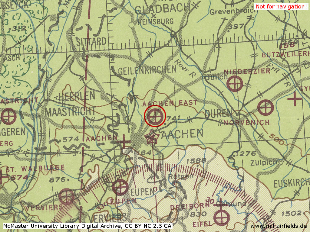
Aachen Merzbrück as "Aachen East" in World War II on a US map from 1943
Source: McMaster University Library Digital Archive, License: Creative Commons Attribution-NonCommercial 2.5 CC BY-NC 2.5 CA
Overview
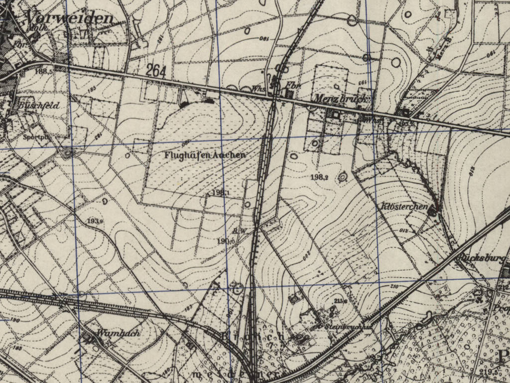
Aachen airfield on a britsh / US map from 1951 - The time of the state shown here is unknown, but could correspond to the 1930s/40s. Immediately north of the field is the road Reichsstraße 264. This is where the L223 road runs today. The double-tracked section of the railway from Stolberg to Alsfeld east of the field is now single-track.
Source: AMS M841 GSGS 4414, Courtesy Harold B. Lee Library, Brigham Young University
During the Cold War
Usage during the Cold War
Army aviation of the Belgian armed forces in Germany (Les Forces belges en Allemagne FBA, Belgische strijdkrachten in Duitsland BSD) and general aviation.
Overview
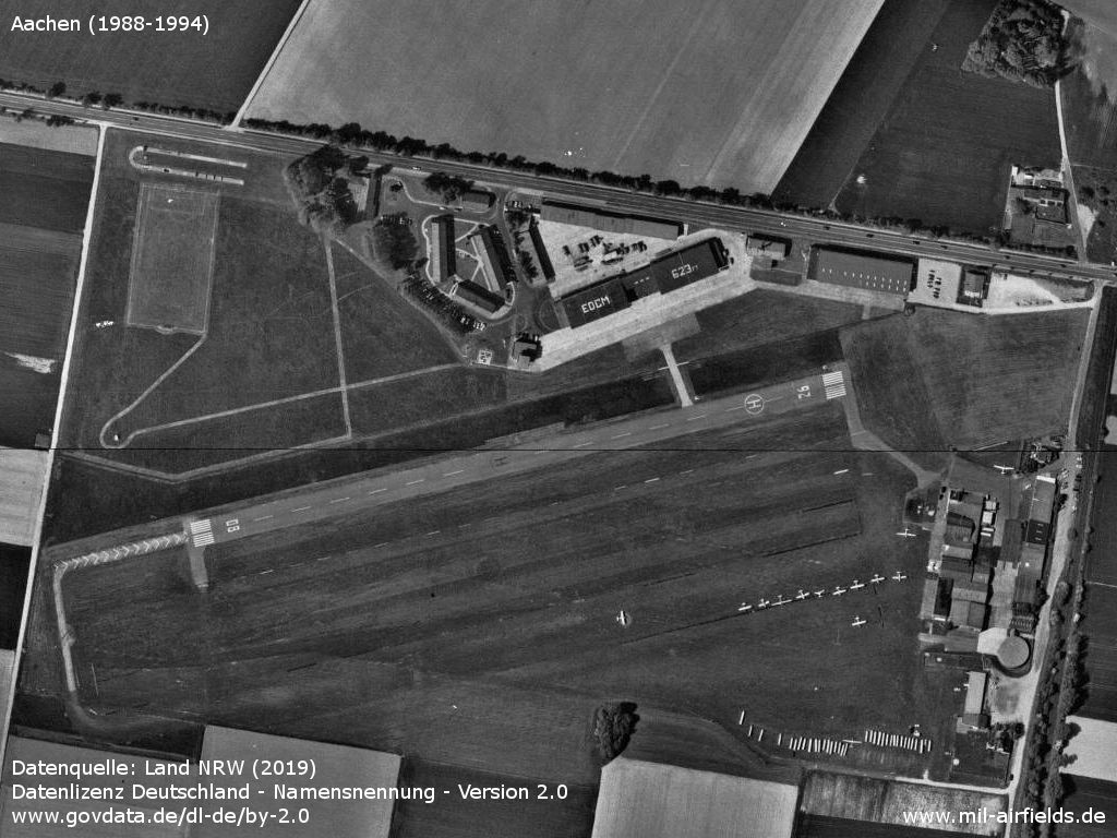
Aerial picture from the late 1980s or early 1990s
Source: Datenquelle: Land NRW (2019) Datenlizenz Deutschland - Namensnennung - Version 2.0 www.govdata.de/dl-de/by-2.0
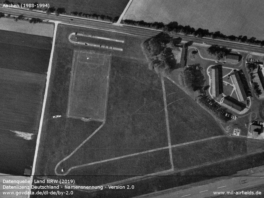
Northwestern part with sports field and practice area
Source: Datenquelle: Land NRW (2019) Datenlizenz Deutschland - Namensnennung - Version 2.0 www.govdata.de/dl-de/by-2.0
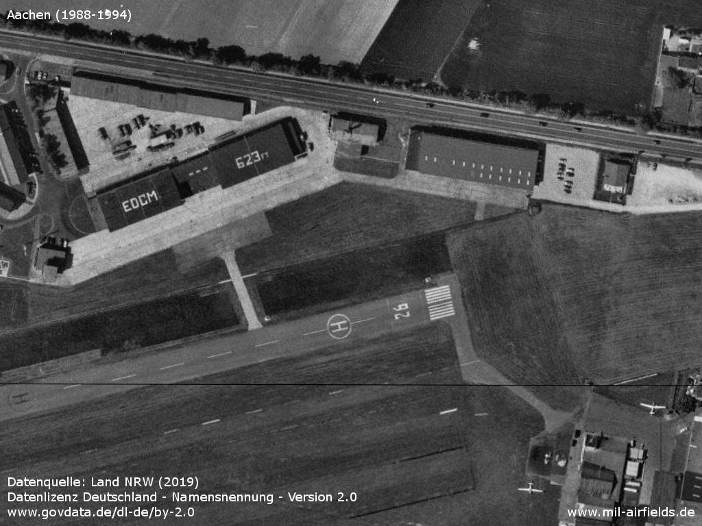
Airfield of the Belgian armed forces in the north with control tower and hangars - At this time, this part of the airfield is still used for military purposes as some military vehicles can be seen.
Source: Datenquelle: Land NRW (2019) Datenlizenz Deutschland - Namensnennung - Version 2.0 www.govdata.de/dl-de/by-2.0
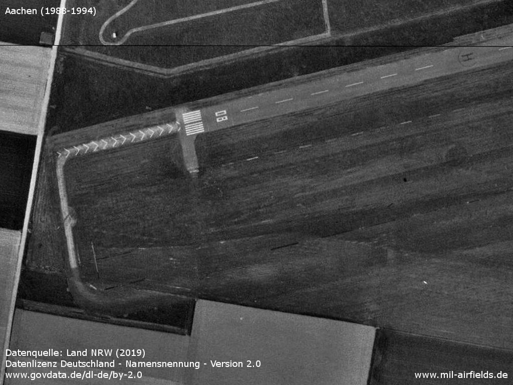
Southwestern part with the beginning of runway 08
Source: Datenquelle: Land NRW (2019) Datenlizenz Deutschland - Namensnennung - Version 2.0 www.govdata.de/dl-de/by-2.0
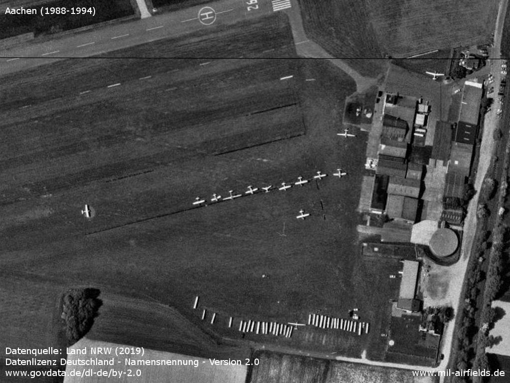
The southeastern part is used for sports aviation.
Source: Datenquelle: Land NRW (2019) Datenlizenz Deutschland - Namensnennung - Version 2.0 www.govdata.de/dl-de/by-2.0
Runways
Data for the year 1983:
- 08/26: 520 m Grass
- 13/31: 600 m Grass
Data for the year 1991:
- 08/26: 520 m Asphalt
Units
Belgian Army 18th Sq / 18th Bat (Alouette, A109BA)
Today
Use
General aviation.
Overview
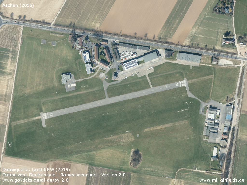
Aerial image 2016
Source: Datenquelle: Land NRW (2019) Datenlizenz Deutschland - Namensnennung - Version 2.0 www.govdata.de/dl-de/by-2.0
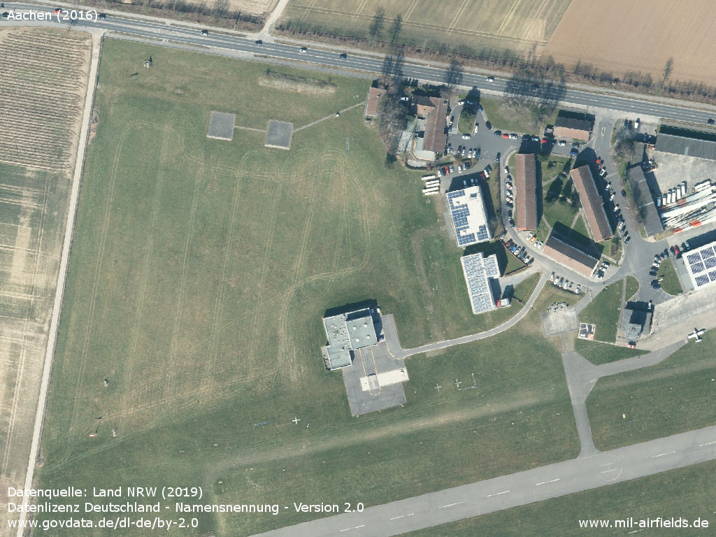
Northwest corner with air rescue centre
Source: Datenquelle: Land NRW (2019) Datenlizenz Deutschland - Namensnennung - Version 2.0 www.govdata.de/dl-de/by-2.0
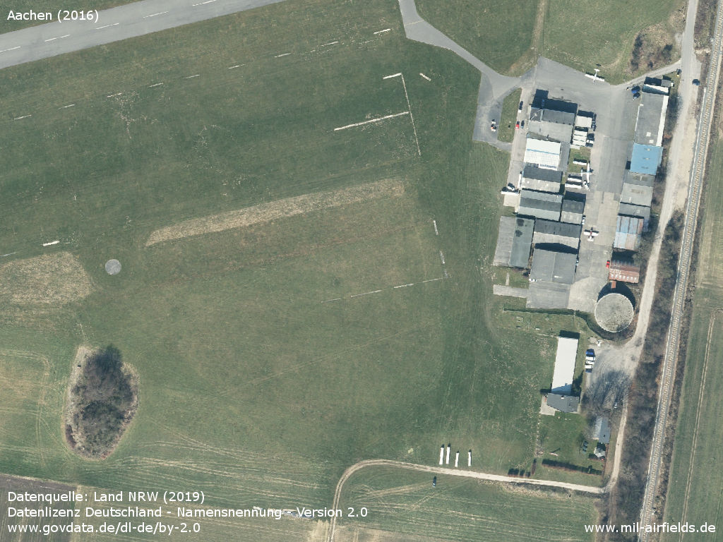
Northeast corner
Source: Datenquelle: Land NRW (2019) Datenlizenz Deutschland - Namensnennung - Version 2.0 www.govdata.de/dl-de/by-2.0
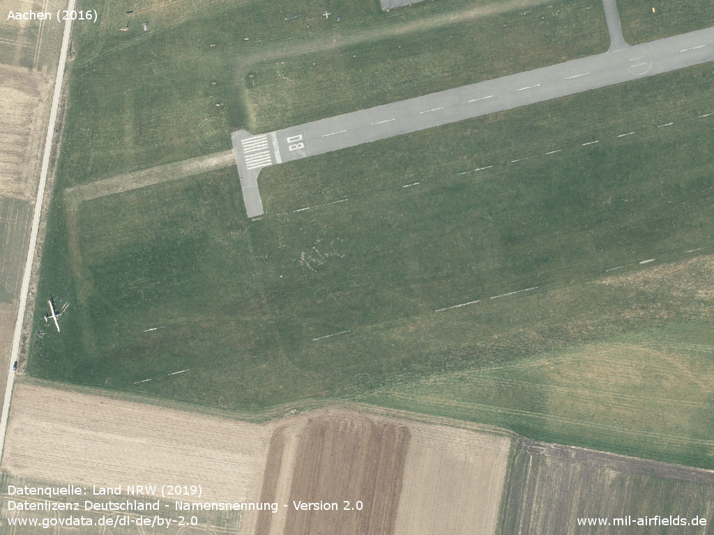
Runway 08
Source: Datenquelle: Land NRW (2019) Datenlizenz Deutschland - Namensnennung - Version 2.0 www.govdata.de/dl-de/by-2.0
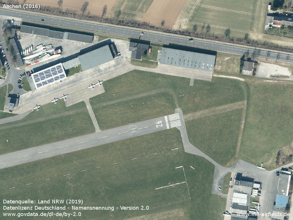
Flying club
Source: Datenquelle: Land NRW (2019) Datenlizenz Deutschland - Namensnennung - Version 2.0 www.govdata.de/dl-de/by-2.0
Sources
- https://lib.byu.edu/collections/german-maps/http:/... - German Maps (Topographische Karte 1:25,000)German Maps (Topographische Karte 1:25,000)
- https://www.geoportal.nrw/ - Geoportal NRW
Links
- https://de.wikipedia.org/wiki/Flugplatz_Merzbr%C3%... - Wikipedia (German)
- http://www.flugplatz-aachen.de - Flugplatz Aachen homepage
- http://www.dascon.de/index.php?id=cam - Webcam
Airfields in the vicinity
Recommended
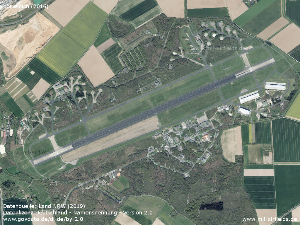
Image credits are shown on the respective target page, click on the preview to open it.
 Follow mil-airfields on Facebook