For historical information only, do not use for navigation or aviation purposes!
| Coordinates | N512700 E0052230 (WGS84) Google Maps |
| Elevation | 74 ft |
| Location indicator | EHEH |
The history of the Cold War airfields: Eindhoven
During the Cold War
In the 1950s
Situation
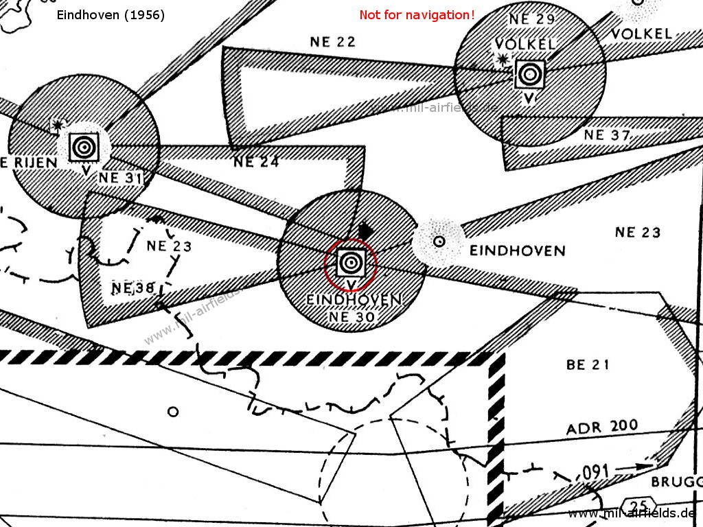
Eindhoven airfield and surrounding airways and restricted areas on a map 1956
Radio beacons
- NDB: 397 "PE", 265°/7.0 NM to field
Radar
GCA
Radio communication
- Homer 117.9
- Tower 117.9, 116.1, 121.5, 243.0, 257.8
- Gonio 121.1
In the 1970s
Situation
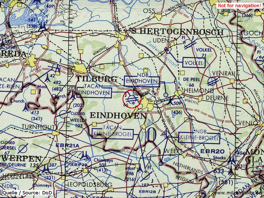
Eindhoven Airport on a map of the US Department of Defense from 1972
Source: ONC E-2 (1972), Perry-Castañeda Library Map Collection, University of Texas at Austin
Runways
Data for the year 1971:
- 08R/26L
In the 1980s and early 1990s
Runways
Data for the year 1990:
- 04/22: 3000 m x 45 m Concrete
Radio beacons
Data for the year 1990:
- TACAN: CH119 "EHV", at field
- NDB: 397 "EHN"
Today
Installations
Rebuilt completely, now suitable for large transport airplanes.
Links
- Eindhoven Airport - Homepage
Airfields in the vicinity
- 239°/21km Arendonk: Ammunition depot helipad (Kwartier DBW Hauptmunitionsdepot (DBW = “Deutsche Bundeswehr))
- 258°/29km Weelde: Airfield
- 168°/32km Kleine Brogel: Air Base (Vliegbasis Kleine-Brogel, Base aérienne de Kleine-Brogel, Basis generaal-majoor vlieger graaf Ivan du Monceau de Bergendal)
- 045°/33km Volkel: Air Base (Nijmegen, Uden, Vliegbasis Volkel)
- 293°/33km Gilze-Rijen: Air Base (Breda)
- 077°/34km De Peel: Air Base (Venray, Vliegbasis De Peel)
 Follow mil-airfields on Facebook