For historical information only, do not use for navigation or aviation purposes!
| Coordinates | N513609 E0060833 (WGS84) Google Maps |
| Elevation | 105 ft |
| Federal state | Nordrhein-Westfalen (North Rhine-Westphalia) |
| Location indicator | EDUL (-1995), ETUL (1995-200x), EDLV |
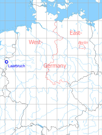
Germany during the Cold War Map
The history of the Cold War airfields: Laarbruch
During the Cold War
Use
Royal Air Force base.
During the 1950s
Lights
Red iIdentification beacon with ident LL
Radio beacons
- EUREKA: 233R, 213T "LL"
- NDB: 406 "LL"
Radio communication
- Approach 117.9, 135.18, 136.08, 111.42, 121.5, 131.58, 283.5, 272.8, 257.8
- Tower 136.08, 135.18, 117.9, 111.42, 283.5, 272.8, 257.8, 243.0
In the 1960s
Runways
- 10/28: 2457 m (8060 ft) x 46 m (150 ft)
- 10/28 Light Aircraft Strip
Lights
Identification beacon with ident LL.
Radio beacons
- NDB: 406 "LL", at field
- ILS, Offset 3° to the north of runway centerline
Radio communication
- Düsseldorf Clutch Radar 338.2
- Approach Control 119.7, 130.8, 257.6, 362.3
- Tower 122.1, 262.4, 257.8
Maps
High altitude ADF approach into Laarbruch in 1968 Source: US DoD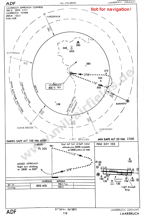
In the 1970s
Situation
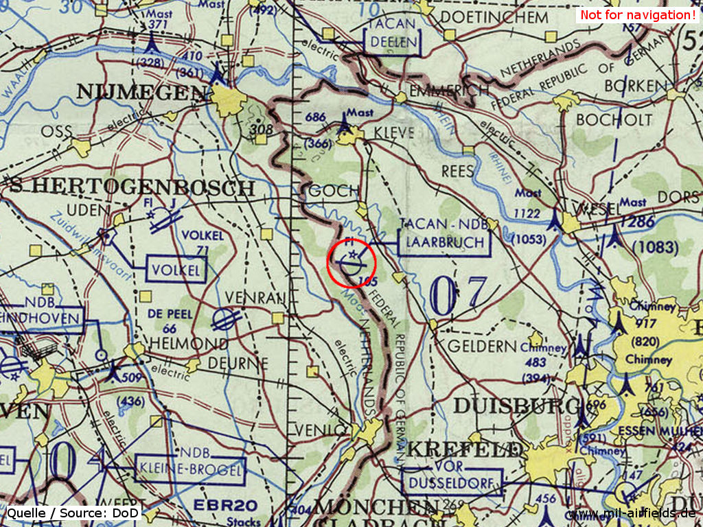
RAF Laabruch on a map of the US Department of Defense from 1972
Source: US DoD
Overview
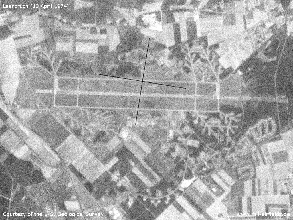
Laarbruch Air Base on a US satellite image from 13 April 1974
Source: U.S. Geological Survey
In the 1980s and early 1990s
Overview
Datenquelle: Land NRW (2019) Datenlizenz Deutschland - Namensnennung - Version 2.0 www.govdata.de/dl-de/by-2.0
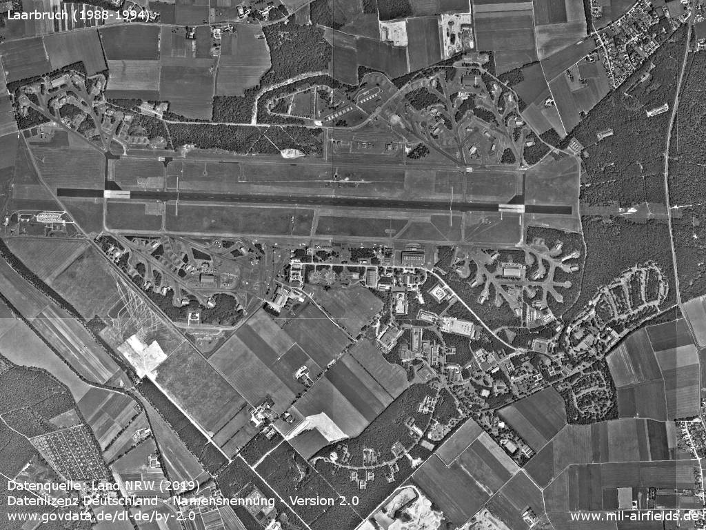
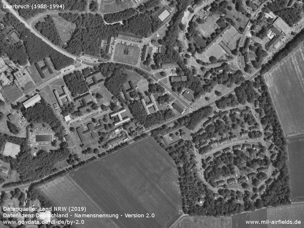
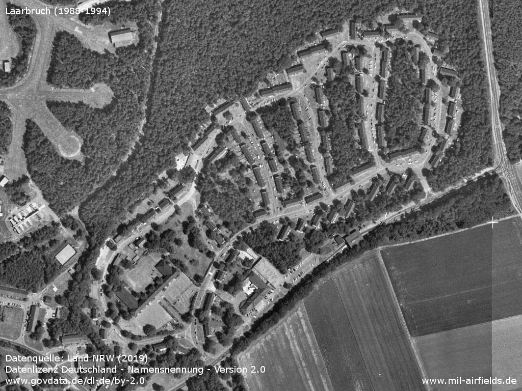
Aerial picture from the late 1980s or early 1990s
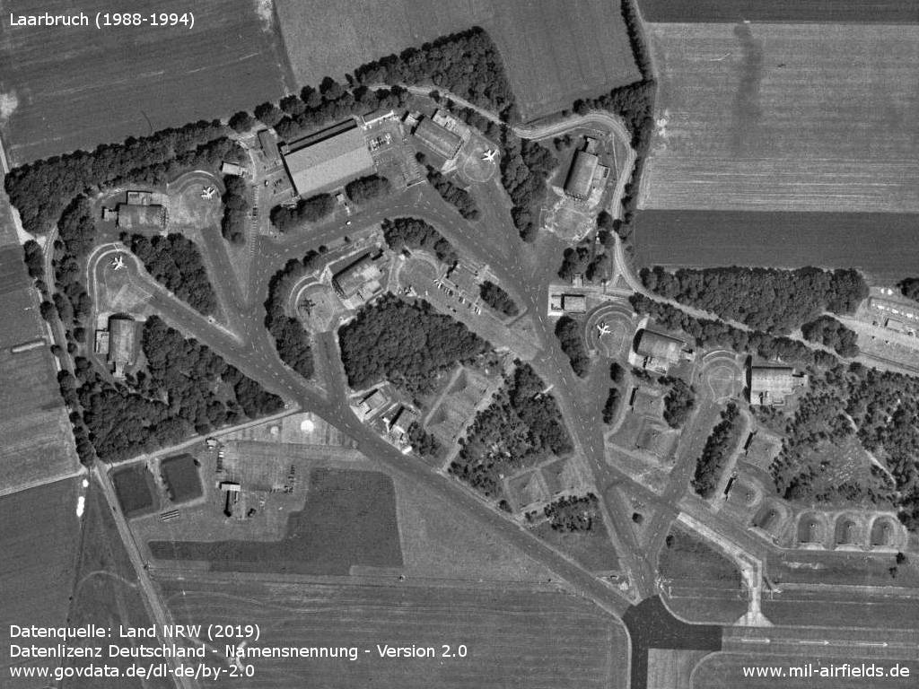
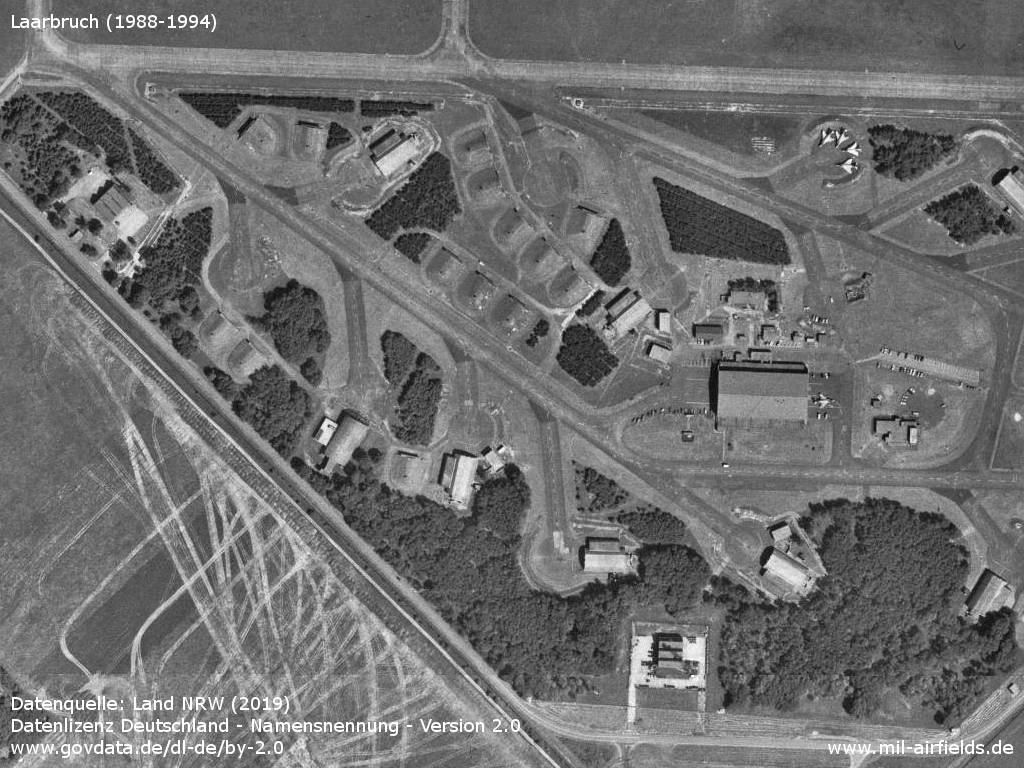
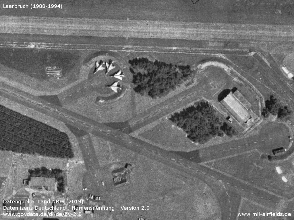
Northwestern shelter area
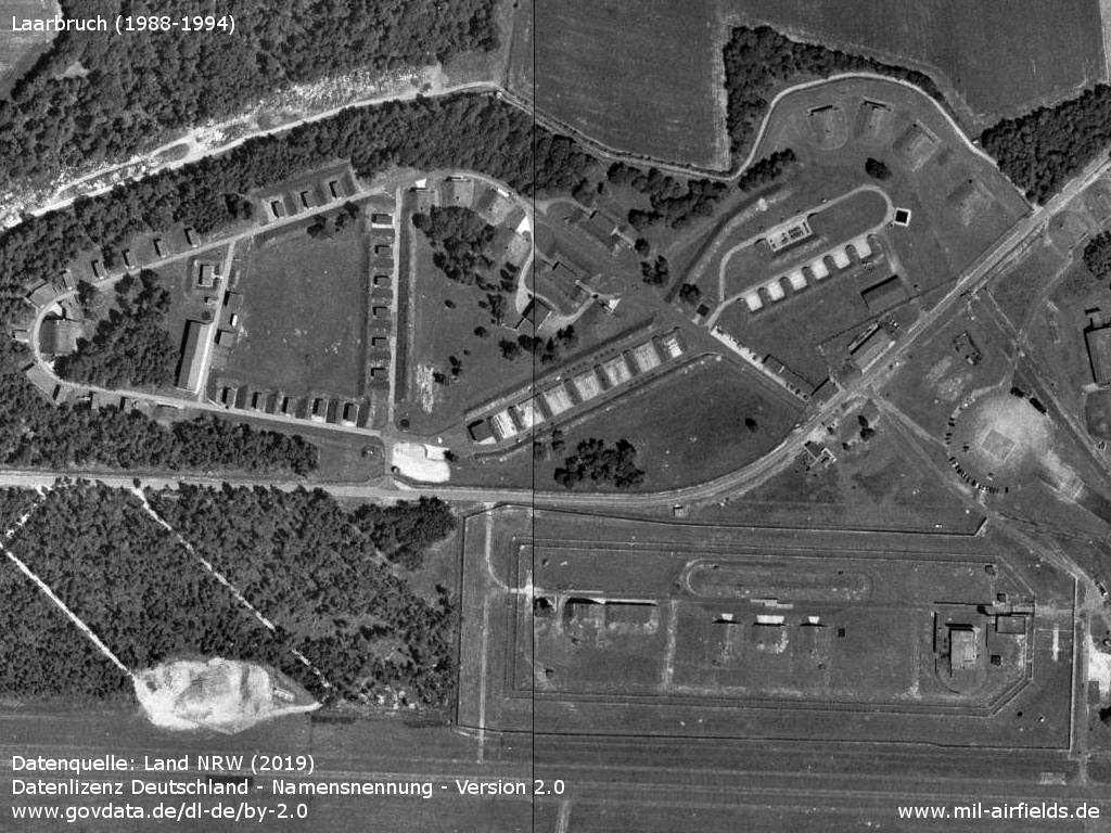
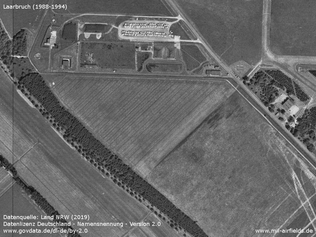
Ammunition dump and special weapons storage
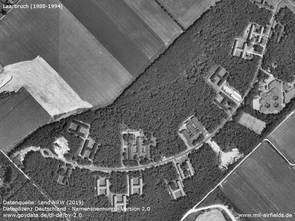
Northeaster shelter area
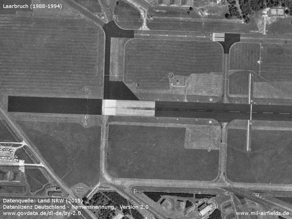
Beginning of runway 10 - The taxiway north of the runway is also marked as a runway.
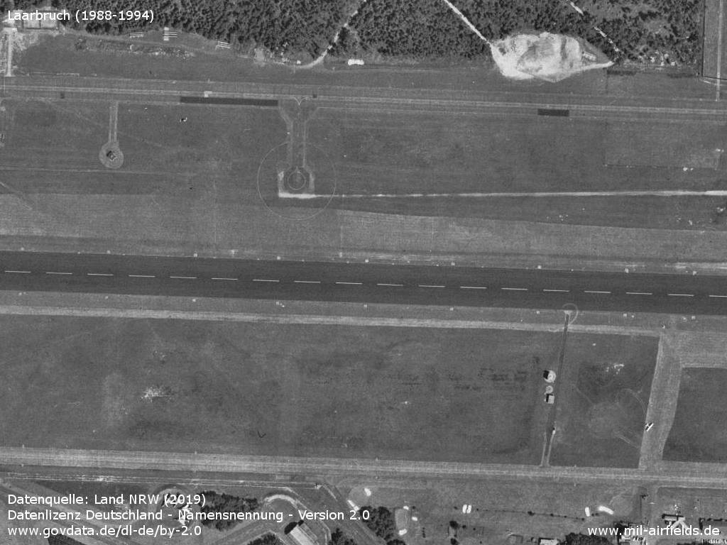
Runway
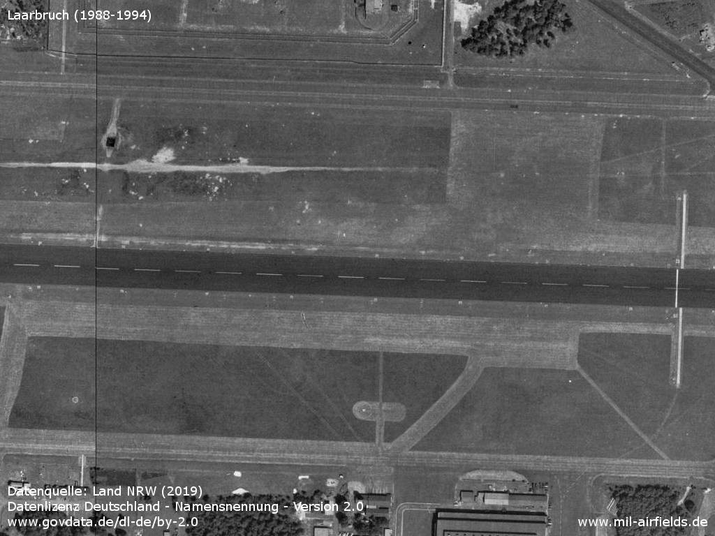
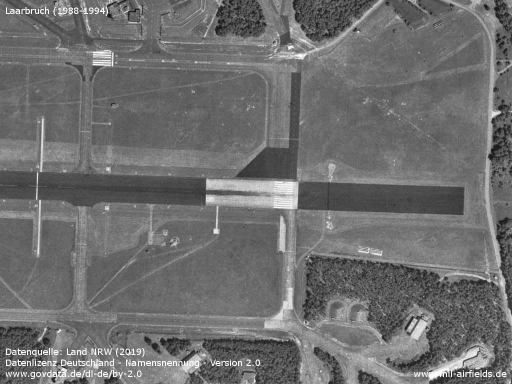
Beginning of runway 28
In the west
Southwestern dispersal area
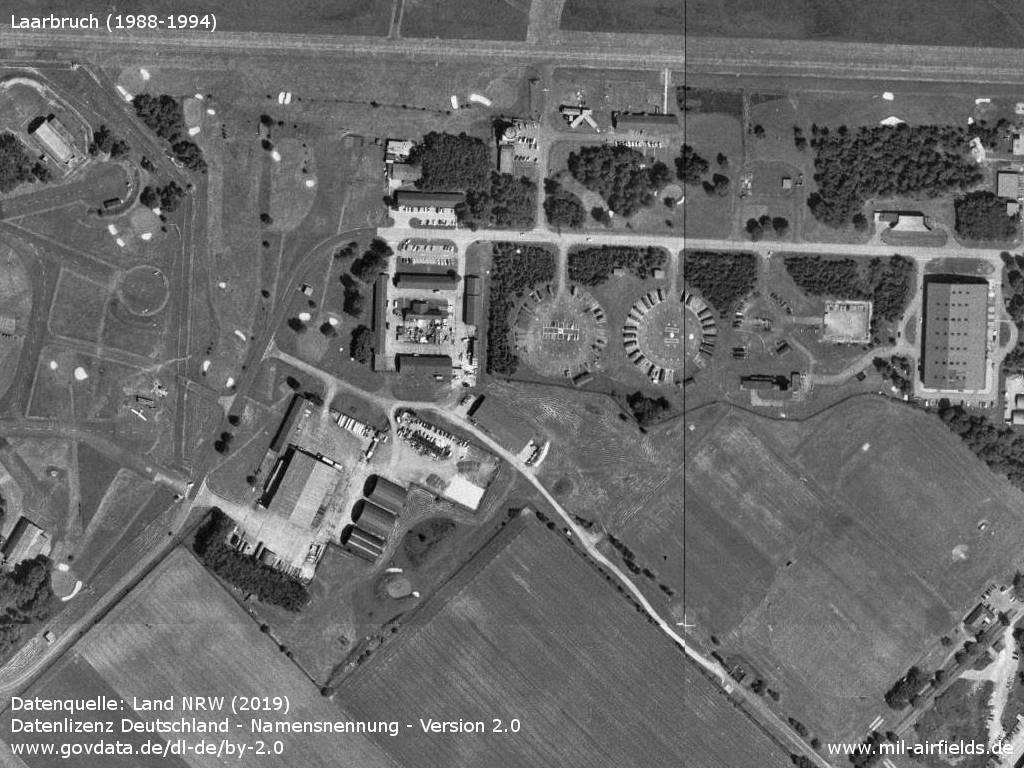
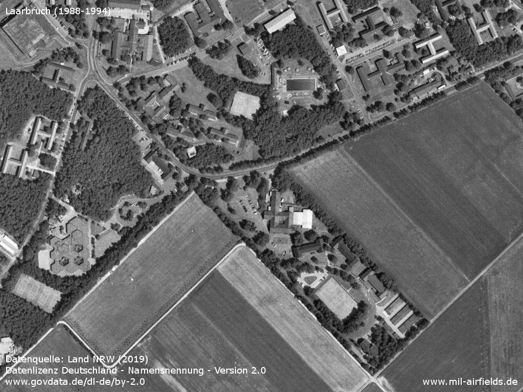
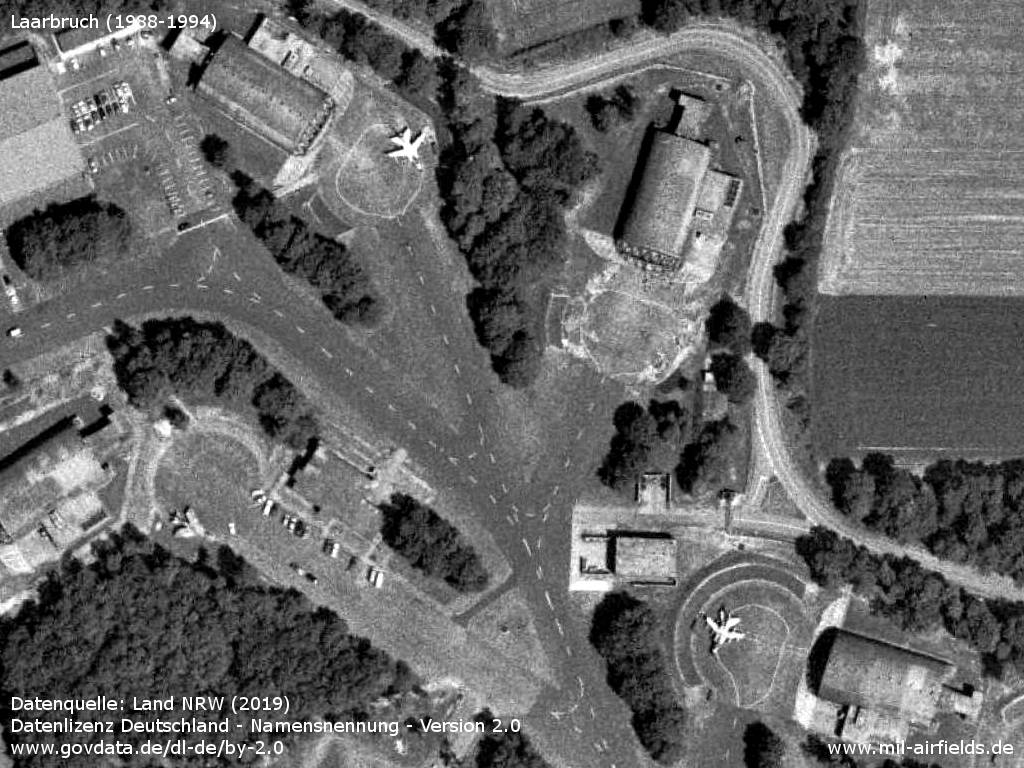
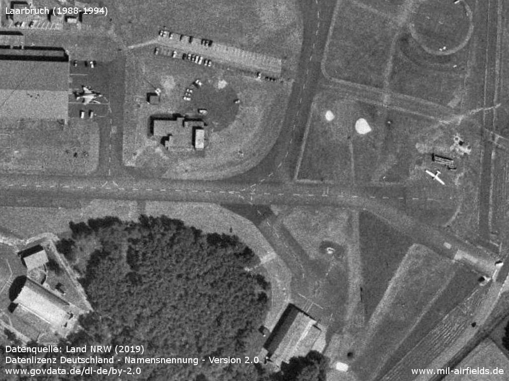
Tower
Hangar
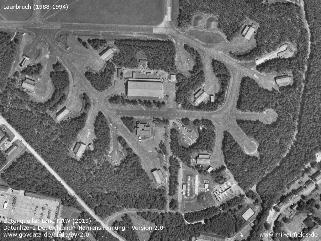
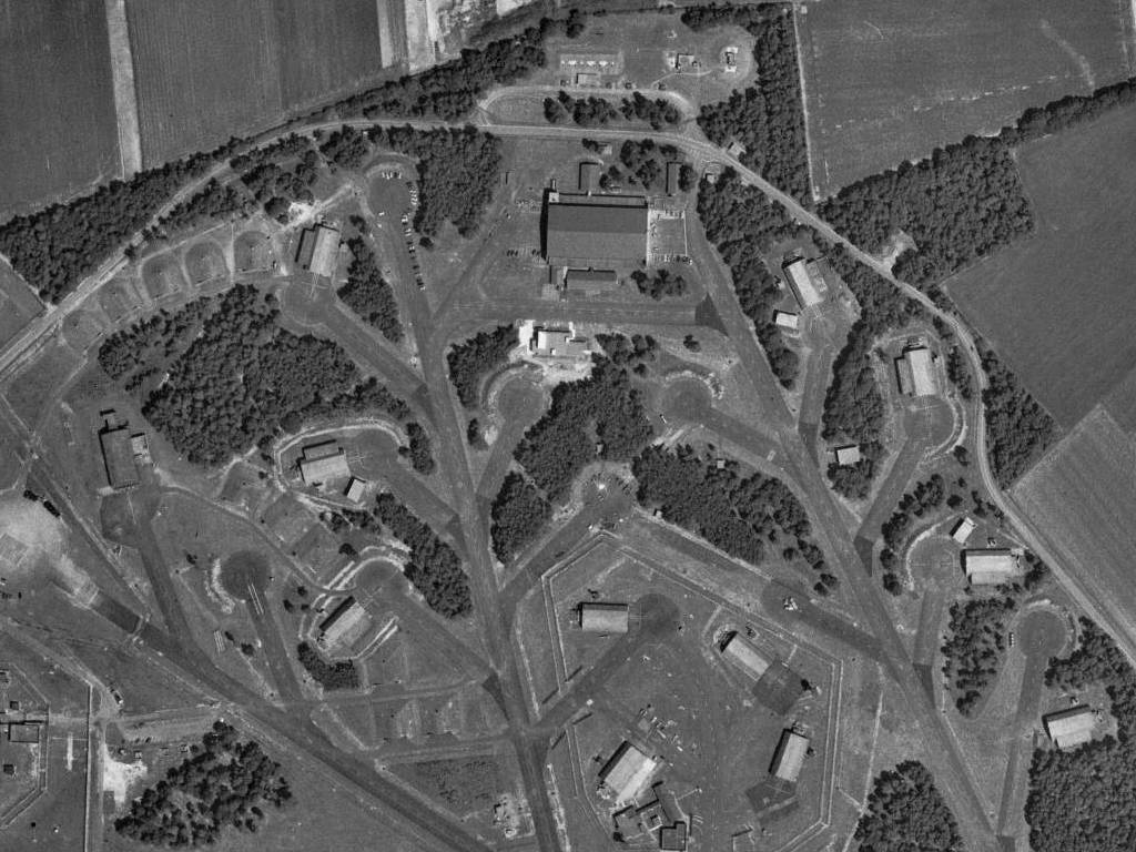
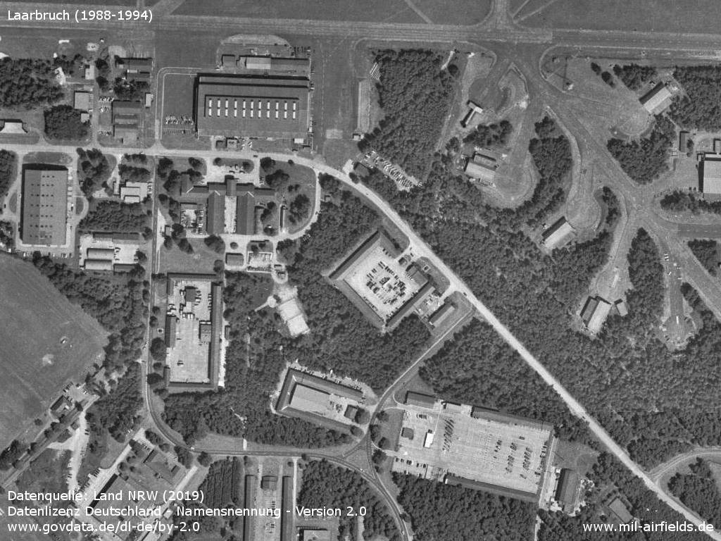
Southeastern dispersal area
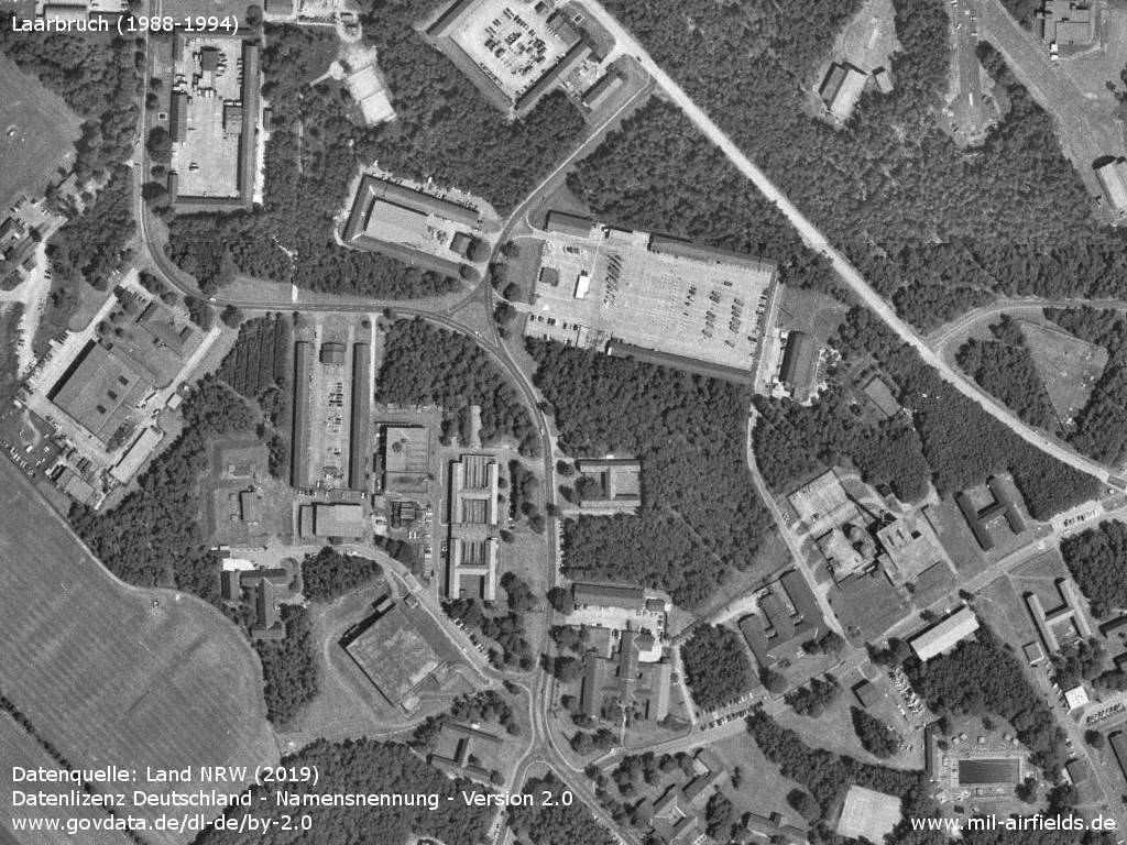
Barracks and housing area
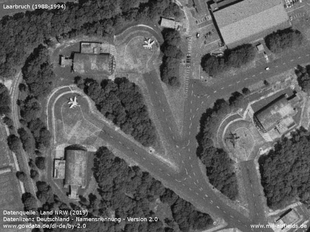
Three Tornado aircraft in the northwestern shelter area
Two Tornado aircraft and one English Electric Lightning as decoy.
Two F-4 Phantom and one Lightning as decoy
One F-4 Phantom in front of the hangar and a small aircraft.
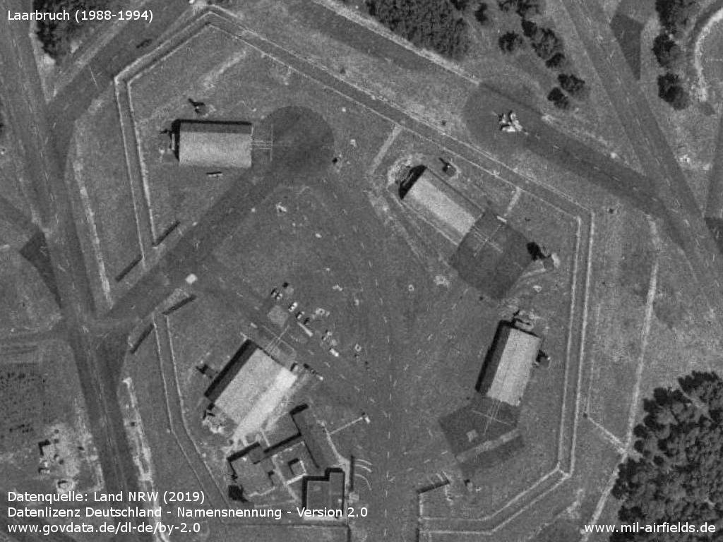
Separately fenced shelter area, top right a BAC Lightning.
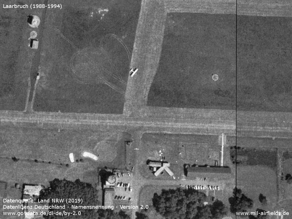
Control tower and small aircraft
Runways
- 10/28: 2442 m (8012 ft) Concrete
Radio beacons
- TACAN: CH95X "LLK"
- ILS 28: 110.7 "LL"
- OM 28: 75, 279°/5.1 NM
- MM 28: 75, 279°/0.7 NM
Radio communication
- Clutch Radar 366.9, 373.3,
- Approach Control 119.7, 130.8, 371.8, 362.3
- Radar (ASR) 130.8, 292.75, 344.0
- Talkdown (PAR) 130.5, 253.3, 368.65
- Tower 122.1, 310.3, 257.8
Today
Use
Weeze Niederrhein Airport.
Overview
Datenquelle: Land NRW (2019) Datenlizenz Deutschland - Namensnennung - Version 2.0 www.govdata.de/dl-de/by-2.0
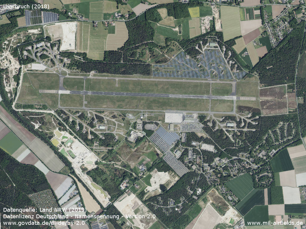
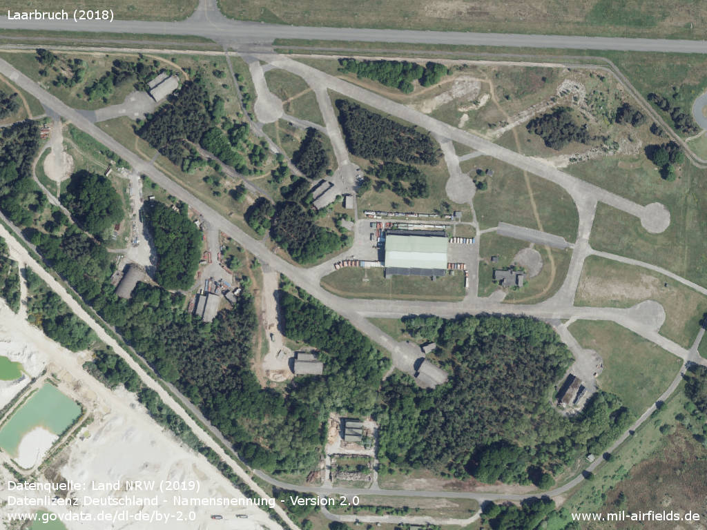
Aerial image (2018)
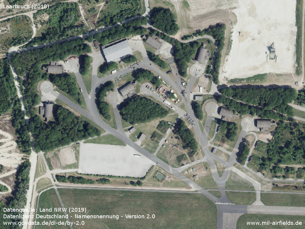
Former shelter area in the northwest
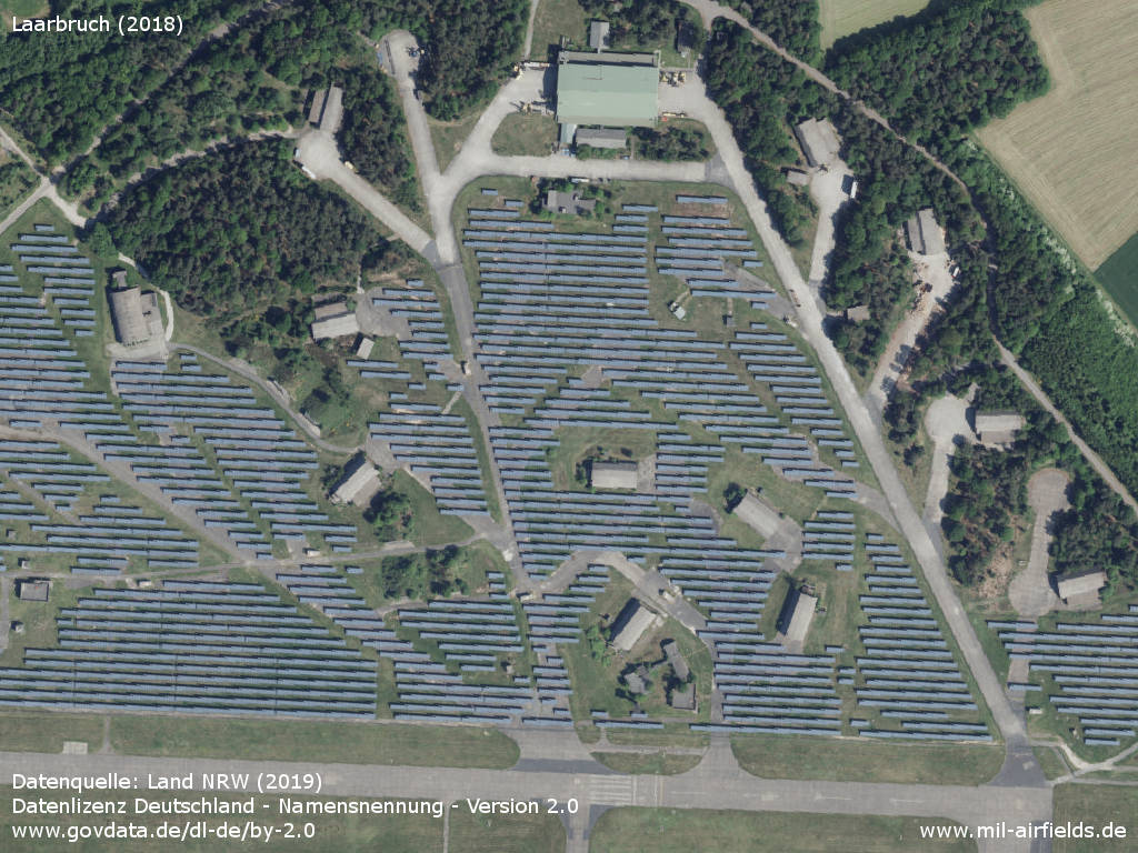
A solar park has been built in the northeast
Former shelter area in the southwest
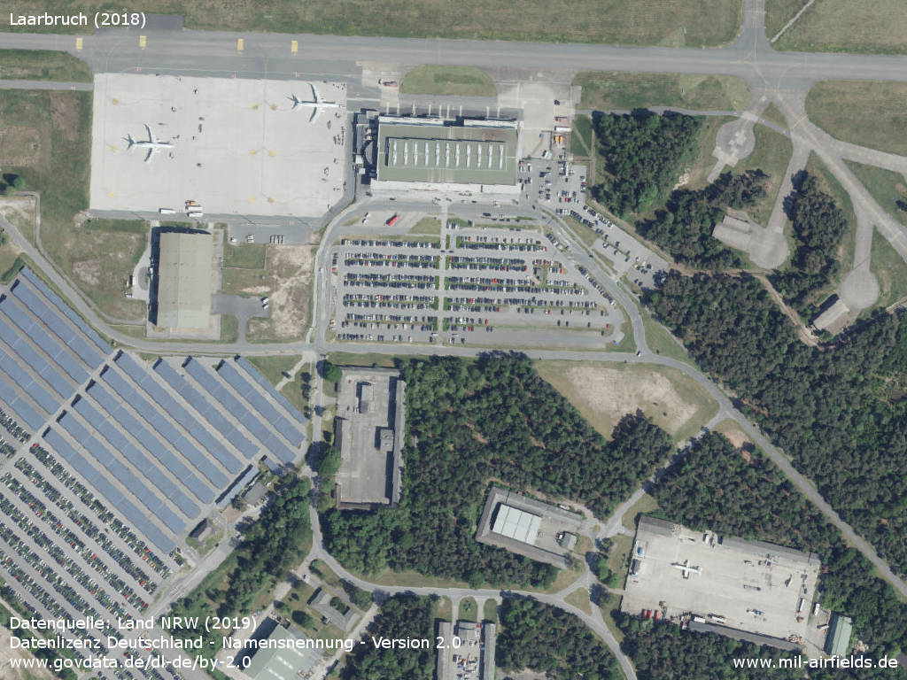
Airport
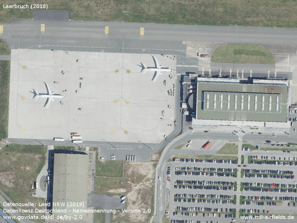
Terminal and apron
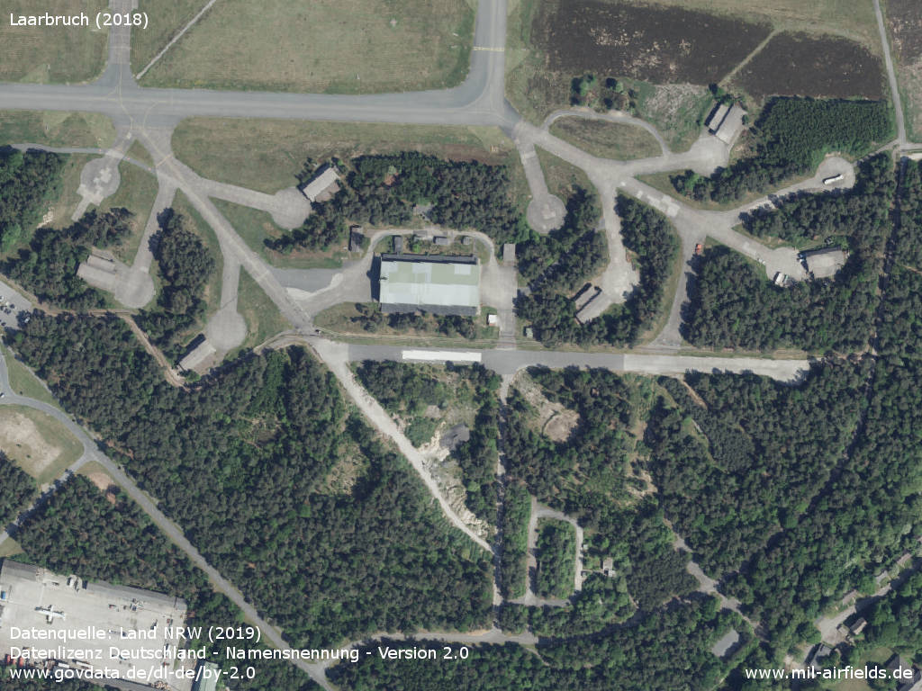
Former shelter area in the southeast
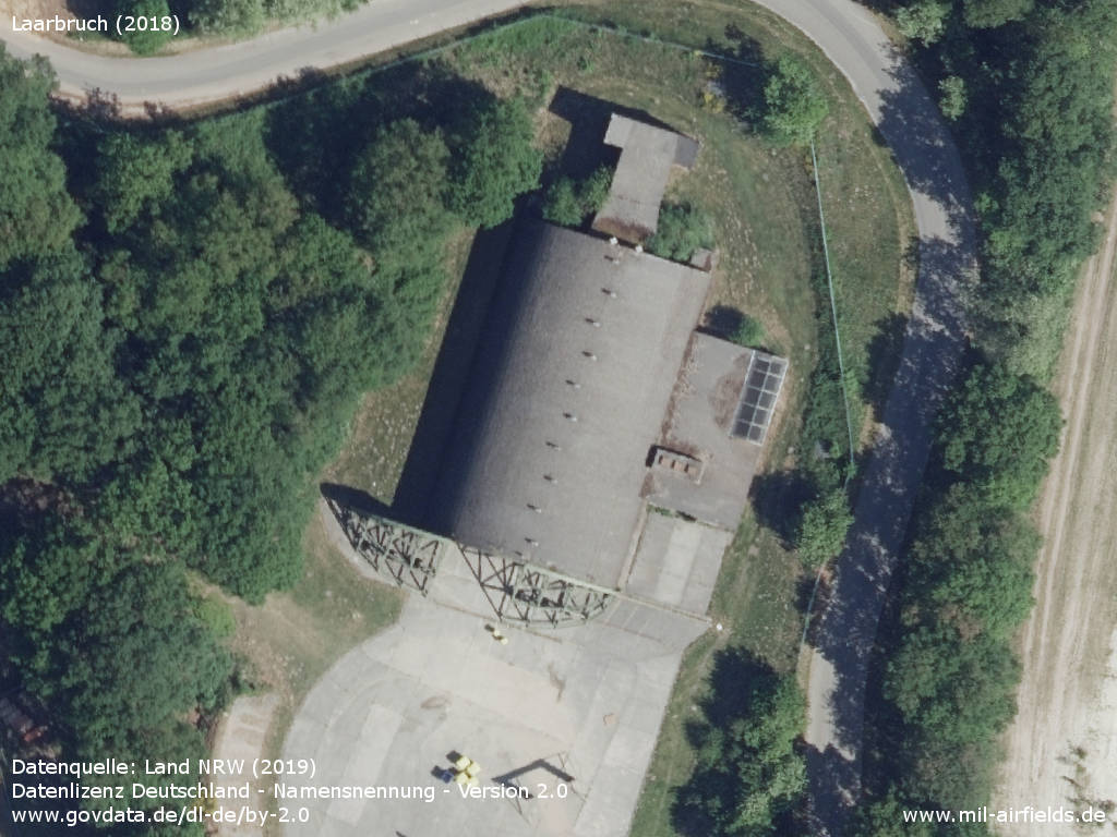
A shelter with opened gate
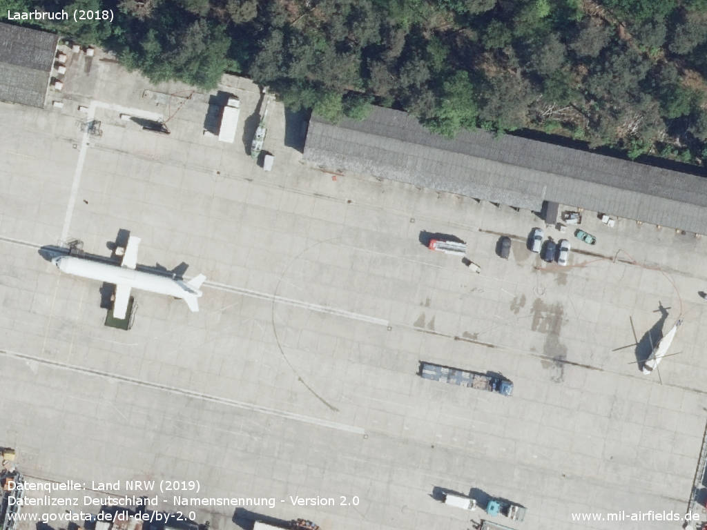
Aircraft and helicopter fuselages
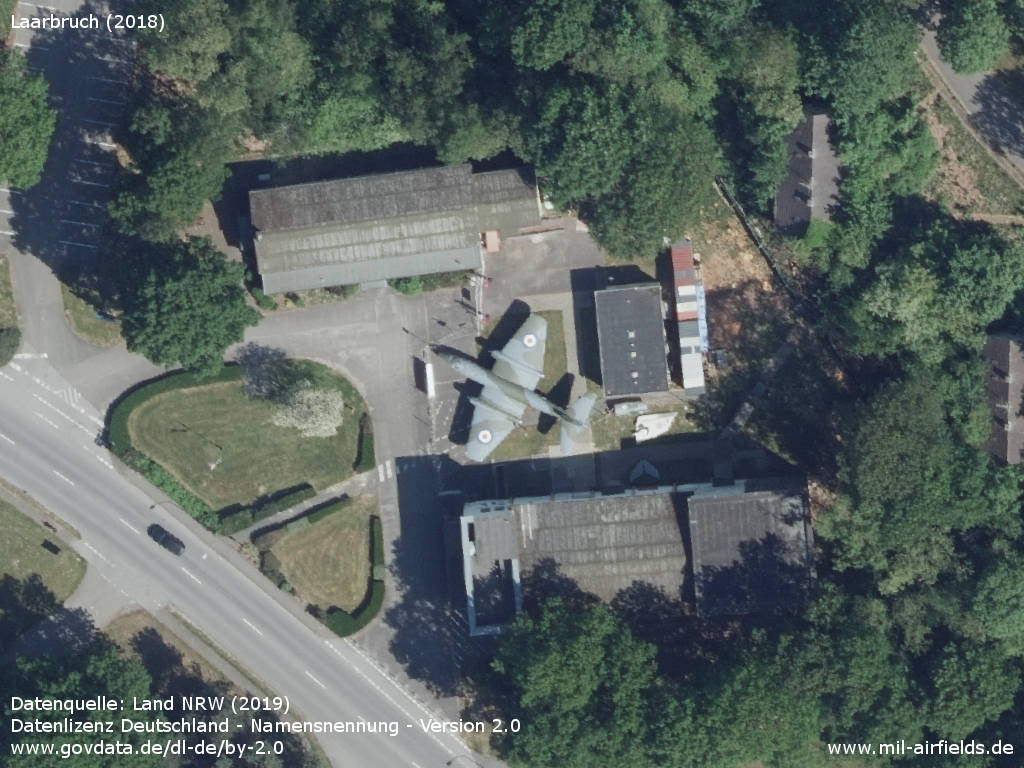
RAF Laarbruch Museum Weeze with a English Electra Canberra
Links
- https://www.youtube.com/watch?v=wwzKCgvQucA - Harriers departure from laarbruch
- https://airport-weeze.com/ - Flughafen Weeze Niederrhein
- http://www.kle.nw.schule.de/laarbruch-museum/Versu... - RAF Laarbruch Museum Weeze e.V.
Airfields in the vicinity
- 099°/20km Alpen: Highway Strip (Notlandeplatz NLP)
Categories
Military Airfields GermanyMilitary Airfields in former West GermanyRoyal Air Force (RAF) Bases in GermanyRecommended
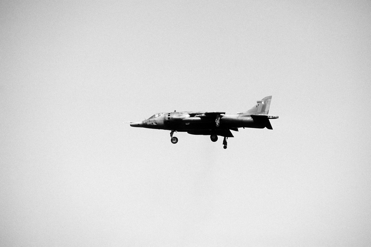
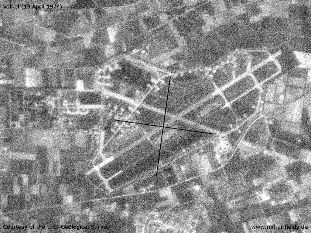
Image credits are shown on the respective target page, click on the preview to open it.
 Follow mil-airfields on Facebook