Albertshof: Airfield
For historical information only, do not use for navigation or aviation purposes!
| Coordinates | N524135 E0133907 ca. (WGS84) Google Maps (approximate location) |
| Former East Germany (GDR) | District of Frankfurt/O |
| Federal state | Brandenburg |
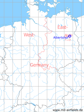
Germany during the Cold War Map
The history of the Cold War airfields: Albertshof
General
Albertshof was a small landing ground of the Soviet forces, which was put into operation in 1948. Probably it was only a few years in use. Today, the airfield is closed, the (suspected) area is used for agriculture.
Location of airfield
Today Albertshof belongs to the municipality of Rüdnitz and is located 5 km north-east of Bernau. The airfield was probably south-southwest of Albertshof. The exact location can not be determined from the available sources.
During the Cold War
Use
Landing ground of the Soviet forces.
Overview
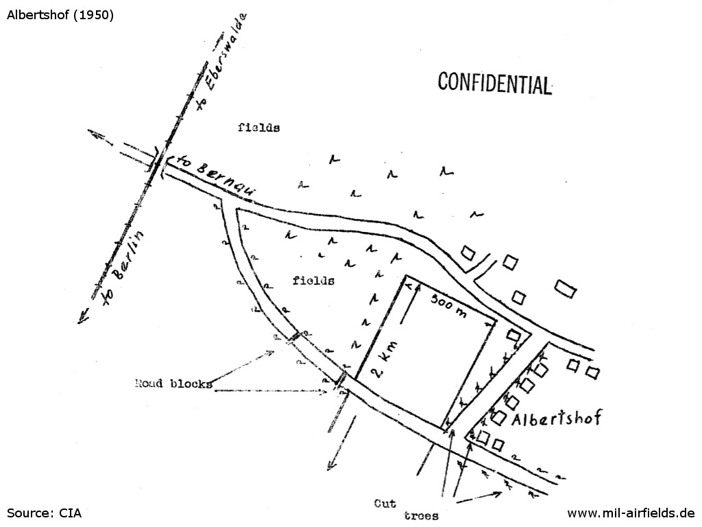
Sketch of Albertshof landing ground from 1950 - The road towards Bernau probably has to go to the southwest
History
CIA report from August 1949
The ALBERTSHOF airfield had been newly constructed in June 1949. There are no buildings. The airfield is assumed to be used as an emergency or training airfield. So far, no air unit has been observed being stationed there.
Source: /CIA-RDP82-00457R003300400008-0/
CIA report from September 1949
A long strip was reserved south of ALBERTSHOF (N 53/V 07) as an emergency landing field. It had been declared off limits and was not to be cultivated.
Four biplanes were observed for the first time on the 150-acre improvised airfield located south of ALBERTSHOF on 20 July 1949. These biplanes practiced flying. A field wire line ran ... along the BERNAU-ALBERTSHOF road.
Source: /CIA RDP82-00457R003400490005-0/
CIA report from February 1950
The Albertshof (N 53/Z 96) emergency landing field was unoccupied and unguarded. The landing field was servicable.
Anmerkung: Only individual PO-2s occasionally landed at the field in 1949. No air unit or ground unit is stationed there.
Source: /CIA RDP82-00457R004500230011-9/
CIA report from March 1950
The Albertshof (N 53/Z 96) improvised airfield which was constructed in 1948 was unoccupied. The landing field, about 300 meters x 2 kilometers, was sodded. There were no buildings or hangars. The former road to Schoenfeld (N 53/V 07) which crossed the landing field was blocked. Trees near the field were being cut.
Source: /CIA RDP82-00457R004600560001-3/
CIA status from May 1951
Landing field intact, 500 x 2,000 meters.
Source: /CIA RDP82-00457R008500050009-8/
BND airfield list from 1953
Albertshof: fomer airstrip, not in use.
Source: /Bundesarchiv B 206/3123/
Today
Use
Closed.
Remarks
In June 1979 an air show was held at Rüdnitz during the propaganda event "National Youth Festival of the GDR". A contemporary source gave as location "between Rüdnitz and Biesenthal", probably north of Rüdnitz and thus not related to the former Albertshof airfield.
Sources
- http://www.cia.gov - CIA
- http://www.bundesarchiv.de/ - Bundesarchiv
Airfields in the vicinity
- 321°/4km Ladeburg: Helipad 3106 (HSLP 3106)
- 288°/8km Ladeburg: Object 5020
- 131°/10km Werneuchen: Air Base (Аэродром Вернейхен (ГДР))
- 185°/12km Blumberg: Agricultural Airfield
- 011°/15km Finow: Air Base (Eberswalde-Finow, Аэродром Финов)
- 031°/15km Spechthausen: Helipad 1026 (HSLP / HLP 1026)
- 179°/15km Hönow: Agricultural Airfield
- 016°/18km Eberswalde: Helipad 1036 (HSLP / HLP 1036, Eberswalde-Finow)
- 075°/21km Wollenberg: Helipad 3025 (HSLP 3025)
- 314°/21km Kreuzbruch: Airfield (FRA-4123 Klosterfelde, Helipad 3114, 6102)
Categories
Military Airfields GermanyMilitary Airfields in former East GermanyAirfields of the Soviet Forces in GermanyRecommended
Image credits are shown on the respective target page, click on the preview to open it.