Merseburg: Air Base
For historical information only, do not use for navigation or aviation purposes!
| Coordinates | N512151 E0115701 (WGS84) Google Maps |
| Elevation | 340 ft |
| Former East Germany (GDR) | District of Halle |
| Federal state | Sachsen-Anhalt (Saxony-Anhalt) |
| Location indicator | EDAM |
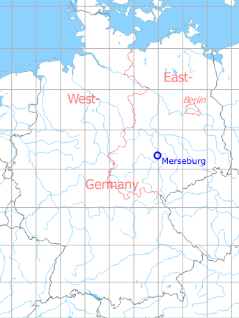
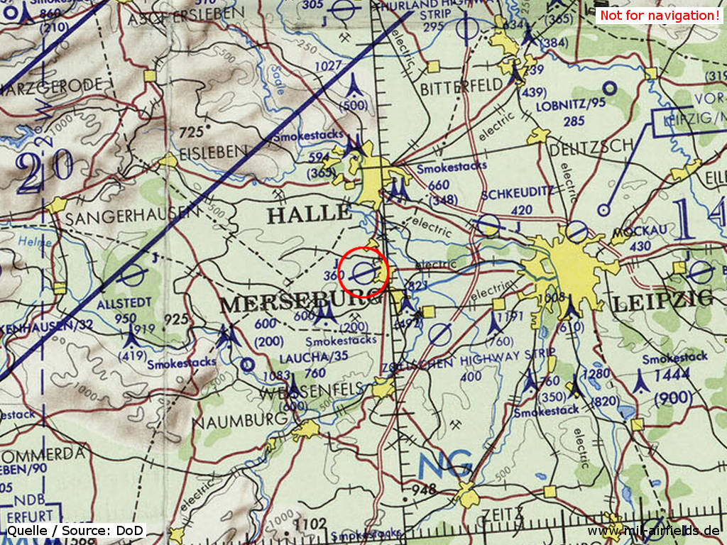
Germany during the Cold War Map
The history of the Cold War airfields: Merseburg
During World War II
Use
Luftwaffe airbase.
Situation
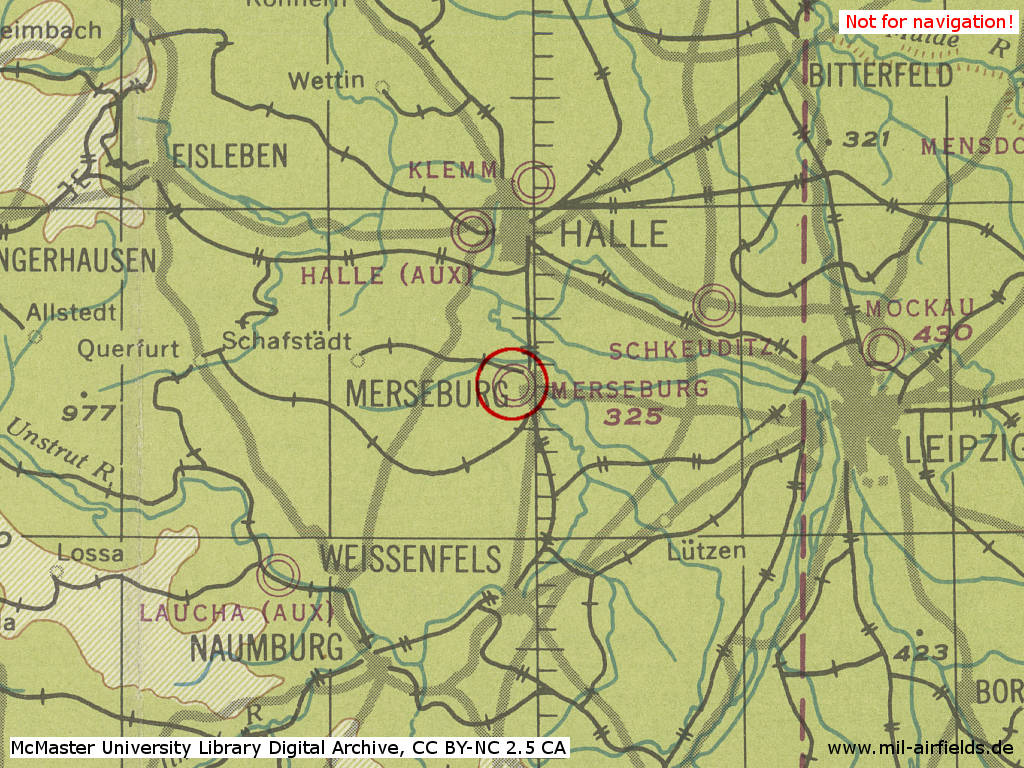
Merseburg Air Base in World War II on a US map from 1944
Source: McMaster University Library Digital Archive, License: Creative Commons Attribution-NonCommercial 2.5 CC BY-NC 2.5 CA
During the Cold War
Use
Soviet/russian airbase.
In the 1950s
Units
1954
- Headquarters Soviet fighter division
- Soviet fighter regiment (P. O. Box of the technical unit: 62 335),
- A total of 38 MiG-15/MiG-15U were counted at the airfield.
Source: BND/Bundesarchiv B 206/3033
(For the P. O. Box numbers the digits 3 and 5 may be confused, because they are difficult to distinguish in the source document)
(For the P. O. Box numbers the digits 3 and 5 may be confused, because they are difficult to distinguish in the source document)
History
- September/October 1954
Temporary relocation of Fighter Regiment Merseburg to the Dessau Airfield (27.09.-05.10.1954)
In the 1960s
Overview
1966
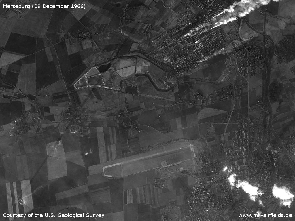
Friday 09 December 1966 - The satellite image shows Merseburg Air Base and in the north the VEB Chemische Werke Buna, one of the largest companies in the GDR. Due to its plumes of smoke, it can already be seen from a great distance.
Source: U.S. Geological Survey
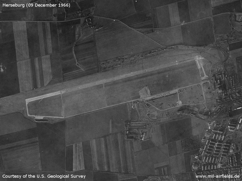
Airfield - The field does not seem to have a very extensive infrastructure.
Source: U.S. Geological Survey
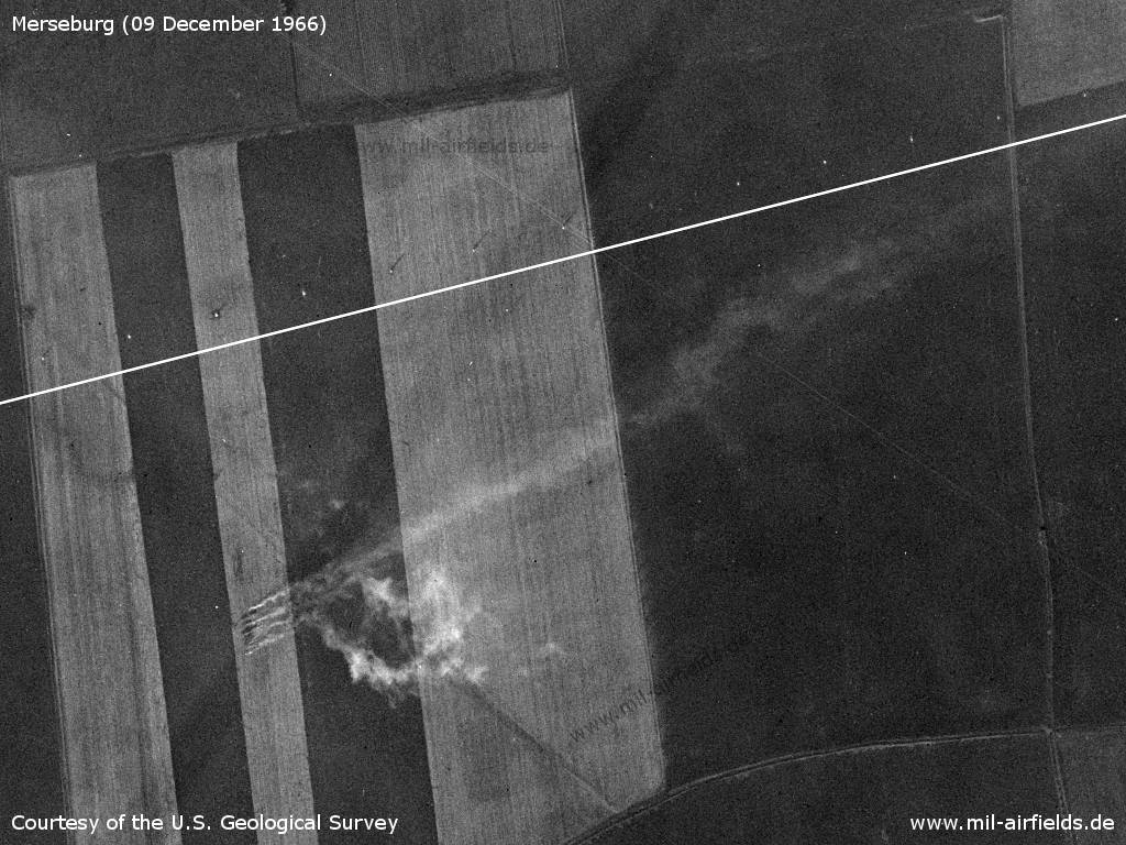
Approach sector in the west - Here you can see a series of poles, which are well recognizable by their shadows caused by the low sun of this December day. The row of poles is located a little north of the extended runway centerline, which is visualized by a white line here. The source of the three or four plumes of smoke to the south is unclear.
Source: U.S. Geological Survey
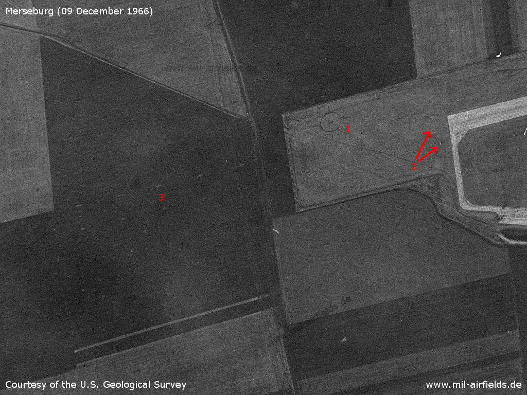
Western end of the runway - Noteworthy: 1: target circle; 2: markers in front of the runway; 3: Several markings outside the field to the left and right of the approach line.
Source: U.S. Geological Survey
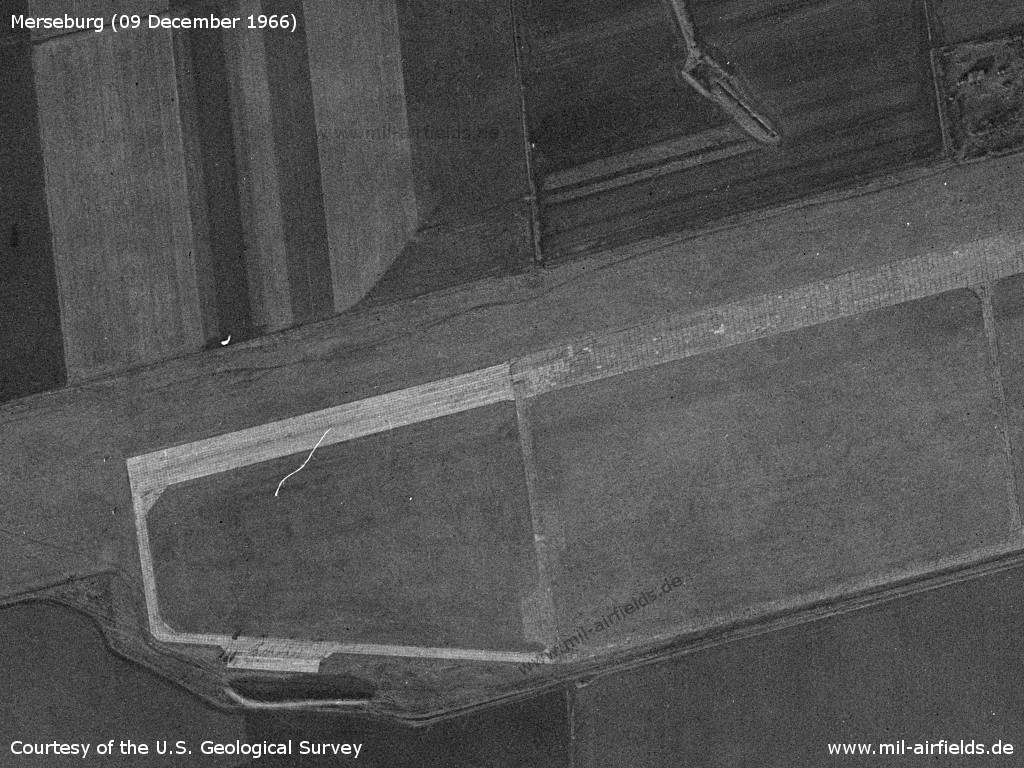
Extension of the runway - At first, the runway was only 2000 m long, the end was in the middle of the picture. Later the runway was extended to 2500 m, but the extension was a bit narrower. This difference in width is no longer visible today, probably it was straightened later.
Source: U.S. Geological Survey
Central part with flight line and old starting platform - On the north side there are various facilities, including a radar site (top right)
Source: U.S. Geological Survey
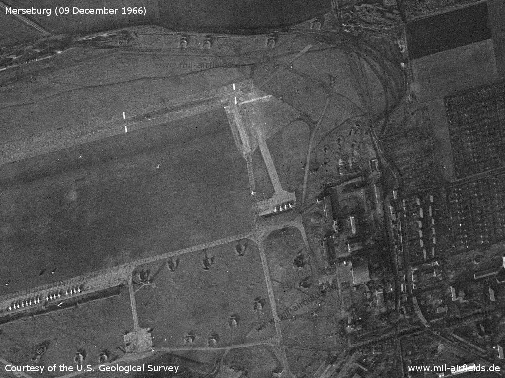
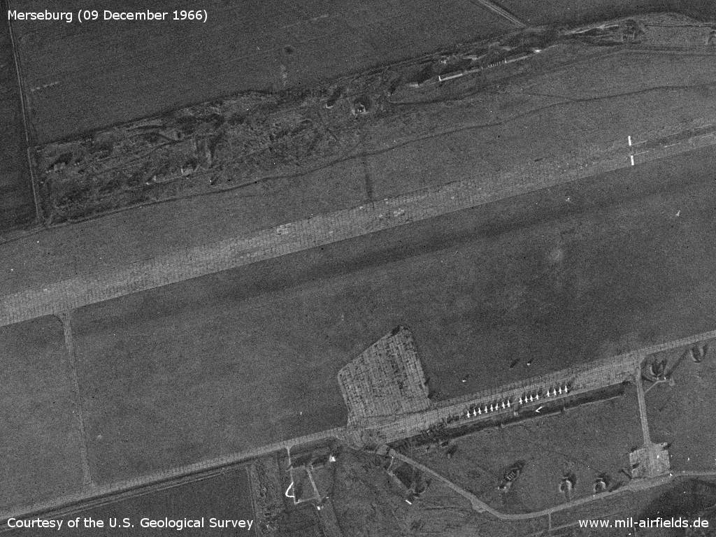
Eastern side - At the beginning of the runway there is another take-off platform from the times as a Fliegerhorst. A taxiway leads from an alert area, on which four airplanes stand.
Source: U.S. Geological Survey
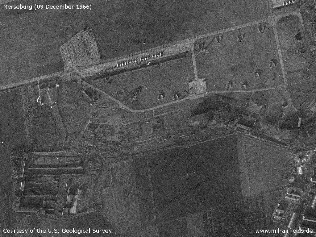
Southeastern part - The field has multiple open aircraft revetments.
Source: U.S. Geological Survey
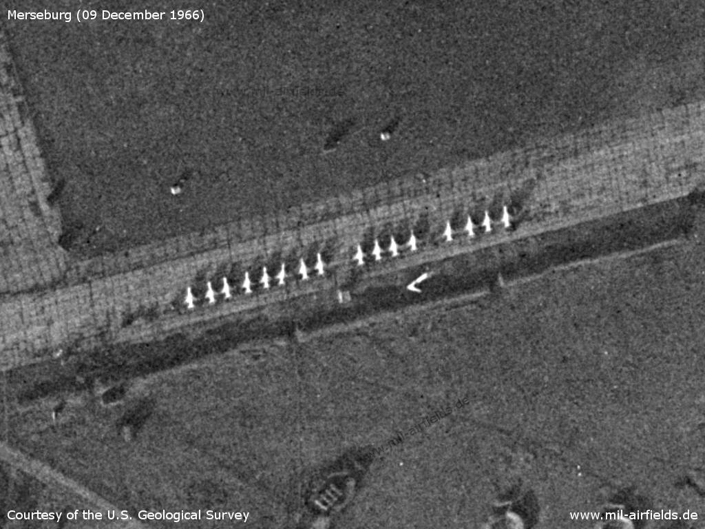
On the flight line there are 16 fighters, presumably MiG-21
Source: U.S. Geological Survey
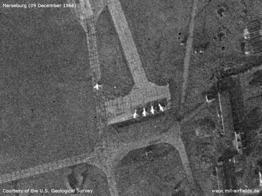
Alert platform with 4 more aircraft, probably MiG-21 - An older airplane is taxiing towards the runway, probably a MiG-15 or MiG-17
Source: U.S. Geological Survey
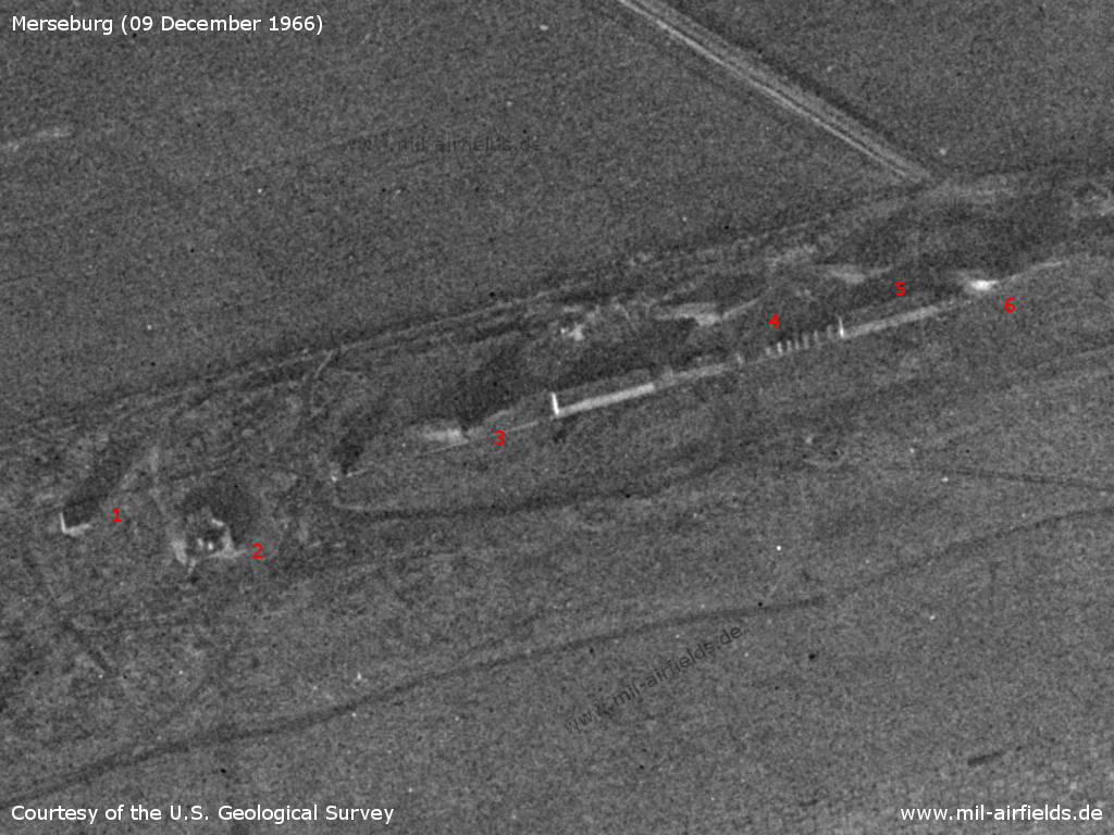
Facilities in the north - 1: a tower; 2: unclear; 3, 4, 5 and possibly 6: pyramid-like hills probably for the elevated placement of radar systems
Source: U.S. Geological Survey
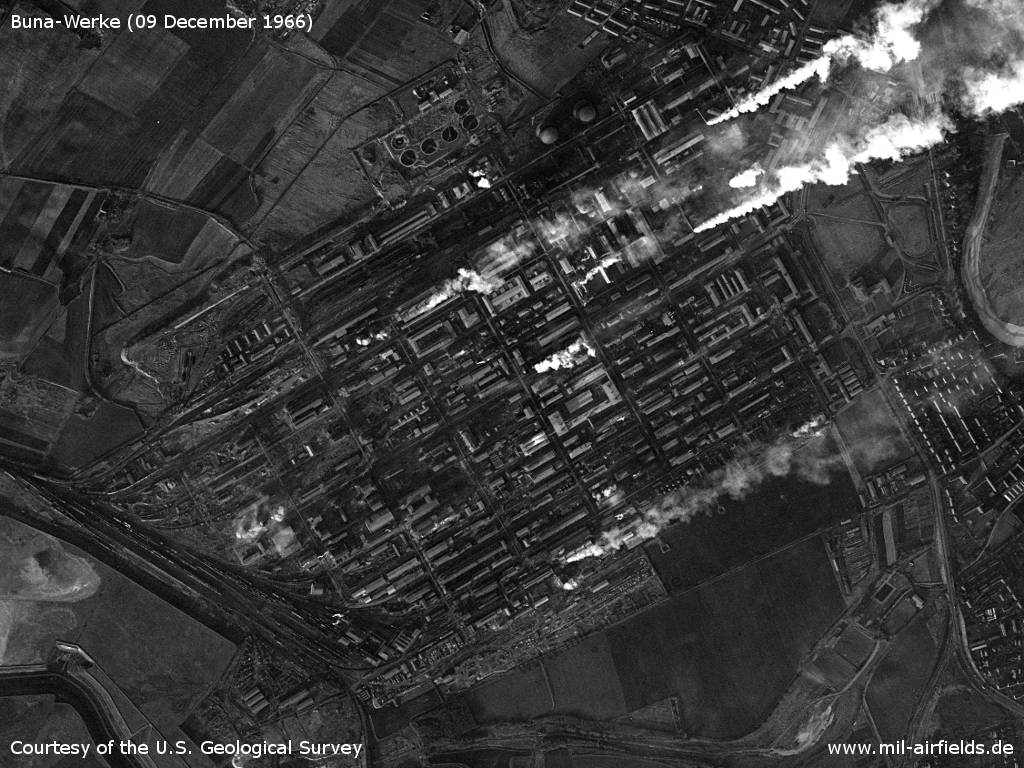
VEB Chemische Werke Buna, Schkopau
Source: U.S. Geological Survey
1969
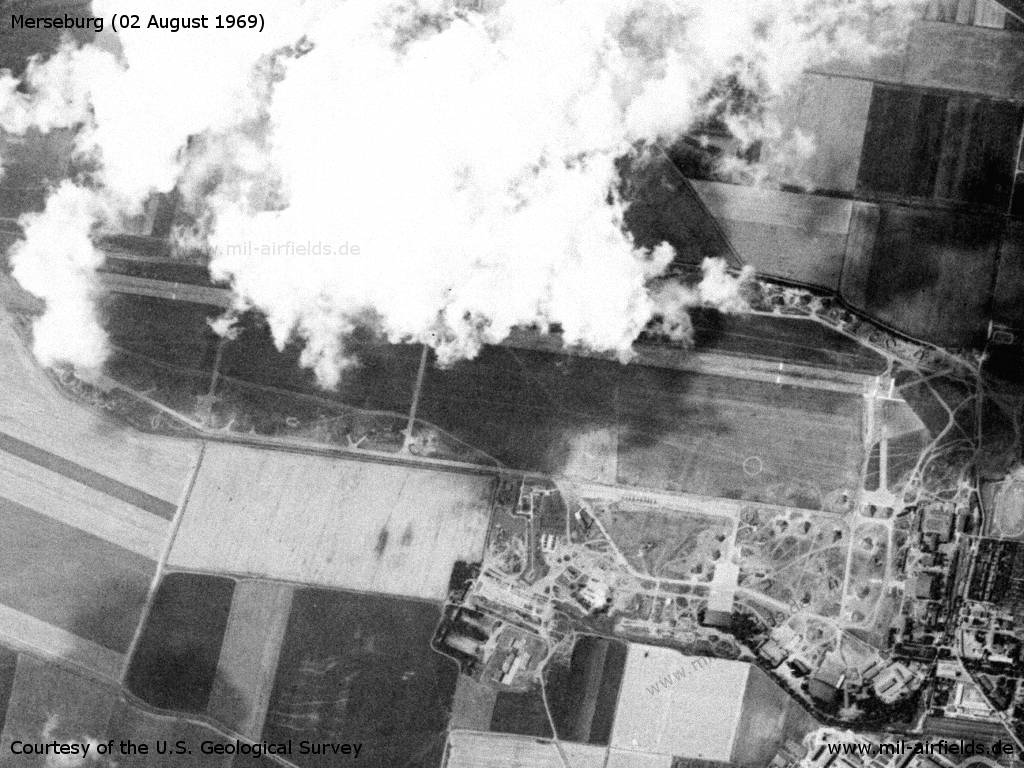
Merseburg on 02 August 1969 - The image is not oriented to the north.
Source: U.S. Geological Survey
Radio communication
Call sign: DOVJELOK (196x).
In the 1970s
Situation
Merseburg Air Base on a map of the US Department of Defense from 1972
Source: ONC E-2 (1972), Perry-Castañeda Library Map Collection, University of Texas at Austin
Overview
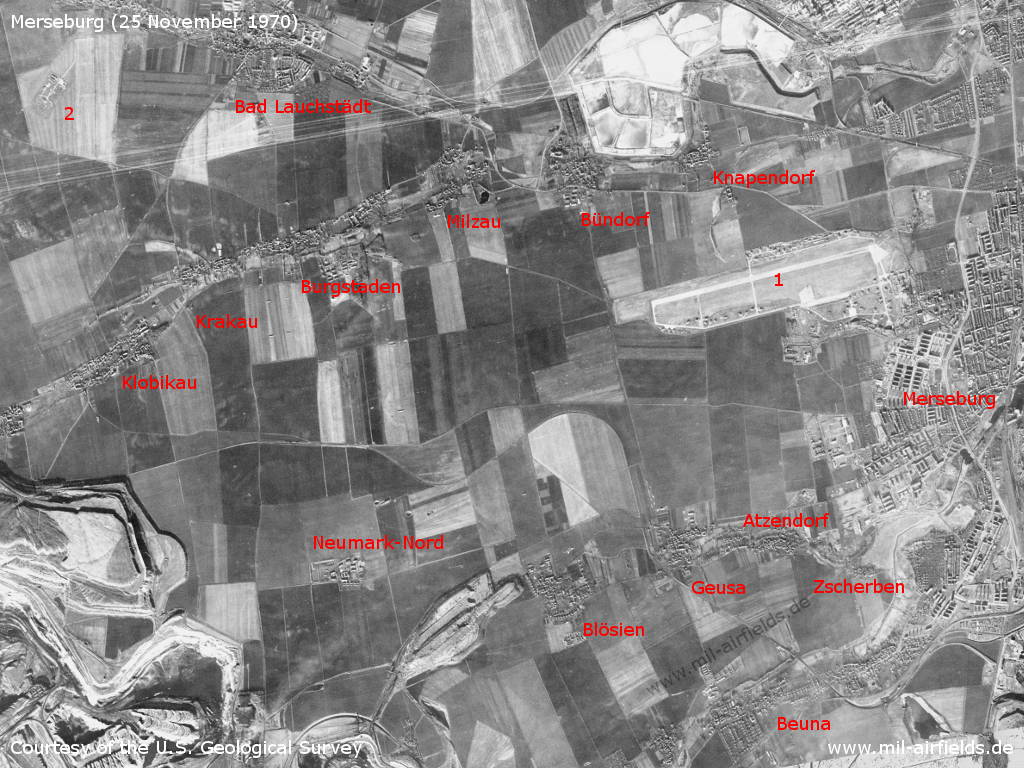
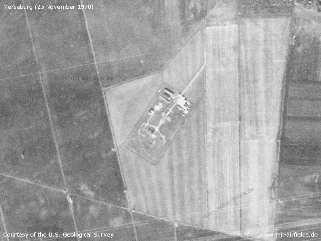
The airfield and surroundings on a US satellite image from 25 November 1970 - 1: airfield; 2: Surface-to-air missile (SAM) site Bad Lauchstädt. Places: Atzendorf, Beuna, Blösien, Bündorf, Burgstaden, Geusa, Klobikau, Knapendorf, Krakau, Milzau, Neumark-Nord, Zscherben.
Source: U.S. Geological Survey
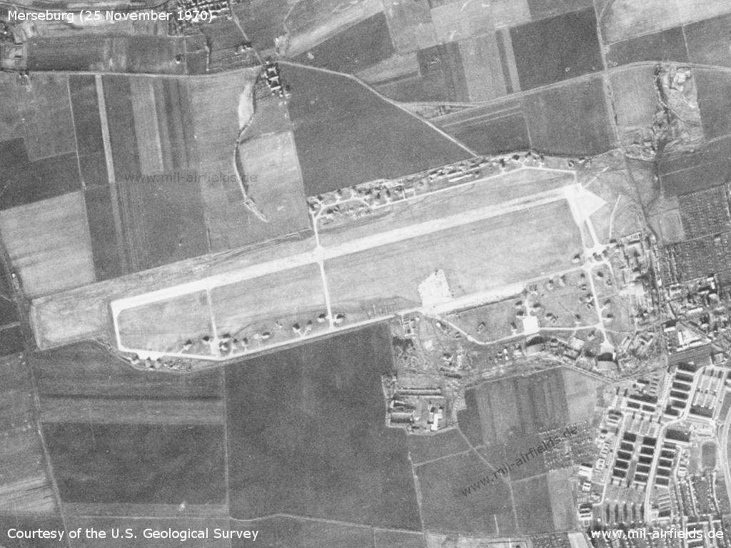
Airfield
Source: U.S. Geological Survey
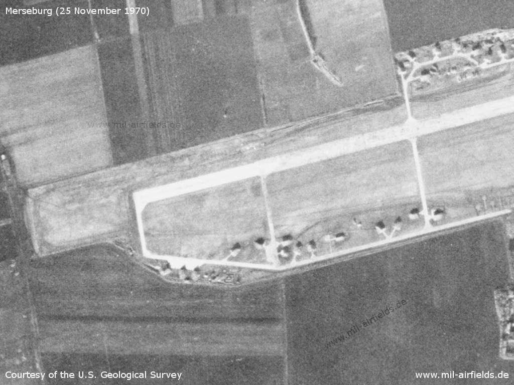
Western part - The aircraft shelters built in recent years are easy to recognize.
Source: U.S. Geological Survey
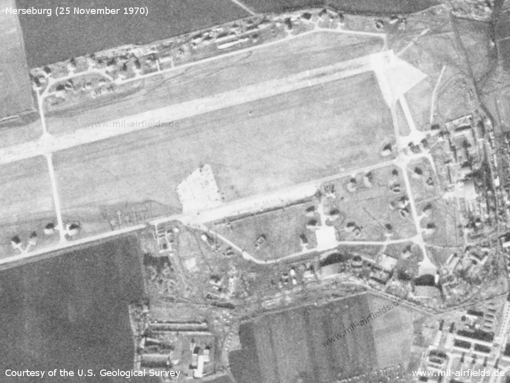
Eastern part - The two take-off platforms of the former Fliegerhorst are still there.
Source: U.S. Geological Survey
Air defence missile site near Bad Lauchstädt to protect the airfield - The site protects the air base and is equipped with S-125 Newa missiles (NATO designation SA-3 Goa).
Source: U.S. Geological Survey
Radio beacons
Data for the year 1970?:
- LOM 26: 398 "DK", 4200m
- LMM 26: 810 "D", 1030m
- LOM 08: 398 "KD"
- LMM 08: 810 "K"
In the 1980s and early 1990s
Runways
- 08/26: 2500 m x 44 m
- 08/26 Grass
Radio beacons
- LOM 26: 614 "DK", 4200 m
- LMM 26: 297 "D", 1030 m
- LOM 08: 614 "LE", 4400 m
- LMM 08: 297 "L", 1000 m
Radio communication
Call signs: MUSKAT (198x)
Airspace
Merseburg Air Base and Leipzig-Schkeuditz Airport are only about 20 km apart. In addition, the approach to Merseburg from the east passes over Schkeuditz Airport. Therefore a coordination between the Leipzig civil air traffic control and the Merseburg Soviet military air traffic control was necessary, which was regulated as follows in the 1980s.
Coordination between the ATC units LEIPZIG and MERSEBURG (as of 04/1986)
For historical information only. Not for navigation!
Die APP LEIPZIG hat
- nicht im FSPLN Standard enthaltene Flüge mit der FSS MERSEBURG abzustimmen;
- Flüge am Flugplatz EILENBURG und auf den im TMA gelegenen Flugplätzen des GST und des AF mit den FSS MERSEBURG und BRANDIS abzustimmen.
Die APP LEIPZIG ist verpflichtet, der FSS MERSEBURG folgende Informationen zu übergeben:
- Arbeitsbeginn und -ende der APP
- Betriebszeit der Radarstation
- Beginn und Ende der Flüge auf den im TMA gelegenen Flugplätzen (ausgenommen der Flugplatz der GST Halle-Oppin) 30 Minuten vor dem ersten Start bzw. unmittelbar mit Ende der Flüge;
- beim Start auf dem Flughafen LEIPZIG mindestens 5 Minuten vor dem Start: voraussichtliche Startzeit, Startrichtung, Typ des Luftfahrzeuges, Flughöhe und Luftstraße;
- bei Landung auf dem Flughafen LEIPZIG mindestens 10 Minuten vor Einflug in den TMA: voraussichtliche Landezeit, Landekurs, Typ des Luftfahrzeuges, Luftstraße und Flughöhe;
- bei Flügen in den Luftstraßen B50 und B51 (ohne Landung auf dem Flughafen LEIPZIG) mindestens 10 Minuten vor Einflug in den TMA: voraussichtliche Überflugzeit VOR LEG, Flughöhe, Typ des Luftfahrzeuges und Flugrichtung;
- bei Flügen von militärischen Luftfahrzeugen in den Luftstraßen B50 und B51 zu den Flugplätzen der GSSD mindestens 10 Minuten vor Ausflug aus der Luftstraße: Ausflugort und -zeit, Flughöhe, Typ des Luftfahrzeuges, Rufzeichen, Bordnummer und Bestimmungsflugplatz.
Außerhalb der Dienstzeit der APP LEIPZIG ist bei Flügen oberhalb FL 110 (3350 m STD= die Zeit des voraussichtlichen Überfluges des VOR LEG bis 10 Minuten vor dem voraussichtlichen Überflug durch die ACC BERLIN/Schönefeld direkt oder über die ATCC an die VHZ zu melden, mit der Bitte um Weiterleitung an die FSS MERSEBURG.
Die FSS MERSEBURG ist verpflichtet, der APP LEIPZIG folgende Informationen zu übergeben:
- Nichtgewährleistung der Sicherstellung geplanter Flüge (Starts und Landungen) auf dem Flughafen LEIPZIG beim Start diensthabender Jagdflugzeuge. Dabei ist es erforderlich, eine Flughöhe für das den Flughafen LEIPZIG anfliegende Luftfahrzeug im Warteverfahren festzulegen. Das Landeverbot für den Flughafen LEIPZIG ist der APP mindestens 5 Minuten vor Überflug des VOR LEG zu übermitteln.
Der Standard-FSPLN für den Flughafen LEIPZIG (einschließlich Überflüge in den Luftstraßen B50 und B51 ist 14 Tage vor Beginn der Sommer- bzw. Winterperiode in 2 Exemplaren an die FSS MERSEBURG zu übergeben.
Die Abstimmung über die Flüge und der Informationsaustausch zwischen der APP LEIPZIG und der MERSEBURG und BRANDIS erfolgen auf direkten Flugsicherungs-Fernsprechstandverbindungen, die in Zuständigkeit der zivilen Luftfahrt zu betreiben sind.
Diensthabende Jagdflugzeuge haben Vorrang beim Durchflug durch den TMA LEIPZIG in der für sie erforderlichen Flughöhe sowie beim Starten und Landen auf dem Flugplatz MERSEBURG
(Source: Anweisung für den zivilen Flugsicherungsdienst in der Deutschen Demokratischen Republik - Anweisung Flugsicherungsdienst (AFD) - Teil 1, Stand 04/1986 und 10/1987)
Units
1990: 85 GwIAP (MiG-29, MiG-29UB, MiG-23UB); Parts of 485 OBVP (Mi-8, Mi-24)
History
- 1988
Observation at Merseburg: "The alert aircraft, uploaded with missiles, were observed with generator vehicles standing by. While the FULCRUM may have a self-start capability, this observation indicates the Soviets prefer or require to have generator trucks available for alert status aircraft." (Source: USMLM 1988) - 1988
Observation of an "Integrated Combat Turn" (ICT): Downloading the missiles from one MiG-29 FULCRUM and uploading of missiles on another FULCRUM. (Source: USMLM 1988) - April 1988
A team of the US Military Liaison Mission observes an air-to-air training between a MiG-29 FULCRUM and a Mi-24 HIND helicopter near Merseburg airfield. "The FULCRUM made attack passes from 5000-6000 feet in a 15-20 degree dive probably simulating IR missile or gun shots against the HIND orbiting at approximately 300 feet. This type of training had never been observed before." (Source: USMLM 1988)
Today
Use
General aviation.
Links
- http://www.sachsenschiene.net/bunker/flp/flp_21.ht... - Sachsenbunker
Bibliography
- United States Military Liaison Mission: "Unit History 1988"
Airfields in the vicinity
- 353°/14km Halle (Saale): Nietleben Airfield
- 138°/15km Zöllschen: Highway Strip (Bad Dürrenberg, Lützen)
- 072°/20km Leipzig: Schkeuditz Airport (Leipzig-Halle)
- 084°/32km Leipzig: Mockau Airport / Airfield (Flughafen Mockau)
- 273°/35km Allstedt: Air Base (Аэродром Альштедт)
Categories
Military Airfields GermanyMilitary Airfields in former East GermanyAirfields of the Soviet Forces in GermanyRecommended
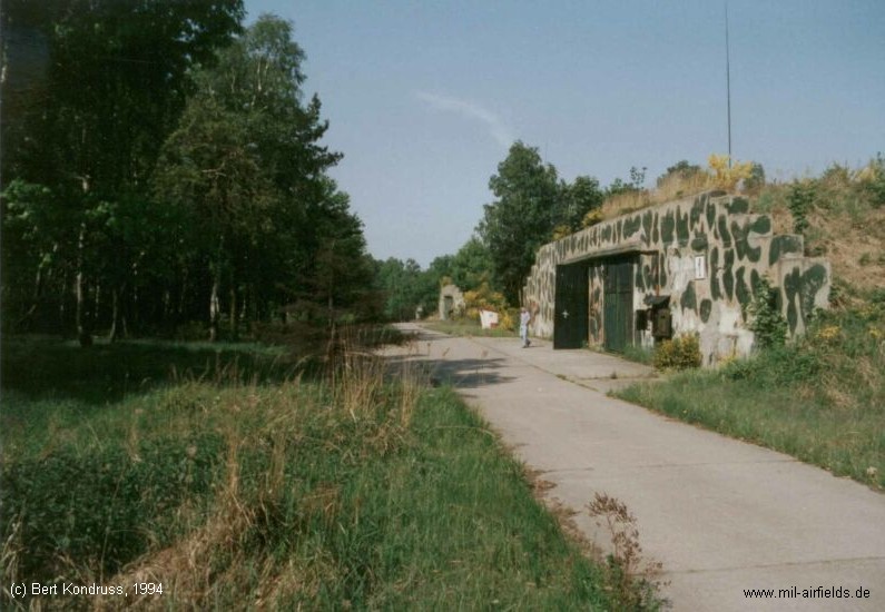
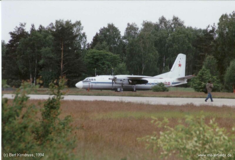
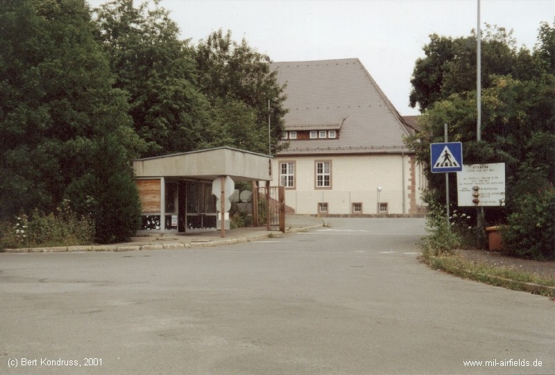

Image credits are shown on the respective target page, click on the preview to open it.
 Follow mil-airfields on Facebook